 Abandoned

Overview
The town the river took

Champoeg grew on the south bank of the Willamette, halfway between Oregon City and Salem. By the 1850s it had a Hudson's Bay Company granary, a ferry, a warehouse, a steamboat landing and a stage office, laid out on a grid of ten streets by six. Settlers had been meeting here since February 1841, when a gathering called to deal with wolves became the first of the "Wolf Meetings".
On May 2, 1843, a meeting at Champoeg voted 52 to 50 to form a provisional government for the Oregon Country, which Britain and the United States still both claimed. Nine men were chosen to lead it and Champoeg became its capital. Three years later the Oregon Treaty settled the border, and when Oregon Territory was organized in 1848 the capital went elsewhere.
On December 2, 1861, the Willamette rose 55 feet above its summer level and put seven feet of water over the town. Only two saloons were left. Robert Newell, whose house stood on higher ground, nearly went bankrupt caring for the flood victims. Champoeg was never rebuilt. A monument went up on the meeting site in 1901, the land became a state park, and the townsite was listed on the National Register as an archaeological district in 1984. Dams built since the 1930s make another flood like it unlikely.
Video
A January mile through the heritage area
Two walkers do a one-mile loop through the park on a cold, clear January day. They stop at the Oregon History sign, the 1901 monument and a panel on the 1843 vote, point out where the 1861 flood's high water reached, far above the river, and follow paved paths through the riverside woods, where one recalls pulling English ivy here with a geocaching group about twenty years earlier. The narration's history is brief and the creators' own; the timeline below follows our sources.
 Play “100 Miles, 100 Days. Day 53 Champoeg State Park in Oregon” from YouTube
Timeline
Champoeg through the years

- The year the National Register gives for the start of the Champoeg archeological district.
- On February 7 Willamette Valley settlers meet at Champoeg with Jason Lee in the chair. They talk about wolves, the first of the "Wolf Meetings".
- On May 2 a meeting at Champoeg votes 52 to 50 to form a provisional government. Nine men are chosen to lead it, and Champoeg is its capital.
- The Oregon Treaty settles the Oregon Country between the United States and Britain.
- Robert Newell plats a town called Oxford about a quarter mile away, later taken into Champoeg (local history blog).
- Oregon Territory is organized, and Champoeg is passed over as its capital.
- Robert Newell builds his house on the higher ground. The restored house is a museum today.
- Champoeg has a Hudson's Bay Company granary, a ferry, a warehouse, a steamboat landing and a stage office, on a grid of ten streets by six.
- On December 2 the Willamette rises 55 feet above its summer level and puts seven feet of water over the town. Only two saloons are left standing.
- The townsite is replatted under the Champoeg name, but the town never comes back (local history blog).
- A monument naming the 52 settlers who voted yes is put up on the meeting site.
- The Pioneer Mothers Memorial Cabin is built near the old town center (local history blog).
- Archaeologists dig the townsite and find remains of buildings destroyed in the 1861 flood (the dig's photos, John Atherton).
- The Champoeg State Park Historic Archeological District goes on the National Register on August 1.
- The heritage area is open for day use and camping all year (Oregon State Parks, read October 29).
What's left
What you'll see


No building of the old town stands. The townsite is open ground by the river; in 2003 a wooden post in the meadow marked one of its street corners. A video posted in January 2026 shows a spot where the 1861 high water is marked, well above today's river. Archaeologists dug here in the 1970s; photos from the project, dated 1973 and 1974, show finds from a building the flood destroyed. The 1901 monument lists the men who voted for the provisional government, and the Pioneer Memorial Building nearby carries the dates 1843 and 1918 over its door.
The park has a visitor center and an 1860s-style garden, and a reconstruction of Donald Manson's barn, which he saved from the flood and rebuilt on the hill, stands at the Manson farmstead. Next to the park entrance, Newell Pioneer Village shows four old buildings: Robert Newell's 1852 house, the Pioneer Mothers Memorial Cabin, the old Butteville jail and the Butteville Academy and teacherage. It is open Friday to Sunday, 11 a.m. to 3 p.m., from March through October, at $8 for adults (its own site, read October 29, 2026).
The historic maps below show the Willamette bending past the site. The small-scale 1964 Vancouver sheet shows the south bank between Newberg and Butteville with no town or park printed; the 1982 Oregon City sheet labels it Champoeg State Park, with the county line in the river.
- Open townsite with street-corner posts
- 1901 monument and Pioneer Memorial Building
- Visitor center and Manson farmstead barn
- Newell House and Pioneer Mothers Memorial Cabin (Newell Pioneer Village)
- Cemetery


Historic maps
Champoeg on USGS maps, 1964–1982
Crops from the USGS Historical Topographic Map Collection, centered on the townsite. Each sheet shows what surveyors mapped that year; compare them with today's topo and aerial on this page.

Day trip
Plan a day trip to Champoeg from Newberg
Take it with you
Day trip itinerary
The essentials, the sample day with boxes to tick, what to photograph and the coordinates, on two printable pages. Handy where there's no signal.
Download the PDF (582 KB)Champoeg is a short drive from Newberg and under an hour from Portland. Plan two or three hours: the visitor center, a walk across the townsite to the river, the monument, and on a weekend from March to October the Newell House.
A sample day
- Leave Newberg on OR 219, cross the Willamette and turn onto Champoeg Road.
- Buy a parking permit and start at the visitor center.
- Walk the townsite to the river, then the monument and the Pioneer Memorial Building.
- Picnic in the park.
- On a Friday to Sunday from March to October, tour the Newell House and its neighbors.
What to photograph and film
- The 1901 monument. Its inscription records the 52 to 50 vote.
- The street-corner posts in the meadow. Shoot low across the grass to show how empty the town grid is.
- The Willamette from the bank. After winter rain the river shows how high it can run.
Map & directions
Getting there
Newberg, across the Willamette, is the nearest town. From Portland, take I-5 south and cut west across French Prairie on county roads. The routes were computed from OpenStreetMap and haven't been driven by us.


Base map: USGS The National Map (public domain). Routes: OSRM on © OpenStreetMap contributors data (ODbL), computed October 2026. Times assume dry roads.
- Turn right on North College Street (OR 219).0.2 mi
- Turn left on East 4th Street, which becomes Wynooski Street and Northeast Wynooski Road.1.8 mi
- Turn right on the St. Paul Highway (OR 219), which becomes River Road Northeast.2.0 mi
- Turn left on Champoeg Road Northeast and follow it into the park.2.5 mi
- From downtown, take Madison Street, 1st Avenue and Harbor Drive to I-405.1.0 mi
- Follow I-405 to I-5 south.21.1 mi
- Take the exit for Ehlen Road Northeast and head west.2.7 mi
- Continue on Yergen Road and McKay Road Northeast.2.6 mi
- Turn right on French Prairie Road Northeast, then onto Champoeg Road into the park.1.3 mi
Road and safety notes
- The Newberg route crosses the Willamette on OR 219, then follows River Road and Champoeg Road east to the park.
- Newell Pioneer Village is at 8089 Champoeg Road NE, next to the park.
- Drones and metal detectors are not allowed anywhere in the park (Oregon State Parks, read October 29, 2026).
Photos
Champoeg in photos
Visitor reports
Been to Champoeg?
Been there lately? Tell the next visitor what you found: whether you could get in, the state of the road and what's still standing. Photos are welcome. We read every report before it appears here.
River and lake
More river and lake ghost towns
The nearest, in other states.

 Guide
Polhamus Landing
35.19, -114.57Mohave County, Arizona
A steamboat landing and warehouse built in 1881 to undercut Hardyville. Within months more freight was landed there than anywhere else on the river…
 Guide
Hardyville
35.12, -114.59Mohave County, Arizona
A ferry crossing and steamboat landing on the Colorado that served as Mohave County's seat in the late 1860s. Railroads took its trade, Bullhead City…
Nearby
Other sites near Champoeg
Straight-line distance from the townsite to other mapped sites in our Oregon index.
- Butteville3.1 mi E · Marion
- Aurora7.0 mi E · Marion
- Kinton12.1 mi N · Washington
- Saint Joseph12.1 mi W · Yamhill
- New Era12.1 mi E · Clackamas
- Zena20.1 mi SW · Polk
- Bethel20.1 mi SW · Polk
- Ballston24.2 mi SW · Polk
Sources
Sources and credits
- ghosttowns.com, "Champoeg": fact sheet (road, climate, best time, the cemetery), the 1843 vote and the 1861 flood.
- Wikipedia, "Champoeg, Oregon", read October 2026: the Wolf Meetings, the 52 to 50 vote, the town's buildings and streets, the 1848 capital, the Newell House, the 1861 flood, the 1901 monument, dams since the 1930s, the National Register listing, ghost town category.
- Oregon State Parks, Champoeg State Heritage Area, read October 29, 2026: open all year, parking permit, facilities, phone, the drone and metal detector ban.
- Wikipedia, "Newell Pioneer Village", read October 29, 2026: Robert Newell built his house in 1852.
- John Atherton, Champoeg townsite archeological project photos, Flickr and Wikimedia Commons: the dig of 1973 and 1974.
- Oregon State Parks, day-use parking permits, read October 29, 2026: permit prices.
- Newell Pioneer Village, read October 29, 2026: hours, season, admission, address and its four buildings.
- PNW Photo Blog, "Ghost town of Champoeg Oregon", January 11, 2014: Oxford (1847), the 1886 replatting, the Manson barn, the 1931 cabin.
- Escape for the Day, "100 Miles, 100 Days. Day 53 Champoeg State Park in Oregon", YouTube, posted January 26, 2026: the video on this page; the monument, the flood high-water mark and the park paths.
- Coordinates: Wikipedia (from USGS GNIS). Elevation: USGS 3D Elevation Program point query. Routes: OSRM on OpenStreetMap data, October 2026.
Photo and map credits
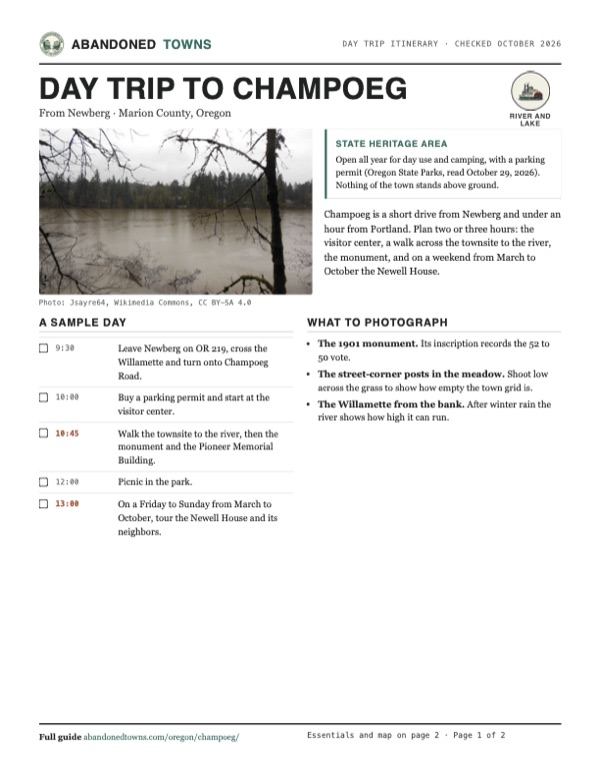
- The Willamette high and muddy after a wet February, 2014: Jsayre64, Wikimedia Commons, CC BY-SA 4.0
- The 1901 monument, August 2011: Little Mountain 5, Wikimedia Commons, CC BY-SA 3.0
- A street-corner post in the meadow, May 2003: Clipdude, Wikimedia Commons, CC BY-SA 3.0
- The visitor center, October 2009: M.O. Stevens, Wikimedia Commons, CC BY-SA 3.0
- The garden at the Manson farmstead, September 2016: Jrozwado, Wikimedia Commons, CC BY-SA 4.0
- The barn at the Manson farmstead, September 2016: Jrozwado, Wikimedia Commons, CC BY-SA 4.0
- River steamers Ruth and Oregona on the Willamette at Champoeg, about 1910: Unknown author (Salem Public Library), Wikimedia Commons, Public domain
- The Pioneer Memorial Building, August 2018: Rick Obst, Wikimedia Commons, CC BY 2.0
- Artifacts from a flood-destroyed building, 1973 dig: John Atherton (gbaku at Flickr), Wikimedia Commons, CC BY-SA 2.0
- Archaeologists on the townsite meadow, summer 1974: John Atherton, Wikimedia Commons, CC BY-SA 2.0
- Excavating the townsite, summer 1974: John Atherton, Wikimedia Commons, CC BY-SA 2.0
- Topo map, area base map and aerial imagery: USGS The National Map (public domain).
- Historic maps: USGS Historical Topographic Map Collection (public domain): Vancouver 1964, 1:250,000; Oregon City 1982, 1:100,000.