 Abandoned

Overview
A mining town without a saloon

Gold brought settlers to Wolf Creek in the late 1840s, and most of them left in 1850 when gold was found on the nearby Salmon River. Chinese miners took over the abandoned mines, and when the settlers came back some years later, they drove them out. Oregon State Parks says an 1850s mining camp on the site gave way to a town around 1890.
Golden had about 100 people at its peak, by the State Parks count, and served miners working claims farther out. Wikipedia puts more than 150 people along Coyote Creek in 1892. The town was known for what it lacked: there were no saloons in the town center. It had two active churches and a large orchard planted by the founding families. A hydraulic mine worked the creek, a post office ran from 1896 to 1920, and a stamp mill went up in 1915.
Josephine County bought the old Ruble mining claims near Golden in 1968. In 2002 the district was listed on the National Register of Historic Places, and Oregon Parks and Recreation bought it that year. It is the only former mining community the agency owns and manages.
Timeline
Golden through the years

- Gold brings the first settlers to Wolf Creek.
- Most of them leave for a new gold find on the nearby Salmon River. Chinese miners take over the abandoned mines; the settlers later return and drive them out.
- A mining camp grows up here (Oregon State Parks).
- A schoolhouse goes up about half a mile downstream from Golden.
- The camp gives way to a town (Oregon State Parks).
- More than 150 people live along Coyote Creek.
- The Golden post office opens.
- A stamp mill is built.
- The post office closes.
- The church is rebuilt.
- Josephine County buys the old Ruble mining claims near Golden.
- The Golden Historic District joins the National Register on July 25. Oregon Parks and Recreation buys the property the same year.
- The state buys another 5.43 acres to add to the site.
- Golden becomes an Oregon State Heritage Site, according to Wikipedia.
What's left
Four buildings above the creek


State Parks lists four buildings: a church, a former residence, a shed, and a structure that once held the post office and store. Wikipedia says the church was rebuilt in 1950. The site sits above the valley the miners worked. Wikipedia also places the 1885 schoolhouse about half a mile downstream, outside that list of four.
The 1954 Glendale sheet in the historic maps below names Golden on Coyote Creek, with the Blue Channel Placer along the creek and the Jackpot, Victor, Morning, MacAbee and Anaconda mines on the slopes around it. The 1904 Riddle sheet doesn't name the town, but it shows a cluster of buildings on Coyote Creek, with Wolf Creek to the west and Greenback to the southeast.
- Church (rebuilt 1950)
- Post office and store building
- Former residence
- Shed


Legend
Haunted, by television
Golden appeared on the paranormal show Ghost Adventures, which presented the town, and the church in particular, as haunted. Locals on the show described feeling disoriented or possessed. That's a television story, not a historical record, and we label it as legend.
Historic maps
Golden on USGS maps, 1904–1954
Crops from the USGS Historical Topographic Map Collection, centered on the townsite. Each sheet shows what surveyors mapped that year; compare them with today's topo and aerial on this page.

Day trip
Plan a day trip to Golden from Grants Pass
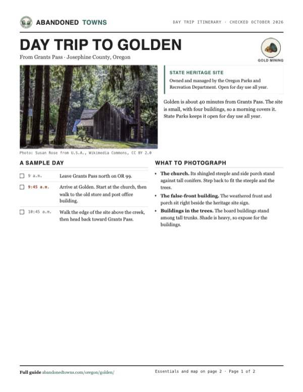
Take it with you
Day trip itinerary
The essentials, the sample day with boxes to tick, what to photograph and the coordinates, on two printable pages. Handy where there's no signal.
Download the PDF (688 KB)Golden is about 40 minutes from Grants Pass. The site is small, with four buildings, so a morning covers it. State Parks keeps it open for day use all year.
A sample day
- Leave Grants Pass north on OR 99.
- Arrive at Golden. Start at the church, then walk to the old store and post office building.
- Walk the edge of the site above the creek, then head back toward Grants Pass.
What to photograph and film
- The church. Its shingled steeple and side porch stand against tall conifers. Step back to fit the steeple and the trees.
- The false-front building. The weathered front and porch sit right beside the heritage site sign.
- Buildings in the trees. The board buildings stand among tall trunks. Shade is heavy, so expose for the buildings.
Map & directions
Getting there
Golden is a short drive off the main north–south corridor through southern Oregon. From Grants Pass, head north on OR 99 and turn onto Coyote Creek Road. From Medford, the drive follows I-5 north to the same road.


Base map: USGS The National Map (public domain). Routes: OSRM on © OpenStreetMap contributors data (ODbL), computed October 2026. Times assume dry roads.
- From downtown, follow Southwest G Street, Southwest 4th Street, Northwest Washington Boulevard and Savage Street.1.2 mi
- Turn left on Northeast 7th Street, OR 99, and continue north on OR 99.18.5 mi
- Take the exit ramp.0.2 mi
- Turn right onto Coyote Creek Road and follow it to Golden.3.6 mi
- From downtown Medford, take 4th Street, Biddle Road and Hilton Road to Crater Lake Highway, OR 62, and the I-5 ramp.2.9 mi
- Follow I-5 north.45.3 mi
- Take the exit ramp.0.2 mi
- Turn right onto Coyote Creek Road and follow it to Golden.3.6 mi
Road and safety notes
- An undated listing rates the road 2WD.
- The State Parks page lists exhibit information as the site's only feature, with no restrooms or water. Bring water and food from Grants Pass.
- Summers are hot and dry, and snow falls some winters.
Photos
Golden in photos
Visitor reports
Been to Golden?
Been there lately? Tell the next visitor what you found: whether you could get in, the state of the road and what's still standing. Photos are welcome. We read every report before it appears here.
Gold mining
More gold mining ghost towns
The nearest in Oregon.

 Guide
Granite
44.81, -118.42Grant County, Oregon
Gold found on the Fourth of July in 1862 gave this camp an early name, Independence. Eighty years of mining ended in 1942, and 32 people lived among…
 Guide
Sumpter
44.75, -118.20Baker County, Oregon
A railroad and deep gold mines made Sumpter a town of more than 2,000 by 1900. Fire took twelve blocks in 1917, the dredges turned over the valley…
Nearby
Other sites near Golden
Straight-line distance from the townsite to other mapped sites in our Oregon index.
- Greenback2.3 mi SE · Josephine
- Placer3.6 mi S · Josephine
- Rock Point21.0 mi SE · Jackson
- Jacksonville31.5 mi SE · Jackson
- Persist37.2 mi E · Jackson
- Sterlingville37.3 mi SE · Jackson
- Kerby37.5 mi SW · Josephine
- Buncom39.0 mi SE · Jackson
Sources
Sources and credits
- ghosttowns.com, "Golden": fact sheet fields (road, climate, best time).
- Wikipedia, "Golden, Oregon", retrieved October 2026: Wolf Creek settlement, 1850 exodus, Chinese miners, hydraulic mine, schoolhouse, 1892 population, post office dates, stamp mill, church rebuild, National Register date, 2011 heritage site, Ghost Adventures.
- Oregon State Parks, Golden State Heritage Site, official site, read October 19, 2026: open for day use year-round, phone numbers, peak population, 1850s camp and town around 1890, no saloons, churches and orchard, four remaining buildings, 1968, 2002 and 2006 purchases, exhibit information as the only listed feature, no fee listed.
- Coordinates: Wikipedia (from USGS GNIS). Elevation: USGS 3D Elevation Program point query. Routes: OSRM on OpenStreetMap data, October 2026.
Photo and map credits
- Board buildings among the conifers, 2019: Susan Rose from U.S.A., Wikimedia Commons, CC BY 2.0
- The church, 2018: Drown Soda, Wikimedia Commons, CC BY-SA 4.0
- The false-front building and the heritage site sign, 2019: Susan Rose from U.S.A., Wikimedia Commons, CC BY 2.0
- A white clapboard building with a side porch at Golden, 2018: Drown Soda, Wikimedia Commons, CC BY-SA 4.0
- A false-front building with a sagging porch, June 2019: Susan Rose from U.S.A., Wikimedia Commons, CC BY 2.0
- The church, 2009: Tedder, Wikimedia Commons, CC BY 3.0
- Inside the church: plank pews, a pulpit and a wooden cross, 2019: Susan Rose from U.S.A., Wikimedia Commons, CC BY 2.0
- A plank-walled room with a blackboard, inside one of Golden's buildings, 2019: Susan Rose from U.S.A., Wikimedia Commons, CC BY 2.0
- Topo map, area base map and aerial imagery: USGS The National Map (public domain).
- Historic maps: USGS Historical Topographic Map Collection (public domain): Riddle 1904, 1:125,000; Glendale 1954, 1:62,500.