 Abandoned

Overview
A railroad town in the woods
Rausch Gap sat on the south slope of Sharp Mountain, where Rausch Creek cuts through on its way to Stony Creek. Coal was found in the valley in 1824, and in the 1850s the Dauphin and Susquehanna Coal Company ran a railroad up it from the Susquehanna River. Rausch Gap became the line's hub, with the company's offices and repair shops, and by 1860 it had about 1,000 people.
In 1872 the shops and offices moved to Pine Grove, and the town never recovered. Fewer than 100 people were left by 1875, most buildings were pulled down around 1883, and by 1910 everyone was gone. Mining in the valley went on into the 1930s, and the railroad quit in 1939.
In 1945 the Game Commission bought the valley, and the rail bed became the Stony Valley rail-trail. The Appalachian Trail crosses it at the townsite, where hikers find stone foundations, a few gravestones from the 1850s and a trail shelter.
Timeline
Sixty years on the railroad

- Moravian missionaries arrive and name the Stony Creek Valley St. Anthony's Wilderness.
- Coal is found in the valley.
- Wikipedia says the town may date from as early as 1828.
- The Dauphin and Susquehanna Coal Company builds a railroad up the valley from the Susquehanna, and Rausch Gap grows fast as its hub, with company offices and repair shops. In 1854 the line reaches east to Pine Grove and Auburn.
- The railroad becomes the Schuylkill and Susquehanna.
- About 1,000 people live here, working in the mines and the railroad shops.
- The machine shops and offices move to Pine Grove, and the line becomes part of the Philadelphia and Reading.
- Fewer than 100 people remain.
- Most of the buildings are torn down.
- The last residents are gone.
- The Reading gives up the money-losing line after a bridge burns.
- The Pennsylvania Game Commission buys about 44,000 acres of the valley. The rail bed later becomes a restricted road and trail through State Game Lands 211.
What's left
Foundations at the crossing
TrailLink puts the townsite at mile 13.5 of the rail-trail, counted from the western end at Dauphin, where the Appalachian Trail crosses. Stone foundations and a cemetery with a few headstones from the 1850s are visible in the forest. An undated listing adds cellar holes in the upper town, a stone arch railroad bridge in disrepair, and four headstones in the cemetery, two of them legible. Wikipedia notes an Appalachian Trail shelter, a cold spring and an outhouse at the site.
The historic maps below show the town's name at the top edge of the 1892 sheet, the Reading's Rausch Gap Station in 1947, and the Appalachian Trail and State Game Lands in 1999.
- Stone foundations and cellar holes
- Cemetery with 1850s headstones
- Stone arch railroad bridge
- Rail bed (Stony Valley rail-trail)
- Appalachian Trail shelter and spring


Historic maps
Rausch Gap on USGS maps, 1892–1999
Crops from the USGS Historical Topographic Map Collection, centered on the townsite. Each sheet shows what surveyors mapped that year; compare them with today's topo and aerial on this page.

Day trip
Plan a day trip to Rausch Gap from Pine Grove
Take it with you
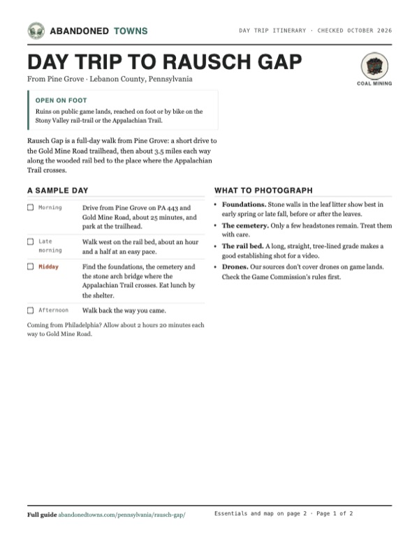
Day trip itinerary
The essentials, the sample day with boxes to tick, what to photograph and the coordinates, on two printable pages. Handy where there's no signal.
Download the PDF (420 KB)Rausch Gap is a full-day walk from Pine Grove: a short drive to the Gold Mine Road trailhead, then about 3.5 miles each way along the wooded rail bed to the place where the Appalachian Trail crosses.
A sample day
- Drive from Pine Grove on PA 443 and Gold Mine Road, about 25 minutes, and park at the trailhead.
- Walk west on the rail bed, about an hour and a half at an easy pace.
- Find the foundations, the cemetery and the stone arch bridge where the Appalachian Trail crosses. Eat lunch by the shelter.
- Walk back the way you came.
Coming from Philadelphia? Allow about 2 hours 20 minutes each way to Gold Mine Road.
What to photograph and film
- Foundations. Stone walls in the leaf litter show best in early spring or late fall, before or after the leaves.
- The cemetery. Only a few headstones remain. Treat them with care.
- The rail bed. A long, straight, tree-lined grade makes a good establishing shot for a video.
- Drones. Our sources don't cover drones on game lands. Check the Game Commission's rules first.
Map & directions
Getting there
No public road reaches Rausch Gap. Both routes below end on Gold Mine Road, the nearest trailhead, about 3.5 to 3.8 miles east of the townsite along the rail-trail. Pine Grove is the closest town; from Philadelphia the route follows the Turnpike to Lebanon and PA 72 north.


Base map: USGS The National Map (public domain). Routes: OSRM on © OpenStreetMap contributors data (ODbL), computed October 2026. Times assume dry roads.
- From Pine Grove, follow PA 443 (South Tulpehocken Street, then Suedberg Road).9.0 mi
- Turn right on Gold Mine Road and follow it up the mountain.3.0 mi
- From Center City, take the Vine Street Expressway (I-676) and the Schuylkill Expressway (I-76) west to the Turnpike.19.8 mi
- Follow the Pennsylvania Turnpike (I-76) west.60.1 mi
- Take PA 72 north (Lebanon Road, then Quentin Road).6.7 mi
- Cross Lebanon on Colebrook Road and South 12th, Walnut, South 16th, Lehman and North 22nd streets.2.9 mi
- Turn left on Ebenezer Road (PA 72), which becomes Suedberg Road (PA 443).13.4 mi
- Turn left on Gold Mine Road.3.0 mi
Road and safety notes
- Visit Lebanon Valley's directions: take PA 72 north, which becomes PA 443, turn left on Gold Mine Road, follow it to the top of the mountain, then turn left on Old Railroad Bed Road. "The trailhead and parking are straight ahead."
- The rail-trail is closed to motor vehicles except for one day each fall, when it opens to cars between the Ellendale Road and Gold Mine Road trailheads. In 2026 the Game Commission's Stoney Valley driving tour ran on Sunday, October 18, from the Ellendale Forge gate to the Gold Mine gate.
- TrailLink rates the surface dirt and gravel. A November 2024 reviewer found it resurfaced with stones he called too big, and an April 2026 reviewer found the large stones a very bumpy ride.
- TrailLink lists no trailside amenities. Carry water and food.
Photos
Have photos of Rausch Gap?
We haven’t added more photographs of Rausch Gap yet. If you’ve visited, share your photos and a field report below.
Visitor reports
Been to Rausch Gap?
Been there lately? Tell the next visitor what you found: whether you could get in, the state of the road and what's still standing. Photos are welcome. We read every report before it appears here.
Coal mining
More coal mining ghost towns
The nearest in Pennsylvania.

 Guide
Centralia
40.80, -76.34Columbia County, Pennsylvania
A coal borough of more than 2,000 people, emptied by a mine fire that has burned beneath it since 1962. A street grid, a few houses, a church and…
 Guide
Concrete City
41.19, -75.98Luzerne County, Pennsylvania
A model village of poured-concrete double houses that a railroad built for its miners in 1911. It was empty by 1924, and the buildings proved too…
Nearby
Other sites near Rausch Gap
Straight-line distance from the townsite to other mapped sites in our Pennsylvania index.
- Alaska21.4 mi NE · Northumberland
- Byrnesville24.6 mi NE · Columbia
- Centralia24.9 mi NE · Columbia
- Alvira47.7 mi NW · Union
- Ingleby49.9 mi NW · Centre
- Milford Mills54.8 mi SE · Chester
- Fricks Locks56.1 mi E · Chester
- Concrete City57.7 mi NE · Luzerne
Sources
Sources and credits
- ghosttowns.com, "Rausch Gap": fact sheet fields (county, roads, climate, best time, remains).
- Wikipedia, "Rausch Gap, Pennsylvania", retrieved October 2026: founding, railroad, population, the 1872 move, abandonment, remains, the shelter and spring, coordinates.
- TrailLink, "Stony Valley Rail-Trail", read October 2026: trail length and mileposts, remains at the townsite, railroad history, the 1945 purchase, hunting-season and orange rules, surface, and dated reviews from 2024 to 2026.
- Visit Lebanon Valley, "Stony Valley Trail" (Gold Mine Road Trail Head): directions to the trailhead, Rausch Gap's distance from it, the Moravian missionaries, 1824 coal discovery, the one-day vehicle opening each fall.
- Pennsylvania Game Commission, "Game Commission to Host Driving Tours on Several Game Lands This Fall", September 8, 2026: the October 18 Stoney Valley tour of State Game Lands 211, the railroad bed across the game lands, the Appalachian and Horse-Shoe trails.
- Elevation: USGS 3D Elevation Program point query. Routes: OSRM on OpenStreetMap data, October 2026.
Photo and map credits
- Rausch Gap Station on the Reading line, 1947 USGS sheet: U.S. Geological Survey, USGS catalog, Public domain
- Area base map, topo and aerial imagery: USGS The National Map (public domain).
- Historic maps: USGS Historical Topographic Map Collection (public domain): Hummelstown 1892, 1:62,500; Indiantown Gap 1947, 1:24,000; Indiantown Gap 1999, 1:24,000.