 Abandoned
Overview
A canal village and its neighbor
Frick's Lock began as farmland along the Schuylkill River, with a farmhouse from the 1750s. In the early 1820s the Schuylkill Navigation Company built two locks on land it bought from John Frick, and a small village grew around them, with a manor house, a locktender's house, a barn and other buildings. Coal boats passed through until the canal's last season in 1925, and the canal closed in 1930.
The village outlived the canal. Then in 1969 and 1970 PECO bought it for the Limerick nuclear plant, rising on the other bank. The residents moved away, and by the time the plant went online in 1986 the village was empty.
The buildings were stabilized and partly restored after 2011, and the district has been on the National Register since 2003. Today East Coventry Township's historical commission and volunteers lead free tours, and the Schuylkill River Trail passes by.
Timeline
Two centuries beside the river

- A farmhouse goes up on the Grumbacher farm; the township dates it to 1757. Wikipedia lists a house built in 1752 that it calls the oldest in Chester County.
- John Frick marries Catherine Grumbacher.
- The Schuylkill Navigation Company is chartered to build a canal along the river.
- The Manor House is built.
- Locks 54 and 55 are built on land bought from John Frick, and the village becomes known as Frick's Locks. Frick dies in 1822.
- The canal opens, and the locktender's house is built.
- John Frick's heirs sell his land at public auction, and his eldest son Jacob buys the part that holds the village.
- The Pennsylvania Railroad opens a station, and a Fricks Lock post office follows.
- Floods fill parts of the canal in late 1925, its last year of use. It closes in 1930.
- PECO buys the village for the Limerick nuclear plant across the river.
- The plant goes online. By then every resident has moved out.
- The 18-acre Fricks Locks Historic District is listed on the National Register of Historic Places.
- The locktender's house burns.
- Exelon effectively donates the land and eleven historic structures to East Coventry Township, by Wikipedia's account. The township's own page instead describes an agreement with Constellation Energy Generation that opens the village for escorted public access. Restoration begins, and the township historical commission's free tours start in 2013.
- Tours run on two Saturdays a month from May to October.
What's left
Old houses under the towers


Wikipedia counts eleven historic structures, among them the 1821 Manor House and a house from 1752 that it calls the oldest in Chester County. The township dates the village's first farmhouse to 1757 and puts the canal about 100 feet north of it and the double lock about 250 feet west. An undated listing names about ten buildings and a barn. The locktender's house burned in 2008. The township says the buildings have been rehabilitated or stabilized, and the tour is held entirely outdoors.
The 1906 and 1943 sheets below show Fricks Lock beside the railroad on the west bank, with the Reading line across the river, and the 1955 sheet carries a later purple overprint adding the plant's cooling towers on the far bank.
- Manor House (1821)
- Farmhouse (1750s)
- Canal-era buildings and barn
- Canal bed
- Stone walls


Historic maps
Frick's Lock on USGS maps, 1906–1984
Crops from the USGS Historical Topographic Map Collection, centered on the townsite. Each sheet shows what surveyors mapped that year; compare them with today's topo and aerial on this page.
Day trip
Plan a day trip to Frick's Lock from Pottstown
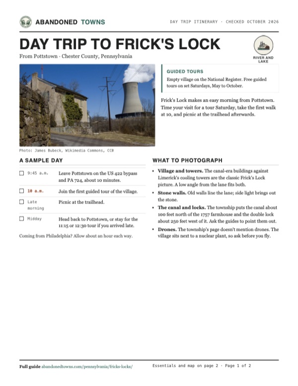
Take it with you
Day trip itinerary
The essentials, the sample day with boxes to tick, what to photograph and the coordinates, on two printable pages. Handy where there's no signal.
Download the PDF (585 KB)Frick's Lock makes an easy morning from Pottstown. Time your visit for a tour Saturday, take the first walk at 10, and picnic at the trailhead afterwards.
A sample day
- Leave Pottstown on the US 422 bypass and PA 724, about 10 minutes.
- Join the first guided tour of the village.
- Picnic at the trailhead.
- Head back to Pottstown, or stay for the 11:15 or 12:30 tour if you arrived late.
Coming from Philadelphia? Allow about an hour each way.
What to photograph and film
- Village and towers. The canal-era buildings against Limerick's cooling towers are the classic Frick's Lock picture. A low angle from the lane fits both.
- Stone walls. Old walls line the lane; side light brings out the stone.
- The canal and locks. The township puts the canal about 100 feet north of the 1757 farmhouse and the double lock about 250 feet west of it. Ask the guides to point them out.
- Drones. The township's page doesn't mention drones. The village sits next to a nuclear plant, so ask before you fly.
Map & directions
Getting there
Pottstown is the closest town, about 10 minutes away by the US 422 bypass and PA 724. From Philadelphia the route follows the Schuylkill Expressway and US 422 up the river. Both end on Fricks Lock Road at the village.


Base map: USGS The National Map (public domain). Routes: OSRM on © OpenStreetMap contributors data (ODbL), computed October 2026. Times assume dry roads.
- From downtown, take Queen Street and South Hanover Street to the bypass.0.8 mi
- Follow the Pottstown Bypass (US 422).1.4 mi
- At the end of the ramp, turn left on East Schuylkill Road (PA 724).1.3 mi
- Turn left on Lower Fricks Lock Road, which becomes Fricks Lock Road.0.8 mi
- From Center City, take the Vine Street Expressway (I-676) and the Schuylkill Expressway (I-76) to exit 328A.18.8 mi
- Follow US 422, the County Line and Pottstown expressways, west.14.4 mi
- Exit and turn sharp left on North Lewis Road, then right on Linfield Road through Linfield.3.1 mi
- Turn right on East Schuylkill Road (PA 724), then right on Sanatoga Road.1.9 mi
- Turn right on Lower Fricks Lock Road, which becomes Fricks Lock Road.0.3 mi
Road and safety notes
- Schuylkill River Greenways lists the Fricks Lock Trailhead, with parking and a picnic area, at 500 Fricks Lock Road.
- The township's page doesn't say where tours meet. Ask the township office (610-495-5443, weekdays 8 a.m. to 4:30 p.m.) if you're unsure.
- Philadelphia drive times assume light traffic on the Schuylkill Expressway.
Photos
Frick's Lock in photos
Visitor reports
Been to Frick's Lock?
Been there lately? Tell the next visitor what you found: whether you could get in, the state of the road and what's still standing. Photos are welcome. We read every report before it appears here.
River and lake
More river and lake ghost towns
The nearest, in other states.

 Guide
Foul Rift
40.80, -75.10Warren County, New Jersey
A river landing at the most dangerous stretch of the Delaware, then a mill site, then a colony of summer cottages. Floods wrecked the cottages…
 Guide
Raritan Landing
40.51, -74.46Middlesex County, New Jersey
For a century and a half the head of navigation on the Raritan River had a busy port town. It is gone, buried under the lawns of Johnson Park, but a…
Nearby
Other sites near Frick's Lock
Straight-line distance from the townsite to other mapped sites in our Pennsylvania index.
- Port Kennedy12.5 mi SE · Montgomery
- Milford Mills12.9 mi SW · Chester
- Shenandoah Woods28.8 mi E · Bucks
- Byrnesville55.6 mi NW · Columbia
- Centralia56.1 mi NW · Columbia
- Rausch Gap56.1 mi W · Lebanon
- Alaska58.8 mi NW · Northumberland
- Concrete City69.7 mi N · Luzerne
Sources
Sources and credits
- ghosttowns.com, "Fricks Locks": fact sheet fields (county, climate, best time, remains).
- Wikipedia, "Fricks Locks Historic District", retrieved October 2026: locks 54 and 55, canal dates, Manor House, the 1752 house, locktender's house and its 2008 fire, NRHP listing, the 1986 plant opening, the 2011 donation, the 2013 start of tours, coordinates.
- East Coventry Township, "Fricks Lock Village", as of October 2026: history and dates, the 1757 farmhouse and the canal and lock locations, PECO purchase, the Constellation agreement and escorted access, 2026 tour dates and times, cost, weather rule, address, phone and office hours.
- Schuylkill River Greenways, "Fricks Lock" trailhead: address, parking, picnic area.
- Elevation: USGS 3D Elevation Program point query. Routes: OSRM on OpenStreetMap data, October 2026.
Photo and map credits
- The old canal store and a Limerick cooling tower, March 2010: James Bubeck, Wikimedia Commons, CC0
- An empty stuccoed house with shuttered windows and a damaged wall, March 2010: James Bubeck, Wikimedia Commons, CC0
- The shell of the former locktender's house behind a No Trespassing sign, March 2010: James Bubeck, Wikimedia Commons, CC0
- A brick house and a sided house in the historic district, June 2023: JJonahJackalope, Wikimedia Commons, CC BY-SA 4.0
- A two-storey house with peeling siding and new windows, June 2023: JJonahJackalope, Wikimedia Commons, CC BY-SA 4.0
- Fricks Lock on the 1906 USGS sheet, beside the Schuylkill Division railroad line, with the Reading across the river: U.S. Geological Survey, USGS catalog, Public domain
- Area base map, topo and aerial imagery: USGS The National Map (public domain).
- Historic maps: USGS Historical Topographic Map Collection (public domain): Phoenixville 1906, 1:62,500; Phoenixville 1943, 1:62,500; Phoenixville 1955, 1:24,000; Reading 1984, 1:100,000.