 Abandoned

Overview
A lumber town at the end of the line

Tremont was the last base of the Little River Lumber Company, which cut most of the Little River watershed in the first decades of the 20th century. For years the company couldn't touch Middle Prong. William Walker, who had farmed Walker Valley since about 1859, refused to sell, so the railroad went east to Elkmont instead. Walker gave in only in December 1918, after a stroke, and on the promise that Thunderhead Prong would not be cut.
When Elkmont was logged out in 1925, the rails were moved to Middle Prong, and a town grew up where Lynn Camp Prong and Thunderhead Prong join. It had a post office, a hotel, maintenance sheds, a general store and a community building that served as church, school and movie theater. The loggers lived in shanties that rode flatcars from camp to camp as the cutting moved up the valley. Townsend kept his promise about Thunderhead Prong until he died in 1935. Then the company cut it, and in December 1938 the last trees came down.
The park took over, the Civilian Conservation Corps turned the rail beds into roads and trails, and the forest grew back. Today the name Tremont covers the whole Middle Prong watershed and the Great Smoky Mountains Institute at Tremont, an education center in Walker Valley about three miles down the road. The townsite itself is the cul-de-sac and parking area at the end of Upper Tremont Road, beside the bridge where the Middle Prong Trail begins.
Timeline
Walker Valley to the last tree
- William Marion Walker settles on Middle Prong in the valley that now carries his name. Tenant farmers follow, and he builds three gristmills.
- John English's logging venture puts a splash dam on Middle Prong at the mouth of Spruce Flats. A flood apparently wipes out his splash dams in the late 1890s, and the business has folded by 1900.
- Colonel Wilson B. Townsend forms the Little River Lumber Company and buys 86,000 acres. Walker refuses to sell Middle Prong.
- After a stroke, Walker sells Middle Prong on Townsend's promise not to cut Thunderhead Prong. He dies six months later.
- With Elkmont cut over, the rails are moved to Middle Prong. A base camp grows up where Lynn Camp Prong and Thunderhead Prong meet and is named Tremont, for "tree" and "mountain".
- The Tremont Hotel opens for loggers and travelers, and later takes tourists. Townsend sells his tract to the park commission but keeps the right to log for 15 years.
- The Civilian Conservation Corps runs a camp up Lynn Camp Prong. Its crews build 32 miles of foot trails, 10 bridges, 34.7 miles of horse trails and 14.9 miles of truck trails.
- Townsend dies. The company then cuts Thunderhead Prong.
- The last trees in the Tremont area are cut, and logging ends.
- Maryville College and the Park Service open the Tremont Environmental Education Center in Walker Valley, down the road from the townsite.
- The center is renamed the Great Smoky Mountains Institute at Tremont.
1926–1938
Rats, floods and a hotel with a reputation
Dora Cope, who lived at Tremont in the late 1920s and 1930s, left a vivid account of camp life, and the Tremont Institute points readers to Florence Cope Bush's book Dorie for more. Cope remembered camps overrun with rats and at the mercy of fire and weather. Middle Prong was a "crystal playground" on a calm day, she said, and a roaring monster after a storm high on the mountain.
Townsend tried to sell Tremont as a resort, as he had Elkmont. The Tremont Hotel opened in 1926 for loggers and travelers, and as the camps moved up the valley it took in tourists. Mountain families talked. Cope recalled that some called the hotels at Elkmont and Tremont "the Sodom and Gomorrah of the mountains", and that local girls were warned to stay away.
What's left
A bridge, a boulder and an old rail grade

Almost nothing of the town survives. The Tremont Institute's guide to the trail says to stand on the bridge at the trailhead and look down on the left: pieces of iron on a boulder are what's left of the dynamo that powered the hotel. An undated listing names the foundation of the water-powered generator. Elsewhere, stray rails, ties and skidder cables turn up beside the trail.
The Middle Prong Trail follows the old railroad bed up Lynn Camp Prong. The Park Service puts Lynn Camp Prong Cascades 1.4 miles round trip from the trailhead. The Institute's guide adds a rusting car about two miles up, a Cadillac in the guidebooks and a Packard according to a man who once worked at Tremont, and, about a mile beyond, the site of the CCC camp, where terraced ground marks the bunkhouses, a pile of chimney stones marks the dining hall and a small brick chimney stands across the trail.
Today's USGS topo marks the Mid Prong Trail trailhead where the road ends, with the Tremont name printed about half a mile down the valley; that printed point is the one Wikipedia and GNIS use. The 1886 sheet in the historic maps below shows only Middle Prong and the ridges. The 1964 Thunderhead Mountain sheet labels Tremont, a gate at the end of the road and a restricted road beyond it along Lynn Camp Prong, and the 1983 sheet still names Tremont, with Meigs Mountain to the northeast.
- Dynamo iron on a boulder below the trailhead bridge
- Generator foundation
- Railroad grade (now the Middle Prong Trail)
- Stray rails, ties and skidder cables
- A car rusting there since the 1930s, about 2 mi up the trail
- CCC camp chimneys, about 3 mi up the trail


Historic maps
Tremont on USGS maps, 1886–1983
Crops from the USGS Historical Topographic Map Collection, centered on the townsite. Each sheet shows what surveyors mapped that year; compare them with today's topo and aerial on this page.

Day trip
Plan a day trip to Tremont from Townsend
Take it with you
Day trip itinerary
The essentials, the sample day with boxes to tick, what to photograph and the coordinates, on two printable pages. Handy where there's no signal.
Download the PDF (655 KB)Tremont is a half day or a full one from Townsend. The townsite is the trailhead at the end of Upper Tremont Road, and what's left of the logging days lies along the Middle Prong Trail, which follows the old railroad bed up Lynn Camp Prong. There's no food or water at the trailhead, so bring both.
A sample day
- Leave Townsend with a parking tag, bought online or at Sugarlands Visitor Center. The last 3.1 miles are on unpaved Upper Tremont Road; about 25 minutes in all.
- Stop at the Tremont Institute's visitor center as it opens, then drive on to the end of the road.
- Stand on the trailhead bridge and look down on the left: the iron on the boulder is what's left of the hotel's dynamo.
- Walk up the old rail bed to Lynn Camp Prong Cascades, 0.7 mile in.
- Eat your packed lunch by the stream.
- Go on to the old car, on a spur trail to the right before the Panther Creek Trail junction, and the CCC camp chimneys a mile beyond. Walk back the way you came.
Coming from Knoxville? Allow about 1 hour 20 minutes each way.
What to photograph and film
- The confluence. Lynn Camp Prong and Thunderhead Prong meet to form Middle Prong, which you can see off the right side of the trailhead bridge.
- The dynamo iron. Look down on the left from the same bridge. A longer lens helps pick out the iron on the boulder.
- Lynn Camp Prong Cascades. The park lists the cascades as a scenic view and photo spot.
- The old car. Guidebooks call it a Cadillac; a former Tremont worker told the Institute it's a Packard. It has rusted there since the 1930s.
- CCC camp. A pile of chimney stones marks the dining hall, and a small brick chimney stands across the trail.
- Drones. Not allowed. The park bans drones and other unmanned aircraft.
Map & directions
Getting there
Townsend is the closest town. Both routes enter the park on the Townsend Entrance Road, turn onto Laurel Creek Road, and follow Tremont Road past the Institute, where Upper Tremont Road continues three miles to the trailhead. From Knoxville the route follows SR 33 and then US 321.


Base map: USGS The National Map (public domain). Routes: OSRM on © OpenStreetMap contributors data (ODbL), computed October 2026. Times assume dry roads.
- Take Chestnut Hill Road to East Lamar Alexander Parkway (US 321) and turn right.2.8 mi
- Continue on the Townsend Entrance Road into the park, then turn right onto Laurel Creek Road.1.0 mi
- Turn left onto Tremont Road.2.0 mi
- Continue on Upper Tremont Road, unpaved, to the Middle Prong trailhead at its end.3.1 mi
- Head south on Henley Street (US 441), which becomes Chapman Highway.1.5 mi
- Turn right onto West Martin Mill Pike (SR 33), then bear right onto Ogle Avenue.1.0 mi
- Follow SR 33 as Maryville Pike, Old Knoxville Highway and East Broadway Avenue.12.2 mi
- At the roundabout take South Everett High Road, then Wilcox Street.1.3 mi
- Turn left onto East Lamar Alexander Parkway (US 321).17.9 mi
- Continue on the Townsend Entrance Road into the park, then turn right onto Laurel Creek Road.1.0 mi
- Turn left onto Tremont Road.2.0 mi
- Continue on Upper Tremont Road, unpaved, to the Middle Prong trailhead at its end.3.1 mi
Road and safety notes
- Upper Tremont Road is "unpaved but well-maintained" (NPS, January 11, 2025). The park lists it as open year-round but subject to closure for snow, ice or muddy conditions (NPS seasonal roads page, April 20, 2026).
- Parking for more than 15 minutes needs a physical park parking tag: $5 a day, $15 a week, $40 a year. America the Beautiful passes don't replace it (NPS fees page, October 8, 2026).
- The routes are computed from OpenStreetMap and haven't been driven by us. Apart from the NPS note on Upper Tremont Road, we have no dated source on road surfaces.
- Dora Cope remembered Middle Prong turning into a torrent after storms high on the mountain. Take care near the water after rain.
Photos
Tremont in photos
Visitor reports
Been to Tremont?
Been there lately? Tell the next visitor what you found: whether you could get in, the state of the road and what's still standing. Photos are welcome. We read every report before it appears here.
Mill, lumber and company
More mill, lumber and company ghost towns
The nearest in Tennessee.

 Guide
Elkmont
35.66, -83.58Sevier County, Tennessee
A Little River Lumber Company town of 1908 that became a summer colony for Knoxville's well-off. The leases ran out in 1992, and the park has…
 Guide
Pressmen's Home
36.45, -83.05Hawkins County, Tennessee
For 56 years a printing union ran its headquarters, trade school, sanatorium and hotel from a hidden valley north of Rogersville. The union left in…
Nearby
Other sites near Tremont
Straight-line distance from the townsite to other mapped sites in our Tennessee index.
- Elkmont5.4 mi NE · Sevier
- Calderwood19.7 mi SW · Monroe
- Tellico Plains39.4 mi SW · Monroe
- Wasp44.5 mi E · Cocke
- Wheat45.2 mi NW · Roane
- Fork Mountain54.8 mi NW · Anderson
- Montgomery63.0 mi NW · Morgan
- Pressmen's Home67.0 mi NE · Hawkins
Sources
Sources and credits
- ghosttowns.com, "Tremont": fact sheet fields (founding year, climate, best time, remains).
- Wikipedia, "Tremont, Tennessee", retrieved October 2026: geography, Tremont Road, William Walker, John English, the Little River Lumber Company, the 1918 sale, the town and its buildings, the name, the hotel, Dora Cope's recollections, the end of logging in 1938, the CCC, the Institute, and the GNIS coordinates.
- Great Smoky Mountains Institute at Tremont, "Middle Prong Trail: A Walk Through Time", by Jeremy Lloyd, January 14, 2021: the trailhead as the heart of the original Tremont, the dynamo iron, Florence Cope Bush's book Dorie, the rusting car, and the CCC camp and its work.
- National Park Service, "Lynn Camp Prong Cascades", updated January 11, 2025: parking at the Middle Prong Trailhead at the end of Upper Tremont Road, the road's surface, and the 1.4-mile round trip.
- National Park Service, "Seasonal Road Schedule", updated April 20, 2026: Upper Tremont Road open year-round, subject to weather closures.
- National Park Service, "Fees & Passes", updated October 8, 2026: parking tag rules and prices, where to buy tags, the physical-tag rule, no entrance fee, and the 2026 fee-free days.
- National Park Service, "Laws & Policies", updated June 28, 2024: the drone ban and the rule on pets on trails.
- Great Smoky Mountains Institute at Tremont, "Contact Us", updated June 22, 2026: the visitor center's hours and the Institute's address on Tremont Road.
- Photos: Wikimedia Commons, credited below each one; the townsite photo's file page places it at the end of Tremont Road, at the confluence. Elevation: USGS 3D Elevation Program point query. Routes: OSRM on OpenStreetMap data, October 2026. Not field-checked.
Photo and map credits
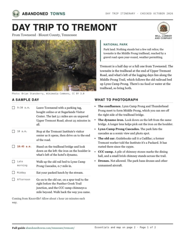
- Lynn Camp Prong just above where it meets Thunderhead Prong, October 2007: Brian Stansberry, Wikimedia Commons, CC BY 3.0
- The townsite, now the trailhead parking area, October 2007: Brian Stansberry, Wikimedia Commons, CC BY 3.0
- A small waterfall on Lynn Camp Prong, October 2007: Brian Stansberry, Wikimedia Commons, CC BY 3.0
- A logging-railroad rail beside the Middle Prong Trail, October 2007: Brian Stansberry, Wikimedia Commons, CC BY 3.0
- Area base map, topo and aerial imagery: USGS The National Map (public domain).
- Historic maps: USGS Historical Topographic Map Collection (public domain): Knoxville 1886, 1:125,000; Thunderhead Mtn 1964, 1:24,000; Knoxville 1983, 1:100,000.