 Abandoned

Overview
Everybody's somebody

Luckenbach sits among caliche hills and bottomland on Grape Creek, a tributary of the Pedernales. German farmers settled here around 1850, among them the Luckenbach brothers. The post office opened in 1854 as South Grape Creek, and Minnie Engel Luckenbach kept a store and saloon. In 1886 August Engel reopened the post office and renamed the town Luckenbach, and William Engel, the next postmaster, opened the general store that still stands.
The town peaked at 492 people in 1904 and then drained away. From the 1920s to the 1950s about 20 people lived here, and in 1967 the school closed. In 1971 Benno Engel sold the place to Hondo Crouch, a former swimming champion and columnist from Comfort, and his partners. Crouch called himself its mayor and declared it "a free state of mind."
Then came the music. Jerry Jeff Walker recorded Viva Terlingua here in 1973, and in 1977 Waylon Jennings's song about the town became a national hit. The general store, saloon and dance hall are open every day, and there is live music every weekend.
Timeline
Farm hamlet to free state of mind


- German farmers settle on Grape Creek, among them the brothers Jacob and August Luckenbach.
- A post office opens as South Grape Creek. The 1986 state marker says instead that a Grape Creek office ran briefly after 1858.
- Schoolmaster Jacob Brodbeck's airplane demonstration ends in a crash.
- The post office reopens with August Engel as postmaster, and the town is named Luckenbach. William Engel, the next postmaster, opens the general store, which still stands in its original building.
- The population peaks at 492. It falls to about 20 from the 1920s to the 1950s.
- The dance hall is rebuilt with a maple floor.
- The school is consolidated with Fredericksburg.
- Benno Engel sells the town to Hondo Crouch, with partners Kathy Morgan and Guich Koock. The 1986 state marker dates the purchase to 1970.
- The post office closes after 85 years.
- Jerry Jeff Walker records Viva Terlingua here.
- Waylon Jennings's hit "Luckenbach, Texas (Back to the Basics of Love)" makes the town famous, a year after Crouch's death.
- Willie Nelson's Fourth of July Picnic is held here.
What's left
Store, saloon and dance hall


Two buildings make the town. One holds the post office, saloon and general store, now mostly a souvenir shop. The other is the dance hall, rebuilt in the early 1930s with a maple floor. The old school stands nearby; a Luckenbach Club met there to keep up the grounds. State markers for the school and the town went up in 1982 and 1986.
- General store and post office (original building)
- Saloon
- Dance hall (early 1930s)
- School
- State historical markers


Historic maps
Luckenbach on USGS maps, 1894–1985
Crops from the USGS Historical Topographic Map Collection, centered on the townsite. Each sheet shows what surveyors mapped that year; compare them with today's topo and aerial on this page.

Day trip
Plan a day trip to Luckenbach from Fredericksburg
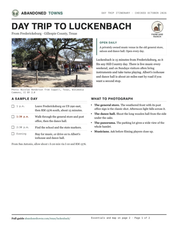
Take it with you
Day trip itinerary
The essentials, the sample day with boxes to tick, what to photograph and the coordinates, on two printable pages. Handy where there's no signal.
Download the PDF (568 KB)Luckenbach is 15 minutes from Fredericksburg, so it fits any Hill Country day. There is live music every weekend, and on Sundays visitors often bring instruments and take turns playing. Albert's icehouse and dance hall is about 20 miles east by road if you want a second stop.
A sample day
- Leave Fredericksburg on US 290 east, then RM 1376 south, about 15 minutes.
- Walk through the general store and post office, then the dance hall.
- Find the school and the state markers.
- Stay for music, or drive on to Albert's icehouse and dance hall.
From San Antonio, allow about 1 h 20 min via I-10 and RM 1376.
What to photograph and film
- The general store. The weathered front with its post office sign is the classic shot. Afternoon light falls across it.
- The dance hall. Shoot the long wooden hall from the side under the oaks.
- The panorama. The parking lot gives a wide view of the whole hamlet.
- Musicians. Ask before filming players close up.
Map & directions
Getting there
Fredericksburg is 15 minutes away on US 290 east and RM 1376 south. From San Antonio, take I-10 to Comfort and RM 1376 north through Sisterdale. Road signs to Luckenbach are often stolen as souvenirs, so follow the route rather than the signs.


Base map: USGS The National Map (public domain). Routes: OSRM on © OpenStreetMap contributors data (ODbL), computed October 2026. Times assume dry roads.
- Head east on East Main Street (US 87/US 290) out of downtown Fredericksburg.2.4 mi
- Continue east on US 290.3.2 mi
- Turn right on RM 1376 to Luckenbach.4.5 mi
- From downtown San Antonio, take Durango Boulevard to I-10/US 87 at exit 156 and head northwest.1.7 mi
- Follow I-10 to exit 537 at Comfort.32 mi
- Take North Main Street (US 87 Business) into Comfort.1.0 mi
- Turn left on Sisterdale Road (RM 1376) and follow it north through Sisterdale to Luckenbach.28 mi
Road and safety notes
- Paved all the way. RM 1376 is a winding two-lane road; watch for deer and cyclists.
- Road signs to Luckenbach go missing as souvenirs. Follow the route or a map.
- Primitive RV camping, $25 a night with a two-night limit, is offered only on select non-ticketed weekends. Call ahead.
Photos
Luckenbach in photos
Visitor reports
Been to Luckenbach?
Been there lately? Tell the next visitor what you found: whether you could get in, the state of the road and what's still standing. Photos are welcome. We read every report before it appears here.
Farm and ranch
More farm and ranch ghost towns
The nearest in Texas.

 Guide
Albert
30.19, -98.60Gillespie County, Texas
A stage stop renamed for the storekeeper who moved here from Luckenbach. The town was put up for sale on eBay in 2007, and its icehouse and dance…
 Guide
Morris Ranch
30.22, -99.01Gillespie County, Texas
A town built around a big thoroughbred operation. The horses left in 1902, the post office in 1954, and the stone schoolhouse now stands on a private…
Nearby
Other sites near Luckenbach
Straight-line distance from the townsite to other mapped sites in our Texas index.
- Grapetown2.4 mi S · Gillespie
- Cain City3.5 mi W · Gillespie
- Bankersmith4.7 mi SW · Kendall
- Fort Martin Scott7.1 mi NW · Gillespie
- Albert9.3 mi E · Gillespie
- Pedernales11.3 mi W · Gillespie
- Nebgen School12.4 mi NE · Gillespie
- Morris Ranch15.4 mi W · Gillespie
Sources
Sources and credits
- Handbook of Texas Online, "Luckenbach, TX", accessed October 19, 2026: settlement, post office names, Engel family, store, population, dance hall, 1971 sale, Crouch, Walker, Jennings song, markers, Willie Nelson picnics.
- Luckenbach Texas, official site, and its lodging and food pages, as of October 2026: hours, address, phone, RV camping, food hours, ticketed shows.
- Wikipedia, "Luckenbach, Texas", retrieved October 2026: layout of the two main buildings, souvenir shop, weekend music and Sunday jams, post office closing in 1971.
- Elevation: USGS 3D Elevation Program point query. Routes: OSRM on OpenStreetMap data, October 2026.
Photo and map credits
- Luckenbach from the parking lot: WikiTryHardDieHard, Wikimedia Commons, CC BY-SA 3.0
- The Luckenbach state marker, 1986: WikiTryHardDieHard, Wikimedia Commons, CC BY-SA 3.0
- The general store and post office, 2019: Nicolas Henderson from Coppell, Texas, Wikimedia Commons, CC BY 2.0
- The dance hall, 2019: Nicolas Henderson from Coppell, Texas, Wikimedia Commons, CC BY 2.0
- The dance hall, another view, 2019: Nicolas Henderson from Coppell, Texas, Wikimedia Commons, CC BY 2.0
- The Luckenbach school, 2018: Renelibrary, Wikimedia Commons, CC BY-SA 4.0
- The Engel family state marker, 1990: WikiTryHardDieHard, Wikimedia Commons, CC BY-SA 3.0
- Area base map, topo and aerial imagery: USGS The National Map (public domain).
- Historic maps: USGS Historical Topographic Map Collection (public domain): Fredericksburg 1894, 1:125,000; Llano 1954, 1:250,000; Cain City 1963, 1:24,000; Pedernales River 1985, 1:100,000.