 Abandoned
Overview
The quicksilver camp that came back

Terlingua grew up on mercury. Prospectors found quicksilver ore in the desert west of the Chisos Mountains in the mid-1880s, and the first camp, on the Marfa and Mariposa claims, took the name Terlingua. In 1903 Howard E. Perry, a Chicago businessman, founded the Chisos Mining Company about ten miles to the east. When the older mine closed in 1910 the post office moved to Perry's camp, and the name moved with it.
Perry ran the mine mostly from Chicago. His camp had a company store and hotel, a doctor, and mail three times a week, and by 1913 about 1,000 people lived there, most of them Mexican miners and their families. The Chisos Mine had 23 miles of workings and turned out about 100,000 flasks of quicksilver before it closed. In 1922 the Terlingua district produced 40 percent of the country's supply.
The company went bankrupt on October 1, 1942, a successor quit at the end of World War II, and the families left. Tourism revived the village from the late 1960s, and the first chili cookoff was held in 1967. Today a restaurant in the old movie theater and a gift shop sit among the roofless stone houses.
Then and now
Terlingua from the air, 1985 and 2022
On September 23, 1985, the federal National High Altitude Photography program photographed Terlingua, more than forty years after the Chisos Mining Company went bankrupt and the families left. Tourism had begun to bring the village back in the late 1960s, but the photograph shows only scattered buildings along its roads. It was taken on color infrared film and is shown here in black and white. The second photograph comes from the federal farm survey of September 18, 2022.
The roads are where they were: the road into the village, Barnsville Road running north and FM 170 at the lower right. By 2022 many more buildings stood in the village and along the side roads. The 2020 census counted 78 people in the Terlingua census place, which spreads over several miles of desert to the east.


1985: U.S. Geological Survey NHAP, via the Texas Geographic Information Office, source, Public domain. 2022: U.S. Department of Agriculture NAIP, via USGS The National Map, source, Public domain. Both photographs cover the same 1.6 by 1.2 km and were lined up on 68 matched ground features spread over the frame, to within about 1 m, and checked by eye on the roads; shadows differ with the sun and the slopes. Labels: Barnsville Road and Terlingua Ghost Town Road from today's USGS topo, FM 170 as this guide names it (the topo calls it Ranch Road 170), the buildings from what the photographs show.
Video
Terlingua in 30 seconds
The Chisos Mining Company's quicksilver camp: a stone house, the town in about 1936, the Federico Villalba marker, St. Agnes Church in 1973, and the village today.
Timeline
From quicksilver to chili


- Quicksilver (mercury) is found in the area. The Marfa and Mariposa camp on the west side comes to be called Terlingua.
- Jack Dawson reportedly produces the district's first mercury.
- A Terlingua post office opens at the Marfa and Mariposa camp.
- The Chisos deposit is found. Terlingua is a mine complex and temporary buildings housing some 200 to 300 laborers, mostly Mexican.
- Howard E. Perry of Chicago founds the Chisos Mining Company. The earliest known grave in the cemetery dates from the same year.
- The population reaches about 1,000.
- The Marfa and Mariposa closes, and the post office moves about ten miles east to the Chisos camp, the Terlingua of today.
- The Chisos Mine's best year: 7,200 flasks of quicksilver.
- Terlingua produces 40 percent of the quicksilver mined in the United States.
- The company builds the Perry School.
- The Chisos Mining Company files for bankruptcy. A successor firm stops work at the end of World War II and most residents leave.
- The first chili cookoff is held. Tourism revives the village in the late 1960s and early 1970s.
- The census counts 78 people in the Terlingua census place.
Record and claims
Where the numbers differ
How many people. The Handbook of Texas puts the camp at about 1,000 in 1905 and again in 1913. Wikipedia's lead says the mercury rush made a city of about 2,000, and gives about 3,000 for the area in 1903. An undated listing also gives about 2,000 for the Chisos boom. The higher figures likely count the whole district.
The name. Wikipedia says Terlingua may come from tres lenguas, Spanish for three tongues. That's an explanation, not a record.
Two Terlinguas. The first Terlingua was the Marfa and Mariposa camp on the west side of the district. The ghost town visitors see is the Chisos camp, which took the name in 1910. The census place called Terlingua spreads over several miles of desert to the east. The 1903 USGS sheet in the historic maps below already labels Terlingua at the Chisos site, with California Mountain and the Colquitt-Tigner Mine to the west. The 1965 sheet marks a separate "Terlingua (abandoned)" just west of it, with abandoned mines farther west.
What's left
Walking the ghost town


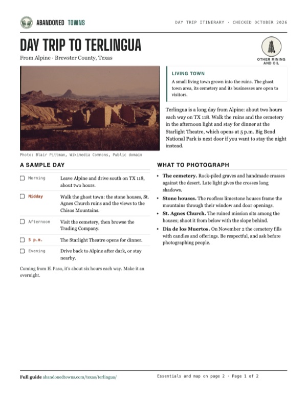
Stone and adobe houses spread over the slope, most of them roofless. The ruins of St. Agnes Church, also called Chisos Mission, stand among them. The cemetery, a short walk from the Starlight Theatre, has graves from as early as 1903, marked with rock piles, handmade crosses and rusted metal. Many share the death year 1918, the year of the Spanish flu. Residents still bury their dead there, and the town marks Día de los Muertos at the cemetery each November 2.
The Starlight Theatre, opened as the town's movie house in 1931, is now a restaurant and bar. The Terlingua Trading Company, the town gift shop, sells local art, jewelry and books. Several nearby mines are capped and abandoned. Stay out of fenced areas, and treat the houses that are lived in as private.
- Stone and adobe houses
- St. Agnes Church ruins
- Terlingua Cemetery
- Starlight Theatre (restaurant)
- Terlingua Trading Company (gift shop)
- Capped mines


Historic maps
Terlingua on USGS maps, 1903–1985
Crops from the USGS Historical Topographic Map Collection, centered on the townsite. Each sheet shows what surveyors mapped that year; compare them with today's topo and aerial on this page.

Day trip
Plan a day trip to Terlingua from Alpine
Take it with you
Day trip itinerary
The essentials, the sample day with boxes to tick, what to photograph and the coordinates, on two printable pages. Handy where there's no signal.
Download the PDF (522 KB)Terlingua is a long day from Alpine: about two hours each way on TX 118. Walk the ruins and the cemetery in the afternoon light and stay for dinner at the Starlight Theatre, which opens at 5 p.m. Big Bend National Park is next door if you want to stay the night instead.
A sample day
- Leave Alpine and drive south on TX 118, about two hours.
- Walk the ghost town: the stone houses, St. Agnes Church ruins and the views to the Chisos Mountains.
- Visit the cemetery, then browse the Trading Company.
- The Starlight Theatre opens for dinner.
- Drive back to Alpine after dark, or stay nearby.
Coming from El Paso, it's about six hours each way. Make it an overnight.
What to photograph and film
- The cemetery. Rock-piled graves and handmade crosses against the desert. Late light gives the crosses long shadows.
- Stone houses. The roofless limestone houses frame the mountains through their window and door openings.
- St. Agnes Church. The ruined mission sits among the houses; shoot it from below with the slope behind.
- Día de los Muertos. On November 2 the cemetery fills with candles and offerings. Be respectful, and ask before photographing people.
Map & directions
Getting there
Alpine is the nearest real town, about two hours north on TX 118. From El Paso the drive runs east on I-10 and down US 90 through Marfa to Alpine, then the same way south. The last turn is from FM 170 onto Ivey Road. An undated listing rates the road 2WD.


Base map: USGS The National Map (public domain). Routes: OSRM on © OpenStreetMap contributors data (ODbL), computed October 2026. Times assume dry roads.
- From downtown Alpine, take North 5th Street and East Holland Avenue (US 67/90), then turn right on South Cockrell Street, TX 118.1.2 mi
- Follow TX 118 south through the desert to Study Butte.76.8 mi
- Turn right on FM 170 and head west.4.6 mi
- Turn right on Ivey Road, then go straight on Terlingua Ghost Town Road.0.6 mi
- From downtown El Paso, take I-10 east to exit 140A at Van Horn.120 mi
- Follow US 90 south and east through Marfa to Alpine.99.4 mi
- In Alpine, turn right on South Cockrell Street, TX 118, and follow it south to Study Butte.77.5 mi
- Turn right on FM 170, then right on Ivey Road and straight on Terlingua Ghost Town Road.5.2 mi
Road and safety notes
- TX 118 is long and empty. Fill up in Alpine and carry water.
- Summer highs at low elevations in the Big Bend pass 100°F. Go between October and April if you can.
- On the first weekend of November two chili cookoffs bring hundreds of people to town. Book lodging early, or pick another weekend.
- Several nearby mines are capped and abandoned. Stay out of fenced areas and off the ruins' walls.
Photos
Terlingua in photos
Visitor reports
Been to Terlingua?
Been there lately? Tell the next visitor what you found: whether you could get in, the state of the road and what's still standing. Photos are welcome. We read every report before it appears here.
Other mining and oil
More lead, iron, mercury and oil ghost towns
The nearest, in other states.

 Guide
Hilltop
31.99, -109.28Cochise County, Arizona
A lead and silver camp high in the Chiricahua Mountains, built around the range's biggest mine and joined to its far side by a tunnel through Shaw…
 Guide
Kelly
34.09, -107.20Socorro County, New Mexico
A lead, silver and zinc camp in a gulch above Magdalena that held close to 3,000 people around 1900 and was empty by 1947. The church of St. John the…
Nearby
Other sites near Terlingua
Straight-line distance from the townsite to other mapped sites in our Texas index.
- Lajitas10.5 mi SW · Brewster
- Castolon14.6 mi SE · Brewster
- Contrabando17.1 mi W · Presidio
- Glenn Springs30.3 mi E · Brewster
- San Vicente37.7 mi E · Brewster
- Shafter53.8 mi NW · Presidio
- Adobes64.0 mi NW · Presidio
- Dryden103.1 mi NE · Terrell
Sources
Sources and credits
- ghosttowns.com, "Terlingua": fact sheet fields (road, climate, best time, boom population).
- Wikipedia, "Terlingua, Texas", retrieved October 2026: Perry and the 1903 founding of the Chisos Mining Company, Chisos Mine discovery, output, workings and 1943 closure, 1917 peak, Jack Dawson, 1903 population, name, capped mines, cemetery still in use, 2020 census.
- Kenneth B. Ragsdale, "Terlingua, TX," Handbook of Texas, TSHA: Marfa and Mariposa camp, 1899 post office and 1910 move, 1902 laborers, 1905 and 1913 population, 1913 town services, 1922 share of US output, 1930 school, 1942 bankruptcy, revival.
- Chet Garner, "Terlingua's Traces," Texas Co-op Power, October 2025: the cemetery today, 1918 graves, the Starlight Theatre restaurant.
- Visit Dallas, "Terlingua, Texas ghost town guide," March 2024: Starlight Theatre opened 1931, Trading Company, St. Agnes Church (Chisos Mission), cemetery still used, cookoff weekend and crowds, November 2 celebration.
- Starlight Theatre, official site, October 2026: hours, live entertainment and reservation policy.
- Big Bend National Park, "Weather," NPS: summer heat and best seasons.
- Coordinates: USGS GNIS 1379150. Elevation: USGS 3D Elevation Program point query. Routes: OSRM on OpenStreetMap data, October 2026.
- Aerial photographs: USGS National High Altitude Photography color-infrared photograph of September 23, 1985, via the Texas Geographic Information Office's NHAP image service; USDA NAIP imagery of September 18, 2022, via USGS The National Map.
Photo and map credits
- Roofless adobe walls, early 1970s, photographed for Documerica: Blair Pittman, Wikimedia Commons, Public domain
- St. Agnes Church, January 1973: Blair Pittman, Wikimedia Commons, Public domain
- The mining town in about 1936: George A. Grant, Wikimedia Commons, Public domain
- A two-room house of stacked limestone in the ghost town: ClaudiaDurand, Wikimedia Commons, CC BY-SA 4.0
- The Federico Villalba state marker (2014): Pi3.124, Wikimedia Commons, CC BY-SA 4.0
- 1985 aerial photograph: U.S. Geological Survey NHAP, via the Texas Geographic Information Office, source, Public domain
- 2022 aerial photograph: U.S. Department of Agriculture NAIP, via USGS The National Map, source, Public domain
- Area base map, topo and aerial imagery: USGS The National Map (public domain).
- Historic maps: USGS Historical Topographic Map Collection (public domain): Terlingua 1903, 1:125,000; Emory Peak 1959, 1:250,000; Emory Peak 1965, 1:250,000; Chisos Mountains 1985, 1:100,000.