 Abandoned

Overview
Silver in sandstone

Silver is not usually found in sandstone, and when samples from the reefs above Leeds reached the experts, the Smithsonian reportedly called one an interesting fake. The ore was real. In 1875 William Barbee staked 21 claims for the Walker brothers of Salt Lake City and wrote up the find for the Salt Lake Tribune. Miners poured in, many from the failing camp at Pioche, and the settlement took the name Silver Reef.
By 1879 about 2,000 people lived here, with businesses along a Main Street a mile long. There were five stamp mills, a Wells Fargo office, a newspaper, a Catholic church and a Chinatown. The town never had a Mormon meeting house, but it got on well with the Mormon farm towns around it. Falling silver prices, wage fights and flooded shafts closed most mines by 1884, and the last in 1891.
Later owners tried again, including ASARCO in 1928 and a uranium venture in the 1950s. Many buildings were sold for their lumber and stone. Today the Wells Fargo office is a museum, a few ruins line a short stretch of street, and homes fill the rest of the old townsite.
Video
Silver Reef in 30 seconds
A silver camp in sandstone: mine works, stone ruins, the Wells Fargo office in 1968 and the jail, in a townsite now mostly private homes.
Timeline
Silver Reef's boom and fade

- Prospector John Kemple finds a silver vein in sandstone near Harrisburg, by the commonly accepted account. Geologists doubt silver can occur in sandstone.
- Salt Lake City bankers, the Walker brothers, send William Barbee to stake claims. His newspaper report sets off a rush, and Bonanza City and the tent camp of Rockpile spring up. Miners from Pioche arrive and the camp becomes Silver Reef.
- Main Street has a hotel, nine stores, six saloons, five restaurants, a bank, two dance halls and a newspaper. Five stamp mills serve 37 mines.
- A fire found under a restaurant spreads to the Harrison House Hotel and other businesses. The businesses are rebuilt.
- The population reaches about 2,000, including a Chinatown of some 250 people south of town.
- The census counts 1,046 residents.
- Wage cuts lead to a miners' union and a shutdown of the Savage mine. A posse arrests 25 union men, many held in the Rice Building.
- Most mines are idle or closed after silver prices fall and the shafts flood.
- The last mine officially closes. The district produced about $8 million in silver.
- Revivals under Alex Colbath, ASARCO (1928) and a uranium venture (1951) come to little. About 2,500 pounds of uranium oxide is shipped.
- The Wells Fargo office is listed on the National Register of Historic Places.
What's left
What you'll see

The museum occupies the stone Wells Fargo & Company Express office and the Wooley, Lund & Judd Mercantile. The museum also lists the jail, the Harrison House hotel, a mill overlook, mining equipment and a walking tour of the old town. The Rice Building, rebuilt in 1991 after it burned, holds more exhibits and opens on request. The Cosmopolitan, a reconstructed restaurant that closed in 2010, now hosts the museum's lectures.
The Catholic and Protestant cemeteries south of the old business district were restored by the Leeds Lions Club in 1998 and can be visited. Main Street is now only a few hundred yards long, with private homes on a private drive around it. In the historic maps below, the 1885 sheet marks Silver Reef just north of Leeds, with Harrisburg to the southwest and Toquerville to the east. The 1954 sheet shows a few buildings beside White Reef and the Leeds Ditch.
- Wells Fargo office (museum)
- Wooley, Lund & Judd Mercantile
- Rice Building
- Jail
- Harrison House hotel
- The Cosmopolitan (reconstructed)
- Silver and uranium mill overlook
- Old mining equipment
- Catholic and Protestant cemeteries


Historic maps
Silver Reef on USGS maps, 1885–1954
Crops from the USGS Historical Topographic Map Collection, centered on the townsite. Each sheet shows what surveyors mapped that year; compare them with today's topo and aerial on this page.

Day trip
Plan a day trip to Silver Reef from St. George
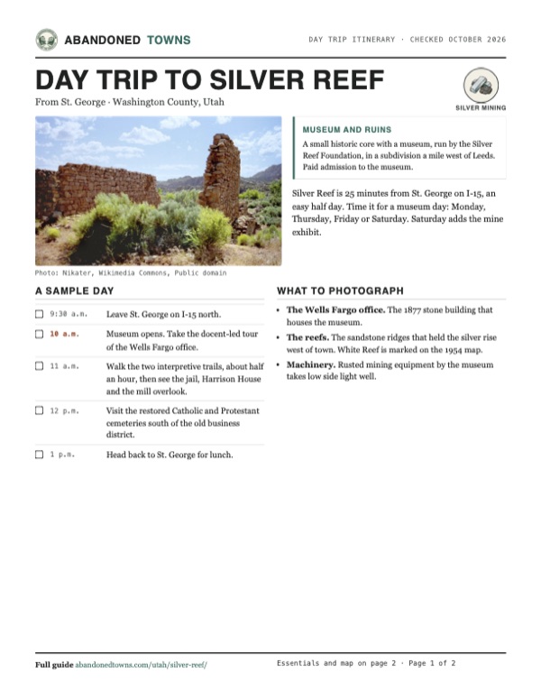
Take it with you
Day trip itinerary
The essentials, the sample day with boxes to tick, what to photograph and the coordinates, on two printable pages. Handy where there's no signal.
Download the PDF (538 KB)Silver Reef is 25 minutes from St. George on I-15, an easy half day. Time it for a museum day: Monday, Thursday, Friday or Saturday. Saturday adds the mine exhibit.
A sample day
- Leave St. George on I-15 north.
- Museum opens. Take the docent-led tour of the Wells Fargo office.
- Walk the two interpretive trails, about half an hour, then see the jail, Harrison House and the mill overlook.
- Visit the restored Catholic and Protestant cemeteries south of the old business district.
- Head back to St. George for lunch.
What to photograph and film
- The Wells Fargo office. The 1877 stone building that houses the museum.
- The reefs. The sandstone ridges that held the silver rise west of town. White Reef is marked on the 1954 map.
- Machinery. Rusted mining equipment by the museum takes low side light well.
Map & directions
Getting there
From St. George, take I-15 north to the Leeds exit, drive north on Main Street through Leeds and turn west on Silver Reef Road under the freeway. The museum gives exit 22 for drivers from the south. From Las Vegas it's the same, after 131 miles on I-15.


Base map: USGS The National Map (public domain). Routes: OSRM on © OpenStreetMap contributors data (ODbL), computed October 2026. Times assume dry roads.
- From downtown St. George, take 700 South and River Road to St. George Boulevard and I-15 north.2.1 mi
- Follow I-15 north.13.0 mi
- Exit and turn left onto South Main Street, SR 228, through Leeds.1.7 mi
- Turn left onto Silver Reef Road, SR 228, under the freeway.1.2 mi
- Keep left onto Silver Reef Drive to the museum.0.3 mi
- From downtown Las Vegas, get on I-15 north.1.7 mi
- Follow I-15 north past Mesquite and St. George.131 mi
- Exit and turn left onto South Main Street, SR 228, through Leeds.1.7 mi
- Turn left onto Silver Reef Road and keep left onto Silver Reef Drive.1.5 mi
Road and safety notes
- The museum's own directions use I-15 exit 23 from the north and exit 22 from the south. Legends of America puts the town 1.5 miles west of exit 22.
- Most of the old townsite is now private homes. Stay on the streets and in the museum area.
- Summer temperatures here often top 100°F. Visit in the cooler months or early in the day.
Photos
Silver Reef in photos
Visitor reports
Been to Silver Reef?
Been there lately? Tell the next visitor what you found: whether you could get in, the state of the road and what's still standing. Photos are welcome. We read every report before it appears here.
Silver mining
More silver mining ghost towns
The nearest in Utah.

 Guide
Frisco
38.46, -113.26Beaver County, Utah
A silver boomtown of about 6,000 people and 23 saloons, built on the Horn Silver Mine until the mine caved in in 1885. Five stone beehive charcoal…
 Guide
Mammoth
39.93, -112.12Juab County, Utah
The town below the Mammoth Mine, one of the big producers of the Tintic Mining District. It had roughly 1,800 to 3,000 people around 1910 and about…
Nearby
Other sites near Silver Reef
Straight-line distance from the townsite to other mapped sites in our Utah index.
- Harrisburg3.6 mi SW · Washington
- Duncan's Retreat13.8 mi E · Washington
- Grafton16.9 mi E · Washington
- Fort Harmony17.2 mi NE · Washington
- Adventure17.4 mi E · Washington
- Northrop20.5 mi E · Washington
- Hamblin24.0 mi NW · Washington
- Old Irontown24.4 mi N · Iron
Sources
Sources and credits
- ghosttowns.com, "Silver Reef": fact sheet field (roads).
- Wikipedia, "Silver Reef, Utah", retrieved October 2026: discovery, Barbee, population, businesses, fire, strike, decline, production, later mining, NRHP listing, cemeteries, Main Street today, climate and summer heat.
- Legends of America, "Silver Reef", updated August 2026: the 1877 Wells Fargo office, the "private drive restricting public access" around the old Main Street, and the distance from exit 22.
- Silver Reef Museum, Visit, official site: hours, admission, address, phone, directions, mine exhibit, as of October 19, 2026 ("Hours for 2026").
- Silver Reef Museum, home page, read October 19, 2026: buildings, jail, Harrison House, mill overlook, mining equipment, walking tour, Cosmopolitan lectures, Silver Reef Foundation.
- Silver Reef Museum, "Walking Tour", "Museum Exhibits", "Cosmopolitan" and "Cemeteries", read October 19, 2026: the two trails, 23 stops and 30 minutes, docents and the underground mine exhibit, outdoor mining equipment, the Cosmopolitan's 1992 rebuild, 2010 closing and restrooms, the cemeteries open to visitors. None of the museum's pages mention food.
- Coordinates: Wikipedia (from USGS GNIS). Elevation: USGS 3D Elevation Program point query. Routes: OSRM on OpenStreetMap data, October 2026.
Photo and map credits
- Stone ruins, 1998: Nikater, Wikimedia Commons, Public domain
- A business street in the mining years: George Ottinger, Wikimedia Commons, Public domain
- The Wells Fargo office, 1968 (HABS): P. Kent Fairbanks, Wikimedia Commons, Public domain
- Old mining machinery and ore cars, 2009: K O, Wikimedia Commons, CC BY 2.0
- Topo map, area base map and aerial imagery: USGS The National Map (public domain).
- Historic maps: USGS Historical Topographic Map Collection (public domain): St George 1885, 1:250,000; La Verkin 2 SE 1954, 1:24,000.