 Abandoned

Overview
Henry Ford's coal town

Nuttallburg stood at the mouth of Short Creek on the north side of the New River. John Nuttall, born in England, had opened anthracite mines in Pennsylvania before he started buying coal land in the gorge in 1870. He had his mines and tracks ready when the Chesapeake and Ohio Railway arrived in 1873, and Nuttallburg became the second town in the gorge to ship the region's prized smokeless coal. The seam was high on the gorge wall, hundreds of feet above the river, so coal came down the slope to be sorted and loaded onto railroad cars at the bottom.
Nuttall died in 1897 and his heirs kept the mines going. Around 1920 the town drew national notice when Henry Ford took over the mines to supply his own works, part of his plan to control every step of making a car. Ford's company improved the mine and the town and in 1923 built the long steel conveyor that still runs down the hillside. The plan failed because Ford could not control the railroad that carried his coal, and he sold out in 1928.
After Ford, three more owners worked the mines for an ever smaller market. The post office closed in 1955 and production stopped in 1958. The Nuttall family handed the site to the Park Service in 1998, and by 2011 the Park Service had cleared the vines and stabilized the structures. It calls Nuttallburg one of the most intact coal mining complexes in West Virginia.
Timeline
From Nuttall's land to the national park

- John Nuttall, an English-born mine operator from the Pennsylvania anthracite fields, starts buying land along Keeneys Creek, at $2 to $8 an acre by e-WV's account.
- The Chesapeake and Ohio Railway is finished through the gorge. Nuttallburg becomes the second town in the gorge to ship its smokeless coal.
- John Nuttall dies. His heirs keep the mines running.
- An undated listing gives the population as 75 in 1903, 410 in 1910 and 359 in 1920. e-WV says it peaked at 500 in the 1920s.
- Henry Ford takes over the mines to feed his own plants. e-WV says Ford had the mine by 1919; an undated listing dates the lease to 1920.
- Ford's company builds the conveyor down the slope, which e-WV calls the world's largest incline tipple. The Park Service puts the cost at $100,000.
- Ford sells his interest. He could neither control nor afford to buy the railroad that hauled his coal, the Park Service says.
- The post office closes, according to Wikipedia.
- Coal production stops.
- e-WV calls Nuttallburg a mined-out ghost town by now.
- The Nuttall family transfers the site to the National Park Service.
- The Park Service says the town and mine complex were listed on the National Register of Historic Places this year; e-WV gives 2007.
- The Park Service finishes several years of clearing vegetation and stabilizing structures.
What's left
Tipple, conveyor and the town on the hill


The steel tipple, where coal was sized, sorted and dropped into railroad cars, stands by the tracks near the parking area, with the conveyor rising behind it up the gorge wall to the headhouse at the mine. Coke ovens sit near the tipple. Up the hillside are the foundations of the company store, the school and church sites and the homesites, many of them marked by the piers the houses stood on. Short Creek once split the town in two. White families lived on the west side and African American families on the east, and the road in passes the site of the African American community and the depot. A short trail at the northwest end leads to Seldom Seen, another group of foundations downriver.
The old USGS sheets in the historic maps below label Nuttallburg on the north bank with Nuttall Station by the tracks, Edmond and Beauty up the hill, and Kaymoor across the river. The 1928 sheet adds South Nuttall on the south bank, and the 1969 sheet marks the mine, the conveyor and the tipple.
- Tipple
- Conveyor (1923)
- Headhouse and mine entrance
- Coke ovens
- Company store foundation
- School and church sites
- House piers and foundations
- Seldom Seen foundations
- African American community and depot sites


Historic maps
Nuttallburg on USGS maps, 1897–1969
Crops from the USGS Historical Topographic Map Collection, centered on the townsite. Each sheet shows what surveyors mapped that year; compare them with today's topo and aerial on this page.

Day trip
Plan a day trip to Nuttallburg from Fayetteville
Take it with you
Day trip itinerary
The essentials, the sample day with boxes to tick, what to photograph and the coordinates, on two printable pages. Handy where there's no signal.
Download the PDF (691 KB)From Fayetteville, Nuttallburg is about half an hour away, the last four miles on Keeneys Creek Road. A morning on the Tipple and Town Loop trails covers the tipple, the coke ovens and the hillside town. There are no services at the site, so bring water and lunch.
A sample day
- Leave Fayetteville. The drive is 12.7 miles, about 34 minutes; take Keeneys Creek Road slowly.
- From the parking area, walk back along the road past the site of the African American community and the depot, then follow the road to the tipple and coke ovens.
- Climb the Town Loop Trail to the company store foundation, the school and church sites and the house piers.
- Picnic at the car, then drive back up Keeneys Creek Road.
- The Canyon Rim Visitor Center on US 19, on the way back to Fayetteville, is open daily from 9 a.m. to 5 p.m. except Thanksgiving, Christmas and New Year's Day.
Fit and well shod? Swap the town loop for the strenuous Conveyor Trail up to the headhouse, about 3 miles round trip and 5 to 6 hours by the Park Service's estimate.
What to photograph and film
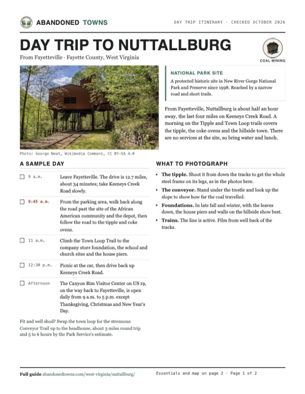
- The tipple. Shoot it from down the tracks to get the whole steel frame on its legs, as in the photos here.
- The conveyor. Stand under the trestle and look up the slope to show how far the coal travelled.
- Foundations. In late fall and winter, with the leaves down, the house piers and walls on the hillside show best.
- Trains. The line is active. Film from well back of the tracks.
Map & directions
Getting there
Fayetteville is the closest town, about 34 minutes away, and its route is the one the Park Service gives from the Canyon Rim Visitor Center: Lansing-Edmond Road to Winona, then Keeneys Creek Road down to the river. From Charleston the drive follows US 60 through Ansted to Lookout and joins the same road. Both routes end at the main Nuttallburg parking area (NPS GPS 38.05019, -81.03976).


Base map: USGS The National Map (public domain). Routes: OSRM on © OpenStreetMap contributors data (ODbL), computed October 2026. Times assume dry roads.
- From North Court Street (WV 16), turn right onto US 19 north.2.7 mi
- Turn right on Lansing-Edmond Road (CR 5, which becomes CR 82) and follow it to Winona.5.9 mi
- At the end of the road turn right onto Keeneys Creek Road (CR 85/2). Past the houses it turns to gravel and descends to the Nuttallburg parking area.4.1 mi
- From downtown Charleston, take Lee Street East and Brooks Street (US 60) onto I-64/I-77 east, then exit onto US 60 and follow it southeast.42.4 mi
- Stay on US 60, the Midland Trail, through Ansted (West Main Street) to Lookout.15.2 mi
- Turn right on Lansing-Edmond Road (CR 82) to Winona.2.1 mi
- Continue onto Keeneys Creek Road (CR 85/2) down to the parking area.4.1 mi
Road and safety notes
- The Park Service (February 2026) says Keeneys Creek Road is narrow, winding and steep, partly paved and partly gravel, and mostly one lane. Drivers may have to pull off or back up the steep road to let others pass. Large vehicles and trailers are not recommended.
- The railroad tracks through Nuttallburg are active, and trains run throughout the day.
- As of September 24, 2026, the Keeney's Creek Rail Trail is closed above its junction with the Conveyor Trail; the lower end still connects to it.
- The Headhouse Trail, an old service road, drops 0.75 mile from the Short Creek Trailhead on Beauty Mountain Road to the headhouse. The Park Service calls it steep and strenuous.
- Don't climb, sit or walk on walls and structures, and leave artifacts where they lie. Report vandalism to the park at 304-465-0508.
- Camping is prohibited in the Nuttall historic area, from rim to river (Superintendent's Compendium, July 2026).
Photos
Nuttallburg in photos
Visitor reports
Been to Nuttallburg?
Been there lately? Tell the next visitor what you found: whether you could get in, the state of the road and what's still standing. Photos are welcome. We read every report before it appears here.
Coal mining
More coal mining ghost towns
The nearest in West Virginia.

 Guide
Kaymoor
38.05, -81.06Fayette County, West Virginia
A Low Moor Iron Company coal town built in three layers down the side of the New River Gorge, with houses on the rim, the mine halfway down and the…
 Guide
Sewell
38.00, -81.02Fayette County, West Virginia
A coal and coke town on the New River, where nearly 200 beehive ovens burned until 1956 and the last resident left in 1973. The ovens, an office…
Nearby
Other sites near Nuttallburg
Straight-line distance from the townsite to other mapped sites in our West Virginia index.
- Nuttallburg Coal Mining Complex and Town Historic District0.0 mi N · Fayette
- South Nuttall0.3 mi SE · Fayette
- Keeneys Creek1.1 mi SE · Fayette
- Kaymoor1.3 mi W · Fayette
- Fayette2.0 mi NW · Fayette
- Boone2.1 mi SE · Fayette
- Caperton2.1 mi S · Fayette
- South Caperton2.3 mi S · Fayette
Sources
Sources and credits
- ghosttowns.com, "Nuttallburg": fact sheet fields (county, climate, best time) and the population figures for 1903, 1910 and 1920 in its town notes.
- Wikipedia, "Nuttallburg, West Virginia", retrieved October 2026: coordinates and elevation, the post office until 1955, Ford's conveyor and 1928 sale, the end of production in 1958.
- National Park Service, "Nuttallburg", updated February 21, 2026: Nuttall's land purchases from 1870, the 1873 railroad, the second town to ship coal, Ford's lease and sale, production to 1958, the 1998 transfer, the 2005 listing, the 2011 stabilization, driving directions and the road advisory, the Headhouse Trail.
- National Park Service, "Exploring Nuttallburg", updated January 6, 2020: the Tipple, Town Loop and Conveyor trails, the restroom and no drinking water, Short Creek's division of the town, Ford's $100,000 conveyor.
- National Park Service, "Road and Trail Closures", updated September 24, 2026: the Keeney's Creek Rail Trail closure. "Directions", updated March 17, 2026: Nuttallburg GPS. "Operating Hours & Seasons", updated October 1, 2024: the park is open year-round; Canyon Rim hours. "Fees & Passes", read October 20, 2026: no entrance fee. "Superintendent's Compendium", updated July 6, 2026: drones prohibited without written approval; no camping in the Nuttall historic area.
- e-WV, "Nuttallburg" by William N. Grafton, revised January 30, 2025: Nuttall's background and land prices, the peak of 500, Ford by 1919, the 1923 incline tipple, a ghost town by the early 1960s, the 2007 listing.
- Photos: Wikimedia Commons, credited below each one. Elevation: USGS 3D Elevation Program point query. Routes: OSRM on OpenStreetMap data, October 2026. Not field-checked.
Photo and map credits
- The tipple and its loading tracks in spring, May 2026: George Neat, Wikimedia Commons, CC BY-SA 4.0
- The conveyor climbing the gorge wall, July 2011: Brian M. Powell (user Bitmapped on en.wikipedia), Wikimedia Commons, CC BY-SA 3.0
- The tipple, December 2015: Bestbudbrian, Wikimedia Commons, CC BY-SA 4.0
- The conveyor's steel trestle running down to the tipple, December 2015: Bestbudbrian, Wikimedia Commons, CC BY-SA 4.0
- Tracks running under the tipple, December 2015: Bestbudbrian, Wikimedia Commons, CC BY-SA 4.0
- Under the tipple, looking toward the river, December 2015: Bestbudbrian, Wikimedia Commons, CC BY-SA 4.0
- A rusted mine car, December 2015: Bestbudbrian, Wikimedia Commons, CC BY-SA 4.0
- The Tipple Trail, with the tipple ahead: NPS photo/Dave Bieri, Wikimedia Commons, Public domain
- Stone foundation of the company store: NPS photo/Dave Bieri, Wikimedia Commons, Public domain
- The Seldom Seen Trail past old foundations: NPS photo/Dave Bieri, Wikimedia Commons, Public domain
- The tipple and the foot of the conveyor, July 2026: George Neat, Wikimedia Commons, CC BY-SA 4.0
- Area base map, topo and aerial imagery: USGS The National Map (public domain).
- Historic maps: USGS Historical Topographic Map Collection (public domain): Kanawha Falls 1897, 1:125,000; Fayetteville 1908, 1:48,000; Fayetteville 1910, 1:62,500; Fayetteville 1928, 1:62,500; Fayetteville 1969, 1:24,000.