 Abandoned

Overview
A fort at the bridge

The Union Pacific reached the North Platte River in 1868, and the Army built Fort Fred Steele on the west bank where the tracks crossed. It was one of three posts put up to guard the line across Wyoming, with Fort Sanders near Laramie and Fort D. A. Russell at Cheyenne. Its men protected the railroad bridge and the work crews, policed the line, and were sent out on campaigns. In 1879 a column from the fort rode into the ambush at Milk Creek in Colorado, where its commander, Maj. Thomas Thornburgh, was killed.
The Army left in 1886, but the place did not empty. Logs cut in the mountains upriver were floated down the North Platte to Fort Steele, sawn into railroad ties, timbers and fence posts, and loaded onto the railroad. The Cosgriff brothers bought what was left of the post in 1894 and ran a big sheep operation with a shearing plant. In the 1920s the Lincoln Highway, the first highway across the country, ran straight through the old parade ground, and the barracks were turned into gas stations, cafes and motels.
In 1939 the highway was moved south to about where I-80 runs now. The tie trade was ending too, and the town faded fast. Fires, many started by sparks from passing trains, took most of the buildings. The state made the ruins a historic site in 1973.
Video
The interpretive trail on a sunny day
A visitor walks the state historic site with the fort's map and wayside panels: the stone powder magazine, an old house now serving as the visitor center with rooms on Wyoming's mining, sheep and lumber industries, and the red bridge tender's house looking out on the Union Pacific bridge over the North Platte. Across the railroad embankment he follows the foundations of the barracks and officers' row, the quartermaster's office and the chimneys of the commanding officer's quarters, with the schoolhouse in the distance. The narration dates the troops' call-out against the Utes to 1874; the Battle of Milk Creek, where Major Thornburgh was killed, was in 1879. The video was posted in June 2021, in the site's summer season.
 Play “Fort Fred Steele” from YouTube
Timeline
Soldiers, ties, sheep and the highway
- The Army establishes Fort Fred Steele where the Union Pacific crosses the North Platte River, one of three posts guarding the new railroad across Wyoming. It is named for Gen. Frederick Steele.
- Generals Ulysses S. Grant and William T. Sherman meet at the new fort while inspecting the railroad, with other generals and Union Pacific officials.
- Troops sent from the fort are ambushed at the Battle of Milk Creek in the White River War. Their commander, Maj. Thomas Thornburgh of Fort Steele, is killed. Legends of America gives the date; the Wikipedia article on the fort says 1878.
- The War Department deactivates the fort. The civilian settlement stays on as a logging and shipping point.
- Most of the post's buildings are sold at auction and hauled away.
- The Cosgriff brothers, sheep ranchers, buy the remaining buildings and land. WyoHistory.org says only "the 1890s".
- Joseph Stimson photographs a new railroad bridge going up over the North Platte at Fort Steele.
- The Cosgriffs build a large sheep-shearing plant. In 1905 more than 800,000 pounds of wool ship to Boston, which Legends of America calls the largest single wool shipment ever sent from Wyoming.
- The Carbon Timber Company, owner of the sawmill, floats more than 1.5 million timbers down the North Platte.
- Sheepman L. E. Vivion buys the land.
- The Lincoln Highway comes through the fort grounds. Legends of America dates it to 1920, WyoHistory.org to 1922. Old barracks become gas stations, cafes and motels.
- A 22-room hotel in a former barracks burns.
- The highway is moved south to about where I-80 runs today. Business ends, and with the end of the tie and timber trade the town empties.
- Fort Fred Steele is listed on the National Register of Historic Places.
- The Wyoming Legislature creates Fort Fred Steele State Historic Site.
- A volunteer from the site guides a tour group down the old Lincoln Highway grade to the pylons of its vanished river bridge (Cowboy State Daily, September 20, 2025).
After the Army
Tie drives and the Lincoln Highway

Fort Steele outlived the fort because of the river. Tie cutters in the mountains to the south sent their logs down the North Platte each spring, and at Fort Steele they were cut into ties and fence posts and shipped on the Union Pacific. WyoHistory.org calls the town a shipping point for lumber and ties. In 1909, Legends of America says, the Carbon Timber Company floated more than 1.5 million timbers down the river. A sheep-shearing operation ran here too, and in 1905 the Cosgriffs shipped more than 800,000 pounds of wool to Boston.
The Lincoln Highway brought a second life. It came through about 1920 to 1922 (the sources differ) and ran right through the fort grounds, crossing the river on its own steel truss bridge south of the railroad, which still stood in a March 2019 photo. A volunteer at the site told Cowboy State Daily in 2025 that the highway was only at Fort Steele from the 1920s to 1939, and that moving it for the new road "killed the town of Fort Steele." On the stretch of old grade the tour followed, the road ends at the river between two pylons of a vanished bridge.
What's left
Foundations on the west bank

Very few structures are intact, the state says, but many foundations are visible, and a self-guided interpretive trail with signs runs through the grounds. Legends of America (updated April 2026) lists what stands: the powder magazine, which it calls the only fully intact structure, the remnants of two large warehouses and the officers' quarters, a couple of wooden buildings, cemetery remains, the bridge tender's house, and a house, lean-to and shed from the Cosgriff and Vivion sheep years. Remains of the Carbon Timber Company are across the river. The bridge tender's job was to put out fires set by passing trains and keep the bridge supports clear.
The state lists a museum, a group picnic shelter, restrooms, river access and fishing at the site. Cowboy State Daily's 2025 photos show the old Fort Steele schoolhouse, with a pair of seesaws still standing beside it.
- Powder magazine, the only fully intact Army structure
- Bridge tender's house
- Remnants of two warehouses and the officers' quarters
- Foundations of the post buildings
- Cemetery remains
- The old Lincoln Highway grade and its truss bridge south of the fort


The historic maps below show the place through time. The 1893 Fort Steele sheet marks the town where the railroad crosses the river, and the 1914 Walcott sheet shows a small grid of buildings at the crossing. By the 1971 Fort Steele sheet the label reads "Fort Fred Steele (Site)", with a cemetery and a pumping station to the south. The 1980 Medicine Bow sheet shows I-80 and US 30 running just south of it.
Historic maps
Fort Fred Steele on USGS maps, 1893–1980
Crops from the USGS Historical Topographic Map Collection, centered on the townsite. Each sheet shows what surveyors mapped that year; compare them with today's topo and aerial on this page.

Day trip
Plan a day trip to Fort Fred Steele from Rawlins
Take it with you
Day trip itinerary
The essentials, the sample day with boxes to tick, what to photograph and the coordinates, on two printable pages. Handy where there's no signal.
Download the PDF (486 KB)Fort Fred Steele is a short summer outing from Rawlins: about half an hour each way on I-80, then an hour or two on the grounds. The site is open only from Memorial Day to Labor Day.
A sample day
- Drive east from Rawlins on I-80 to Exit 228 and north on County Road 347.
- Walk the interpretive trail: the powder magazine, the warehouse and officers' quarters foundations, the cemetery.
- Lunch at the picnic shelter, then the bridge tender's house and the river.
- Back to Rawlins.
What to photograph and film
- The railroad bridge over the North Platte. Trains still cross where the fort was built to guard them.
- The powder magazine. The one fully intact Army building; low morning or evening light shows its walls best.
- The bridge tender's house. The red-painted house, photographed here in 2007.
Map & directions
Getting there
Rawlins is the closest town with services. Both routes take I-80 to the Fort Steele exit, which the state gives as Exit 228, and run north on County Road 347 to the site, 1.25 miles north of the rest area. They were computed from OpenStreetMap and haven't been driven by us.


Base map: USGS The National Map (public domain). Routes: OSRM on © OpenStreetMap contributors data (ODbL), computed October 2026. Times assume dry roads.
- From downtown Rawlins, turn left on 3rd Street (I-80 Business).0.2 mi
- Turn left on West Cedar Street (I-80 Business) and follow it east out of town.2.3 mi
- Continue onto the ramp to I-80.0.4 mi
- Merge onto I-80 east.11.9 mi
- Take the Fort Steele exit (Exit 228).0.3 mi
- Turn left on County Road 347.0.4 mi
- Continue on County Road 347 north to the site.2.0 mi
- From downtown Cheyenne, take West 24th Street to Central Avenue and turn right.0.6 mi
- Turn right on West Lincolnway (I-80 Business).2.5 mi
- Take the ramp to I-80.0.7 mi
- Merge onto I-80 west through Laramie.129.8 mi
- Take the Fort Steele exit (Exit 228).0.3 mi
- Turn right on County Road 347.0.3 mi
- Continue on County Road 347 north to the site.2.0 mi
Road and safety notes
- The road rating is 2WD. We have no dated report on the surface of County Road 347.
- Don't follow the old Lincoln Highway grade across the river. There is no bridge, and Cowboy State Daily (September 2025) reports that drivers sent that way by navigation apps when I-80 closes in winter get stuck.
- I-80 across southern Wyoming closes in winter storms; snow and wind are the rule in winter.
Photos
Fort Fred Steele in photos
Visitor reports
Been to Fort Fred Steele?
Been there lately? Tell the next visitor what you found: whether you could get in, the state of the road and what's still standing. Photos are welcome. We read every report before it appears here.
Railroad and road
More railroad, road and fort ghost towns
The nearest in Wyoming.

 Guide
Bosler
41.58, -105.70Albany County, Wyoming
A railroad and cattle-shipping town platted in 1909 on the old Bosler Ranch, then a Lincoln Highway stop of nearly 300 people. Interstate 80 bypassed…
 Guide
Sherman
41.13, -105.40Albany County, Wyoming
At the top of the first transcontinental railroad, trains changed engines in a town of several hundred people. The tracks moved south and Sherman…
Nearby
Other sites near Fort Fred Steele
Straight-line distance from the townsite to other mapped sites in our Wyoming index.
- Carbon29.8 mi E · Carbon
- Medicine Bow39.3 mi E · Carbon
- Riverside39.8 mi S · Carbon
- Encampment40.1 mi S · Carbon
- Lamont40.9 mi NW · Carbon
- Rambler42.9 mi S · Carbon
- McFadden43.0 mi E · Carbon
- Battle43.0 mi S · Carbon
Sources
Sources and credits
- Wikipedia, "Fort Fred Steele State Historic Site", read October 29, 2026: the 1868 founding at the North Platte crossing, the three railroad forts, General Steele, the Grant and Sherman meeting, Milk Creek and Thornburgh (dated 1878 there), abandonment in 1886, fires, the National Register listing of April 16, 1969, the coordinates.
- ghosttowns.com, "Fort Fred Steele", read October 29, 2026: road, climate, best time, remains, logs floated down the river and cut into ties and fence posts, the sheep-shearing operation, the Lincoln Highway revival and the 1939 rerouting.
- WyoHistory.org, "Fort Fred Steele", November 8, 2014: June 30, 1868, the post buildings, the railroad bridge, the tie and lumber trade, 1886, the Cosgriff brothers in the 1890s and the Leo Sheep Company, fires from train sparks, the Lincoln Highway from 1922 to 1939, few structures left. (Its visitor note gives May 1 to September 15; we follow the state's current hours.)
- Kathy Alexander, "Fort Fred Steele, Wyoming – Abandoned But Not Forgotten," Legends of America, updated April 2026: August 7, 1886, the 1892–93 auction, the Cosgriffs in 1894, the 1903 shearing plant, the 1905 wool shipment, Thornburgh's column ambushed on September 29, 1879, the Carbon Timber Company in 1909, Vivion in 1915, the Lincoln Highway from 1920, the 1923 hotel fire, 1939, the 1973 state site, the list of surviving structures.
- Wyoming State Parks, "Fort Fred Steele State Historic Site" and its hours page, read October 29, 2026: daily 9 a.m. to 7 p.m. from Memorial Day, closed for winter on Labor Day, the Exit 228 address 1.25 miles north of the rest area, the phone, the museum, shelter, restrooms, river access and interpretive trail, foundations and few intact structures.
- Wyoming State Parks, "Permits & Fees", read October 29, 2026: the 2026 historic site fees of $4 (resident) and $8 (nonresident) per adult, children free.
- Renée Jean, "Driving From Laramie To Sinclair On Wyoming's Forgotten Lincoln Highway," Cowboy State Daily, September 20, 2025: the volunteer-guided tour at Fort Steele, the highway's years there, the bridge pylons, the stuck winter drivers, the schoolhouse seesaws.
- Wikimedia Commons, Fort Fred Steele: the bridge tender's house (2007, with the photographers' note on the tender's job), the 2018 view, the March 2019 view of the Lincoln Highway bridge and the Exit 228 sign, the Army plan of the post, the Jackson photograph and the 1901 Stimson bridge photographs (Wyoming State Archives, via the University of Colorado Boulder Libraries).
- Elevation: USGS 3D Elevation Program point query. Routes: OSRM on OpenStreetMap data, October 2026. Not field-checked.
- Wyoming Traveler, "Fort Fred Steele", YouTube, posted June 8, 2021: the interpretive trail, the powder magazine, the bridge tender's house and the barracks and officers' row foundations (the video on this page); checked against its captions and storyboard frames.
Photo and map credits
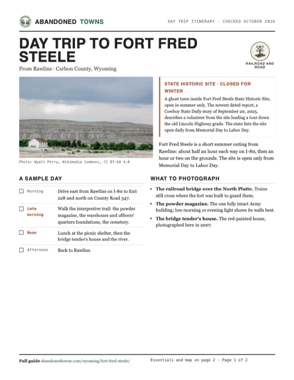
- A white frame building at the site below the bluffs, August 2018: Wyatt Perry, Wikimedia Commons, CC BY-SA 4.0
- The bridge tender's house, September 2007: Jerrye & Roy Klotz MD, Wikimedia Commons, CC BY-SA 3.0
- The North Platte at Fort Steele, by William Henry Jackson, 1869: William Henry Jackson, Wikimedia Commons, Public domain
- Building the new railroad bridge, 1901: a Union Pacific crane on the trestle: Stimson, Joseph Elam, 1870-1952, Wikimedia Commons, Public domain
- The 1901 bridge work, with a steel span on flatcars: Stimson, Joseph Elam, 1870-1952, Wikimedia Commons, Public domain
- Workers on the 1901 bridge deck over the river: Stimson, Joseph Elam, 1870-1952, Wikimedia Commons, Public domain
- The Lincoln Highway's steel truss bridge over the North Platte, south of the fort, March 2019. The brown Exit 228 sign for the state historic site carries a CLOSED plate.: Chris Light, Wikimedia Commons, CC BY-SA 4.0
- Army plan of the post, November 1870: the buildings around the parade ground, the railroad and the river (War Department, Office of the Chief of Engineers): War Department, Office of the Chief of Engineers, Wikimedia Commons, Public domain
- Area base map, topo and aerial imagery: USGS The National Map (public domain).
- Historic maps: USGS Historical Topographic Map Collection (public domain): Fort Steele 1893, 1:125,000; Walcott 1914, 1:62,500; Rawlins 1954, 1:250,000; Fort Steele 1971, 1:24,000; Medicine Bow 1980, 1:100,000.