 Abandoned

Overview
The top of the line

Sherman grew in the late 1860s at the summit of the Union Pacific between Cheyenne and Laramie, the highest point on the first transcontinental railroad. Trains stopped here to change engines, and locomotives were double-headed up the steep grade from Laramie. The railroad built a five-stall roundhouse, a turntable and a big windmill and water tank. Within 15 months the town had machine shops, a Wells Fargo office, a newspaper and two hotels. Wikipedia puts the peak at several hundred people.
In 1882 the Union Pacific raised a 60-foot granite pyramid beside the town in memory of Oakes and Oliver Ames, the Massachusetts brothers behind the line. H. H. Richardson designed it and Augustus Saint-Gaudens made the two portrait medallions.
The railroad later moved its line to easier grades. Wyoming State Parks and Wyoming Tales and Trails say the tracks moved several miles south in 1901; Wikipedia says the station house closed in 1918, when the tracks moved about three miles south and the last residents left. The name Sherman moved with the line: on the 1905 USGS sheet it marks a station on the new tracks to the southeast, and the Union Pacific still calls that spot Sherman. The old townsite is foundations, holes in the ground and a small cemetery.
Video
The dirt road to the pyramid
The creator stops first at the Lincoln bust at the I-80 rest area, then drives east to exit 329 and about two miles of dirt road across open grassland, with the pyramid growing on the horizon. From the small parking area a short gravel path with railings leads to the monument, and the camera takes in its granite blocks up close and the empty plain all around. The video doesn't show or mention the townsite, which is private land.
 Play “Wyoming's Giant Lincoln & Hidden Pyramid! | Laramie Road & Lincoln Highway Drive” from YouTube
Timeline
Summit town

- Union Pacific crews call the summit Lone Tree Pass or Evans Pass, after surveyor James A. Evans. The town at the top is named for General William Tecumseh Sherman, reportedly at his request.
- The Dale Creek Bridge opens west of town, a wooden trestle about 130 feet high, then the highest railroad bridge in the world.
- Within 15 months of the railroad's arrival Sherman has machine shops, a Wells Fargo office, a newspaper and two hotels, the Sherman House and the Summit House. Trains change engines here at the summit of the line.
- The yard holds a five-stall roundhouse, a turntable, section houses and a windmill with 20-foot vanes filling a 50,000-gallon tank. Several hundred people live in town at its peak, with a store, post office, school, two hotels and two saloons.
- The Union Pacific finishes the Ames Monument beside the town: a 60-foot granite pyramid by H. H. Richardson honoring Oakes and Oliver Ames, at a cost of $65,000.
- William Murphy buys the land under the monument, planning to paint advertising on it. The railroad gets a special deed to the property in 1889.
- The railroad moves its line several miles south to easier grades, leaving the monument beside the old grade (Wyoming State Parks; Wyoming Tales and Trails).
- Wikipedia gives 1918 for the closing of the station house and the final move of the tracks about three miles south. The residents leave.
- The Ames Monument is listed on the National Register of Historic Places on July 24, 1972.
- The Union Pacific gives the monument to the State of Wyoming, which keeps it as a state historic site.
- The monument becomes a National Historic Landmark on October 31, 2016.
What's left
What you'll see


The monument is the one thing you can walk up to. Wyoming State Parks keeps it as a state historic site, open daily from sunrise to sunset. Its granite came from Reed's Rock, half a mile west. Photos from June 2015 show three markers on posts at its foot.
The town itself left little. Visitor photos from October 2007 show only foundations, holes in the ground and the cemetery, with the railroad grade still plain to see. Wyoming Tales and Trails adds the foundation stones of the windmill, pottery shards and rusted cans, and a cemetery on a knoll about a quarter mile west of the town site, where relatives moved many burials away after the town emptied. One grave is a child's from 1888. Sources differ on where the town stood: Wyoming State Parks says just north of the monument, Wyoming Tales and Trails says about a quarter mile west of it. The 1905 and 1987 USGS sheets below mark the cemetery northwest of the monument and the old railroad grade running past it.
That same page notes that the town site is private property and that the owners have asked for no trespassing. We found no newer word on access, so treat the foundations and the cemetery as private and look from the monument grounds.
- The Ames Monument (1882), a 60-foot granite pyramid
- Foundations and cellar holes (private land)
- The cemetery (private land)
- The old Union Pacific grade
- Windmill foundation stones


Historic maps
Sherman on USGS maps, 1905–1987
Crops from the USGS Historical Topographic Map Collection, centered on the townsite. Each sheet shows what surveyors mapped that year; compare them with today's topo and aerial on this page.

Day trip
Plan a day trip to Sherman from Laramie
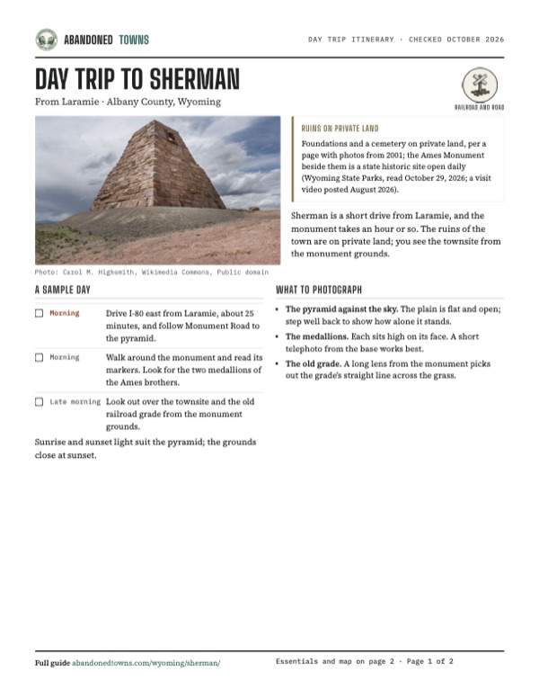
Take it with you
Day trip itinerary
The essentials, the sample day with boxes to tick, what to photograph and the coordinates, on two printable pages. Handy where there's no signal.
Download the PDF (489 KB)Sherman is a short drive from Laramie, and the monument takes an hour or so. The ruins of the town are on private land; you see the townsite from the monument grounds.
A sample day
- Drive I-80 east from Laramie, about 25 minutes, and follow Monument Road to the pyramid.
- Walk around the monument and read its markers. Look for the two medallions of the Ames brothers.
- Look out over the townsite and the old railroad grade from the monument grounds.
What to photograph and film
- The pyramid against the sky. The plain is flat and open; step well back to show how alone it stands.
- The medallions. Each sits high on its face. A short telephoto from the base works best.
- The old grade. A long lens from the monument picks out the grade's straight line across the grass.
Map & directions
Getting there
Laramie is the closest city, about 25 minutes east on I-80 and then Monument Road. A video posted August 2026 takes exit 329 and about two miles of dirt road; Wyoming Tales and Trails names the exit Vedauwoo Road, about 16 miles east of Laramie. From Denver the drive runs north on I-25 to Cheyenne and west on I-80, a little under two and a half hours.


Base map: USGS The National Map (public domain). Routes: OSRM on © OpenStreetMap contributors data (ODbL), computed October 2026. Times assume dry roads.
- From downtown Laramie, turn right on East Grand Avenue (I-80 Business).0.1 mi
- Turn left on South 3rd Street (US 287).1.0 mi
- Take the ramp onto I-80 east.15.9 mi
- Take exit 329 and turn left on Monument Road (CR 234), a dirt road.2.2 mi
- Turn right to the monument.0.1 mi
- From downtown Denver, follow Bannock Street, West 13th Avenue and Speer Boulevard to I-25.2.2 mi
- Follow I-25 north to Cheyenne.95.9 mi
- Take exit 8B onto I-80 west.30.3 mi
- Take the exit and turn left on Monument Road (CR 234).2.3 mi
- Turn right to the monument.0.1 mi
Road and safety notes
- A video posted August 2026 leaves I-80 at exit 329 and follows about two miles of dirt road to the monument, which it calls manageable for just about any car; no truck or four-wheel drive needed.
- Wyoming Tales and Trails: leave I-80 at Vedauwoo Road, about 16 miles east of Laramie, and follow signs on a graded road south of the interstate; the last part is an unimproved road.
- The monument grounds are open sunrise to sunset. The townsite and cemetery are private property.
- The site is above 8,000 feet and open to the wind; the townsite listing calls winter the one season to avoid.
Photos
Sherman in photos
Visitor reports
Been to Sherman?
Been there lately? Tell the next visitor what you found: whether you could get in, the state of the road and what's still standing. Photos are welcome. We read every report before it appears here.
Railroad and road
More railroad, road and fort ghost towns
The nearest in Wyoming.

 Guide
Bosler
41.58, -105.70Albany County, Wyoming
A railroad and cattle-shipping town platted in 1909 on the old Bosler Ranch, then a Lincoln Highway stop of nearly 300 people. Interstate 80 bypassed…
 Guide
Fort Fred Steele
41.78, -106.95Carbon County, Wyoming
An Army post built in 1868 to guard the Union Pacific bridge over the North Platte. After the soldiers left in 1886 it lived on as a tie, sheep and…
Nearby
Other sites near Sherman
Straight-line distance from the townsite to other mapped sites in our Wyoming index.
- Buford5.0 mi E · Albany
- Hecla11.8 mi E · Laramie
- Jelm-Frank Smith Ranch Historic District32.4 mi W · Albany
- Bosler34.4 mi NW · Albany
- McFadden52.4 mi NW · Carbon
- Medicine Bow67.4 mi NW · Carbon
- Carbon70.9 mi NW · Carbon
- Riverside72.2 mi W · Carbon
Sources
Sources and credits
- ghosttowns.com, "Sherman": fact sheet fields (county, road, climate, best time, remains), the roundhouse and turntable, the cemetery, the townsite beside the Ames Monument.
- Wikipedia, "Sherman, Wyoming", retrieved October 2026: the names of the pass, the name, the roundhouse, section houses and windmill, the Dale Creek Bridge of 1868, several hundred people, the store, post office, school, hotels and saloons, the 1885 purchase and 1889 deed, the 1918 closing and move, the later railroad Sherman 3.4 miles southeast.
- Wikipedia, "Ames Monument", retrieved October 2026: coordinates, the National Register listing of July 24, 1972, the 1983 gift to Wyoming, the National Historic Landmark of October 31, 2016.
- Wyoming State Parks, "Ames Monument State Historic Site", read October 29, 2026: open daily, sunrise to sunset; address and phone; the 1882 monument, $65,000, 60 feet, 8,247 feet, Richardson, Saint-Gaudens, Reed's Rock; the 1901 move of the line; Sherman just north of the monument.
- Wyoming Tales and Trails, "Building the Union Pacific: Sherman", with photos by Geoff Dobson from 2001: the shops, newspaper and hotels within 15 months, the windmill and tank, the 1901 move, the remains, the cemetery a quarter mile west, the 1888 child's grave, the private-property notice, the Vedauwoo Road directions.
- Rocky Mountain Profiles, "Sherman, Wyoming", photos by Mike Sinnwell, October 2007: foundations, holes, the cemetery and the railroad grade.
- Carol M. Highsmith, photographs of the Ames Monument, June 7, 2015 (Library of Congress), and a Commons photograph of December 18, 2022: the monument and its markers as they stood then.
- Postcards Across America, "Wyoming's Giant Lincoln & Hidden Pyramid! | Laramie Road & Lincoln Highway Drive", YouTube, posted August 27, 2026: the video on this page; exit 329, the two miles of dirt road and the walkway at the monument.
- Elevation: USGS 3D Elevation Program point query. Routes: OSRM on OpenStreetMap data, October 2026.
Photo and map credits
- The monument on the open plain, panorama looking southeast, September 2015: Mschiavi, Wikimedia Commons, CC BY-SA 4.0
- The monument about 1881, by C. R. Savage: Charles Roscoe Savage, Wikimedia Commons, Public domain
- The pyramid and its markers, June 2015: Carol M. Highsmith, Wikimedia Commons, Public domain
- One face of the pyramid and its medallion, June 2015: Carol M. Highsmith, Wikimedia Commons, Public domain
- The pyramid face on, with granite blocks in the foreground, June 2015: Carol M. Highsmith, Wikimedia Commons, Public domain
- The pyramid on its gravel rise, June 2015: Carol M. Highsmith, Wikimedia Commons, Public domain
- Winter light on the monument, December 2022: Jodaph, Wikimedia Commons, CC BY-SA 4.0
- From the northeast, 1974 (HABS): Jack Boucher, Wikimedia Commons, Public domain
- The cemetery and the Ames Monument on the 1905 USGS Sherman sheet, with the new station named Sherman to the southeast: U.S. Geological Survey, USGS catalog, Public domain
- Area base map, topo and aerial imagery: USGS The National Map (public domain).
- Historic maps: USGS Historical Topographic Map Collection (public domain): Sherman 1905, 1:125,000; Sherman Mountains 1948, 1:62,500; Sherman Mountains West 1987, 1:24,000.