 Abandoned

Overview
A mining camp kept as a museum

Castle Dome was a mining camp at the foot of the Castle Dome Mountains, about 42 road miles from Yuma and 10 miles east of US 95. Don't confuse it with Castle Dome Landing, the camp's shipping point on the Colorado River about 17 miles to the southwest in a straight line. The landing's site now lies under Martinez Lake, behind Imperial Dam. The camp's site is the Castle Dome Mines Museum, a privately owned ghost town on three patented mining claims inside the Kofa National Wildlife Refuge.
Prospectors arrived in the early 1860s and found signs of older workings. In 1863 the Castle Dome Mining Company bought claims and laid out the river landing to ship ore to California. Steady mining began in 1869, and the camp, first called Pitoti, was renamed Castle Dome. The miners came for silver, but most of the veins turned out to be galena, a lead ore. Recorded output, mostly before 1900, came to about 10,700 tons of lead and 498,000 ounces of silver. The camp had its own post office for just under a year, from December 1875 to December 1876.
Mining came and went for more than a century. The mines reopened in 1890 and supplied lead in both world wars. The school closed in 1950, and the mines shut down and the last residents left in 1978 or 1979. Allen and Stephanie Armstrong bought the townsite in 1993 or 1994, and when the refuge moved to clear old mine buildings from the surrounding desert in the late 1990s, they got permission to salvage them. The result is a walk-through mining town of more than 50 buildings, seven of them original to the site.
Timeline
More than a century of mining
- Prospectors find old workings in the Castle Dome Mountains. One story says Native people had carried ore 18 miles to adobe furnaces on the Gila River.
- The Castle Dome Mining Company, owned by Conner and Jacob Snively, buys claims and plans a landing on the Colorado River to ship ore to California. William P. Blake reports the district's lead ores are valuable.
- Steady mining begins. The camp, first called Pitoti, is renamed Castle Dome.
- The district's first patented mine opens, by one account, and works on and off into the 1970s.
- Castle Dome gets a post office. It closes on December 4, 1876.
- A post office runs at Castle Dome Landing on the river, the first steamboat stop above Yuma, until June 16, 1884.
- The mines reopen.
- The Kofa refuge is established to protect desert bighorn sheep. The mining district lies inside it.
- The district supplies lead through both world wars. The Arizona Lead Company reopens the mines in 1943.
- The school closes.
- The mines shut down and the last residents leave. Sources give both years.
- Allen and Stephanie Armstrong buy the townsite. Sources give both years.
- The refuge plans to clear old mine structures. The Armstrongs get permission to salvage them, and the museum grows.
- The museum says a fluorescent mineral wall turned up in an 1860s drift of the Hull Mine in 2016. Public tours start January 21, 2018.
- A San Diego State University geology alumni group schedules a Hull Mine tour, one sign the museum is still operating.
Three places, one name
Which Castle Dome?


Three places share the name, and older guides mix them up.
- Castle Dome, the mining camp. At the foot of the Castle Dome Mountains, at the end of Castle Dome Mine Road. Its post office ran from 1875 to 1876. Its site is the museum. This page.
- Castle Dome Landing. The river port the mining company planned in 1863, with a hotel, saloon, store and smelters. Its post office ran from 1878 to 1884, and steamboats from Yuma stopped there. The site is under Martinez Lake. An undated listing treats it as a separate town.
- Castle Dome Peak. The 3,793-foot summit of the range on the 1942 USGS sheet, about 3 miles northeast of the museum, inside the refuge.
Population figures suffer from the same confusion. Some accounts say more than 3,000 people lived at Castle Dome and that it rivaled Yuma around 1880. Others put the full-time population at about 50. The sources rarely say whether they mean the camp, the landing or the whole district.
What's there
A town put back together


The museum counts more than 60 buildings, and Wikipedia more than 50. Seven are original to the town. The rest were moved in from around the district or rebuilt from salvaged local materials, and they're filled with artifacts gathered from the desert, from about 30 mines and from donations. A fenced walking loop of about 1.8 miles passes a saloon, hotel, mercantile, bank, barber shop, sheriff's office, schoolhouse, machine shop and a section set up as the 1950s and 1970s. Visitors can walk into the buildings. Across a small bridge are the cemetery, the site of the first cabin, the doctor's office and the post office.
The guided Hull Mine tour goes about 600 feet into the mountain to a room of fluorescent minerals lit by ultraviolet lamps. The district is known to mineral collectors for wulfenite, vanadinite, fluorite and other species from the Hull and Puzzler mines.
The museum's own lore includes a Lady in White said to appear upstairs in the hotel. That one is a ghost story.
The historic maps below show the district before the museum. The 1942 sheet marks the Castle Dome Mine on Castle Dome Mine Road, with McPherson Tank and Castle Dome Peak to the northeast. The 1965 sheet is crowded with shaft symbols along the foot of the range, with the Hull Mine and a water tank to the north. The 1986 and 1990 sheets add the refuge boundary, Doc Carter Spring and the scattered shafts and prospects.
- Seven original buildings
- Rebuilt saloon, hotel and mercantile
- Schoolhouse
- Blacksmith and machine shops
- Cemetery
- Doctor's office and post office
- Mine shafts
- Hull Mine (guided tours)


Historic maps
Castle Dome on USGS maps, 1942–1990
Crops from the USGS Historical Topographic Map Collection, centered on the townsite. Each sheet shows what surveyors mapped that year; compare them with today's topo and aerial on this page.
Day trip
Plan a day trip to Castle Dome from Yuma
Take it with you
Day trip itinerary
The essentials, the sample day with boxes to tick, what to photograph and the coordinates, on two printable pages. Handy where there's no signal.
Download the PDF (442 KB)Castle Dome takes a full day from Yuma. The museum sits at the end of Castle Dome Mine Road, about 10 miles off US 95, and its walking loop alone is 1.8 miles. The museum's website lists no food or drinking water, and the refuge around it has none either, so bring lunch and plenty of water, fill the tank in Yuma, and carry cash.
A sample day
- Fill the tank and leave Yuma on US 95 north. The computed drive is about 2 h 40 min. It treats the dirt road as a slow track, so you may get there sooner.
- The museum opens. Pay in cash and start the walking loop past the saloon, hotel, mercantile, bank and schoolhouse.
- If you've arranged the Hull Mine tour, it takes you 600 feet into the mountain to the room of fluorescent minerals. Tour times aren't posted, so call ahead.
- Eat a packed lunch. A 2026 field-trip group planned its lunch in the parking lot.
- Cross the small bridge to the cemetery, the site of the first cabin, the doctor's office and the post office.
- Head back to Yuma, arriving about 5:10 p.m. on the computed time. The museum closes at 5.
- Lute's Casino on Main Street in downtown Yuma is a pool and domino hall with a kitchen. It's open until 7:30 p.m. Monday to Thursday, 9 p.m. Friday and Saturday, and 6 p.m. Sunday.
From Phoenix the computed drive is over five hours each way, too long for one day. Stay the night in Yuma.
What to photograph and film
- The museum town. More than 50 buildings, seven of them original. You can walk in, so expose for the dim interiors rather than the glare outside.
- The 1950s and 1970s section. Part of the town is set up as those decades. Pair a shot of it with one of the older buildings to show the span of mining here.
- The fluorescent room. On the Hull Mine tour, ultraviolet lamps light up the mineral wall. Brace the camera and skip the flash, which washes out the glow.
- Castle Dome Peak. The 3,793-foot summit stands about 3 miles northeast of the museum. It makes the backdrop for wide shots of the town.
- The cemetery. Across the bridge. Keep to the paths and leave the graves as they are.
- Drones. Not on refuge land, where takeoff and landing are banned. The museum's claims are private, so ask there first.
Map & directions
Getting there
Yuma is the closest city. Both routes follow US 95 and then Castle Dome Mine Road, which the museum says is paved for 3 miles and graded dirt for about 7 more, ending at the museum. The road crosses Yuma Proving Ground land and then the Kofa refuge, so stay on it. The routed times run long because the routing treats the dirt section as a slow track.


Base map: USGS The National Map (public domain). Routes: OSRM on © OpenStreetMap contributors data (ODbL), computed October 2026. Times assume dry roads.
- From downtown Yuma, take 19th Street and 4th Avenue to 16th Street.0.6 mi
- Turn right onto 16th Street, which is US 95, and follow it east out of town.11.8 mi
- Continue on US 95 north toward Quartzsite. The turnoff is at milepost 55, signed for Kofa National Wildlife Refuge and Castle Dome.19.8 mi
- Turn right onto Castle Dome Mine Road. It's paved for about 3 miles, then graded dirt.8.4 mi
- Continue on Castle Mine Road to the museum at the end of the road.0.9 mi
- Take I-10 west from downtown Phoenix to Quartzsite.126 mi
- Take the I-10 Business exit and follow Riggles Road and Kuehn Street to Central Boulevard, which is US 95. Turn left.1.8 mi
- Follow US 95 south toward Yuma.46.8 mi
- The computed route turns left on an unnamed road and then left onto Castle Dome Mine Road. The museum's directions use the signed turnoff at milepost 55 instead. Either way, follow Castle Dome Mine Road east.7.8 mi
- Continue on Castle Mine Road to the museum at the end of the road.0.9 mi
Road and safety notes
- Castle Dome Mine Road is graded dirt after the first 3 miles. A 2026 field-trip notice says low-clearance cars aren't usually suited to the dirt roads here; a 2022 visitor found the main road bumpy but passable for any vehicle. Ask the museum after rain.
- The first miles cross Yuma Proving Ground land, where the Army tests weapons. Stay on the road. The refuge warns that unexploded ordnance may be present and that its southern parts can close for military testing.
- Inside the refuge, drive only on designated roads and park no more than 100 feet from the road.
- Cell service is unreliable or absent at the museum. Bring cash; there's an ATM on site.
- Summers are very hot. The season runs October to April; call before a summer visit.
Photos
Castle Dome in photos
Visitor reports
Been to Castle Dome?
Been there lately? Tell the next visitor what you found: whether you could get in, the state of the road and what's still standing. Photos are welcome. We read every report before it appears here.
Other mining and oil
More lead, iron, mercury and oil ghost towns
The nearest in Arizona.

 Guide
Alamo Crossing
34.26, -113.58Mohave County, Arizona
A prospectors' camp at a river ford below the Artillery Mountains that never grew past a small mill and a few stores. Since 1968 it has lain under…
 Guide
Mineral Park
35.38, -114.15Mohave County, Arizona
Once the Mohave County seat, Mineral Park lost the title to Kingman in 1887 and faded away. Its cemetery and last ruins now sit inside an open-pit…
Nearby
Other sites near Castle Dome
Straight-line distance from the townsite to other mapped sites in our Arizona index.
- Castle Dome Landing17.5 mi W · Yuma
- Kofa19.7 mi NE · Yuma
- Polaris21.1 mi NE · Yuma
- Dome22.7 mi SW · Yuma
- Gila City23.4 mi SW · Yuma
- La Laguna23.9 mi SW · Yuma
- Williamsport24.1 mi W · La Paz
- Filibusters Camp26.2 mi S · Yuma
Sources
Sources and credits
- ghosttowns.com, "Castle Dome": fact sheet fields (county, roads, legal description, climate, best time, remains, post office years).
- Wikipedia, "Castle Dome Landing, Arizona", retrieved October 2026: camp and landing history, post office dates, Pitoti, production, minerals, 1943 reopening, 1950 and 1978 dates, the Armstrongs, building count, population claims.
- Castle Dome Mines Museum, official site, as of October 2026: season, hours, prices, phone, directions, building count, original buildings, Hull Mine tour, the Lady in White.
- Castle Dome Mines Museum, "Intro", "Castle Dome City" and "Hull Mine", as of October 2026: hours, holiday closures, children's prices, metal animal tour, ATM, outhouse, rest stops on the fenced loop, walking into buildings to photograph, the 600-foot mine tour, cash payment.
- San Diego State University, Geology Alumni Field Trip 2026: March 2026 tours, cash only, turnoff signage, road surface, cell service, the 11 a.m. mine tour and 2:30 p.m. departure, packed lunch in the parking lot.
- US Fish and Wildlife Service, Kofa National Wildlife Refuge, Visit Us, as of October 2026: no entry fee, restrooms only at the Yuma headquarters on weekdays, no water, fuel or towing on the refuge.
- US Fish and Wildlife Service, "May I fly a drone on a national wildlife refuge?": drone takeoff and landing banned on refuges (50 CFR 27.34).
- Lute's Casino, official site: address and hours, as of October 2026.
- Megan Kopp, Time Travel Trek (April 2022): 1871 patent, 1993 purchase, patented claims, salvage from the refuge, road condition.
- Greg Disch (March 2022): museum GPS position, seven original buildings, 3 paved and 7 gravel miles.
- US Fish and Wildlife Service, Kofa National Wildlife Refuge: 1939 establishment, designated roads, 100-foot rule, military testing closures, unexploded ordnance.
- Coordinates: the museum's position from OpenStreetMap, matching a visitor's GPS reading. Castle Dome Landing and Castle Dome Peak: USGS GNIS. Elevation: USGS 3D Elevation Program point query. Routes: OSRM on OpenStreetMap data, October 2026. Status checked against the sources above on October 19, 2026.
Photo and map credits
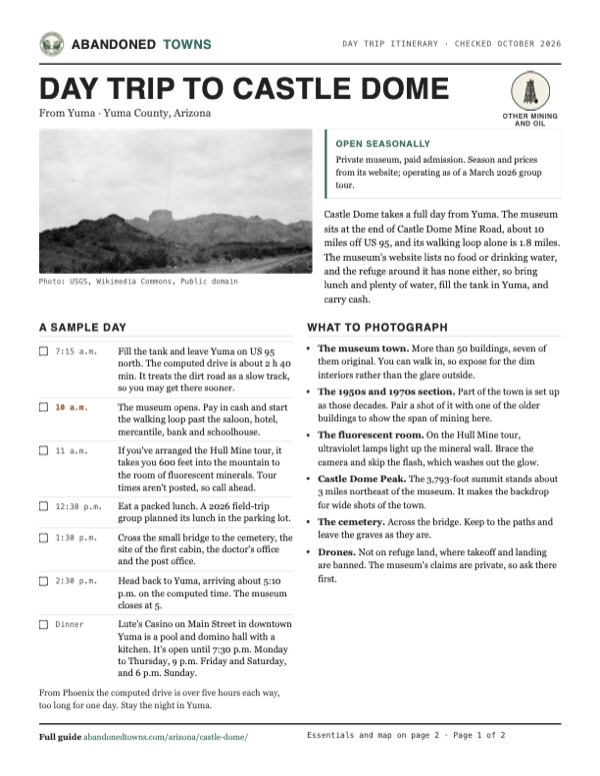
- The Castle Dome Mountains from the Hull property at Castle Dome, 1926: USGS, Wikimedia Commons, Public domain
- Castle Dome Peak, inside the Kofa refuge, 2015: Richard J. Rehman, Wikimedia Commons, CC BY-SA 4.0
- A steamboat at Castle Dome Landing on the Colorado, about 1877. A different site from the camp: Unknown author, Wikimedia Commons, Public domain
- Wulfenite from the Hull Mine: Robert M. Lavinsky, Wikimedia Commons, CC BY-SA 3.0
- Vanadinite from the Puzzler Mine: Robert M. Lavinsky, Wikimedia Commons, CC BY-SA 3.0
- The 1942 Blythe sheet: Castle Dome Mine Road, the mine and the peak: U.S. Geological Survey, USGS catalog, Public domain
- Topo map, area base map and aerial imagery: USGS The National Map (public domain).
- Historic maps: USGS Historical Topographic Map Collection (public domain): Blythe 1942, 1:250,000; Castle Dome Mts 1965, 1:62,500; Trigo Mts 1986, 1:100,000; Castle Dome Peak 1990, 1:24,000.