 Abandoned

Overview
A ford, a mill and a lot of empty years

Alamo Crossing sat where an old road forded the Bill Williams River, on the south side of the small Artillery Mountains. Tom Rodgers started the camp in the late 1890s as a base for prospectors working the range. It never grew much. At its best it had a five-stamp mill and a few stores, and most of the men who passed through camped out. A post office opened in 1899, closed a year later, reopened as Alamo in 1911 and shut for good at the end of 1918.
After that the camp came and went with the price of manganese. By Al Rogers' account, the area's first manganese went out in 1928, about 11 cars of it bound for Alabama. The Rodgers family still held claims nearby in the early 1950s, when a short manganese boom made the ford an important river crossing again. A 1949 report said Alamo was the only settlement in the Artillery Mountains and was sometimes empty. The 1960 census counted 18 people.
Congress had authorized a flood-control dam downstream in 1944. The Army Corps of Engineers finished Alamo Dam in 1968, and the lake rose over the town. The Corps' records since 1981 show the water has never dropped low enough to uncover it.
Timeline
From river ford to lake bed

- Tom Rodgers starts a camp at the Bill Williams River crossing as a base for prospectors working the Artillery Mountains. One source dates it to about 1899.
- The Alamo Crossing post office opens.
- The post office closes.
- It reopens under the name Alamo.
- The post office closes for good. The camp empties and fills again for decades.
- The USGS Signal map marks Alamo at a junction of roads near Alamo Butte.
- The area's first manganese ships to Alabama, about 11 cars of it, by Al Rogers' account.
- A 1949 report puts the whole Artillery Mountains population at probably fewer than 25, adding that Alamo, the only settlement, is at times abandoned.
- Congress authorizes a flood-control dam on the Bill Williams River in the Flood Control Act of 1944.
- A manganese boom. The Oversight mine north of town opens in 1952 and closes in 1954 after more than 1,000 long tons of ore.
- The census counts 18 people.
- The USGS Artillery Peak map shows the crossing, a few buildings and two cemeteries, and notes the planned lake's normal pool.
- The Army Corps of Engineers finishes Alamo Dam, and the lake covers the town.
- Alamo Lake State Park opens on the shore.
- The lake peaks at about 1,182 feet, the highest level in Corps records since 1981.
- A British company, Power Metal Resources, starts digging for gold nuggets around the lake.
- The lake stands at about 1,099 feet, roughly 40 feet above the old crossing.
What's left
Forty feet down

The 1966 USGS map, published two years before the dam was finished, is the last detailed picture of the town. The road from the northwest crosses the riverbed at a benchmark of 1,056 feet. A cemetery sits on the west bank. A few buildings stand on the east bank by a second benchmark of 1,060 feet. Another cemetery lies about a mile southeast near a group of springs. The same sheet already prints the lake's planned normal pool, 1,070 feet, right across the townsite.
The lake has run higher than that ever since. In the Army Corps of Engineers' gauge records, which start in April 1981, the lowest reading is about 1,077 feet in December 2016 and the highest about 1,182 feet in February 1993. In September 2026 the surface stood near 1,099 feet. So the old crossing has been under at least 15 feet of water since 1981, and under about 40 feet today. Wikipedia describes the remains as still intact underwater, and an undated listing says the old road runs into the water a few hundred yards short of the town. We haven't found a diver's report.
The southeast cemetery is the one piece that may still be above water. OpenStreetMap marks a cemetery there at about 1,130 feet, above the current lake but flooded in high years like 1993, 2005 and 2023. We haven't confirmed what's left of it.
The townsite also sat on a county line. The 1942 and 1966 maps run the Mohave–Yuma line down the Bill Williams River, and the 1990 map labels the same line Mohave–La Paz. The mapped town point and the west-bank cemetery are on the Mohave side; the 1966 buildings are just across it. That's why GNIS files Alamo Crossing under La Paz County while Wikipedia and an undated listing put it in Mohave.
- Townsite under Alamo Lake
- West-bank cemetery (under water)
- Southeast cemetery (mapped, not verified)
- Old road ending at the shore


Legend and record
Poison and a missing postmaster
A local story says Native Americans raided Alamo Crossing, looted the store and poisoned the storekeeper, and that the postmaster soon got bored, took the post office's money and left. It's a good campfire tale, and no record we found supports any part of it.
The record points somewhere duller. The mines around the crossing gave out, the post office closed in 1918, and the camp stayed small and half-empty until the lake took it.
Historic maps
Alamo Crossing on USGS maps, 1923–1990
Crops from the USGS Historical Topographic Map Collection, centered on the townsite. Each sheet shows what surveyors mapped that year; compare them with today's topo and aerial on this page.

Day trip
Plan a day trip to Alamo Crossing from Wickenburg
Take it with you
Day trip itinerary
The essentials, the sample day with boxes to tick, what to photograph and the coordinates, on two printable pages. Handy where there's no signal.
Download the PDF (447 KB)Alamo Crossing is under the lake, so this trip is a long drive to the shore of Alamo Lake State Park, where you look out over the water that covers the town. Plan on about two and a half hours each way from Wickenburg. The park has restrooms, a small store and trails, but no restaurant. Pack food and water, and fill your tank in Wickenburg.
A sample day
- Fill up and leave Wickenburg on US 60. Wenden is about an hour west.
- In Wenden, turn north onto Alamo Road. The last 35 miles to Camp Area E take about an hour and a half.
- Pay the entry fee at the visitor center and pick up a map.
- Drive Cholla Road to Camp Area E. The townsite lies about a mile and a quarter across the water, roughly 40 feet down at the September 2026 level.
- Walk a shoreline trail, or the Rattlesnake Overlook trail for a view over the lake.
- Picnic lunch by the water.
- Head back. You'll be in Wickenburg by about 4 p.m.
From Phoenix the drive is about 3 hours 40 minutes each way by I-10 and Salome. That makes a long day, so consider staying over: the park has campsites and camping cabins.
What to photograph and film
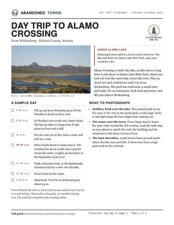
- Artillery Peak over the lake. The pointed peak across the water is the view in the 2008 photo on this page. Early or late light keeps the bare ridges from washing out.
- The water over the town. From Camp Area E, frame the open water toward the old crossing. Load the 1966 map on your phone to match the road, the buildings and the cemeteries to the shore in front of you.
- The bare shoreline. A pale band of bare ground marks where the lake rises and falls. It shows best from a high point such as the overlook.
Map & directions
Getting there
The townsite is under water, so both routes end at Camp Area E in Alamo Lake State Park, the closest public shore. Wickenburg is the closest city with full services. Both routes reach the park on Alamo Road, a paved road that runs north from Wenden on US 60. The last fuel is in Salome, according to Arizona State Parks.


Base map: USGS The National Map (public domain). Routes: OSRM on © OpenStreetMap contributors data (ODbL), computed October 2026. Times assume dry roads.
- From downtown Wickenburg, head west on US 60 (Wickenburg Way), which becomes the Quartzsite–Wickenburg Highway.48.7 mi
- In Wenden, turn right on 2nd Street, which becomes Alamo Road. Follow it north to the state park.33.2 mi
- Turn right on Cholla Road and follow it to Camp Area E on the lake's east shore.1.6 mi
- From downtown Phoenix, take I-10 west.100.4 mi
- Exit at Vicksburg Road and go north to US 60.6.3 mi
- Turn right on US 60 and follow it east through Salome to Wenden.15.7 mi
- In Wenden, turn left on 2nd Street, which becomes Alamo Road. Follow it north to the state park.33.2 mi
- Turn right on Cholla Road and follow it to Camp Area E on the lake's east shore.1.6 mi
Road and safety notes
- Alamo Road from Wenden is paved all the way to the park, about 38 miles, according to Arizona State Parks' park history.
- Get fuel in Salome or earlier. There is none at the lake.
- Cholla Road inside the park closes at times. As of October 2026, Arizona State Parks says it has reopened for the season. Check the park page before you go.
- The lake rises fast after big storms. Wikipedia notes it once rose 11 feet in a single night.
- Summer heat here is extreme. The park's record high is 124°F, set in July 1995. Carry plenty of water.
- Other roads reach the north shore over many miles of dirt from US 93. We haven't checked them, and routing estimates treat them as very slow.
Photos
Alamo Lake in photos
Visitor reports
Been to Alamo Crossing?
Been there lately? Tell the next visitor what you found: whether you could get in, the state of the road and what's still standing. Photos are welcome. We read every report before it appears here.
Other mining and oil
More lead, iron, mercury and oil ghost towns
The nearest in Arizona.

 Guide
Mineral Park
35.38, -114.15Mohave County, Arizona
Once the Mohave County seat, Mineral Park lost the title to Kingman in 1887 and faded away. Its cemetery and last ruins now sit inside an open-pit…
 Guide
Castle Dome
33.05, -114.18Yuma County, Arizona
A lead and silver camp mined on and off from the 1860s to the late 1970s. Its site is now a private museum town, open in the cool months.
Nearby
Other sites near Alamo Crossing
Straight-line distance from the townsite to other mapped sites in our Arizona index.
- Signal15.0 mi N · Mohave
- Swansea16.3 mi SW · La Paz
- Greenwood17.1 mi N · Mohave
- Nothing20.7 mi NE · Mohave
- Planet21.8 mi W · La Paz
- Bouse29.5 mi SW · La Paz
- Aubrey Landing31.6 mi W · Mohave
- Empire Flat35.0 mi W · La Paz
Sources
Sources and credits
- ghosttowns.com, "Alamo Crossing": post office dates, the five-stamp mill and stores, the road ending at the water.
- Wikipedia, "Alamo Crossing, Arizona", retrieved October 2026: founding by Tom Rodgers, post office history, the 1938 population and 1949 report, manganese mines, the 1960 census, the legend, the 2020 prospecting, coordinates (GNIS).
- Wikipedia, "Alamo Lake State Park", retrieved October 2026: 1968 dam, flood-control purpose, the 11-foot overnight rise, climate and record temperatures.
- Destination4x4, "Alamo Crossing" (August 2023): founding about 1899, the alternate post office name, GNIS ID.
- Arizona State Parks, "Alamo Lake State Park" and "Park History", as of October 2026: hours, fees, fuel in Salome, Cholla Road, the 1944 authorization, the paved road from Wenden, the November 1969 opening.
- Arizona State Parks, "Alamo Lake: Facility Information", as of October 2026: restrooms, store items, group ramadas, trails and the leash rule. The park's main page supplied the visitor center and store hours and the camping cabins.
- Arizona State Parks, FAQ, as of October 2026: the ban on recreational drones in state parks and filming permits.
- U.S. Army Corps of Engineers, CWMS Data, Alamo reservoir elevation (NGVD-29), April 1981 to September 2026: lake levels.
- USGS topographic maps: Artillery Peak 1:62,500 (1966) for the benchmarks, buildings, cemeteries and planned pool; Signal 1:250,000 (1923, 1942) and Artillery Peak 1:24,000 (1990) for the county line. Township and section: BLM PLSS (CadNSDI). County check: US Census TIGERweb.
- GNIS record 25299, "Alamo Crossing (historical)", via The National Map: coordinates and La Paz County filing. Southeast cemetery: OpenStreetMap, October 2026; its elevation from the USGS 3D Elevation Program.
- Routes: OSRM on OpenStreetMap data, October 2026. Status checked against the sources above on October 19, 2026.
Photo and map credits
- Alamo Lake and Artillery Peak, 2008. The townsite is under the lake: duroc2006, Wikimedia Commons, CC BY-SA 2.0
- Alamo Dam from the air, in an undated Army Corps photo: U.S. Army Corps of Engineers, Wikimedia Commons, Public domain
- USGS Artillery Peak sheet, 1966: the crossing, its two cemeteries and the lake's planned normal pool of 1,070 feet: U.S. Geological Survey, USGS catalog, Public domain
- Area base map, topo and aerial imagery: USGS The National Map (public domain).
- Historic maps: USGS Historical Topographic Map Collection (public domain): Signal 1923, 1:250,000; Signal 1942, 1:250,000; Artillery Peak 1966, 1:62,500; Alamo Lake 1979, 1:100,000; Artillery Peak 1990, 1:24,000.