 Abandoned

Overview
A replica town on a real gold camp

Goldfield sits at the west foot of the Superstition Mountains, on the Apache Trail about four and a half miles northeast of Apache Junction. Prospectors found low-grade gold ore here in 1892, and the camp got a post office in October 1893. For a few years it had three saloons, a boarding house, a general store, a brewery, a blacksmith, a butcher and a school. One account puts the local mines' output at more than $1.5 million in gold, at $20 an ounce.
The boom didn't last. In 1897 the vein faulted and the ore grade dropped, and the post office closed in November 1898. George U. Young, a former secretary of Arizona Territory, tried again in the early 1900s with a new mill and a cyanide plant. The camp took his name, and a Youngberg post office ran from 1921 to 1926.
The town you walk through today is a replica. Bob and Lou Ann Schoose bought the five-acre Goldfield Mill site in 1984 and built an 1890s-style main street on it, working from old photographs and maps. It opened in 1988 or 1989, depending on the source, and now covers about 45 acres with a mine tour, a museum, a narrow-gauge train and weekend gunfights. None of the original buildings survive.
Timeline
Two booms and a rebuild
- Low-grade gold ore is found at the west foot of the Superstition Mountains, and a tent camp grows up.
- The Goldfield post office opens, with James L. Patterson as postmaster.
- The camp has three saloons, a boarding house, a general store, a brewery, a blacksmith, a butcher and a school.
- The vein faults, the ore grade drops and the mines shut down.
- The post office closes and the camp empties.
- George U. Young, a former secretary of Arizona Territory, reopens the mines with a new mill and a cyanide plant.
- The post office reopens as Youngberg, also spelled Youngsberg. Wikipedia dates the opening to 1920.
- The Youngberg post office closes. Young dies four weeks later, on November 26.
- Bob and Lou Ann Schoose buy the five-acre Goldfield Mill site and start building a replica town.
- Goldfield Ghost Town opens to visitors. Sources give both years.
- A privately run attraction, open daily, with a mine tour, a museum and a narrow-gauge train.
What's real
What's original and what's rebuilt


Nothing on Goldfield's main street dates from the mining years. One account says fire took the last old buildings soon after the camp emptied, and when the Schooses arrived in the 1980s they found little left. They laid out the new town from old photographs and maps, which showed that most of the original town had stood on their land. A 2014 KJZZ report describes both the mine and the buildings as replicas.
Genuine
- The townsite, on the old Goldfield Mill property
- An 1890 Porter steam locomotive said to have worked in Goldfield's mines
- The grave of an unknown prospector, whose bones turned up during the rebuild
Rebuilt or added
- Main street storefronts, saloon, bordello, church, livery and jail
- The underground mine tour, in a reconstructed tunnel
- The 36-inch narrow-gauge railroad around the town
- Museum, zipline and other attractions
The prospector's grave sits at the edge of town. Bob Schoose found the skeletal remains while working the grounds and believes they belong to a man who fell 150 feet down a mine shaft in 1896.
Visiting
Tickets and what's on


The official site lists no entry fee for the town itself. You pay for each attraction separately. Prices below are from goldfieldghosttown.com in October 2026.
- Train: $12 adults, $10 seniors, $8 ages 5–12, under 5 free. A 20-minute narrated loop on 1.5 miles of track
- Mine tour: same prices. About 25 minutes underground
- Museum: $10 adults, $8 seniors 65+, $5 children, under 8 free
- Gunfights: weekends November–April, every hour from noon to 4 p.m.
- Also: Mystery Shack ($7–$9), zipline ($15), bordello ghost tour ($9–$13), night walking ghost tour ($25–$35), gold panning and horseback rides
The museum covers local history, antique firearms, minerals and the Lost Dutchman Mine. That last one is a legend. Jacob Waltz, the “Dutchman,” died in 1891, and the rich gold mine he supposedly worked somewhere in the Superstitions has never been found. People have died looking for it. The legend helped draw miners to Goldfield in the 1890s.
Professional photography in the ghost town needs the management's permission.
Site map
Where the camp stood
The 1900 Florence sheet in the historic maps below shows Goldfield as a small cluster on a road running northeast, just south of the Maricopa–Pinal county line at the foot of the Superstitions. By 1956 the Goldfield sheet marks the Goldfield Mine and a water tower west of the Apache Trail, the Bluebird Mine across the road and a landing strip to the southwest. On the 1994 sheet, Apache Junction's street grid has reached the landing strip. The 2004 edition moves the Goldfield label west of the road, among the buildings around the old mine, and shows Lost Dutchman State Park next door. Today's USGS map labels the spot Youngberg.


Historic maps
Goldfield on USGS maps, 1900–2004
Crops from the USGS Historical Topographic Map Collection, centered on the townsite. Each sheet shows what surveyors mapped that year; compare them with today's topo and aerial on this page.

Day trip
Plan a day trip to Goldfield from Apache Junction
Take it with you
Day trip itinerary
The essentials, the sample day with boxes to tick, what to photograph and the coordinates, on two printable pages. Handy where there's no signal.
Download the PDF (489 KB)Goldfield is ten minutes from Apache Junction, so spend the morning in town and the afternoon farther up the Apache Trail. Each attraction is ticketed separately, and there's food on site. On weekends from November to April, gunfight shows run every hour from noon.
A sample day
- Leave central Apache Junction on the Apache Trail (AZ 88), about 10 minutes.
- Coffee and a pastry at the Coffee Cantina, open from 9.
- The shops, train and mine tour open. Ride the narrow-gauge train first; it leaves every 35 minutes.
- Take the 25-minute mine tour, then the museum.
- On weekends from November to April, catch the first gunfight. Then lunch at the Mammoth Steakhouse & Saloon.
- Next door, Lost Dutchman State Park charges $10 per vehicle with one person or $20 with two to four. Walk one of its trails at the foot of the Superstitions.
- Drive on up the paved Apache Trail to Tortilla Flat, about 20 minutes. Its saloon and store stay open until 6 p.m.
- Head back to Apache Junction, about half an hour.
From Phoenix, Goldfield is about 55 minutes by Loop 202. Leave by 8:15 a.m. to start with coffee.
What to photograph and film
- Main street and the Superstitions. False fronts with the cliffs behind are the classic shot. The cliffs face west, so late-afternoon light warms them.
- The headframe and depot. Frame the wooden headframe and Goldfield Station against the mountains.
- The train. The narrow-gauge train loops the town on 1.5 miles of track. Film it from beside the line, not on it.
- The gunfights. Weekend shows from November to April. Get to the front early for a clear view and steady video.
- Details. The turreted Victorian house, the jail and the old machinery around town make good detail shots.
- Professional shoots. Need the management's consent. The site doesn't mention drones.
Map & directions
Getting there
Apache Junction is the closest city, about six miles away. From Phoenix, the route below runs out the Red Mountain Freeway (Loop 202) and east on Brown Road. The attraction's own directions use US 60 to exit 196, Idaho Road, instead. Both end on the Apache Trail (AZ 88), and the whole drive is paved.


Base map: USGS The National Map (public domain). Routes: OSRM on © OpenStreetMap contributors data (ODbL), computed October 2026. Times assume dry roads.
- From central Apache Junction, take Linda Avenue to Royal Palm Road and head south.0.8 mi
- Turn left onto the Old West Highway (historic US 80).0.6 mi
- Turn right onto Idaho Road (AZ 88), then right again onto the Apache Trail.0.8 mi
- Stay on the Apache Trail (AZ 88) through the roundabout and northeast toward the Superstitions. Goldfield is on the left.4.1 mi
- From downtown Phoenix, take 7th Street to I-10 east and keep right onto the Red Mountain Freeway (Loop 202 east) at exit 147.2.7 mi
- Follow Loop 202 east and south around Mesa.25.9 mi
- Take exit 26, Brown Road, and head east. Brown Road becomes Lost Dutchman Boulevard in Apache Junction.8 mi
- Turn left onto the Apache Trail (AZ 88). Goldfield is on the left.2.5 mi
Road and safety notes
- The drive is paved from Phoenix and Apache Junction. The gunfight shows run only on weekends from November to April.
- Summers are hot. The saloon keeps shorter hours in summer, so call ahead, and carry water if you plan to hike in nearby Lost Dutchman State Park.
- Going farther up the Apache Trail? The pavement ends past Tortilla Flat. After the 2019 Woodbury Fire and flood damage, the road was closed between mileposts 222 and 229; it reopened in September 2024 to high-clearance 4WD vehicles and UTVs only. Check az511.gov before you continue.
Photos
Goldfield in photos
Visitor reports
Been to Goldfield?
Been there lately? Tell the next visitor what you found: whether you could get in, the state of the road and what's still standing. Photos are welcome. We read every report before it appears here.
Gold mining
More gold mining ghost towns
The nearest in Arizona.

 Guide
Columbia
34.03, -112.31Yavapai County, Arizona
A small gold camp on Humbug Creek that had a post office for 21 years and served its neighbor Humbug. Its last buildings came down around 2000, the…
 Guide
Humbug
34.05, -112.32Yavapai County, Arizona
A gold camp in a canyon of the southern Bradshaw Mountains whose 1930s buildings outlasted the mine because a caretaker never left. It's private and…
Nearby
Other sites near Goldfield
Straight-line distance from the townsite to other mapped sites in our Arizona index.
- Youngberg0.0 mi N · Pinal
- Tortilla Flat7.3 mi NE · Maricopa
- De Noon22.5 mi SE · Pinal
- Reymert22.5 mi SE · Pinal
- Pinal23.7 mi SE · Pinal
- Pinal City23.7 mi SE · Pinal
- Silver King Mine24.7 mi E · Pinal
- Silver King24.7 mi E · Pinal
Sources
Sources and credits
- ghosttowns.com, "Goldfield": fact sheet fields (legal description, climate, best time, both post office date ranges, alternate name).
- Wikipedia, "Goldfield, Arizona", retrieved October 2026: coordinates (GNIS), first postmaster, George U. Young and his death date.
- Wikipedia, "List of historic properties in Goldfield, Arizona": the 1897 fault, the 1890 Porter locomotive, the 1984 purchase.
- Goldfield Ghost Town, official site (home, attractions and directions pages): hours, prices, address, phone, exit 196 route, photography rule, as of October 2026.
- Goldfield Ghost Town, merchants and saloon pages, and the attractions page, as of October 2026: coffee shop hours, places to eat, saloon closures, train departures, tour lengths, gunfight schedule.
- Arizona State Parks, Lost Dutchman State Park: day-use fees, as of October 2026. Tortilla Flat, official website: closing time, as of October 2026.
- Legends of America, "Goldfield, Arizona": the 1892 find, businesses, the 4,000 figure, Young's mill and cyanide plant, the Schooses, 1988 opening.
- KJZZ, "Did You Know: Goldfield Ghost Town Was Alive In The 1800s" (2014): replica buildings and mine, Schoose's 500–1,500 estimate, old photos and maps, the prospector's grave, 45 acres.
- Arizona & Pacific Railroad, "Goldfield": $1.5 million output, the 3,000–5,000 estimate, fire after 1898, 1989 opening.
- Wikipedia, "Lost Dutchman's Gold Mine" and "Lost Dutchman State Park": Jacob Waltz, the legend, park location.
- Wikipedia, "Arizona State Route 88": paving, the 2019–2024 closure and vehicle limits beyond Tortilla Flat.
- Elevation: USGS 3D Elevation Program point query. Routes: OSRM on OpenStreetMap data, October 2026. Status checked against the official site on October 19, 2026.
Photo and map credits
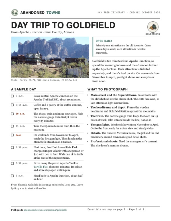
- Goldfield's rooftops below the Superstition Mountains: Marine 69-71, Wikimedia Commons, CC BY-SA 4.0
- The museum: dconvertini, Wikimedia Commons, CC BY-SA 2.0
- Headframe and depot under the Superstitions: Cindy Devin, Wikimedia Commons, CC BY 2.0
- Goldfield Station, the train depot: dconvertini, Wikimedia Commons, CC BY-SA 2.0
- A turreted Victorian-style house: dconvertini, Wikimedia Commons, CC BY-SA 2.0
- Main street: dconvertini, Wikimedia Commons, CC BY-SA 2.0
- The jail: dconvertini, Wikimedia Commons, CC BY-SA 2.0
- The saloon: dconvertini, Wikimedia Commons, CC BY-SA 2.0
- The narrow-gauge track and a steam locomotive: dconvertini, Wikimedia Commons, CC BY-SA 2.0
- A staged gunfight: Marine 69-71, Wikimedia Commons, CC BY-SA 4.0
- Plaque on the tower thanking the people who rebuilt Goldfield: Marine 69-71, Wikimedia Commons, CC BY-SA 4.0
- The coffee cantina, with the Superstitions behind: dconvertini, Wikimedia Commons, CC BY-SA 2.0
- Area base map, topo and aerial imagery: USGS The National Map (public domain).
- Historic maps: USGS Historical Topographic Map Collection (public domain): Florence 1900, 1:125,000; Goldfield 1956, 1:24,000; Mesa 1960, 1:250,000; Mesa 1994, 1:100,000; Goldfield 2004, 1:24,000.