 Abandoned

Overview
The camp that stayed open

Tortilla Flat sits in a narrow valley on Tortilla Creek, 17 miles up the Apache Trail from Apache Junction, where the Superstition Mountains close in on the road. There was no town here until 1904, when crews built a road to the Roosevelt Dam site. Tortilla Flat began as a freight camp and stage stop on that road. Once the dam was done it became a stop for tourists and mail carriers, and it stayed one through the 1930s.
It never grew large. The town sits on Tonto National Forest land, which it has leased since the forest was created in 1905. A school opened in 1932 with 14 pupils. A flood in 1942 or 1943, depending on the source, badly damaged the town and sent many people away. In 1987 a fire burned the store, restaurant and motel, leaving only the schoolhouse.
Each time, the town rebuilt. The saloon and restaurant reopened in 1988, and a mercantile followed in 2009. Today Tortilla Flat is a busy roadside stop whose sign puts the population at six. It calls itself the oldest operating stagecoach town in Arizona.
Timeline
Freight camp to roadside stop

- The Yavapai use the valley as part of a trail through the Superstition Mountains. No settlement shows on old trail maps.
- Crews build the road to Roosevelt Dam. Tortilla Flat starts as a freight camp and stage stop on it.
- Freight haulers, then tourists to Roosevelt Dam and mail carriers, stop here.
- Tonto National Forest is created. Tortilla Flat and the other road camps sit on forest land, and the town's caretakers have held a lease ever since.
- The first USGS sheet shows Tortilla Flat on the road beside Tortilla Creek, with a line marked "Electric" running past it.
- A school opens with 14 pupils from Tortilla Flat, the Canyon Lake area and Horse Mesa Dam.
- A flood badly damages the town and many residents move away. The town's history dates it to 1943; other accounts say 1942. The schoolhouse is moved to Horse Mesa Dam.
- Barry Storm lives in town. His 1946 book, Thunder God's Gold, later becomes the Columbia Pictures film Lust for Gold.
- Fire destroys the store, restaurant and motel. The schoolhouse is the only building left untouched.
- Arizona Attorney General Robert Corbin dedicates the rebuilt restaurant and bar.
- The mercantile and gift shop is built.
- After the Woodbury Fire, flooding wrecks the unpaved Apache Trail east of town. The state closes it between mileposts 222 and 229.
- The schoolhouse museum is redesigned.
- The Apache Trail reopens east of Tortilla Flat, but only to high-clearance four-wheel-drive vehicles and UTVs.
- Monsoon storms damage the unpaved road about six miles past town. ADOT makes quick repairs and reopens it, and the town stays open.
Legend and record
Gold, a president and a name
The Superstitions breed stories, and Tortilla Flat repeats several. The best known says Don Miguel Peralta of Mexico took great quantities of gold from these mountains in 1847 and 1848, and that Apaches killed all but one of his party at a spot now called the Massacre Grounds. Wikipedia says he "supposedly" amassed the gold, so treat it as legend. Barry Storm, who lived here from 1942 to 1945, worked the mountains' treasure stories into a 1946 book, Thunder God's Gold, which Columbia Pictures filmed as Lust for Gold.
The town's history is also blunt about its own legends. It says stories of a prospectors' camp here in the 1880s, and of a founding in 1867 or 1886, are just that. Before the 1904 road there was no stage stop, because there was no road. Theodore Roosevelt passed through in 1911 on his way to dedicate the dam, but the story that he stopped here for lunch is labeled legend.
Even the name has two stories, and neither can be proved.
One says the flat was named for a nearby butte shaped like a tortilla. The other credits John Cline, a Tonto Basin pioneer, who said he was stranded here around 1867 with nothing but flour for tortillas. The town's history doubts the 1867 date, given how young Cline would have been.
What's here
Saloon, store and schoolhouse


Most of what stands today went up after the 1987 fire. The Superstition Saloon and restaurant is the center of town, its walls papered with signed dollar bills and its bar lined with saddles for stools. Next door is the country store, then the mercantile and gift shop built in 2009. At the end of the street, the red schoolhouse is a replica of the 1932 school, which was moved to Horse Mesa Dam after the 1940s flood. It holds the town museum, redesigned in 2021, beside what the town calls the old hanging tree. A false-front harness and buggy shop and a few other old-style facades fill out the street.
The historic maps below show the setting. The 1907 sheet puts Tortilla Flat on the road beside Tortilla Creek, with Mormon Flat and Mesquite Flat on either side, and the 1909 sheet spells it Tortilla Flats. By 1954 Canyon Lake fills the canyon to the west behind Mormon Flat Dam.
- Superstition Saloon and restaurant (rebuilt 1988)
- Country store
- Mercantile and gift shop (2009)
- Schoolhouse museum (replica)
- False-front shop facades


Historic maps
Tortilla Flat on USGS maps, 1907–1994
Crops from the USGS Historical Topographic Map Collection, centered on the townsite. Each sheet shows what surveyors mapped that year; compare them with today's topo and aerial on this page.
Day trip
Plan a day trip to Tortilla Flat from Apache Junction
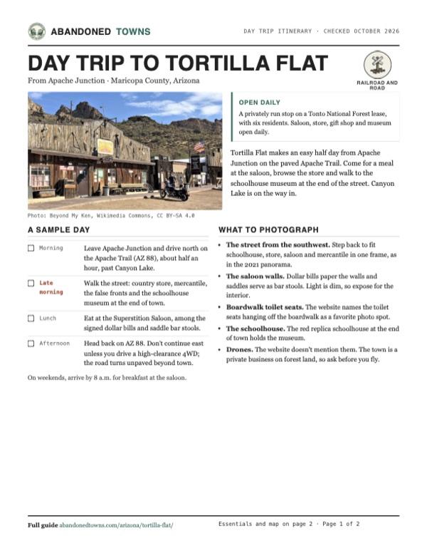
Take it with you
Day trip itinerary
The essentials, the sample day with boxes to tick, what to photograph and the coordinates, on two printable pages. Handy where there's no signal.
Download the PDF (619 KB)Tortilla Flat makes an easy half day from Apache Junction on the paved Apache Trail. Come for a meal at the saloon, browse the store and walk to the schoolhouse museum at the end of the street. Canyon Lake is on the way in.
A sample day
- Leave Apache Junction and drive north on the Apache Trail (AZ 88), about half an hour, past Canyon Lake.
- Walk the street: country store, mercantile, the false fronts and the schoolhouse museum at the end of town.
- Eat at the Superstition Saloon, among the signed dollar bills and saddle bar stools.
- Head back on AZ 88. Don't continue east unless you drive a high-clearance 4WD; the road turns unpaved beyond town.
On weekends, arrive by 8 a.m. for breakfast at the saloon.
What to photograph and film
- The street from the southwest. Step back to fit schoolhouse, store, saloon and mercantile in one frame, as in the 2021 panorama.
- The saloon walls. Dollar bills paper the walls and saddles serve as bar stools. Light is dim, so expose for the interior.
- Boardwalk toilet seats. The website names the toilet seats hanging off the boardwalk as a favorite photo spot.
- The schoolhouse. The red replica schoolhouse at the end of town holds the museum.
- Drones. The website doesn't mention them. The town is a private business on forest land, so ask before you fly.
Map & directions
Getting there
Apache Junction is the closest city, about half an hour away on AZ 88, the Apache Trail. From Phoenix, the route runs out the Red Mountain Freeway and joins the Apache Trail north of Apache Junction. Both are paved to Tortilla Flat.


Base map: USGS The National Map (public domain). Routes: OSRM on © OpenStreetMap contributors data (ODbL), computed October 2026. Times assume dry roads.
- From downtown Apache Junction, head north on Apache Trail.0.7 mi
- At the roundabout, stay on Apache Trail (AZ 88) and follow it northeast into the mountains to Tortilla Flat.16.3 mi
- From downtown Phoenix, take Roosevelt Street and 7th Street to I-10 east, then exit 147 onto the Red Mountain Freeway (Loop 202).28.5 mi
- Take exit 26 and follow Brown Road east. It becomes Lost Dutchman Boulevard.7.9 mi
- Turn left on Apache Trail (AZ 88) and follow it to Tortilla Flat.14.7 mi
Road and safety notes
- AZ 88 is paved from Apache Junction to Tortilla Flat. It winds through the mountains past Canyon Lake, so allow more time than the miles suggest.
- Beyond Tortilla Flat the Apache Trail turns unpaved on its way to Roosevelt Dam. Since it reopened in September 2024 that stretch has been limited to high-clearance four-wheel-drive vehicles and UTVs. Storm damage closed it again in July 2026 until ADOT repaired it. Check ADOT's current status before you continue toward Roosevelt.
- Summer heat is severe here at 1,750 feet. Carry water, especially if you hike into the Superstition Wilderness from nearby trailheads.
- The town is a business on leased forest land. Park in the lots and respect closed areas.
Photos
Tortilla Flat in photos
Visitor reports
Been to Tortilla Flat?
Been there lately? Tell the next visitor what you found: whether you could get in, the state of the road and what's still standing. Photos are welcome. We read every report before it appears here.
Railroad and road
More railroad, road and fort ghost towns
The nearest in Arizona.

 Guide
Cochran
33.11, -111.15Pinal County, Arizona
A railroad stop on the Gila River that had a post office for ten years. Across the river stand five stone charcoal ovens, older than the town. One…
 Guide
Maricopa Wells
33.16, -112.08Pinal County, Arizona
The busiest stage stop on the desert road to California, abandoned when the railroads came. It's on Gila River Indian Community land, and little or…
Nearby
Other sites near Tortilla Flat
Straight-line distance from the townsite to other mapped sites in our Arizona index.
- Goldfield7.3 mi SW · Pinal
- Youngberg7.3 mi SW · Pinal
- Silver King Mine22.0 mi SE · Pinal
- Silver King22.1 mi SE · Pinal
- Pinal22.4 mi SE · Pinal
- Pinal City22.4 mi SE · Pinal
- De Noon23.0 mi SE · Pinal
- Reymert23.0 mi SE · Pinal
Sources
Sources and credits
- ghosttowns.com, "Tortilla Flat": fact sheet fields (roads, climate, best time, remains including the 1987 fire, resident count).
- Wikipedia, "Tortilla Flat, Arizona", retrieved October 2026: coordinates and elevation (GNIS), the 1904 founding, the 1942 flood, name stories, the Peralta legend, the 2009 mercantile, population.
- Tortilla Flat, official website and its history page, checked October 2026: hours, address, phone, the 1932 school, the 1943 flood, the 1988 rebuilding, the 2021 museum, Barry Storm, which stories are legend.
- Wikipedia, "Arizona State Route 88", retrieved October 2026, citing ADOT and the Arizona Republic (September 16, 2024): the 2019 closure and the 2024 reopening for high-clearance vehicles.
- azfamily.com, "Apache Trail restored, reopened after monsoon storms" (July 23, 2026): the July 2026 storm closure and reopening, and the town staying open.
- USGS historical topographic maps, Roosevelt (1907), Four Peaks (1909), Mesa (1954), Mormon Flat Dam (1964): the early road, the power line and the spelling.
- Legal description: BLM PLSS survey grid. Land status: BLM surface management map. Road surface: OpenStreetMap. Routes: OSRM on OpenStreetMap data, October 2026. Status checked against the sources above on October 19, 2026.
Photo and map credits
- Schoolhouse, store, saloon and mercantile from the southwest, 2021: Beyond My Ken, Wikimedia Commons, CC BY-SA 4.0
- The schoolhouse museum, 2021: Beyond My Ken, Wikimedia Commons, CC BY-SA 4.0
- The country store, 2021: Beyond My Ken, Wikimedia Commons, CC BY-SA 4.0
- The false-front harness and buggy shop, 2021: Beyond My Ken, Wikimedia Commons, CC BY-SA 4.0
- The town sign, 2021: Beyond My Ken, Wikimedia Commons, CC BY-SA 4.0
- Signs at the patio, with a butte above town at dusk, 2016: J Etzel from Surprise, AZ, USA, Wikimedia Commons, CC BY 2.0
- The store and saloon from the northeast, 2021: Beyond My Ken, Wikimedia Commons, CC BY-SA 4.0
- Tortilla Flat on the 1907 USGS Roosevelt sheet: U.S. Geological Survey, USGS catalog, Public domain
- Area base map, topo and aerial imagery: USGS The National Map (public domain).
- Historic maps: USGS Historical Topographic Map Collection (public domain): Roosevelt 1907, 1:125,000; Four Peaks 1909, 1:125,000; Mesa 1954, 1:250,000; Mormon Flat Dam 1964, 1:24,000; Theodore Roosevelt Lake 1994, 1:100,000.