 Abandoned

Overview
Where Jerome's copper changed trains
Jerome Junction stood on the open grassland of Little Chino Valley, at what is now the northeast edge of the town of Chino Valley. It existed for one job. In 1892 the Santa Fe, Prescott and Phoenix Railway built south from Ash Fork to Prescott, and two years later William A. Clark, the Montana businessman and later senator who controlled the United Verde mine at Jerome, built a railroad of his own to meet it. He paid the whole $600,000 himself.
Clark's United Verde & Pacific was narrow gauge, three feet between the rails, because that was cheaper to lay over Woodchute Mountain. It climbed from 4,616 feet at the junction to 5,939 feet at its summit and took 186 curves to cover 26 miles. The catch was that its cars couldn't run on the Santa Fe's standard-gauge track. Every load had to be moved from one train to the other at the junction, by dumping or by hand.
So a town grew around the transfer: a roundhouse, a turning wye, loading platforms, stock pens, water tanks and a station shared by both lines, plus houses, the Junction Hotel, two saloons and a school that doubled as a church. About 150 people lived here in 1917. Then Clark moved his smelter down to Clarkdale and built standard-gauge lines to it. The last narrow-gauge train ran in May 1920, and by 1923 the junction's business had moved to Chino Valley.
Timeline
Twenty-five years of changing trains
- Santa Fe interests build the Santa Fe, Prescott and Phoenix Railway from Ash Fork south to Prescott, through Little Chino Valley.
- William A. Clark, owner of the United Verde copper mine at Jerome, builds a 26-mile narrow-gauge line to meet it. Jerome Junction is established where the two lines touch.
- Scheduled trains begin on Clark's United Verde & Pacific. A post office named Junction opens on June 7.
- A yardmaster for the narrow gauge moves his family to the junction, as a Sharlot Hall Museum family history records.
- The official name changes from Junction to Jerome Junction.
- Company records list 147 narrow-gauge cars, among them Clark's private coach.
- About 150 people live at the junction.
- A standard-gauge line from Clark's new smelter at Clarkdale reaches Jerome. The narrow gauge is now obsolete.
- The last United Verde & Pacific train runs. Jerome Junction loses its reason to exist.
- The stop is renamed Copper Siding, and the town's business is absorbed by Chino Valley. The 1947 USGS map labels the siding Copper.
- The Town of Chino Valley buys five miles of the old rail corridor with Arizona Heritage Fund money.
- The Chino Valley Peavine Trail opens on the old grade, straight through the junction.
- A railroad-history website photographs the yard: a stone-lined oil pit, a concrete track-scale pit, a coke ramp and the outline of the depot.
United Verde & Pacific
The crooked line to Jerome
The United Verde & Pacific ran from the junction east and then up over Woodchute Mountain in the Black Hills before dropping to the smelter at Jerome. Its steepest grade was 3 percent on both sides of the summit, at a spot called First View. Baldwin built all ten of its locomotives, small 2-6-0 engines. The first four burned coal until they were converted to fuel oil in 1903, and two of the originals were destroyed in wrecks.
The line carried passengers as well as freight. In 1915 its roster held four combination coach and baggage cars, ore and coal cars, flatcars, stock cars and oil cars, and one private coach reserved for Clark alone.
Coke for the smelter came in and copper went out through the junction, and every load had to be shifted between the two gauges by dumping or by hand.
The end came from Jerome itself. Fires that had burned in the United Verde mine since 1894 pushed Clark toward open-pit mining, and that meant moving the smelter off the top of the ore. From 1911 he built Clarkdale in the Verde Valley, a standard-gauge railroad from Clarkdale to the Santa Fe at Drake, and a tunnel line up to the mine. Once that line reached Jerome in 1919, nothing needed the narrow gauge, and Jerome Junction went with it.
What's left
A yard on the Peavine Trail
The old Santa Fe grade is now the Chino Valley Peavine Trail, and it runs right through the yard. A railroad-history website that photographed it in 2010 found the stone-lined pit where fuel oil was unloaded, the round scar of the big oil tank about 300 feet to the east, a concrete scale pit built for both gauges, an earthen ramp from the coke trestle and black coke dust on the ground where the bins stood. Little is left of the depot beyond a faint outline. The engine-house site, at the tail of the wye across the road, was fenced off.
A road toward Jerome separates the yard from the engine-house site, and the same source says it runs on top of the narrow-gauge grade for most of its length. The historic maps below show the sequence. The 1892 sheet has only roads and a settlement called Chino. The 1905 sheet marks Jerome Junc where the United Verde line leaves the Santa Fe. By 1947 the siding is called Copper, and the 1979 sheet labels the line east of the crossing Old Railroad Grade.
- Peavine Trail on the Santa Fe grade
- Oil unloading pit
- Oil tank outline
- Dual-gauge track-scale pit
- Coke ramp
- Depot outline
- Narrow-gauge grade


Historic maps
Jerome Junction on USGS maps, 1892–1979
Crops from the USGS Historical Topographic Map Collection, centered on the townsite. Each sheet shows what surveyors mapped that year; compare them with today's topo and aerial on this page.

Day trip
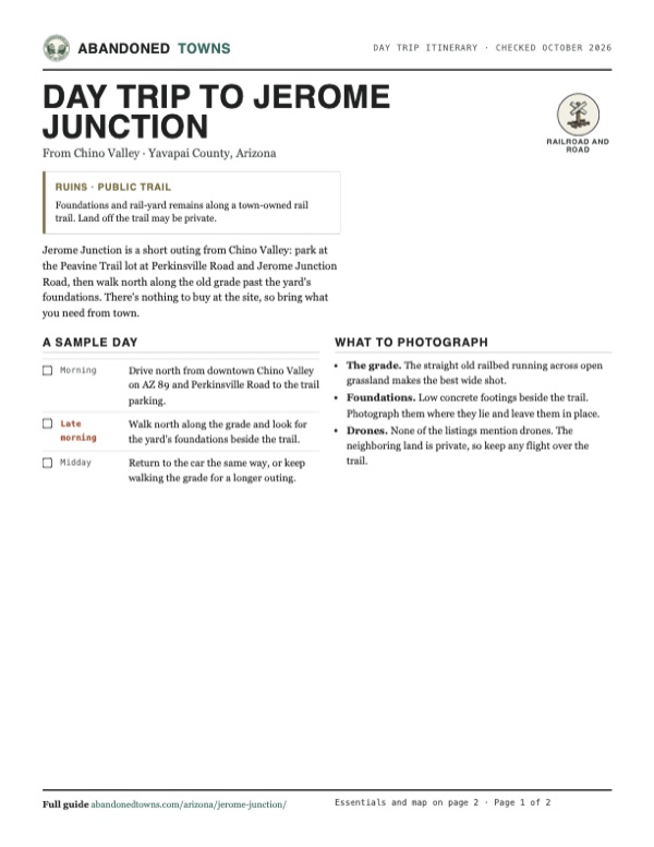
Plan a day trip to Jerome Junction from Chino Valley
Take it with you
Day trip itinerary
The essentials, the sample day with boxes to tick, what to photograph and the coordinates, on two printable pages. Handy where there's no signal.
Download the PDF (334 KB)Jerome Junction is a short outing from Chino Valley: park at the Peavine Trail lot at Perkinsville Road and Jerome Junction Road, then walk north along the old grade past the yard's foundations. There's nothing to buy at the site, so bring what you need from town.
A sample day
- Drive north from downtown Chino Valley on AZ 89 and Perkinsville Road to the trail parking.
- Walk north along the grade and look for the yard's foundations beside the trail.
- Return to the car the same way, or keep walking the grade for a longer outing.
What to photograph and film
- The grade. The straight old railbed running across open grassland makes the best wide shot.
- Foundations. Low concrete footings beside the trail. Photograph them where they lie and leave them in place.
- Drones. None of the listings mention drones. The neighboring land is private, so keep any flight over the trail.
Map & directions
Getting there
Chino Valley is the nearest town, and the site is on its northeast edge, about 1.4 miles out Perkinsville Road from AZ 89. Prescott is about 15 miles south on AZ 89. From Phoenix the route runs up I-17 and AZ 69, then crosses to AZ 89 on Fain Road and AZ 89A.


Base map: USGS The National Map (public domain). Routes: OSRM on © OpenStreetMap contributors data (ODbL), computed October 2026. Times assume dry roads.
- Head north on AZ 89 from downtown Chino Valley.0.9 mi
- Bear right onto East Perkinsville Road (County Road 70).1.4 mi
- Turn left on Jerome Junction Road. TrailLink lists Peavine Trail parking at this corner, and the yard lies along the trail just north.0.1 mi
- From downtown Phoenix, take 3rd Avenue to I-10 west, then exit 143A onto I-17 north.3.2 mi
- Follow I-17 north to exit 262.60.6 mi
- Take AZ 69 toward Prescott, turn right on Fain Road and continue on AZ 89A.35.1 mi
- Take exit 317 and follow AZ 89 north through the roundabouts into Chino Valley.10 mi
- Bear right on East Perkinsville Road, then turn left on Jerome Junction Road.1.5 mi
Road and safety notes
- The Peavine Trail is closed to motor vehicles. It's a 5.8-mile dirt path for walking, cycling and horseback riding.
- TrailLink lists two parking areas at the north end: at East Perkinsville Road and Jerome Junction Road, and where the trail crosses East Road 2 North.
- Land beside the trail may be private, and the engine-house site was fenced in 2010. Stay on the trail and don't collect anything.
- Chino Valley has fuel, food and water a few minutes away.
Photos
Have photos of Jerome Junction?
We haven’t added photographs of Jerome Junction yet. If you’ve visited, share your photos and a field report below.
Visitor reports
Been to Jerome Junction?
Been there lately? Tell the next visitor what you found: whether you could get in, the state of the road and what's still standing. Photos are welcome. We read every report before it appears here.
Railroad and road
More railroad, road and fort ghost towns
The nearest in Arizona.

 Guide
Glen Oaks
34.44, -112.55Yavapai County, Arizona
A name on the Prescott–Wickenburg highway that appears on the 1947 map and is marked a site by 1969. The written record is nearly empty, so this page…
 Guide
Cordes
34.30, -112.17Yavapai County, Arizona
An adobe stage stop on the old road between Prescott and Phoenix that became a store, post office and sheep station. The highway left it behind in…
Nearby
Other sites near Jerome Junction
Straight-line distance from the townsite to other mapped sites in our Arizona index.
- Perkinsville16.1 mi NE · Yavapai
- Jerome18.3 mi E · Yavapai
- Clarkdale21.1 mi E · Yavapai
- Walker22.2 mi S · Yavapai
- Clemenceau22.9 mi E · Yavapai
- Glen Oaks23.9 mi S · Yavapai
- Big Bug24.0 mi S · Yavapai
- Catoctin24.8 mi S · Yavapai
Sources
Sources and credits
- MTB Project, Chino Valley Peavine Trail, and TrailLink's listing, read October 2026: trail length, gravel and cinder surface, free parking, no water or restrooms.
- ghosttowns.com, "Jerome Junction": fact sheet fields (roads, legal description, climate, best time, remains), the private-land note and the trail access.
- Wikipedia, "Jerome Junction, Arizona", retrieved October 2026: founding, 1917 population, post office names and dates, the 1923 move to Chino Valley.
- Wikipedia, "United Verde & Pacific Railway", retrieved October 2026 (citing Russell Wahmann, Narrow Gauge to Jerome, 1983): the railroad's cost, route, grades, curves, rolling stock, the junction's buildings and the May 1920 last run.
- Sharlot Hall Museum, Days Past, Bob Ross, "A Pioneer Family of Yavapai County, Part 2" (2011): the 1903 yardmaster family, 1895–1920 transfer role, location at Perkinsville and Jerome Junction roads 1.4 miles east of Route 89.
- Dave's Rio Grande, "Jerome Junction" (photos March 2010): the oil pit, oil tank outline, scale pit, coke ramp, depot outline, fenced engine-house site and the road on the narrow-gauge grade.
- TrailLink, "Chino Valley Peavine Trail", current listing checked October 2026: the town's corridor purchase, 1994 opening, length, surface, uses and parking.
- Coordinates: USGS historical topographic maps (Jerome 1905, Paulden 1947, Chino Valley North 1979) and USGS aerial imagery, checked against the Sharlot Hall Museum description. Elevation: USGS 3D Elevation Program point query. Routes: OSRM on OpenStreetMap data, October 2026. Status checked against the sources above on October 19, 2026.
Photo and map credits
- Area base map, topo and aerial imagery: USGS The National Map (public domain).
- Historic maps: USGS Historical Topographic Map Collection (public domain): Prescott 1892, 1:250,000; Jerome 1905, 1:125,000; Paulden 1947, 1:62,500; Chino Valley North 1979, 1:24,000.