 Abandoned

Overview
A copper town that stayed alive

Jerome hangs on the side of Cleopatra Hill in the Black Hills of Yavapai County, looking east over the Verde Valley. Two huge copper ore bodies lay under the hill. The United Verde, bought by Montana's William A. Clark in 1888, became the territory's leading copper mine. The United Verde Extension, or Little Daisy, hit a bonanza in 1914 under James S. Douglas. Together the mines produced metal said to be worth more than $1 billion.
The town grew with them. It had 250 people in 1890 and more than 2,500 by 1900. In 1903 a New York paper called it the wickedest town in the West. Accounts of the peak run from more than 10,000 people in the 1920s to about 15,000 around World War I. Then copper prices crashed, the ground under downtown began to sink, and the mines wound down. Phelps Dodge closed the last of them in the early 1950s; sources give 1950, 1952 and 1953. Fewer than 100 people stayed.
Those who stayed formed a historical society, opened a museum and sold Jerome as a ghost town. The state turned the Douglas family's mansion into a park in 1965, and the town became a National Historic Landmark in 1967. Artists and shop owners moved into the empty buildings. Today Jerome is a living town of 464 people. The ghost town is mostly history and branding now. The buildings are still here, and most are in use.
Video
A day and a night on Cleopatra Hill
A couple spends a cold, wet day and a night in Jerome. They start at the Douglas Mansion, the state park museum, with its mining models, mineral cases and yard of old mine equipment, then eat at the Haunted Hamburger, taste wine while rain and snow blow through, and look through kaleidoscopes at the Nellie Bly shop. They stop at the Sliding Jail and spend the night at the Jerome Grand Hotel, the old United Verde Hospital, riding its 1926 elevator and reading the hospital floor plans posted in the halls. The history in the narration is the creators' own. It puts the peak above 15,000 people and the jail's slide at 225 feet; our sources give 10,000 to about 15,000 and about 200 feet.
 Play “Visiting the largest ghost town in America! | Jerome, Arizona” from YouTube
Timeline
From copper camp to art town

- Hohokam people live and farm near the later townsite.
- Spanish explorers note the copper ore on the hill but leave it alone. They were sent for gold and silver.
- Angus McKinnon and Morris A. Ruffner file the first copper claims.
- Governor Frederick Tritle, Frederick F. Thomas and New York backers form the United Verde Copper Company. Sources give both years. The camp is named for Eugene Jerome, the company secretary.
- The Jerome post office opens. It has never closed.
- Copper prices fall by half and the company shuts down.
- Montana mining magnate William A. Clark buys the United Verde. He enlarges the smelter and orders a narrow-gauge railroad to Jerome Junction.
- Four major fires burn much of the business district and half the homes.
- Jerome incorporates as a town and adopts building codes against fire.
- A New York newspaper, The Sun, calls Jerome "the wickedest town in the West."
- James S. Douglas develops the Little Daisy (UVX) mine, strikes a bonanza in 1914 and builds his mansion above it in 1916.
- United Verde opens a new smelter railroad. The Jerome smelter is torn down, and smelting moves to the new company town of Clarkdale.
- Armed vigilantes round up IWW union members and ship them out of town in a cattle car. Counts run from about 60 to 67.
- Boom years, with a dip after World War I. Accounts of the peak population run from more than 10,000 in the 1920s to about 15,000 during the war.
- Copper prices collapse. Ground subsidence wrecks dozens of buildings, the jail and post office among them. Phelps Dodge buys United Verde in 1935, and the UVX company folds in 1938.
- The mines close for good. Sources give 1950, 1952 and 1953. The population falls below 100.
- Residents form the Jerome Historical Society and open a mining museum.
- The Douglas Mansion opens as Jerome State Historic Park, Arizona's fifth state park.
- Jerome is designated a National Historic Landmark.
- The Historical Society takes over the Sliding Jail from the town.
- The census counts 464 residents.
- The state park marks its 60th anniversary.
Subsidence
The town that slid downhill

About 88 miles of mine shafts run under Jerome. In the first half of the 20th century the ground beneath downtown began to move. By 1928 subsidence had damaged at least 10 buildings beyond repair, and it got worse through the 1930s. Dozens of buildings were lost as the earth under them gave way. Sources point to faulting, blasting in the mines, and erosion that smelter smoke may have made worse by killing the plants on the slopes.
The town jail is the best-known casualty. It slid about 200 feet downhill from where it was built. The move left it unusable but not destroyed. The Historical Society took it over in 2017. It now sits beside the town's lower parking lot, and it is one of the first things most visitors see.
Jerome has a reputation as a haunted town, and songs and at least one horror film have played on it. Treat the ghost stories as legend. They belong with the slogan the town adopted after the mines closed, America's newest and biggest ghost town.
What's historic, what's current
What you'll see today


Almost everything in Jerome is historic, and almost all of it is in use. The list below separates what you can go inside from what you see from the street.
Open to visitors. The Douglas Mansion, built in 1916 above the Little Daisy mine, holds the state park museum, with photographs, minerals, a video and a 3-D model of the town and the mines beneath it. The Jerome Historical Society's Mine Museum at 200 Main Street has run since the early 1950s and shows mining tools, ore carts and saloon relics. The Sliding Jail sits outdoors beside the lower parking lot.
Historic, in new use. The brick business blocks on Main Street and Hull Avenue now hold galleries, shops, restaurants and wineries. The former Jerome High School complex houses artists' galleries. The old United Verde Hospital at the top of town is now the Jerome Grand Hotel. Most houses are private homes.
Seen from outside. The Little Daisy Hotel stands north of the Douglas Mansion, beyond the old Audrey and Edith shafts. The United Verde open pit, about 300 feet deep, sits on the edge of town beside Cleopatra Hill. The Historical Society's Audrey Headframe Park, around a headframe built in 1918, carried a "temporarily closed" notice when we checked in October 2026.
- Douglas Mansion (1916), state park museum
- Mine Museum, 200 Main St
- Sliding Jail
- Main Street business blocks
- Former United Verde Hospital (hotel)
- Little Daisy Hotel
- Audrey headframe (1918)
- United Verde open pit
The historic maps below show the change. The 1887 sheet marks Jerome as a dot high in the Black Hills. By 1905 the town fills its hillside, and a railroad winds north past points named Horseshoe and First View, most likely Clark's narrow-gauge line to Jerome Junction. The 1965 sheet adds Clarkdale, Clemenceau and Smelter City in the valley, with the United Verde and Hopewell Tunnel mines above. The 1973 sheet draws the street grid and the C and J and Gadsden shafts, and the 1981 sheet shows the strip mine, quarries and mine dumps above town.


Historic maps
Jerome on USGS maps, 1887–1981
Crops from the USGS Historical Topographic Map Collection, centered on the townsite. Each sheet shows what surveyors mapped that year; compare them with today's topo and aerial on this page.

Day trip
Plan a day trip to Jerome from Cottonwood
Take it with you
Day trip itinerary
The essentials, the sample day with boxes to tick, what to photograph and the coordinates, on two printable pages. Handy where there's no signal.
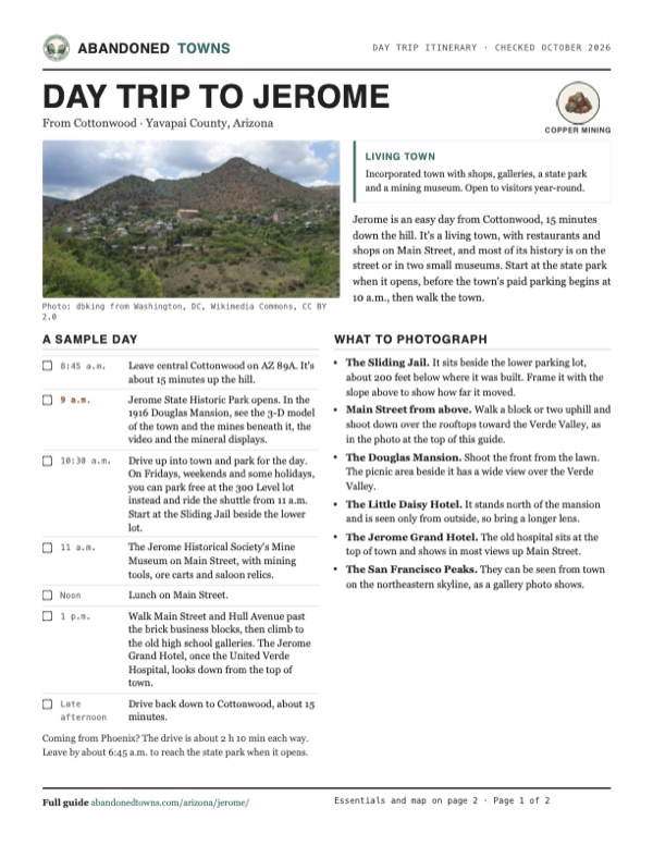
Download the PDF (498 KB)Jerome is an easy day from Cottonwood, 15 minutes down the hill. It's a living town, with restaurants and shops on Main Street, and most of its history is on the street or in two small museums. Start at the state park when it opens, before the town's paid parking begins at 10 a.m., then walk the town.
A sample day
- Leave central Cottonwood on AZ 89A. It's about 15 minutes up the hill.
- Jerome State Historic Park opens. In the 1916 Douglas Mansion, see the 3-D model of the town and the mines beneath it, the video and the mineral displays.
- Drive up into town and park for the day. On Fridays, weekends and some holidays, you can park free at the 300 Level lot instead and ride the shuttle from 11 a.m. Start at the Sliding Jail beside the lower lot.
- The Jerome Historical Society's Mine Museum on Main Street, with mining tools, ore carts and saloon relics.
- Lunch on Main Street.
- Walk Main Street and Hull Avenue past the brick business blocks, then climb to the old high school galleries. The Jerome Grand Hotel, once the United Verde Hospital, looks down from the top of town.
- Drive back down to Cottonwood, about 15 minutes.
Coming from Phoenix? The drive is about 2 h 10 min each way. Leave by about 6:45 a.m. to reach the state park when it opens.
What to photograph and film
- The Sliding Jail. It sits beside the lower parking lot, about 200 feet below where it was built. Frame it with the slope above to show how far it moved.
- Main Street from above. Walk a block or two uphill and shoot down over the rooftops toward the Verde Valley, as in the photo at the top of this guide.
- The Douglas Mansion. Shoot the front from the lawn. The picnic area beside it has a wide view over the Verde Valley.
- The Little Daisy Hotel. It stands north of the mansion and is seen only from outside, so bring a longer lens.
- The Jerome Grand Hotel. The old hospital sits at the top of town and shows in most views up Main Street.
- The San Francisco Peaks. They can be seen from town on the northeastern skyline, as a gallery photo shows.
Map & directions
Getting there
Cottonwood, in the Verde Valley below, is the closest city, about 15 minutes away. From Phoenix, take I-17 north and cross the valley on AZ 260 to Cottonwood. Both routes finish on AZ 89A, a paved highway that climbs straight into town.


Base map: USGS The National Map (public domain). Routes: OSRM on © OpenStreetMap contributors data (ODbL), computed October 2026. Times assume dry roads.
- Head south on South Main Street (historic US 89A).0.7 mi
- Turn right onto East Cottonwood Street, AZ 89A. It becomes the Prescott–Flagstaff Highway.1.9 mi
- Keep right at the fork and stay on AZ 89A through four roundabouts.2.0 mi
- After the last roundabout, AZ 89A climbs the hill into Jerome.3.4 mi
- From downtown Phoenix, take 3rd Avenue north to I-10 and follow exit 143A to I-17 north.3.2 mi
- Follow I-17 (the Black Canyon Freeway) north and leave at the AZ 260 exit.86 mi
- Turn left onto Finnie Flat Road, AZ 260, and follow it northwest through a string of roundabouts to Cottonwood.12.4 mi
- In Cottonwood, turn left onto Main Street, then left onto East Cottonwood Street, and follow AZ 89A up to Jerome.7.9 mi
Road and safety notes
- AZ 89A is paved the whole way and fine for any car. Through town it switchbacks steeply, so drive slowly and watch for people on foot.
- Town lots charge $5 for the day between 10 a.m. and 4 p.m., paid by card at the kiosks. Cars with disability placards park free.
- The 300 Level lot on Perkinsville Road is free. A free shuttle runs from it into town on Fridays, Saturdays, Sundays and holidays.
- If you come from Prescott instead, 89A crosses Mingus Mountain on a winding grade. Check az511.gov for closures before you go.
- Jerome gets about 5 inches of snow in an average January, and summer thunderstorms can be violent. Spring and fall are often windy.
- Old mine workings around town are dangerous. Stay on streets and public paths.
Photos
Jerome in photos
Visitor reports
Been to Jerome?
Been there lately? Tell the next visitor what you found: whether you could get in, the state of the road and what's still standing. Photos are welcome. We read every report before it appears here.
Copper mining
More copper mining ghost towns
The nearest in Arizona.

 Guide
Clemenceau
34.74, -112.03Yavapai County, Arizona
James Douglas's smelter town of 1917 in the Verde Valley, emptied when the smelter closed in 1937 and taken into Cottonwood in 1960. Its 1923 school…
 Guide
Briggs
34.06, -112.48Yavapai County, Arizona
Two tries at copper mining on Castle Creek, in the early 1880s and again in 1890, left a pair of camp names on the map. The way in is a 4WD creek-bed…
Nearby
Other sites near Jerome
Straight-line distance from the townsite to other mapped sites in our Arizona index.
- Clarkdale2.9 mi E · Yavapai
- Clemenceau4.7 mi E · Yavapai
- Perkinsville11.6 mi NW · Yavapai
- Cherry11.7 mi S · Yavapai
- Jerome Junction18.3 mi W · Yavapai
- Big Bug22.8 mi SW · Yavapai
- Walker25.4 mi SW · Yavapai
- Venezia30.2 mi SW · Yavapai
Sources
Sources and credits
- ghosttowns.com, "Jerome": fact sheet fields (roads, legal description, climate, best time, remains, post office date).
- Wikipedia, "Jerome, Arizona", retrieved October 2026: history, 1917 deportation, subsidence, Sliding Jail, population and census figures, climate, coordinates (GNIS).
- Legends of America, "Jerome, Arizona: Copper Queen on the Hill": 1888 sale, the 15,000 peak figure, the 1952 closure date, the deportation count of 67, the ghost-town slogan and haunting claims.
- Arizona State Parks, Jerome State Historic Park: hours, holiday hours, fees, address, phone, museum contents and the picnic area, as of October 2026; its facility information: restrooms, pets, no food in the museum, as of October 2026; the Arizona State Parks FAQ: the ban on recreational drones and filming permits; and its October 7, 2025 press release: park opening date, Little Daisy mine dates.
- Jerome Historical Society, Mine Museum and Audrey Headframe Park: museum address and exhibits, headframe date, closure notice; museum hours and admission as of October 2026.
- Town of Jerome, "Parking and Shuttle Service", checked October 2026: paid and free lots, fees and shuttle days. "Free Shuttle Service", as of October 2026: shuttle hours and stops.
- Jerome Grand Hotel: the hotel occupies the former United Verde Hospital.
- Kev and Jess, "Visiting the largest ghost town in America! | Jerome, Arizona", YouTube, uploaded April 19, 2025: the video on this page; the Douglas Mansion museum, the Sliding Jail and the Jerome Grand Hotel.
- Elevation: USGS 3D Elevation Program point query. Routes: OSRM on OpenStreetMap data, October 2026. Status checked against the sources above on October 19, 2026.
Photo and map credits
- Jerome about 1909, from a panoramic print: Uncredited photographer for West Coast Art Co, Wikimedia Commons, Public domain
- The village and the hills around it, 1898: Passenger Dept., Santa Fe Route, Wikimedia Commons, Public domain
- Jerome on Cleopatra Hill, 2010: dbking from Washington, DC, Wikimedia Commons, CC BY 2.0
- The Sliding Jail: Tobyc75, Wikimedia Commons, CC BY-SA 3.0
- The Douglas Mansion, now the state park museum: Benjamin Cody, Wikimedia Commons, CC BY-SA 3.0
- The town from the cemetery, 2013: Finetooth, Wikimedia Commons, CC BY-SA 3.0
- Main Street above the Verde Valley, 2013: Mike McBey, Wikimedia Commons, CC BY 2.0
- Main Street, with the Jerome Grand Hotel on the hill: Finetooth, Wikimedia Commons, CC BY-SA 4.0
- Jerome Avenue, 2025: Seasider53, Wikimedia Commons, CC BY 4.0
- The New State Motor Building, now a Historical Society venue: Marine 69-71, Wikimedia Commons, CC BY-SA 4.0
- The Little Daisy Hotel, 2025: Seasider53, Wikimedia Commons, CC BY 4.0
- The San Francisco Peaks from Jerome: Seth Matson, Wikimedia Commons, CC BY-SA 3.0
- Area base map, topo and aerial imagery: USGS The National Map (public domain).
- Historic maps: USGS Historical Topographic Map Collection (public domain): Prescott 1887, 1:250,000; Jerome 1905, 1:125,000; Prescott 1965, 1:250,000; Cottonwood 1973, 1:24,000; Prescott 1981, 1:100,000.