 Abandoned

Overview
A gold camp that never quite emptied

Pearce sits in the Sulphur Springs Valley, at the north end of the Ghost Town Trail that runs south to Courtland and Gleeson. In 1894 James Pearce, a Cornish miner turned cattleman, found gold near his ranch. The claim became the Commonwealth Mine, one of Arizona's major silver and gold producers. Miners and merchants came over from Tombstone, a post office opened in 1896 and a railroad station in 1903. By 1919 about 1,500 people lived here, with the mill camp of Fittsburg a mile to the east.
The Commonwealth worked over a million tons of ore between 1895 and 1942. Estimates of its output vary from about $8 million in silver and $2.5 million in gold to more than $15 million in gold. The ore ran down and the Depression arrived, and by the late 1940s Pearce was nearly a ghost town.
It never fully emptied. In 1961 a developer, Horizon Land Company, began selling lots at Sunsites, just to the north. The two places now run together as Pearce–Sunsites, a community that lives on retirees and tourism and shares the Pearce post office and ZIP code. The old gold camp is the cluster of old buildings around the corner of the Ghost Town Trail and Pearce Road: the general store, a 1916 church, the 1915 jail and a few shops, with the mine's dumps on Pearce Hill behind them.
Timeline
From the Commonwealth to Sunsites
- James Pearce, a Cornish miner and cattleman, finds gold near his ranch. His claim becomes the Commonwealth Mine.
- Pearce sells the mine to John Brockman for $250,000. His wife's contract keeps her the right to run a boardinghouse beside it. Brockman builds a 200-stamp mill, and a mill camp called Fittsburg grows up about a mile east.
- The Pearce post office opens. Constable George Bravin hires Burt Alvord as his deputy.
- The mill burns and is rebuilt.
- Brockman sells the mine.
- The railroad station opens.
- A cave-in closes the mine for a time. A cyanide plant goes up to rework the tailings.
- The jail goes up in 1915 and Our Lady of Victory Catholic Church in 1916.
- Pearce has about 1,500 people.
- The Depression hits and the Commonwealth winds down. Sources put its last closing anywhere from 1930 to the late 1940s. The railroad tracks are pulled up.
- Horizon Land Company starts selling lots at Sunsites, just north of the old town.
- The Soto Bros. & Renaud general store is listed on the National Register of Historic Places.
- The store, a western museum since 1988, closes and its contents are auctioned.
- Our Lady of Victory is listed on the National Register.
- Marlin Gold buys Commonwealth Silver and Gold, which planned to reopen the mine as an open pit. We found no later news of the project.
- The Old Pearce Preservation Association opens the 1915 jail on the first Saturday of each month, October to May.
Law and outlaws
The deputy who robbed trains
Pearce grew fast and rough, and in 1896 its constable, George Bravin, took on a deputy named Burt Alvord. Alvord later switched sides. With Billy Stiles he formed the Alvord–Stiles gang, which robbed trains around southern Arizona and used Pearce as a base. Their raids included a failed attempt on the train at Fairbank.
The jail that now anchors the old townsite came later, in 1915, and held prisoners until the 1930s.
What's left
Store, church, jail and the hill


The landmark is the Soto Bros. & Renaud general store, a two-story adobe on the southwest corner of the Ghost Town Trail and Pearce Road, and one of the largest adobe buildings in Cochise County. Sources date it to 1893 or 1896. It sold goods for most of a century, ran as a western museum from 1988 to 1990, and now opens only for occasional events. Our Lady of Victory Catholic Church dates from 1916. The 1915 jail is owned by the Old Pearce Preservation Association, a local nonprofit. Nearby stand the old post office, an 1899 pottery shop, an old ranch house, a 1900 wooden bridge over Middle March Creek and the ruins of an older jail. The cemetery is west of town.
The historic maps below show how the town sat on the railroad. On the 1916 sheet the Arizona Eastern railroad runs through Pearce and roads fan out in every direction, with Pearce Hill and Sixmile Hill just south. The 1926 sheet writes the Commonwealth Mine across Pearce Hill. By 1958 the tracks are an old grade, and the 1985 and 1996 sheets show tailings ponds at the foot of the hill and mine shafts across its slopes.
- Soto Bros. & Renaud general store (NRHP)
- Our Lady of Victory Catholic Church (1916, NRHP)
- Jail (1915)
- Old post office
- Pottery shop (1899)
- Wooden bridge (1900)
- Older jail ruins
- Cemetery
- Commonwealth Mine dumps and shafts


Historic maps
Pearce on USGS maps, 1916–1996
Crops from the USGS Historical Topographic Map Collection, centered on the townsite. Each sheet shows what surveyors mapped that year; compare them with today's topo and aerial on this page.

Day trip
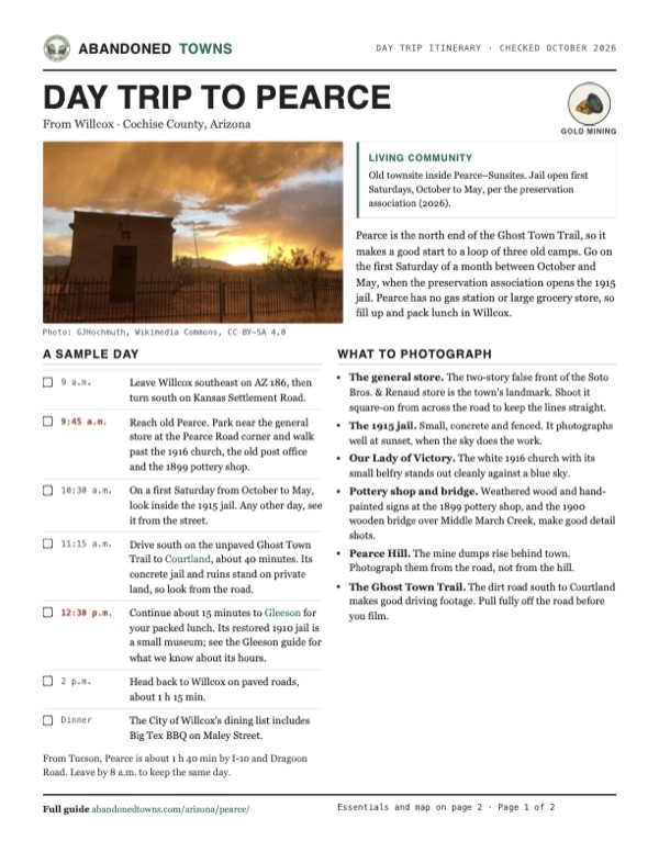
Plan a day trip to Pearce from Willcox
Take it with you
Day trip itinerary
The essentials, the sample day with boxes to tick, what to photograph and the coordinates, on two printable pages. Handy where there's no signal.
Download the PDF (478 KB)Pearce is the north end of the Ghost Town Trail, so it makes a good start to a loop of three old camps. Go on the first Saturday of a month between October and May, when the preservation association opens the 1915 jail. Pearce has no gas station or large grocery store, so fill up and pack lunch in Willcox.
A sample day
- Leave Willcox southeast on AZ 186, then turn south on Kansas Settlement Road.
- Reach old Pearce. Park near the general store at the Pearce Road corner and walk past the 1916 church, the old post office and the 1899 pottery shop.
- On a first Saturday from October to May, look inside the 1915 jail. Any other day, see it from the street.
- Drive south on the unpaved Ghost Town Trail to Courtland, about 40 minutes. Its concrete jail and ruins stand on private land, so look from the road.
- Continue about 15 minutes to Gleeson for your packed lunch. Its restored 1910 jail is a small museum; see the Gleeson guide for what we know about its hours.
- Head back to Willcox on paved roads, about 1 h 15 min.
- The City of Willcox's dining list includes Big Tex BBQ on Maley Street.
From Tucson, Pearce is about 1 h 40 min by I-10 and Dragoon Road. Leave by 8 a.m. to keep the same day.
What to photograph and film
- The general store. The two-story false front of the Soto Bros. & Renaud store is the town's landmark. Shoot it square-on from across the road to keep the lines straight.
- The 1915 jail. Small, concrete and fenced. It photographs well at sunset, when the sky does the work.
- Our Lady of Victory. The white 1916 church with its small belfry stands out cleanly against a blue sky.
- Pottery shop and bridge. Weathered wood and hand-painted signs at the 1899 pottery shop, and the 1900 wooden bridge over Middle March Creek, make good detail shots.
- Pearce Hill. The mine dumps rise behind town. Photograph them from the road, not from the hill.
- The Ghost Town Trail. The dirt road south to Courtland makes good driving footage. Pull fully off the road before you film.
Map & directions
Getting there
Willcox is the closest city, about 45 minutes north. From Tucson, take I-10 east and cut south on Dragoon Road. Both routes are paved all the way. Pearce is also the north end of the Ghost Town Trail, an unpaved road south to Courtland and Gleeson.


Base map: USGS The National Map (public domain). Routes: OSRM on © OpenStreetMap contributors data (ODbL), computed October 2026. Times assume dry roads.
- From downtown Willcox, take Maley Street (AZ 186) southeast onto the Willcox–Bonita Highway.6 mi
- Turn right on Kansas Settlement Road and follow it south.20.1 mi
- At the end of the road, turn right onto US 191.4.1 mi
- Turn sharp left onto the Ghost Town Trail into old Pearce. The general store is at the Pearce Road corner.1.1 mi
- Take I-10 east from downtown Tucson, past Benson.61 mi
- Take the Dragoon Road exit and follow Dragoon Road east.13.3 mi
- Turn right onto US 191.8.6 mi
- Turn right onto the Ghost Town Trail into old Pearce.1.1 mi
Road and safety notes
- Both routes are paved to the townsite, and Bisbee101 says most of the town is reachable in an ordinary car.
- South of town the Ghost Town Trail to Courtland and Gleeson turns to gravel and dirt in OpenStreetMap. Check conditions after heavy rain.
- Most buildings in old Pearce are private homes or closed. Look from the street unless a building is open.
- Pearce Hill, south of town, is covered in old mine shafts and prospects on the USGS maps. Stay out of the workings.
- Bisbee101 says Pearce itself has no gas station or large grocery store. Fill up in Willcox or along I-10.
Photos
Pearce in photos
Visitor reports
Been to Pearce?
Been there lately? Tell the next visitor what you found: whether you could get in, the state of the road and what's still standing. Photos are welcome. We read every report before it appears here.
Gold mining
More gold mining ghost towns
The nearest in Arizona.

 Guide
Dos Cabezas
32.18, -109.61Cochise County, Arizona
A stage stop that became a gold camp and then a copper boomtown. Adobe ruins still line AZ 186, 15 miles from Willcox.
 Guide
Kentucky Camp
31.74, -110.74Pima County, Arizona
The adobe headquarters of a hydraulic gold-mining venture that lasted about four years. The Forest Service restored it, and it's open year-round with…
Nearby
Other sites near Pearce
Straight-line distance from the townsite to other mapped sites in our Arizona index.
- Bisbee6.6 mi SW · Cochise
- Courtland9.4 mi S · Cochise
- Gleeson11.8 mi S · Cochise
- Cochise15.6 mi N · Cochise
- Tombstone19.7 mi SW · Cochise
- Johnson19.9 mi NW · Cochise
- Dos Cabezas22.3 mi NE · Cochise
- Contention City24.3 mi SW · Cochise
Sources
Sources and credits
- ghosttowns.com, "Pearce and Fittsburg": fact sheet fields (roads, legal description, climate, best time, remains, post office date, Fittsburg).
- Wikipedia, "Pearce, Arizona", retrieved October 2026: coordinates, elevation, James Pearce, railroad station, 1919 population, mine output, Sunsites and the shared post office and ZIP code.
- Wikipedia, "Pearce General Store" and "List of historic properties in Pearce, Arizona": store dates, museum years, National Register listings, church, jail, Fittsburg, building dates.
- Legends of America, "The Ghost Town Trail" (updated July 2024): sale to Brockman, the boardinghouse clause, the mill, fire, cave-in and cyanide plant, Bravin and Alvord, the higher production figure.
- Arizona Highways, "Ghost Town Trail" (undated): families and businesses moving over from Tombstone, the town on US 191 today.
- Old Pearce Preservation Association, historicpearce.com (live 2026): jail ownership, first-Saturday season, appointments and the phone number for them, as of October 2026.
- City of Willcox, "Dining": Big Tex BBQ on Maley Street, as of October 2026.
- Bisbee101, "Pearce Ghost Town" (2025–2026): general store opening for events, no gas station or large grocery store, road access, as of October 2026.
- Southern Arizona Guide, "Tour Pearce AZ": ore tonnage and underground workings, the mining company's open-pit plan.
- GlobeNewswire, Marlin Gold release (May 2015): acquisition of the Commonwealth project.
- Places and road surfaces: OpenStreetMap, October 2026. Elevation: USGS 3D Elevation Program point query. Routes: OSRM on OpenStreetMap data, October 2026. Status checked against the sources above on October 19, 2026.
Photo and map credits
- The 1915 jail at sunset, 2023: GJHochmuth, Wikimedia Commons, CC BY-SA 4.0
- Our Lady of Victory Catholic Church, built 1916: Marine 69-71, Wikimedia Commons, CC BY-SA 4.0
- The Soto Bros. & Renaud general store, 2019: Marine 69-71, Wikimedia Commons, CC BY-SA 4.0
- The same store in 2007: dedhed1950, Wikimedia Commons, CC BY-SA 2.0
- The old post office: Marine 69-71, Wikimedia Commons, CC BY-SA 4.0
- Inside the ruins of the older jail, 2010: StellarD, Wikimedia Commons, CC BY-SA 4.0
- The 1899 pottery shop: Marine 69-71, Wikimedia Commons, CC BY-SA 4.0
- The 1900 bridge over Middle March Creek: Marine 69-71, Wikimedia Commons, CC BY-SA 4.0
- The 1896 ranch house and old farm equipment: Marine 69-71, Wikimedia Commons, CC BY-SA 4.0
- The cemetery gate, 2010: StellarD, Wikimedia Commons, CC BY-SA 4.0
- The townsite sign, 2023: GJHochmuth, Wikimedia Commons, CC BY-SA 4.0
- Old machinery among prickly pear, 1989: LBM1948, Wikimedia Commons, CC BY-SA 4.0
- Area base map, topo and aerial imagery: USGS The National Map (public domain).
- Historic maps: USGS Historical Topographic Map Collection (public domain): Pearce 1916, 1:125,000; Courtland 1926, 1:62,500; Pearce 1958, 1:62,500; Pearce 1985, 1:24,000; Pearce 1996, 1:24,000.