 Abandoned

Overview
A silver camp that stayed alive

In 1877 Ed Schieffelin, an Army scout stationed at what became Fort Huachuca, went prospecting in the hills east of the San Pedro River during the Apache Wars. He found silver on a high plateau called Goose Flats, and his first claim, filed that September, carried the name Tombstone. When a town was laid out on the mesa in March 1879, it took the claim's name.
The Tombstone district turned out to be the most productive silver district in Arizona, with about 32 million ounces mined. Water was scarce on the mesa, so ore went by wagon to stamp mills on the San Pedro about nine miles west, and mill towns grew up there: Charleston, Contention City and Fairbank. By mid-1881 Tombstone had four churches, two banks, three newspapers, an opera house and more than a hundred saloons. When Cochise County was created that February, Tombstone became its seat.
The mines hit water in the early 1880s. Big Cornish pumps kept them working until May 1886, when the Grand Central's hoist and pumping plant burned. Rebuilding the pumps was judged unprofitable, and silver prices were falling. The census count dropped from 1,875 in 1890 to 646 in 1910, and the courthouse kept the town going until voters moved the county seat to Bisbee in 1929. Films and television brought visitors back from the 1950s on. A 2005 CNN report put them at about 450,000 a year, in a town that counted 1,308 residents in 2020.
Video
Tombstone in 30 seconds
Arizona's richest silver district: C. S. Fly's view of about 1881, the 1882 courthouse, Boothill and Allen Street, and the town today.
Timeline
From claim to county seat to tourist town

- Ed Schieffelin, an Army scout stationed at what became Fort Huachuca, prospects the hills east of the San Pedro River from Brunckow's Cabin.
- His first claim is filed. He names it Tombstone.
- A post office opens. It has never closed.
- A townsite is surveyed on Goose Flats, a mesa above the Goodenough Mine. Allen Street lots sell for $5.
- The Tombstone Epitaph prints its first issue.
- Cochise County is created with Tombstone as its seat. The town incorporates on February 21.
- Fire destroys 66 businesses in the eastern half of the business district.
- The gunfight near the O.K. Corral. Three Cowboys are killed in about 30 seconds.
- The Bird Cage Theatre opens on Allen Street. It runs until 1889.
- The Grand Central Mine strikes water at 620 feet in March. A second fire on May 25 destroys more than 100 businesses. The county courthouse goes up for about $45,000.
- The Grand Central hoist and pumping plant burns. Rebuilding is judged unprofitable, silver prices fall, and the mines lay off workers.
- The census counts 646 residents, the town's low point.
- County voters move the seat of government to Bisbee.
- The empty courthouse reopens as a museum.
- The Tombstone Historic District becomes a National Historic Landmark.
- The National Park Service warns that the landmark designation is threatened by unsympathetic alterations.
- The census counts 1,308 residents.
Legend and record
What happened, and what Hollywood added


The name. The story goes that Schieffelin was warned all he would find in those hills was his own tombstone. The line is usually credited to the scout Al Sieber, and an older version has friends telling him to take his coffin along. The wording changes from one telling to the next, so treat it as a story. Another account says one early claim was called Graveyard because it proved worthless.
The gunfight. On October 26, 1881, City Marshal Virgil Earp, his brothers Wyatt and Morgan and Doc Holliday confronted five Cowboys over a town ordinance against carrying guns. About 30 shots were fired in about 30 seconds. Tom and Frank McLaury and Billy Clanton were killed, and all three lie in Boothill. The fight didn't happen inside the O.K. Corral. It took place in a narrow lot beside C. S. Fly's photo studio on Fremont Street, six doors west of the corral's back entrance. Virgil was the marshal in charge. Wyatt, Morgan and Holliday were his temporary deputies.
The shootout was little known until Stuart Lake's 1931 biography of Wyatt Earp. Its name comes from the 1957 film Gunfight at the O.K. Corral.
The population. Popular accounts put boom-time Tombstone at 8,000, 10,000 or even 15,000 people. The federal census came in 1880 and 1890, on either side of the peak, and counted 973 and 1,875. The real peak is unknown, and we give the range.
The Bird Cage. The theatre's best-known description, "the wildest, wickedest night spot between Basin Street and the Barbary Coast," is usually credited to The New York Times in 1882. We haven't seen the original article.
The streetscape. Some of what looks old is new. In 2004 the National Park Service listed what it called inappropriate changes in the landmark district, among them fake "historic" dates on new buildings, hitching rails and Spanish-tile porches that never existed in Tombstone, and lighted signs. The courthouse, Schieffelin Hall and the Bird Cage are original. When in doubt, ask whether a building is a restoration or a reconstruction.
What's left
What you can see


Most of the sights sit within a few blocks of Allen Street, which is closed to cars between 3rd and 6th Streets. The 1882 Cochise County Courthouse on Toughnut Street is now a state historic park with a museum and a reproduction gallows in its yard. The Bird Cage Theatre (1881) and Schieffelin Hall, the opera house Al Schieffelin built in 1881, still stand. The Crystal Palace Saloon was restored in 1964 to its 1881 look, working from old photographs.
At the O.K. Corral, life-size figures stand where the fighters stood, placed from a map Wyatt Earp drew, and C. S. Fly's photo gallery is part of the complex. As of October 2026, the O.K. Corral's ticket page says admission also covers the Historama next door and the Epitaph's museum on Fifth Street. Boothill Graveyard is on AZ 80 at the north edge of town. The Rose Tree Museum shows a Lady Banksia rose planted in 1885 that covered more than 8,000 square feet by 2014. Ed Schieffelin, who died in Oregon in 1897, is buried about 3 miles northwest of town under a 25-foot stone monument shaped like a prospector's claim marker.
The old USGS sheets in the next section show the town's street grid on the slope below Comstock Hill, the railroad coming in from the northwest, and mine buildings scattered across the Tombstone Hills to the south. The 1952 sheet marks Boothill on the highway north of town.
- Cochise County Courthouse (1882)
- Gallows yard (reproduction)
- Bird Cage Theatre (1881)
- Schieffelin Hall (1881)
- Crystal Palace Saloon (restored 1964)
- O.K. Corral and Fly's gallery
- Epitaph museum
- Boothill Graveyard
- Rose Tree Museum
- Schieffelin monument


Historic maps
Tombstone on USGS maps, 1915–1996
Crops from the USGS Historical Topographic Map Collection, centered on the townsite. Each sheet shows what surveyors mapped that year; compare them with today's topo and aerial on this page.

Day trip
Plan a day trip to Tombstone from Sierra Vista
Take it with you
Day trip itinerary
The essentials, the sample day with boxes to tick, what to photograph and the coordinates, on two printable pages. Handy where there's no signal.
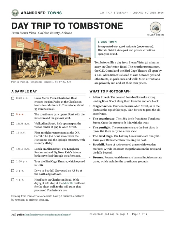
Download the PDF (504 KB)Tombstone fills a day from Sierra Vista, 35 minutes away on Charleston Road. The courthouse museum, the O.K. Corral and the Bird Cage Theatre all open by 9 a.m. Allen Street is closed to cars between 3rd and 6th Streets, so park once and walk. Most attractions are privately run and set their own prices.
A sample day
- Leave Sierra Vista. Charleston Road crosses the San Pedro at the Charleston townsite and climbs to Tombstone, about 35 minutes in all.
- The courthouse park opens. Start with the museum and the gallows yard.
- Walk Allen Street. Pick up a map at the visitor center at 395 E. Allen Street.
- First gunfight reenactment at the O.K. Corral. The $10 ticket also covers the Historama and the Epitaph museum, with re-entry all day.
- Lunch on Allen Street. The Longhorn Restaurant and Big Nose Kate's Saloon both serve food through the afternoon.
- Tour the Bird Cage Theatre, which opened in 1881.
- Drive to Boothill Graveyard on AZ 80 at the north edge of town.
- Head back on Charleston Road. With daylight left, stop at the Millville trailhead for the short walk to the mill ruins that processed Tombstone's ore.
Coming from Tucson? Allow about 1 hour 30 minutes, and leave by 7:30 a.m. to arrive at opening.
What to photograph and film
- Allen Street. The covered boardwalks make strong leading lines. Shoot along them from the end of a block.
- Stagecoaches. Tour coaches use Allen Street, as in the photo at the top of this page. Wait for one to pass the old storefronts.
- The courthouse. The 1882 brick front faces Toughnut Street. Cross the street to fit it in with the trees.
- The gunfight. The reenactments are the best video in town. Get there early for a clear view.
- The Bird Cage. The balcony boxes inside are dimly lit. Raise your ISO rather than reaching for flash.
- Boothill. Rows of rock-covered graves with wooden markers. A wide lens from the path takes in the rows and the hills beyond.
- Drones. Recreational drones are banned in Arizona state parks, which includes the courthouse grounds.
Map & directions
Getting there
Sierra Vista is the nearest city. The direct road from there is Charleston Road, which crosses the San Pedro River beside the ruins of Charleston, one of Tombstone's old mill towns. From Tucson, take I-10 to Benson and AZ 80 south. Both routes are paved.


Base map: USGS The National Map (public domain). Routes: OSRM on © OpenStreetMap contributors data (ODbL), computed October 2026. Times assume dry roads.
- Head east on Fry Boulevard.1.5 mi
- Turn left on Coronado Drive, which becomes Martin Luther King Jr. Parkway.1.3 mi
- Continue onto Charleston Road. It crosses the San Pedro River at the Charleston townsite and climbs to Tombstone.16.1 mi
- Charleston Road enters town as Sumner Street. Turn right on Toughnut Street to the historic district.0.4 mi
- From downtown Tucson, take Congress Street to I-10 and head east toward Benson.45 mi
- Take exit 303 into Benson and follow Business I-10, also Historic US 80, through town.2.5 mi
- Bear right onto AZ 80 and follow it southeast to Tombstone.23.3 mi
- AZ 80 becomes Fremont Street. Turn right on 4th Street into the historic district.0.4 mi
Road and safety notes
- Both routes are paved all the way. Allen Street is closed to cars between 3rd and 6th Streets, so park nearby and walk.
- Summer days are hot; the record is 112°F. Most of the year's rain falls in monsoon storms from July to September.
- Most attractions on Allen Street are privately run, and their hours and prices change. Check before a long drive.
- Old mine workings lie in the hills just south of town. Stay out of fenced areas and off mine dumps.
Photos
Tombstone in photos
Visitor reports
Been to Tombstone?
Been there lately? Tell the next visitor what you found: whether you could get in, the state of the road and what's still standing. Photos are welcome. We read every report before it appears here.
Silver mining
More silver mining ghost towns
The nearest in Arizona.

 Guide
Millville
31.64, -110.17Cochise County, Arizona
The mill site across the San Pedro from Charleston, where two stamp mills crushed Tombstone's silver ore around the clock. Stone foundations and slag…
 Guide
Charleston
31.63, -110.18Cochise County, Arizona
The town where Tombstone's silver was milled, on the west bank of the San Pedro. An earthquake finished it in 1887. A few adobe walls survive in the…
Nearby
Other sites near Tombstone
Straight-line distance from the townsite to other mapped sites in our Arizona index.
- Fairbank7.1 mi W · Cochise
- Millville8.1 mi SW · Cochise
- Charleston8.4 mi SW · Cochise
- Contention City8.8 mi NW · Cochise
- Bisbee13.1 mi NE · Cochise
- Gleeson14.1 mi E · Cochise
- Courtland15.7 mi E · Cochise
- Fittsburg19.7 mi NE · Cochise
Sources
Sources and credits
- ghosttowns.com, "Tombstone": fact sheet fields (roads, legal description, climate, best time, remains, post office date) and the 15,000 population claim.
- Wikipedia, "Tombstone, Arizona", retrieved October 2026: founding, mines and flooding, fires, census figures, county seat, landmark district and the 2004 NPS review, rose tree, climate.
- Wikipedia, "Gunfight at the O.K. Corral": location of the fight, shots and duration, Virgil Earp's role, Stuart Lake and the films.
- Wikipedia, "Ed Schieffelin": the versions of the tombstone warning, his death and the monument.
- Legends of America, "Tombstone, Arizona: The Town Too Tough To Die": the 8,000 population claim, the 1886 pump fire, the 1929 county seat vote.
- Arizona State Parks, Tombstone Courthouse State Historic Park: hours, fees, address, phone, construction notice, restrooms, pets and photography, as of October 19, 2026.
- O.K. Corral, official site: complex hours, reenactment schedule, Fly's photo gallery, the Historama and Epitaph museum locations, the figures placed from Wyatt Earp's map, as of October 19, 2026.
- City of Tombstone, official site, as of October 2026.
- Tombstone Chamber of Commerce, "Location and Hours": visitor center address and hours, as of October 2026.
- O.K. Corral, "Buy Tickets": prices, what the ticket covers (the complex, the Historama and the Epitaph museum, with re-entry all day), holiday closures and gunfight schedules, as of October 19, 2026.
- Bird Cage Theatre, self-guided tours: hours and admission, as of October 2026.
- Arizona State Parks, FAQ: recreational drones prohibited in state parks, as of October 2026.
- The Longhorn Restaurant, official site, and the Tombstone Chamber of Commerce listing: Allen Street location, oldest continually operated restaurant in town, opening hours, as of October 2026.
- Big Nose Kate's Saloon, official site: Allen Street location, saloon and kitchen hours, as of October 2026.
- Circle K, 15 W. Bruce St., Tombstone: open 24 hours, gas and diesel, as of October 2026.
- Coordinates: USGS Geographic Names Information System, populated place "Tombstone" (feature ID 12590). Elevation: USGS 3D Elevation Program point query. Routes: OSRM on OpenStreetMap data, October 2026.
Photo and map credits
- Allen Street boardwalk, looking east: Ken Thomas, Wikimedia Commons, Public domain
- Tombstone in 1881, photographed by C. S. Fly: C. S. Fly, Wikimedia Commons, Public domain
- Miners in the Tough Nut workings, 1880, by Carleton Watkins: Carleton Watkins, Wikimedia Commons, Public domain
- The 1882 Cochise County Courthouse, now a state park: Grenzlandstern, Wikimedia Commons, CC BY-SA 4.0
- The Bird Cage Theatre in 1940: Russell Lee, Wikimedia Commons, Public domain
- Boothill Graveyard: DrStew82, Wikimedia Commons, CC BY-SA 4.0
- The plaque on Ed Schieffelin's monument: Marine 69-71, Wikimedia Commons, CC BY-SA 4.0
- The 1885 Lady Banksia rose at the Rose Tree Museum: Mikepascoe, Wikimedia Commons, CC BY-SA 4.0
- A tour stagecoach passes the Campbell & Hatch sign on Allen Street: Packbj, Wikimedia Commons, CC BY-SA 4.0
- Balcony boxes inside the Bird Cage Theatre: Marine 69-71, Wikimedia Commons, CC BY-SA 4.0
- Topo map, area base map and aerial imagery: USGS The National Map (public domain).
- Historic maps: USGS Historical Topographic Map Collection (public domain): Benson 1915, 1:125,000; Fairbank 1932, 1:62,500; Benson 1943, 1:125,000; Tombstone 1952, 1:24,000; Tombstone 1996, 1:24,000.