 Abandoned

Overview
The mill town across the river

Tombstone had silver but no water, so its ore went nine miles southwest to the San Pedro River for milling. Two stamp mills went up on the east bank at Millville in 1879. On the west bank, Amos Stowe had claimed the land in October 1878 and laid out a town for the mill workers. It took the name of its first postmaster, Charles D. Handy, and had about 40 buildings by May 1879.
Charleston counted 350 people in the 1880 census and probably passed 400 in the boom that followed. It had a school, a church, a doctor, five general stores, a brewery, a hotel and at least four saloons. The lawman John Slaughter owned one of its two butcher shops. In their best year, 1881–82, the mills turned out almost $1.4 million in silver bullion.
When Tombstone's mines flooded in 1886, the mills shut down. The Sonoran earthquake of May 3, 1887, left the adobe town in ruins, the post office closed in October 1888, and both towns were empty by 1889. Scavenging, Army training in World War II and the eroding riverbank took most of what was left. Today the site is public land in the San Pedro Riparian National Conservation Area, managed by the Bureau of Land Management.
Timeline
Ten years on the San Pedro


- Amos Stowe claims the land on the west bank, across from the planned mill site. The town is laid out in 26 blocks of 16 lots.
- The post office opens. The town is named for its first postmaster, Charles D. Handy.
- About 40 buildings stand. Across the river, Millville gets its own post office on May 26.
- Two stamp mills start work at Millville, run by the Tombstone Mill and Mining Company and the Corbin Mill and Mining Company.
- Millville's post office closes. Charleston is where the mill workers live.
- The census counts 350 people. The town likely tops 400 a few years later.
- Peak years. In one year the mills turn out almost $1.4 million in silver bullion.
- Mining engineer M. R. Peel is killed at Millville in a failed robbery of the Tombstone Mining Company.
- Tombstone's mines flood and the mills shut down.
- The Sonoran earthquake leaves Charleston's adobe buildings in ruins.
- The post office closes. By 1889 Charleston and Millville are empty.
- A small group of Mexican immigrants lives in the ruins for a time and burns what wood is left.
- Soldiers from Fort Huachuca use the townsite for live-fire urban combat training and call it Little Tunisia.
- Congress creates the San Pedro Riparian National Conservation Area. The BLM manages the townsites as part of it.
Legend and record
A wild reputation, and Judge Burnett
Charleston had a name as a wild, lawless place, and much of that came from East Coast newspapers. Frank Stilwell, later killed by Wyatt Earp, owned a saloon here until he sold it to Jacob W. Swart in 1881. The Clanton ranch lay about five miles south, and some of the best-known Cowboys worked for it or rode with it, among them Johnny Ringo, Curly Bill Brocius and the McLaury brothers.
The record is quieter. No robbery of silver or cash in Charleston ever succeeded. The one serious attempt we know of, at Millville in March 1882, failed and left an engineer dead. In May 1882 the Tombstone Epitaph called Charleston "one of the most peaceful places we were ever in."
Justice of the Peace James Burnett is said to have held court wherever he found an offender and kept the fines himself.
The stories about Burnett run from fines of nine cords of wood for theft to $1,000 when a saloon keeper shot a man. Treat the details as local lore, though every account agrees he was corrupt. He left for Pearce when Charleston emptied. In July 1897 the rancher William Greene shot him dead in Tombstone, believing Burnett had blown up a dam and caused the death of Greene's daughter. No surviving evidence ties Burnett to the dam.
What's left
Ruins on both banks


Very little of Charleston survives. A few adobe walls and scattered stone foundations sit in thick mesquite on the west bank, and the river has cut away part of the townsite. The cemetery was about a mile and a half north and is now hard to find. There's no trail, and the BLM doesn't encourage visits.
Millville, on the east bank, is the place to go. A signed trail from a parking area off Charleston Road leads past stacked-stone foundations of the two mills, the outline of Richard Gird's house, which doubled as the Tombstone Mill and Mining Company office, waste-rock and slag piles, and panels with historic photos. One branch passes petroglyph panels along the river. Sources put the walk at 1.5 to 2.5 miles round trip, depending on the route.
The historic maps below show both banks. The 1915 and 1932 sheets put the name Charleston at the river crossing, beside the railroad on the east bank, and the 1932 sheet marks a ford. The 1952 sheet outlines "Ruins" in the bend west of the river, where we place the town, and marks more ruins and a long embankment at Millville. By 1996 the name sits on a railroad benchmark and the ruins are no longer labeled. GNIS, the federal names database, puts its point for Charleston on the east bank among the Millville ruins.
- Adobe wall fragments (Charleston)
- Stone foundations in mesquite
- Cemetery traces, 1.5 mi north
- Mill foundations (Millville)
- Gird house outline (Millville)
- Slag and waste-rock piles
- Petroglyph panels


Historic maps
Charleston on USGS maps, 1915–1996
Crops from the USGS Historical Topographic Map Collection, centered on the townsite. Each sheet shows what surveyors mapped that year; compare them with today's topo and aerial on this page.

Day trip
Plan a day trip to Charleston from Tombstone
Take it with you
Day trip itinerary
The essentials, the sample day with boxes to tick, what to photograph and the coordinates, on two printable pages. Handy where there's no signal.
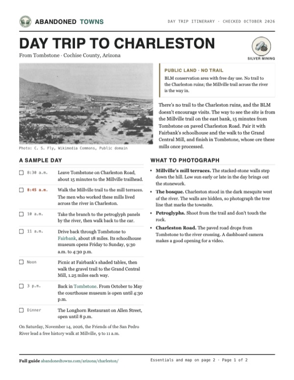
Download the PDF (458 KB)There's no trail to the Charleston ruins, and the BLM doesn't encourage visits. The way to see the site is from the Millville trail on the east bank, 15 minutes from Tombstone on paved Charleston Road. Pair it with Fairbank's schoolhouse and the walk to the Grand Central Mill, and finish in Tombstone, whose ore these mills once processed.
A sample day
- Leave Tombstone on Charleston Road, about 15 minutes to the Millville trailhead.
- Walk the Millville trail to the mill terraces. The men who worked these mills lived across the river in Charleston.
- Take the branch to the petroglyph panels by the river, then walk back to the car.
- Drive back through Tombstone to Fairbank, about 18 miles. Its schoolhouse museum opens Friday to Sunday, 9:30 a.m. to 4:30 p.m.
- Picnic at Fairbank's shaded tables, then walk the gravel trail to the Grand Central Mill, 1.25 miles each way.
- Back in Tombstone. From October to May the courthouse museum is open until 4:30 p.m.
- The Longhorn Restaurant on Allen Street, open until 8 p.m.
On Saturday, November 14, 2026, the Friends of the San Pedro River lead a free history walk at Millville, 9 to 11 a.m.
What to photograph and film
- Millville's mill terraces. The stacked-stone walls step down the hill. Low sun early or late in the day brings out the stonework.
- The bosque. Charleston stood in the dark mesquite west of the river. The walls are hidden, so photograph the tree line that marks the townsite.
- Petroglyphs. Shoot from the trail and don't touch the rock.
- Charleston Road. The paved road drops from Tombstone to the river crossing. A dashboard camera makes a good opening for a video.
Map & directions
Getting there
Tombstone is the closest town, nine miles away on paved Charleston Road. From Tucson, the fastest route runs down AZ 90 past Sierra Vista and east on Charleston Road. Both routes end where Charleston Road reaches the river, beside the Millville trailhead. There's no route to the Charleston ruins themselves.


Base map: USGS The National Map (public domain). Routes: OSRM on © OpenStreetMap contributors data (ODbL), computed October 2026. Times assume dry roads.
- From the historic district, take Toughnut Street west and turn left on Sumner Street.0.4 mi
- Sumner Street becomes Charleston Road. Follow it southwest to the San Pedro River. The Millville trailhead turnoff is on the right just before the bridge.8.3 mi
- From downtown Tucson, take Congress Street to I-10 and head east.44 mi
- Take exit 302 and turn right onto AZ 90. Follow it south through Huachuca City toward Sierra Vista.28 mi
- Turn left onto the AZ 90 Bypass.4.2 mi
- Turn left on Charleston Road and follow it east to the San Pedro River. The Millville trailhead turnoff is on the left just past the bridge.7.8 mi
Road and safety notes
- Charleston Road is paved from Tombstone to the river. Watch for the Millville trailhead turnoff on the right just before the bridge.
- There's no trail to the Charleston ruins, and the BLM doesn't encourage visits. The river corridor is thick with mesquite and brush.
- Day use is free. Overnight backcountry camping needs a BLM permit, and campfires are allowed only in designated areas.
- Carry water. Summers are hot, the river is subject to seasonal flooding, and monsoon storms are common in summer.
- Leave artifacts where they lie. Removing or damaging historic and archaeological material on BLM land is against federal law.
Photos
Charleston and Millville in photos
Visitor reports
Been to Charleston?
Been there lately? Tell the next visitor what you found: whether you could get in, the state of the road and what's still standing. Photos are welcome. We read every report before it appears here.
Silver mining
More silver mining ghost towns
The nearest in Arizona.

 Guide
Millville
31.64, -110.17Cochise County, Arizona
The mill site across the San Pedro from Charleston, where two stamp mills crushed Tombstone's silver ore around the clock. Stone foundations and slag…
 Guide
Tombstone
31.71, -110.07Cochise County, Arizona
Arizona's richest silver district and the scene of the 1881 gunfight near the O.K. Corral. The mines flooded and the census count fell to 646 by…
Nearby
Other sites near Charleston
Straight-line distance from the townsite to other mapped sites in our Arizona index.
Sources
Sources and credits
- ghosttowns.com, "Charleston": fact sheet fields (township, climate, best time, remains, post office dates). Its county and range entries are errors, and we don't use them.
- Wikipedia, "Charleston, Arizona", retrieved October 2026: founding, name, mills, population, businesses, reputation, Burnett, earthquake, World War II use, remains.
- Archaeology Southwest, "Charleston and Millville Sites": peak population, decline, BLM management, foot-only access, which bank each town is on.
- BLM, San Pedro Riparian National Conservation Area: designation date, free day use, camping permits, access via Charleston Road to the Millville Historic Townsite, office phone, as of October 2026. The BLM's Fairbank Historic Townsite page (updated 2025): flooding and monsoon warnings for the conservation area, ban on removing artifacts.
- AZ Offroad, "Millville" (2023): paved road from Tombstone, trailhead parking and toilets, 1.5-mile round trip, mill foundations, Gird house, BLM advice against visiting Charleston.
- Arizona Highways, "Charleston Road": no trail to Charleston, BLM discourages visits, Millville trail network with petroglyph panels, 2.5-mile round trip.
- Friends of the San Pedro River, public events calendar: free Saturday history walks at Fairbank (November 7, 2026), Millville (November 14) and the Grand Central Mill (November 28), with meeting points, distances, trail conditions, shade and the Millville trailhead vault toilet, as of October 2026.
- BLM, "Fairbank Historic Townsite": parking hours, schoolhouse museum days and hours, fees, vault toilet, no drinking water, shaded picnic tables, the 1.25-mile trail to the Grand Central Mill, pets, metal detectors, cell reception, as of October 2026.
- Arizona State Parks, Tombstone Courthouse State Historic Park: daily hours by season, as of October 2026.
- The Longhorn Restaurant, official site, and the Tombstone Chamber of Commerce listing: Allen Street location, oldest continually operated restaurant in town, opening hours, as of October 2026.
- USGS Historical Topographic Map Collection, Fairbank 1:24,000 sheet (1952): position of the Charleston ruins west of the river. GNIS "Charleston (historical)", feature ID 24360, for comparison. Elevation: USGS 3D Elevation Program. Routes: OSRM on OpenStreetMap data, October 2026.
Photo and map credits
- Charleston in 1885, photographed by C. S. Fly: C. S. Fly, Wikimedia Commons, Public domain
- J. W. Swart's saloon, 1885. Drinks 12½ cents: Unknown author, Wikimedia Commons, Public domain
- Stacked-stone mill wall at Millville: Bureau of Land Management (BLM) Arizona, Wikimedia Commons, Public domain
- Mill terraces at Millville below the hills: Bureau of Land Management (BLM) Arizona, Wikimedia Commons, Public domain
- Stone retaining walls of a Millville mill: Bureau of Land Management (BLM) Arizona, Wikimedia Commons, Public domain
- A dry-laid stone wall at Millville: Bureau of Land Management (BLM) Arizona, Wikimedia Commons, Public domain
- Petroglyphs along the Millville trail: Bureau of Land Management (BLM) Arizona, Wikimedia Commons, Public domain
- The Millville trailhead sign: BLMArizona, Wikimedia Commons, Public domain
- Rock art and old stone walls in the conservation area: Bureau of Land Management, Wikimedia Commons, CC BY 2.0
- Charleston and Millville on an 1882 county map: Samuel Augustus Mitchell, Wikimedia Commons, Public domain
- Topo map, area base map and aerial imagery: USGS The National Map (public domain).
- Historic maps: USGS Historical Topographic Map Collection (public domain): Benson 1915, 1:125,000; Fairbank 1932, 1:62,500; Benson 1943, 1:125,000; Fairbank 1952, 1:24,000; Fairbank 1996, 1:24,000.