 Abandoned

Overview
The copper town that outlived its mines

Bisbee fills the canyons of the Mule Mountains about 11 miles north of the Mexican border at Naco. In the fall of 1877 Army scouts and cavalrymen found promising rock in Tombstone Canyon. The camp that grew up, Mule Gulch, was a town by 1880 and took the name of Judge DeWitt Bisbee, a backer of the Copper Queen Mine. Phelps Dodge soon owned most of the Copper Queen and became the district's biggest company.
The boom lasted half a century. Bisbee incorporated in 1902 and had 9,019 people by 1910, the territory's third-largest town, ringed by suburbs such as Warren, Lowell and San Jose. A 1908 fire burned the business district, which was rebuilt by 1910. In July 1917, during a strike, Phelps Dodge, private police and Sheriff Harry Wheeler's deputies rounded up more than 1,000 miners and shipped them out of the state in cattle cars. By Legends of America's count, the mines produced almost 3 million ounces of gold, more than 100 million ounces of silver and more than 8 billion pounds of copper.
Bisbee became the county seat in 1929, but the population fell from 9,205 in 1920 to 3,801 in 1950. The Lavender Pit brought a second boom in the 1950s and swallowed most of Lowell. Phelps Dodge stopped mining in 1975. Within a year part of the Copper Queen opened for tours, and artists and counterculture newcomers moved into the cheap old houses, followed later by people priced out of places like Aspen. Bisbee never emptied, which is why so much of the mining town survives.
Video
Riding into the Copper Queen
A YouTuber takes the Queen Mine Tour. He looks over the old mining equipment outside and the visitor center's mineral displays and gift shop, signs the waiver and gets a fitted hard hat. Then the tour train carries the group into the Copper Queen mine. They get off at two stops while the guide, who worked in the mine like his father and grandfather, explains blasting, collecting the rock and the dangers of mine work. He gives the same five daily tour times as the alert above, and says his tour ran about an hour and 20 minutes.
 Play “Queen Mine Tour in Bisbee, Arizona” from YouTube
Timeline
Copper Queen to county seat
- Army scouts and cavalrymen find promising rock in Tombstone Canyon in the Mule Mountains.
- The camp, Mule Gulch, becomes a town named for Judge DeWitt Bisbee, a backer of the Copper Queen Mine.
- German-Swiss immigrants open the first breweries in Brewery Gulch.
- The railroad reaches Bisbee.
- Bisbee incorporates as a city.
- Fire destroys the commercial district. It is rebuilt by 1910.
- The census counts 9,019 people, the third-largest town in Arizona Territory.
- Open-pit mining begins, to meet World War I copper demand.
- The Bisbee Deportation. More than 1,000 striking miners are rounded up at gunpoint, packed into cattle cars and left in Hermanas, New Mexico.
- The population reaches 9,205, its high point before the long decline.
- The county seat moves from Tombstone to Bisbee.
- The population has fallen to 3,801.
- The Lavender Pit opens. It grows to 300 acres and about 1,000 feet deep, taking Sacramento Hill and most of the suburb of Lowell.
- Open-pit work and annexation lift the census to 9,914, the city's peak.
- Phelps Dodge sells the Copper Queen Hotel to Stephen and Marcia Hutchison, after offering the deed to any local resident for $1 and finding no takers.
- Phelps Dodge halts mining at Bisbee.
- The Queen Mine Tour opens, after volunteers clear fallen rock and re-timber the old workings.
- The Bisbee Historic District is listed on the National Register of Historic Places.
- Freeport-McMoRan buys Phelps Dodge.
- The census counts 4,923 people.
Visiting
The mine, the museum and the pit


The Queen Mine Tour takes visitors into the Copper Queen. After the mines closed, community volunteers cleared tons of fallen rock and re-timbered the old workings, the federal Economic Development Administration helped pay for it, and the tour opened on February 1, 1976. More than a million people have ridden the mine train in since. Tours run daily from the tour building at 478 N. Dart Road, take about an hour and need a reservation. Children under 6 aren't allowed underground.
The Bisbee Mining & Historical Museum is in the old Phelps Dodge General Office Building, a National Historic Landmark, and is a Smithsonian affiliate. It's open daily from 10 a.m. to 4 p.m., except Thanksgiving and Christmas, and costs $12 for adults.
The Lavender Pit, an inactive open pit in the middle of town, covers about 300 acres and drops some 1,000 feet. It replaced Sacramento Hill.
Old Bisbee was laid out before cars, so it's compact, steep and best seen on foot. Look for the Art Deco county courthouse, the 1905 Central School, now an art center, the Copper Queen Hotel and Brewery Gulch, where the first breweries opened in 1881. Warren Ballpark, built in 1909, may be the oldest ballpark still in use.
- Queen Mine Tour
- Mining & Historical Museum
- Lavender Pit
- Copper Queen Hotel
- Cochise County Courthouse
- Central School (1905)
- Brewery Gulch
- Warren Ballpark (1909)
Lost to the pit
Lowell, the suburb that became a hole
Lowell was a sizable mining town just southeast of Old Bisbee. When the Lavender Pit was dug in the 1950s, most of the original townsite went with it. What's left is a short stretch of Erie Street, the Evergreen Cemetery, the Saginaw neighborhood and Lowell Middle School. Locals now treat Lowell more as a place name than a community.
The historic maps show the change. The 1902 and 1910 sheets show Bisbee strung down Tombstone Canyon from Mule Pass, with Brewery Gulch branching off. By 1933 Lowell appears at the lower right of the crop. The 1958 and 1996 sheets, at a larger scale, show uptown Bisbee in detail.


Historic maps
Bisbee on USGS maps, 1902–1996
Crops from the USGS Historical Topographic Map Collection, centered on the townsite. Each sheet shows what surveyors mapped that year; compare them with today's topo and aerial on this page.

Day trip
Plan a day trip to Bisbee from Sierra Vista
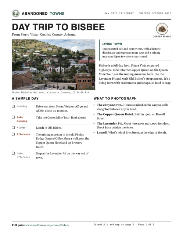
Take it with you
Day trip itinerary
The essentials, the sample day with boxes to tick, what to photograph and the coordinates, on two printable pages. Handy where there's no signal.
Download the PDF (653 KB)Bisbee is a full day from Sierra Vista on paved highways. Ride into the Copper Queen on the Queen Mine Tour, see the mining museum, look into the Lavender Pit and walk Old Bisbee's steep streets. It's a living town with restaurants and shops, so food is easy.
A sample day
- Drive east from Sierra Vista on AZ 90 and AZ 80, about 40 minutes.
- Take the Queen Mine Tour. Book ahead.
- Lunch in Old Bisbee.
- The mining museum in the old Phelps Dodge General Office, then a walk past the Copper Queen Hotel and up Brewery Gulch.
- Stop at the Lavender Pit on the way out of town.
What to photograph and film
- The canyon town. Houses stacked on the canyon walls along Tombstone Canyon Road.
- The Copper Queen Hotel. Built in 1902, on Howell Street.
- The Lavender Pit. About 300 acres and 1,000 feet deep. Shoot from outside the fence.
- Lowell. What's left of Erie Street, at the edge of the pit.
Map & directions
Getting there
Sierra Vista is the closest city, about 40 minutes away. From Tucson, the classic route runs east on I-10 to Benson and south on AZ 80 through Tombstone. Both are paved all the way and end on Tombstone Canyon Road in Old Bisbee.


Base map: USGS The National Map (public domain). Routes: OSRM on © OpenStreetMap contributors data (ODbL), computed October 2026. Times assume dry roads.
- Take Fry Boulevard east. It becomes AZ 90; follow it to its end.17.6 mi
- Turn right on AZ 80 toward Bisbee.6.9 mi
- Keep right onto Tombstone Canyon Road into Old Bisbee.0.5 mi
- From downtown Tucson, take I-10 east.45.2 mi
- Take exit 303 into Benson and follow AZ 80 (Historic US 80) south to Tombstone.25.8 mi
- Continue on AZ 80 through Tombstone, where it is Fremont Street, to Bisbee.22.7 mi
- Keep right onto Tombstone Canyon Road into Old Bisbee.0.5 mi
Road and safety notes
- AZ 80, AZ 90 and the Tucson route are paved all the way.
- Old Bisbee's streets are narrow and steep. Park once and walk.
- Monsoon storms bring most of the year's rain from July to September, often with severe thunderstorms.
- The Lavender Pit and the old mine workings are dangerous. See the mine on the tour, and don't climb fences.
Photos
Bisbee in photos
Visitor reports
Been to Bisbee?
Been there lately? Tell the next visitor what you found: whether you could get in, the state of the road and what's still standing. Photos are welcome. We read every report before it appears here.
Copper mining
More copper mining ghost towns
The nearest in Arizona.

 Guide
Lowell
31.43, -109.89Cochise County, Arizona
A copper town of more than 6,000 people that the Lavender Pit swallowed in the 1950s. One block of Erie Street survives, lined with old storefronts…
 Guide
Gleeson
31.73, -109.83Cochise County, Arizona
A copper town built on an old turquoise camp, burned in 1912 and emptied in the 1930s. Its concrete jail has been restored, and a few people still…
Nearby
Other sites near Bisbee
Straight-line distance from the townsite to other mapped sites in our Arizona index.
Sources
Sources and credits
- ghosttowns.com, "Bisbee": fact sheet fields (roads, legal description, best time) and its "semi-ghost" rating.
- Wikipedia, "Bisbee, Arizona", retrieved October 2026: founding and name, census figures, the 1917 deportation, the county seat, the 1975 closing, the mine tour's opening, the Copper Queen Hotel sale, Lowell, sights, climate, coordinates (GNIS).
- Legends of America, "Bisbee" (updated March 2026): the 1877 discovery, Mule Gulch, Brewery Gulch, the 1889 railroad, the 1908 fire, production totals, the Lavender Pit's size, the date of the deportation, the early-1900s population estimate.
- Queen Mine Tours, official site, its booking page and history page, read October 2026: address, phone, daily tour times, prices and age limit, the volunteers and federal grant behind the tour, its February 1, 1976 opening and visitor count.
- Wandering With Woodside, "Queen Mine Tour in Bisbee, Arizona", YouTube, uploaded July 8, 2026: the video on this page; the visitor center, hard hats and waiver, the tour train, the two underground stops, the five tour times.
- Bisbee Mining & Historical Museum, read October 2026: hours, admission and discounts, Smithsonian affiliation.
- National Register listing 80004487, via Wikipedia's Cochise County list: the Bisbee Historic District, July 3, 1980.
- City of Bisbee, official website, read October 2026: city address and phone.
- Wikimedia Commons, "Bisbee-Copper Queen Hotel-1902": the hotel's 1902 date and Howell Street address.
- USGS topographic maps: Bisbee 1:62,500 (1902, 1910, 1933) and 1:24,000 (1958, 1996). Township and section: BLM PLSS (CadNSDI).
- Elevation: USGS 3D Elevation Program point query. Routes: OSRM on OpenStreetMap data, October 2026. Status checked against the sources above on October 19, 2026.
Photo and map credits
- Bisbee from the south, 2022: Nicholas Hartmann, Wikimedia Commons, CC BY-SA 4.0
- The Copper Queen Hotel, built in 1902: Marine 69-71, Wikimedia Commons, CC BY-SA 4.0
- Old Bisbee in March 1996: Infrogmation, Wikimedia Commons, CC BY-SA 4.0
- Houses on the canyon slopes, 2018: Gillfoto, Wikimedia Commons, CC BY-SA 4.0
- A railroad overpass in town, 2019: Marine 69-71, Wikimedia Commons, CC BY-SA 4.0
- Area base map, topo and aerial imagery: USGS The National Map (public domain).
- Historic maps: USGS Historical Topographic Map Collection (public domain): Bisbee 1902, 1:62,500; Bisbee 1910, 1:62,500; Bisbee 1933, 1:62,500; Bisbee 1958, 1:24,000; Bisbee 1996, 1:24,000.