 Abandoned

Overview
Gentle water, then the flood
Agua Mansa, Spanish for "gentle water," stood on the west bank of the Santa Ana River, in the valley on the south side of Slover Mountain near today's Colton. Its founders were New Mexican colonists from Abiquiú. In 1845 Juan Bandini gave them part of his Rancho Jurupa on condition that they help protect it from raids. About ten families settled La Placita on the east bank, and a second group built Agua Mansa on the west. Wikipedia dates the town to 1842; the county museum dates the colony's first settlement to 1842 and the twin towns to 1845.
Together the two villages were called San Salvador. In the 1840s they were the largest settlements between Santa Fe and Los Angeles, and the first non-native settlements in the San Bernardino Valley. The land around them was farmed in at least a hundred fields. In 1853 the colonists finished a church at Agua Mansa, and its parish was the first outside the missions in Southern California.
The town prospered for almost 20 years. In January 1862 a flood filled the Santa Ana River and destroyed the west-bank town. The chapel and the cemetery, on higher ground, survived. People rebuilt higher up, but Agua Mansa never recovered. Today only the cemetery is left, with burials from 1852 to 1963.
Timeline
From San Salvador to the county museum

- New Mexican colonists settle Politana on Rancho San Bernardino, the start of the colony. Wikipedia dates Agua Mansa itself to 1842.
- Juan Bandini gives the colonists from Abiquiú part of Rancho Jurupa on the Santa Ana River, in return for protection from raids. Agua Mansa grows on the west bank and La Placita on the east. Together they are called San Salvador.
- The first known burial in the cemetery. The county's burial database starts in 1854.
- After La Placita's adobe church collapses into quicksand, a new church is finished at Agua Mansa. It is dedicated as San Salvador in 1857, the first parish outside the missions in Southern California.
- Isaac Slover, a bear hunter, is killed by a bear and buried here.
- A flood fills the Santa Ana River and destroys the west-bank town. The chapel and cemetery, on higher ground, survive. People rebuild higher up, but the town never recovers.
- The parish moves to San Bernardino.
- The chapel is abandoned.
- Preservation of the cemetery begins in 1951, by Wikipedia's account. In 1955 a Friends group forms to stop vandalism.
- The Native Daughters of the Golden West set the marker for California Historical Landmark No. 121.
- The last burial.
- San Bernardino County acquires the cemetery, and it becomes a branch of the county museum.
- A full-size replica of the San Salvador church is dedicated in the cemetery. It is used as a museum.
What's here
The pioneer cemetery


The cemetery is all that remains of the town. Records are incomplete. About 1,400 names had been identified by October 2018 out of an estimated 2,000 burials, and only a few grave markers survive. The county says ground-penetrating radar has found hundreds of unmarked graves. The earliest known burial is Louis Rubidoux's. Cornelius Jensen, a Danish sea captain who kept a store at Agua Mansa, lies here with his wife, Mercedes Alvarado, and members of her family. So does Isaac Slover, a bear hunter killed by a bear in 1854. Lorenzo Trujillo, one of the colony's leaders, is believed to lie in an unmarked grave.
A full-size replica of the San Salvador church was dedicated in the cemetery in 1978 and is used as a museum. The original chapel's bell hangs at the Mission Inn in Riverside. The county museum keeps an online burial database.
The historic maps below trace the site. The 1896 sheet shows open country between Slover Mountain and the Santa Ana River. By 1938 the Agua Mansa road and a transmission line cross it, and the 1954 and 1967 sheets mark the Agua Mansa Cemetery beside the road, with gravel pits nearby.
- Agua Mansa Pioneer Cemetery
- A few original grave markers
- 1978 replica of the San Salvador church, now a museum
- Landmark No. 121 marker (1961)


Historic maps
Agua Mansa on USGS maps, 1896–1967
Crops from the USGS Historical Topographic Map Collection, centered on the townsite. Each sheet shows what surveyors mapped that year; compare them with today's topo and aerial on this page.

Day trip
Plan a day trip to Agua Mansa from Colton
Take it with you
Day trip itinerary
The essentials, the sample day with boxes to tick, what to photograph and the coordinates, on two printable pages. Handy where there's no signal.
Download the PDF (524 KB)The cemetery is ten minutes from downtown Colton. Come Sunday to Thursday, the only days it opens, and pair it with a visit to Riverside, where, by Wikipedia's account, the old chapel's bell now hangs at the Mission Inn. From San Diego it's a long half day.
A sample day
- Leave downtown Colton on I-10 west, then Rancho Avenue and Agua Mansa Road. About 10 minutes.
- The cemetery opens. Start at the landmark marker and the replica church.
- Walk the burial ground and look for the few surviving markers.
- Head back to Colton, or on to Riverside and the Mission Inn, where Wikipedia says the chapel's bell now hangs.
Coming from San Diego? It's about two hours without traffic. Leave by 8 a.m. to arrive at opening.
What to photograph and film
- The replica church. The full-size replica of the 1853 church is the main frame. Step back to fit the whole building in.
- Old markers. Low morning light brings out the lettering on worn stones. Shoot close and don't move anything.
- The landmark marker. The 1961 marker makes a clean establishing shot for video.
Map & directions
Getting there
The cemetery is ten minutes from downtown Colton and about two hours from San Diego without traffic. Both routes end on Agua Mansa Road at the cemetery entrance, paved all the way.


Base map: USGS The National Map (public domain). Routes: OSRM on © OpenStreetMap contributors data (ODbL), computed October 2026. Times assume dry roads.
- Take North Mount Vernon Avenue to I-10 and head west.1.7 mi
- Take exit 70A and turn left on North Rancho Avenue.1.2 mi
- Turn right on Agua Mansa Road, then right into the cemetery at No. 2001.2.2 mi
- From downtown San Diego, take CA 163 north to I-15.11.2 mi
- Follow I-15 north to exit 63.50.9 mi
- Take exit 63 onto I-215 north and follow it to exit 52B.35.5 mi
- Follow Oakley Avenue and turn right on Main Street, which becomes South Riverside Avenue.3.0 mi
- Turn right on Agua Mansa Road, then into the cemetery.0.3 mi
Road and safety notes
- Paved all the way. Any car will do.
- The museum warns of "temporary closures due to high wind or other factors during the year." Call ahead.
- Group tours are by appointment.
Photos
Agua Mansa in photos
Visitor reports
Been to Agua Mansa?
Been there lately? Tell the next visitor what you found: whether you could get in, the state of the road and what's still standing. Photos are welcome. We read every report before it appears here.
Farm and ranch
More farm and ranch ghost towns
The nearest in California, then the nearest elsewhere.

 Guide
Llano del Rio
34.51, -117.83Los Angeles County, California
In 1914 a socialist lawyer from Los Angeles founded a cooperative colony in the desert. It grew to about a thousand people, ran short of water and…
 Guide
Cibola
33.32, -114.67La Paz County, Arizona
A farm town founded in 1898 on the Arizona bank of the Colorado, built on the hope of a 16-mile canal that was never finished. The old town's…
Nearby
Other sites near Agua Mansa
Straight-line distance from the townsite to other mapped sites in our California index.
- La Placita1.8 mi SE · Riverside
- Lytle Creek16.9 mi NW · San Bernardino
- Rancho Temescal20.2 mi S · Riverside
- Pinacate20.9 mi S · Riverside
- Terra Cotta23.4 mi S · Riverside
- Eldoradoville26.6 mi NW · Los Angeles
- Leon31.2 mi SE · Riverside
- Belleville32.8 mi NE · San Bernardino
Sources
Sources and credits
- ghosttowns.com, "Agua Mansa": fact sheet fields (roads, climate, best time).
- Wikipedia, "Agua Mansa, California", retrieved October 2026: founding, San Salvador, Slover Mountain, the Bandini donation, the farm fields, the church, the 1862 flood, burials and notable graves, preservation from 1951, the 1961 marker, the bell at the Mission Inn.
- San Bernardino County Museum, "Agua Mansa Pioneer Cemetery", checked October 2026: hours, holiday and wind closures, no-cost admission, group tours, address, phone, the colony's dates, the 1853 chapel, 1857 dedication, 1867 and 1883, the 1955 Friends group, 1963, 1967, the 1978 replica church, unmarked graves, burial database.
- San Bernardino County, "San Bernardino County History: Agua Mansa Pioneer Cemetery" (April 2025): the 1845 founding, the January 1862 flood and the surviving chapel and cemetery, the 1967 museum branch.
- Elevation from a USGS 3D Elevation Program point query. Routes: OSRM on OpenStreetMap data, October 2026. Status checked against the sources above on October 19, 2026.
Photo and map credits
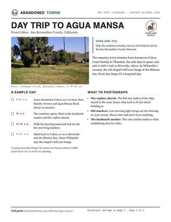
- The cemetery, January 2011: Johnwayne Stroud, Wikimedia Commons, CC BY-SA 3.0
- The 1961 plaque at the cemetery: Johnwayne Stroud, Wikimedia Commons, CC BY-SA 3.0
- The museum building at the cemetery, 2011: Johnwayne Stroud, Wikimedia Commons, CC BY-SA 3.0
- Open lawn with a few white grave markers in the distance, 2011: Johnwayne Stroud, Wikimedia Commons, CC BY-SA 3.0
- Pepper trees and palms over the cemetery, 2011: Johnwayne Stroud, Wikimedia Commons, CC BY-SA 3.0
- Isaac Slover's gravestone: "Pioneer hunter-trapper, killed by a bear near Cajon Pass", 2018: Drseccombe, Wikimedia Commons, CC BY-SA 4.0
- Area base map, topo and aerial imagery: USGS The National Map (public domain).
- Historic maps: USGS Historical Topographic Map Collection (public domain): San Bernardino 1896, 1:62,500; Colton 1938, 1:31,680; San Bernardino South 1954, 1:24,000; San Bernardino South 1967, 1:24,000.