 Abandoned

Overview
Two votes from county seat
Belleville lies in Holcomb Valley, a high meadow in the San Bernardino Mountains north of Big Bear Lake. In early 1860 William F. Holcomb found gold there, and placer miners followed. The town that grew up was named for Belle, the first child born in the camp. By the election of September 1860 nearly 1,500 people lived here, more than in any other camp in the valley.
Belleville wanted to be the county seat. San Bernardino won the vote by two, and some Belleville ballots were said to have burned "by accident." Jed Van Dusen's wagon road of 1861 let stages reach the town from San Bernardino in two days, and the town filled out with a store, two butcher shops, two laundries, a bakery, three carpenter shops, two blacksmiths, a stamp mill, a sawmill and several saloons. It was rough. Holcomb Valley counted 50 murders by 1862, and during the Civil War federal troops were sent to San Bernardino amid fears of a secessionist rising.
The placer gold lasted about ten years. Miners turned to quartz, and Lucky Baldwin's Gold Mountain mine worked for decades, but Belleville was virtually abandoned before 1900. Today the site is national forest land, one of the stops on the Gold Fever Trail.
Timeline
Holcomb Valley's ten-year rush

- William F. Holcomb finds gold in the valley that takes his name. Placer miners rush in.
- Belleville, named for Belle, the first child born in the camp, has nearly 1,500 people at the election, the largest town in Holcomb Valley.
- Belleville loses the vote for San Bernardino County seat to San Bernardino by two votes. Some ballots from a Belleville precinct are said to have burned "by accident." Wikipedia gives both 1860 and 1861.
- Jed Van Dusen builds a wagon road through Hesperia and Cajon Pass for $1,500. Stages now reach Belleville from San Bernardino in two days.
- Federal troops are sent to San Bernardino to head off a feared secessionist uprising.
- Holcomb Valley has counted 50 murders.
- The placer gold runs out and the rush ends. Miners turn to quartz; a stamp mill at Gold Mountain dates to 1874.
- Belleville is virtually abandoned.
- The site is a stop on the Forest Service's Gold Fever Trail in San Bernardino National Forest.
What's here
The Gold Fever Trail


Very little of Belleville survives. The Forest Service's Gold Fever Trail is a self-guided tour of Holcomb Valley's mining history. Big Bear's visitor bureau lists twelve numbered stops, starting from Polique Canyon Road: the Holcomb Valley View Trail, the Last Chance Placer, Two Gun Bill's Saloon, the Grasshopper Quartz Mill, the Hangman's Tree, the spot where Bill Holcomb first found gold, the Belleville Cabin, a mule-powered ore-grinding site, the Ross gravesite, the Pygmy Cabin, which burned in 1983, and the Metzger and Lucky Baldwin mines.
The Hangman's Tree is a tall old juniper inside a wood fence. Wikipedia says the camp had a large hanging tree where many men were punished. We found no record tying this particular tree to a hanging, so treat it as local tradition. In 2024 the bureau noted that the marker for stop 2 was missing, so carry the brochure from the Discovery Center.
The historic maps below run from 1901 to 1982. The 1901 sheet shows Holcomb Valley with Gold Mountain and Baldwin Lake to the east and Bear Lake to the south. The 1947 sheet adds Upper Holcomb Valley, Van Dusen Canyon and the abandoned Harvey K Mine, and the 1982 sheet marks "Belleville (Site)" between two campgrounds, with Big Bear City below.
- Belleville Cabin
- Hangman's Tree
- Grasshopper Quartz Mill site
- Pygmy Cabin site (burned 1983)
- Last Chance Placer
- Metzger and Lucky Baldwin mines


Historic maps
Belleville on USGS maps, 1901–1982
Crops from the USGS Historical Topographic Map Collection, centered on the townsite. Each sheet shows what surveyors mapped that year; compare them with today's topo and aerial on this page.

Day trip
Plan a day trip to Belleville from Big Bear Lake
Take it with you
Day trip itinerary
The essentials, the sample day with boxes to tick, what to photograph and the coordinates, on two printable pages. Handy where there's no signal.
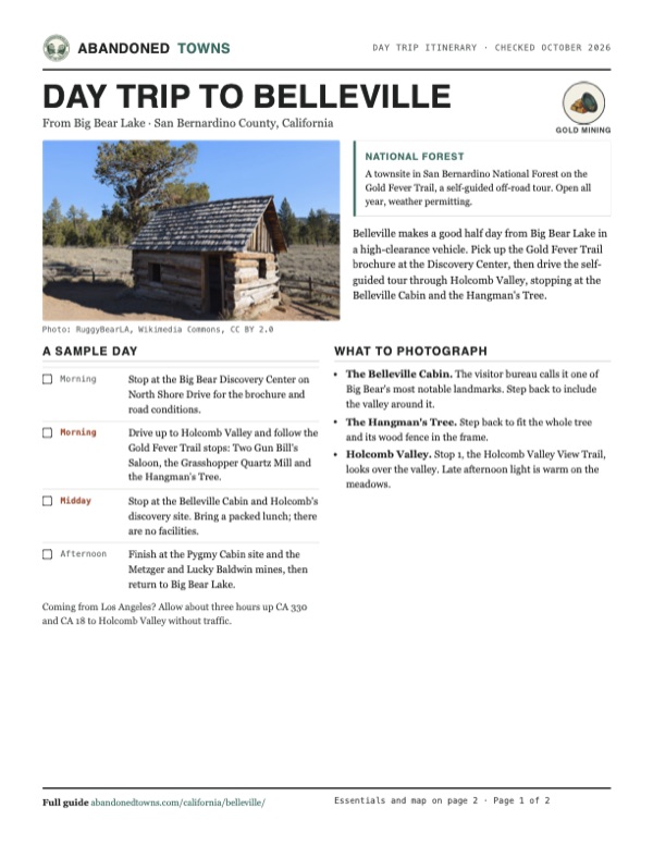
Download the PDF (569 KB)Belleville makes a good half day from Big Bear Lake in a high-clearance vehicle. Pick up the Gold Fever Trail brochure at the Discovery Center, then drive the self-guided tour through Holcomb Valley, stopping at the Belleville Cabin and the Hangman's Tree.
A sample day
- Stop at the Big Bear Discovery Center on North Shore Drive for the brochure and road conditions.
- Drive up to Holcomb Valley and follow the Gold Fever Trail stops: Two Gun Bill's Saloon, the Grasshopper Quartz Mill and the Hangman's Tree.
- Stop at the Belleville Cabin and Holcomb's discovery site. Bring a packed lunch; there are no facilities.
- Finish at the Pygmy Cabin site and the Metzger and Lucky Baldwin mines, then return to Big Bear Lake.
Coming from Los Angeles? Allow about three hours up CA 330 and CA 18 to Holcomb Valley without traffic.
What to photograph and film
- The Belleville Cabin. The visitor bureau calls it one of Big Bear's most notable landmarks. Step back to include the valley around it.
- The Hangman's Tree. Step back to fit the whole tree and its wood fence in the frame.
- Holcomb Valley. Stop 1, the Holcomb Valley View Trail, looks over the valley. Late afternoon light is warm on the meadows.
Map & directions
Getting there
From the town of Big Bear Lake, the route crosses to the north shore and climbs Van Dusen Canyon Road to Holcomb Valley Road (3N16). The last miles are on Forest Service roads. Van Dusen Canyon Road closes in winter, when the Forest Service sends visitors in by Polique Canyon Road.


Base map: USGS The National Map (public domain). Routes: OSRM on © OpenStreetMap contributors data (ODbL), computed October 2026. Times assume dry roads.
- Head east on Big Bear Boulevard (CA 18).3.6 mi
- Turn left on North Division Drive, then right on North Shore Drive (CA 38).1 mi
- Turn left on Van Dusen Canyon Road. It closes in winter.3.9 mi
- At the end, turn right on Holcomb Valley Road (3N16) to the Belleville site.0.6 mi
- From downtown Los Angeles, take I-10 east, the San Bernardino Freeway.61.1 mi
- Take exit 77B onto CA 210, then exit 81 onto CA 330 into the mountains.20 mi
- Continue on CA 18 (Rim of the World Highway, then Big Bear Boulevard) to Big Bear.20.4 mi
- Turn left on North Division Drive, then right on North Shore Drive (CA 38).1 mi
- Turn left on Van Dusen Canyon Road, then right on Holcomb Valley Road (3N16).4.5 mi
Road and safety notes
- The Forest Service calls the Gold Fever Trail an off-road trail. In June 2024 Big Bear's visitor bureau advised high clearance and four- or all-wheel drive.
- The Forest Service says to "take Polique Canyon Road when Van Dusen Canyon Road is closed for winter." Polique Canyon Road, off North Shore Drive, is also where the Gold Fever Trail starts.
- The forest's road closure order of July 2026 (Forest Order 05-12-00-26-06) closes other Mountaintop District roads, not 2N09, 3N09 or 3N16. Check the forest's alerts page for newer orders.
- No restrooms and no drinking water at the site.
- Brochures, maps and road conditions at the Big Bear Discovery Center, 40971 North Shore Drive, Fawnskin; open Thursday to Monday, 9 a.m. to 4 p.m.
Photos
Belleville in photos
Visitor reports
Been to Belleville?
Been there lately? Tell the next visitor what you found: whether you could get in, the state of the road and what's still standing. Photos are welcome. We read every report before it appears here.
Gold mining
More gold mining ghost towns
The nearest in California.

 Guide
Randsburg
35.37, -117.66Kern County, California
Gold at the Yellow Aster in 1895 drew more than 1,500 people to Randsburg within two years. The mine worked off and on until 2006. Forty-five people…
 Guide
Julian
33.07, -116.59San Diego County, California
A gold rush boomtown of the 1870s in the mountains east of San Diego. Julian never emptied. It turned to apples and visitors, and its old Main Street…
Nearby
Other sites near Belleville
Straight-line distance from the townsite to other mapped sites in our California index.
- Agua Mansa32.8 mi SW · San Bernardino
- La Placita33.0 mi SW · Riverside
- Lytle Creek35.2 mi W · San Bernardino
- Daggett38.8 mi N · San Bernardino
- Hector Mine40.5 mi NE · San Bernardino
- Pinacate42.4 mi SW · Riverside
- Calico44.8 mi N · San Bernardino
- Bagdad-Chase Mine46.7 mi NE · San Bernardino
Sources
Sources and credits
- ghosttowns.com, "Belleville": fact sheet fields (climate, best time).
- Wikipedia, "Belleville, California", retrieved October 2026: Holcomb's discovery, the name, population, the county seat vote, Van Dusen's road, businesses, murders, the hanging tree, the Civil War scare, the Gold Mountain mine, decline.
- San Bernardino National Forest, "Gold Fever Interpretive Site", page updated December 2025, read October 2026: open all year weather permitting, off-road trail, no restrooms or water, Discovery Center address, phone and hours.
- San Bernardino National Forest, "Holcomb Valley Campground": page updated January 2026: Van Dusen Canyon Road's winter closure and the Polique Canyon winter route.
- Visit Big Bear, "Explore Gold Fever Trail" (June 2024): the twelve stops, the start at Polique Canyon Road, vehicle advice, the missing stop 2 marker, the Hangman's Tree, the Pygmy Cabin fire, the 1874 Gold Mountain mill.
- San Bernardino National Forest, "Roads Closures MT & FC Ranger Districts", Forest Order 05-12-00-26-06 (July 29, 2026 to July 29, 2027), read October 19, 2026: the roads it closes, which do not include 2N09, 3N09 or 3N16.
- Elevation from a USGS 3D Elevation Program point query. Routes: OSRM on OpenStreetMap data, October 2026. Status checked against the sources above on October 19, 2026.
Photo and map credits
- The Belleville Cabin on the Gold Fever Trail, April 2024: RuggyBearLA, Wikimedia Commons, CC BY 2.0
- The Hangman's Tree, a juniper inside a wood fence, 2024: RuggyBearLA, Wikimedia Commons, CC BY 2.0
- Inside the Belleville Cabin: bare log walls and a dirt floor, 2024: RuggyBearLA, Wikimedia Commons, CC BY 2.0
- Rusted iron machinery in a wet meadow on the Gold Fever Trail, 2024: RuggyBearLA, Wikimedia Commons, CC BY 2.0
- The Belleville Cabin beside a big juniper, July 2018: C Tahauri, Wikimedia Commons, CC BY-SA 4.0
- Area base map, topo and aerial imagery: USGS The National Map (public domain).
- Historic maps: USGS Historical Topographic Map Collection (public domain): Southern California Sheet No 1 1901, 1:250,000; Lucerne Valley 1947, 1:62,500; Big Bear Lake 1982, 1:100,000.