 Abandoned

Overview
The silver camp Walter Knott rebuilt

Calico sits in a canyon of the Calico Mountains, three miles north of I-15, midway between Barstow and Yermo. In 1881 four prospectors set out from Grapevine Station, today's Barstow, for a peak whose banded rock they called calico-colored. They found silver and opened the Silver King mine, which became California's biggest silver producer in the mid-1880s. Their backer was John C. King, the county sheriff and an uncle of Walter Knott.
The town grew fast. By 1883 to 1885 it had more than 500 mines and about 1,200 people, three hotels, five general stores, a weekly paper, a Wells Fargo office and a Boot Hill. Borax kept it going after colemanite was found nearby, and an estimated 3,500 people lived here in 1890. Then the price of silver fell. By 1896 it was down to $0.57 an ounce, the post office closed in 1898, and when borax mining ended in 1907 the town was largely abandoned. Many buildings were hauled off to Barstow, Daggett and Yermo.
Walter Knott, who had already built a ghost town at Knott's Berry Farm, bought Calico in 1951; Legends of America dates the purchase to 1950. His art director rebuilt it from old photographs, and in 1966 Knott gave it to San Bernardino County. Wikipedia counts five original buildings among the reconstructions; Legends of America says a third of the town is original. In 2005 the state named it California's Silver Rush Ghost Town.
Video
Calico in 30 seconds
California's official Silver Rush Ghost Town: ore cars, a building below the Calico Mountains, Main Street and the entrance arch of the county park.
Timeline
Silver, borax and Knott's Berry Farm

- Four prospectors from Grapevine Station, now Barstow, find silver in a peak they call calico-colored. They open the Silver King mine, grubstaked by Sheriff John C. King.
- The post office opens and the weekly Calico Print starts publishing.
- The height of silver production: more than 500 mines and about 1,200 people. The Silver King is California's largest silver producer.
- Borax mining, after the discovery of colemanite nearby, keeps the town going.
- An estimated 3,500 people. The Sherman Silver Purchase Act passes, and silver prices begin to slide.
- Silver is down to $0.57 an ounce, too little to keep the mines working.
- The post office closes. In time, many of the buildings are moved to Barstow, Daggett and Yermo.
- Borax mining in the area ends and the town is largely abandoned.
- A cyanide plant reworks the Silver King's leftover ore. Walter Knott, homesteading nearby, helps build its tanks.
- Knott buys the town and has his art director, Paul von Klieben, restore it from old photographs.
- California Historical Landmark No. 782.
- Knott donates Calico to San Bernardino County, which runs it as a regional park.
- Named California's official Silver Rush Ghost Town, alongside Bodie as the Gold Rush Ghost Town.
What's here
Five old buildings and a rebuilt town


Most of what you see is the 1950s rebuild: weathered wooden false fronts that look the part. Wikipedia lists the buildings that date from the mining years as Lil's Saloon, the town office, Lucy Lane's house, Smitty's Gallery, the general store and Joe's Saloon. Lucy Lane's house was first the post office and courthouse and is now the Lucy Lane Museum, free with admission. The schoolhouse is a replica on the original site. The Chinese residents' homes survive only as ruins, and only part of one rock wall is left of the family houses on the bluff.
The 1953 Yermo sheet in the historic maps below shows the town's buildings at the head of a canyon road, with the cemetery to the southwest and Odessa Canyon to the east. The 1966 sheet marks mines across the Calico Mountains, with Calico Peak to the north, and the 1977 sheet names the Burcham Mine just west of town and the Silver Bow Mine to the north.
- Lil's Saloon
- Lucy Lane house, now a museum
- Town office
- General store
- Joe's Saloon
- Smitty's Gallery
- Maggie Mine (tours)
- Schoolhouse replica
- Ruins of the Chinese quarter
- Boot Hill cemetery


Visiting
What the park offers

The county lists the Maggie Mine, an 1880s silver mine with mining exhibits, the Calico Odessa Railroad, the Mystery Shack and gold panning. Each costs extra, and the county points to calicoattractions.com or 760-254-3719 for prices. Food comes from the Calico House Restaurant, open 8 a.m. to 5 p.m., Silver Rush Burger, Lil's Saloon, a sweets shop and a popcorn wagon.
You can stay the night. The park has RV sites, $75 cabins that sleep four and bunkhouses for groups, and campers get into town free. Dogs are $1 and must stay on a six-foot leash. Festivals cost more to enter than ordinary days.
Historic maps
Calico on USGS maps, 1953–1977
Crops from the USGS Historical Topographic Map Collection, centered on the townsite. Each sheet shows what surveyors mapped that year; compare them with today's topo and aerial on this page.

Day trip
Plan a day trip to Calico from Barstow
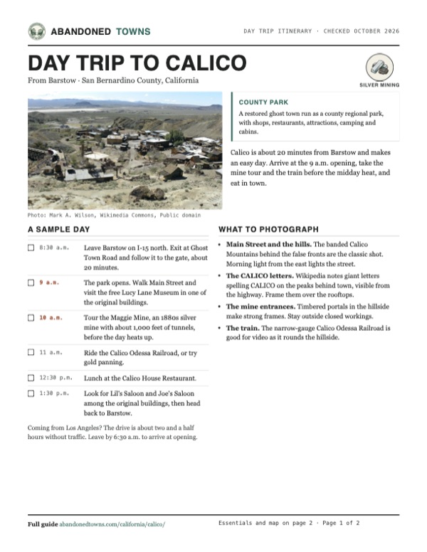
Take it with you
Day trip itinerary
The essentials, the sample day with boxes to tick, what to photograph and the coordinates, on two printable pages. Handy where there's no signal.
Download the PDF (584 KB)Calico is about 20 minutes from Barstow and makes an easy day. Arrive at the 9 a.m. opening, take the mine tour and the train before the midday heat, and eat in town.
A sample day
- Leave Barstow on I-15 north. Exit at Ghost Town Road and follow it to the gate, about 20 minutes.
- The park opens. Walk Main Street and visit the free Lucy Lane Museum in one of the original buildings.
- Tour the Maggie Mine, an 1880s silver mine with about 1,000 feet of tunnels, before the day heats up.
- Ride the Calico Odessa Railroad, or try gold panning.
- Lunch at the Calico House Restaurant.
- Look for Lil's Saloon and Joe's Saloon among the original buildings, then head back to Barstow.
Coming from Los Angeles? The drive is about two and a half hours without traffic. Leave by 6:30 a.m. to arrive at opening.
What to photograph and film
- Main Street and the hills. The banded Calico Mountains behind the false fronts are the classic shot. Morning light from the east lights the street.
- The CALICO letters. Wikipedia notes giant letters spelling CALICO on the peaks behind town, visible from the highway. Frame them over the rooftops.
- The mine entrances. Timbered portals in the hillside make strong frames. Stay outside closed workings.
- The train. The narrow-gauge Calico Odessa Railroad is good for video as it rounds the hillside.
Map & directions
Getting there
Barstow is about 20 minutes away. From Los Angeles, I-10 and I-15 run over Cajon Pass to the same exit. The last stretch is Ghost Town Road to the park gate.


Base map: USGS The National Map (public domain). Routes: OSRM on © OpenStreetMap contributors data (ODbL), computed October 2026. Times assume dry roads.
- Take Melissa Avenue and East Mountain View Street to East Main Street, then turn right.1.3 mi
- Join I-15 north toward Las Vegas.6.8 mi
- Exit and turn left on Daggett–Yermo Road, which becomes Ghost Town Road.3.5 mi
- Turn left to stay on Ghost Town Road to the park entrance.0.6 mi
- From downtown Los Angeles, take US 101 and I-10 east, the San Bernardino Freeway.41.6 mi
- Merge onto I-15 north, the Ontario Freeway, over Cajon Pass and past Barstow.79.4 mi
- Exit and turn left on Daggett–Yermo Road, which becomes Ghost Town Road.3.5 mi
- Turn left to stay on Ghost Town Road to the park entrance.0.6 mi
Road and safety notes
- Summers are very hot. Carry water and plan outdoor walking for the morning.
- The county warns that the mines in the Calico area are extremely hazardous and must not be approached for any reason.
Photos
Calico in photos
Visitor reports
Been to Calico?
Been there lately? Tell the next visitor what you found: whether you could get in, the state of the road and what's still standing. Photos are welcome. We read every report before it appears here.
Silver mining
More silver mining ghost towns
The nearest in California.

 Guide
Darwin
36.27, -117.59Inyo County, California
A silver and lead camp of 1874 that a new highway bypassed in 1937. About 30 people still live here, and they'd like you to know it isn't a ghost…
 Guide
Cerro Gordo
36.54, -117.80Inyo County, California
In 1869 this camp high in the Inyo Mountains led the country in silver and lead, and its bullion helped build early Los Angeles. It's privately owned…
Nearby
Other sites near Calico
Straight-line distance from the townsite to other mapped sites in our California index.
- Daggett6.1 mi S · San Bernardino
- Hector Mine28.3 mi SE · San Bernardino
- Crucero40.1 mi E · San Bernardino
- Ludlow42.9 mi E · San Bernardino
- Belleville44.8 mi S · San Bernardino
- Ragtown44.9 mi SE · San Bernardino
- Stedman45.2 mi SE · San Bernardino
- Bagdad-Chase Mine45.4 mi SE · San Bernardino
Sources
Sources and credits
- Wikipedia, "Calico, California", retrieved October 2026: the 1881 discovery, the Silver King, population, the post office, silver prices, borax, Knott's purchase and donation, original buildings, landmark No. 782, the 2005 designation.
- San Bernardino County Regional Parks, "Calico Ghost Town Regional Park", checked October 2026: hours, admission, address, phone numbers, attractions, food, dogs, camping and cabins.
- Legends of America, "Calico, California": the 1884 population estimate, silver and borax output, Knott's purchase date, the share of original buildings, the Maggie Mine.
- Elevation from a USGS 3D Elevation Program point query. Routes: OSRM on OpenStreetMap data, October 2026. Status checked against the sources above on October 19, 2026.
Photo and map credits
- Calico panorama, 2012: Curimedia, Wikimedia Commons, CC BY 2.0
- The entrance arch on Main Street, 2010: Jan Kronsell, Wikimedia Commons, Public domain
- Calico from the hillside above town, March 2010: Mark A. Wilson, Wikimedia Commons, Public domain
- Calico from the air, 2010: Bobak Ha'Eri, Wikimedia Commons, CC BY 3.0
- Main Street, October 2016: Pierre André Leclercq, Wikimedia Commons, CC BY-SA 4.0
- Storefronts and boardwalks on Main Street, 2016: Pierre André Leclercq, Wikimedia Commons, CC BY-SA 4.0
- A stone house built into the rock, February 2026: Alexander Mason, Wikimedia Commons, CC BY 4.0
- Looking out over stone walls and a small train to the desert hills, 2016: Pierre André Leclercq, Wikimedia Commons, CC BY-SA 4.0
- A two-story building with a wooden balcony, below the rocks, 2016: Pierre André Leclercq, Wikimedia Commons, CC BY-SA 4.0
- Ore cars on a short length of track in town, 2012: Curimedia, Wikimedia Commons, CC BY 2.0
- Area base map, topo and aerial imagery: USGS The National Map (public domain).
- Historic maps: USGS Historical Topographic Map Collection (public domain): Yermo 1953, 1:24,000; San Bernardino 1966, 1:250,000; Newberry Springs 1977, 1:100,000.