 Abandoned

Overview
A mill town erased in a week
In 1845 James Rogers and Charles McDonald, a former governor of Georgia, bought land on Sweetwater Creek west of Atlanta to build a cotton mill. It opened in December 1849 as the Sweetwater Factory, and a post office of the same name followed in 1850. In 1857 the business was sold to the New Manchester Manufacturing Company, named for the English mill city, and the post office took the new name. The five-story brick mill, turned by a water wheel of 45,000 to 50,000 pounds, supported a town of about 250 people, with 90 working in the factory, according to the state park's history. There was a company store.
When the Civil War began, the Confederate government contracted for the mill's cloth. Most of the men left for the army, and women ran the machines. On July 2, 1864, Union cavalry from Kentucky and Illinois rode into New Manchester without firing a shot. On July 9, on Sherman's orders, Major Haviland Thompkins burned the mill and the company store.
The workers, men, women and children, were charged with treason and taken to Marietta, where they joined the workers from the Roswell mills. Wikipedia puts the combined group at about 600, all women and children. They were shipped by train to Louisville, Kentucky, and released north of the Ohio River once they took an oath of allegiance. A few came back after the war, but with no mill there was no work, and the town was never resettled. The land became Sweetwater Creek State Park in 1972.
Video
A family walk to the mill
A parent and a young boy walk the creek trail with the trees in full leaf, past the park's film-trail and history signs, to the mill: the brick walls and the race seen from the wooden overlook and from outside the chain-link fence, with Sweetwater Creek running high beside them. They finish in the visitor center's museum, among artifacts found at the site and a model of the water wheel, where a board lists the day's mill tour. The video stays outside the fence; the mill interior is open only on the park's guided hikes.
 Play “Deep in the Wilderness: Awe-Inspiring Exploration of New Manchester Mill” from YouTube
Timeline
New Manchester through the years
- The land along Sweetwater Creek, Cherokee land, is given out as Lot 929 in Georgia's Gold Lottery (Wikipedia).
- James Rogers and former Georgia governor Charles McDonald buy the land for a textile mill.
- Construction begins. Wikipedia says the bricks were made with slave labor.
- The Sweetwater Factory opens in December, and on December 21 the General Assembly incorporates it as the Sweetwater Manufacturing Company.
- The Sweetwater Factory post office opens on August 9, with Rogers as postmaster.
- The post office becomes New Manchester on September 10. On December 25 the mill is sold for $50,000 to the New Manchester Manufacturing Company (Wikipedia dates the new name to 1858).
- Arnoldus V. Brumby and William J. Russell lease the mill and put $15,000 into new machinery and buildings. The five-story mill supports a town of about 250, with 90 people in the factory.
- The Confederate government contracts for the mill's osnaburg and muslin cloth.
- A local militia, Alexander's Company, is raised to guard the mill from cloth thieves. Its service ends February 1, 1864.
- On July 2 Union cavalry occupy New Manchester without a shot. On July 9 the factory and company store are burned.
- The workers, men, women and children by the park's account, are charged with treason, held in Marietta with the Roswell mill workers and sent by train to Louisville, Kentucky.
- A few return, but with no factory to work in they do not resettle on Sweetwater Creek.
- Sweetwater Creek becomes a state park (Wikipedia).
- The park is open daily, but the mill interior is closed except to guided hikes (Georgia State Parks, read October 29).
What's left
What you'll see

The mill's brick walls stand beside the rapids of Sweetwater Creek, with the millrace that fed its water wheel. Nothing of the houses or the store survives; markers show where buildings stood. The park describes the ruins as five stories; an older listing describes walls three stories high, seen from outside a protective fence.
The Red, or History, Trail runs one mile along the creek from the park and reaches the ruins after half a mile. The park rates it easy to difficult and has a history guide at its interpretive center. The 5.2-mile White Trail meets the Red Trail at an overlook of the ruins. The Yellow Trail on the east side passes the pits dug for the mill's bricks in the late 1840s, easiest to see in winter (Georgia State Parks).
The 1891 and 1901 Marietta sheets below show Sweetwater Creek winding south to the Chattahoochee with no town on it, just a web of country roads, Lizzie to the northeast and Sandtown across the river. The 1981 Atlanta sheet labels Sweetwater Creek State Park and the George H. Sparks Reservoir upstream.
- Brick walls of the five-story mill
- The millrace
- Pits dug for the mill's bricks (Yellow Trail)
- Markers at building sites


Historic maps
New Manchester on USGS maps, 1891–1999
Crops from the USGS Historical Topographic Map Collection, centered on the townsite. Each sheet shows what surveyors mapped that year; compare them with today's topo and aerial on this page.

Day trip
Plan a day trip to New Manchester from Douglasville
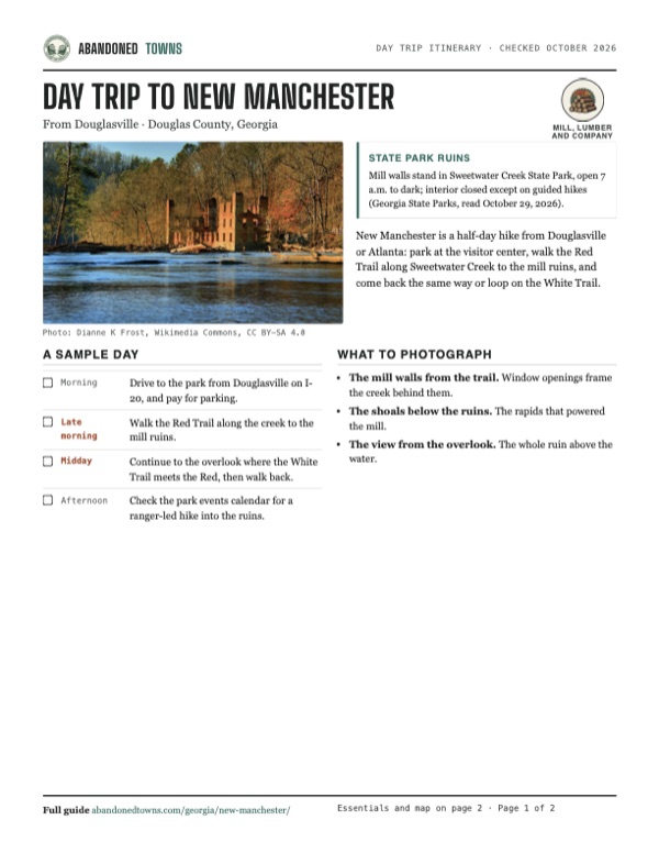
Take it with you
Day trip itinerary
The essentials, the sample day with boxes to tick, what to photograph and the coordinates, on two printable pages. Handy where there's no signal.
Download the PDF (625 KB)New Manchester is a half-day hike from Douglasville or Atlanta: park at the visitor center, walk the Red Trail along Sweetwater Creek to the mill ruins, and come back the same way or loop on the White Trail.
A sample day
- Drive to the park from Douglasville on I-20, and pay for parking.
- Walk the Red Trail along the creek to the mill ruins.
- Continue to the overlook where the White Trail meets the Red, then walk back.
- Check the park events calendar for a ranger-led hike into the ruins.
What to photograph and film
- The mill walls from the trail. Window openings frame the creek behind them.
- The shoals below the ruins. The rapids that powered the mill.
- The view from the overlook. The whole ruin above the water.
Map & directions
Getting there
Douglasville is the nearest city and Atlanta is 18 miles east. Both routes leave I-20 and follow Mount Vernon Road and Factory Shoals Road into the park; the route ends on Factory Shoals Road, near the visitor center at 1750 Mount Vernon Road. The routes were computed from OpenStreetMap and haven't been driven by us.


Base map: USGS The National Map (public domain). Routes: OSRM on © OpenStreetMap contributors data (ODbL), computed October 2026. Times assume dry roads.
- From downtown, head east on Veterans Memorial Highway (US 78).0.4 mi
- Turn right on Fairburn Road, which becomes GA 92.1.7 mi
- Take the ramp onto I-20 east.3.5 mi
- Take exit 41 and keep right on Lee Road.0.4 mi
- Turn left on Monier Avenue.0.9 mi
- Turn right on Mount Vernon Road.1.3 mi
- Turn left on Factory Shoals Road into the park.1.0 mi
- From downtown, take Washington Street and Memorial Drive to the I-20 ramp.0.6 mi
- Follow I-20 west.12.6 mi
- Take exit 44 onto Thornton Road (GA 6).0.7 mi
- Turn right on Blairs Bridge Road.2.1 mi
- Turn left on Mount Vernon Road.1.3 mi
- Turn left on Factory Shoals Road into the park.1.0 mi
Directions go to Sweetwater Creek State Park visitor center, where the drive ends, not to the townsite.
Road and safety notes
- The routes end on Factory Shoals Road in the park. The ruins are on foot from there: half a mile on the Red Trail.
- The park is open 7 a.m. to dark and charges for parking (Georgia State Parks).
Photos
New Manchester in photos
Visitor reports
Been to New Manchester?
Been there lately? Tell the next visitor what you found: whether you could get in, the state of the road and what's still standing. Photos are welcome. We read every report before it appears here.
Mill, lumber and company
More mill, lumber and company ghost towns
The nearest in Georgia, then the nearest elsewhere.

 Guide
Scull Shoals
33.73, -83.29Greene County, Georgia
A mill village on the Oconee River whose cotton economy helped bury its own water supply in silt. The Forest Service maintains the ruins as a…
 Guide
Tremont
35.62, -83.67Blount County, Tennessee
The Little River Lumber Company's last town, built in 1926 where two mountain streams meet and abandoned when the cutting stopped in 1938. The…
Nearby
Other sites near New Manchester
Straight-line distance from the townsite to other mapped sites in our Georgia index.
- Campbellton7.2 mi S · Fulton
- Rough and Ready15.3 mi SE · Clayton
- Constitution16.6 mi E · DeKalb
- Lang20.2 mi SW · Carroll
- Ford36.3 mi NW · Bartow
- Ligon36.6 mi NW · Bartow
- Cement40.2 mi NW · Bartow
- Wynns Mill42.3 mi SE · Henry
Sources
Sources and credits
- ghosttowns.com, "Sweetwater Creek State Park – New Manchester Mfg Co": fact sheet (climate, best time, road), the three-story walls behind a fence, markers at building sites.
- Wikipedia, "Sweetwater Creek State Park" (New Manchester redirects here), read October 2026: the 1832 lottery, slave-made bricks, the 1858 name, Sherman's order and the burning, the 600 prisoners, the 1972 park.
- Georgia State Parks, "Facts on the Town of New Manchester", signed David Jordan: the purchase, opening, incorporation, post office dates, the 1857 sale, the town of 250, the water wheel, the militia, the occupation and burning, the deportation.
- Georgia State Parks, Sweetwater Creek State Park, read October 29, 2026: hours, parking fee, the mill ruins notice, address and phone.
- Georgia State Parks, Sweetwater Creek trails, read October 29, 2026: the Red, White and Yellow trails.
- Ruins and visitor center points: OpenStreetMap ("New Manchester Manufacturing Company Ruins"; 1750 Mount Vernon Road), October 2026.
- Elevation: USGS 3D Elevation Program point query. Routes: OSRM on OpenStreetMap data, October 2026.
- Adventures with Robbie, "Deep in the Wilderness: Awe-Inspiring Exploration of New Manchester Mill", YouTube, posted November 29, 2022: the walk to the mill, the ruins seen from the overlook and the fence, and the museum (the video on this page); checked against its captions and storyboard frames.
Photo and map credits
- The mill ruins across Sweetwater Creek, March 2017: Dianne K Frost, Wikimedia Commons, CC BY-SA 4.0
- Window openings and the wheel frame through the trees, October 2012: John Murphy, Wikimedia Commons, CC BY-SA 2.0
- The walls and wheel pit from above, October 2012: John Murphy, Wikimedia Commons, CC BY-SA 2.0
- The shoals of Sweetwater Creek, August 2013: Thomson200, Wikimedia Commons, CC0
- Trail steps and boardwalk in the woods by the ruins, October 2012: John Murphy, Wikimedia Commons, CC BY-SA 2.0
- Rapids below the mill site, April 2016: Dsdugan, Wikimedia Commons, CC BY-SA 4.0
- Rocks and white water just upstream of the ruins, April 2016: Thomson M, Wikimedia Commons, CC BY 3.0
- The creek downstream of the ruins, April 2016: Thomson M, Wikimedia Commons, CC BY 3.0
- Topo map, area base map and aerial imagery: USGS The National Map (public domain).
- Historic maps: USGS Historical Topographic Map Collection (public domain): Marietta 1891, 1:125,000; Marietta 1901, 1:125,000; Atlanta 1981, 1:100,000; Ben Hill 1999, 1:24,000.