 Abandoned

Overview
The farms that fed the mills also buried the shoals
Scull Shoals grew beside rapids on the Oconee River in what is now Greene County. The New Georgia Encyclopedia dates settlement to 1782. Water-powered industry followed, including grist milling, cotton processing and Georgia’s first paper mill. The Forest Service dates that paper mill to 1811; Wikipedia places its start shortly after 1810.
Cotton farming supported the village and damaged the river that powered it. Erosion from upstream farms carried soil into the channel. The shoals disappeared beneath accumulated sediment, and floods became a recurring problem. By the mid-1880s, according to Wikipedia’s account, water power was no longer workable. The county history also identifies fires and the Civil War as causes of the town’s decline.
This is a mill-town ruin within Oconee National Forest. Much of the settlement is buried, and the surviving masonry represents only part of the village. The prehistoric mound area farther upstream and the experimental forest share the Scull Shoals name, but they are separate features. The map on this guide centers on the east-bank historic-site area rather than the southwest point printed in Wikipedia.
History
Water power and its limits
- Settlement begins, according to the New Georgia Encyclopedia.
- The Forest Service dates Georgia’s first paper mill here to this year.
- A Scull Shoals post office operates.
- Flooding and sediment have made water power infeasible.
- The Forest Service acquires the village site.
What remains
Brickwork above a buried village
Wikipedia identifies remains of a mill and a formerly four-story brick warehouse. The height describes the old building, not an intact structure that visitors can enter. The Forest Service describes a gentle walk along village ruins and explicitly prohibits removing anything from the site.
The 1972 Greshamville sheet labels Scull Shoals Historic Area beside the east bank of the Oconee River. It also shows a picnic area downstream beside the road crossing. Those are distinct places. The broad regional sheets are useful for the river valley, but the 1972 crop is the useful one for locating the historic area.
Historic maps
Scull Shoals on USGS maps, 1972
Crops from the USGS Historical Topographic Map Collection, centered on the townsite. Each sheet shows what surveyors mapped that year; compare them with today's topo and aerial on this page.

Day trip
Plan a day trip to Scull Shoals from Greensboro
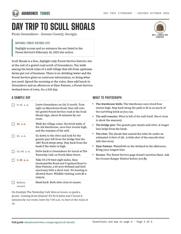
Take it with you
Day trip itinerary
The essentials, the sample day with boxes to tick, what to photograph and the coordinates, on two printable pages. Handy where there's no signal.
Download the PDF (245 KB)Scull Shoals is a free, daylight-only Forest Service historic site at the end of a gravel road north of Greensboro. You walk among the brick ruins of a mill village that silt from upstream farms put out of business. There is no drinking water and the Forest Service gives no restroom information, so bring what you need. Spend the morning at the ruins, then add lunch in Greensboro and an afternoon at Dyar Pasture, a Forest Service wetland west of town, for a full day.
A sample day
- Leave Greensboro on GA 15 north. Turn right on Macedonia Road, then left onto the gravel Forest Service road at the Scull Shoals sign, about 40 minutes by our route.
- Walk the village ruins: the brick walls of the old warehouse, once four stories high, and the remains of the mill.
- Go down to the river and look for the granite pier left from the bridge that the 1887 flood swept away. Stay back from the bank if the water is high.
- Drive back to Greensboro for lunch at The Yesterday Cafe on North Main Street.
- Take US 278 west eight miles, then Greshamville Road and Copeland Road to Dyar Pasture, a 60-acre wetland and bird sanctuary with a short trail. No hunting is allowed there. Wildlife viewing costs $5 a vehicle.
- Head back. Both sites close at sunset.
On Sundays The Yesterday Cafe lists no hours, so pack a picnic. Coming from Atlanta? It’s 92.8 miles and 2 hours 8 minutes by our route; leave by 7:50 a.m. to start at the ruins at 10.
What to photograph and film
- The warehouse walls. The warehouse once stood four stories high. Step back along the path to fit in as much of the surviving brick as you can.
- The mill remains. What is left of the mill itself. Shoot close to show the masonry.
- The bridge pier. The granite pier stands mid-river. A longer lens helps from the bank.
- The river. The shoals that named the town lie under an estimated 14 feet of silt. A wide shot of the smooth river tells that story.
- Dyar Pasture. Waterfowl on the wetland in the afternoon. Bring your longest lens.
- Drones. The Forest Service page doesn’t mention them. Ask the Oconee Ranger District before you fly.
Map & directions
Getting there
The route from Greensboro is 16.6 miles and 42 minutes; Atlanta is 92.8 miles and 128 minutes. These are October 2026 routing estimates, not road inspections. Both approach the east-bank historic-site area by Macedonia Road. The route ends about 65 metres from the guide’s approximate map center. Do not use Wikipedia’s southwest point for driving: it sends the router to the opposite bank.


Base map: USGS The National Map (public domain). Routes: OSRM on © OpenStreetMap contributors data (ODbL), computed October 2026. Times assume dry roads.
- From South Main Street, turn left onto West Broad Street, then right onto North Laurel Avenue (GA 15). Continue as Athens Highway.11.2 mi
- Turn right onto Macedonia Road.2.4 mi
- Turn left onto Skull Shoals Road and continue as Scull Shoals Road to the routed endpoint near the historic area.3.0 mi
- From Capitol Avenue, use Martin Luther King Jr. Drive Southeast and Hill Street Southeast to join I-20 east.1.0 mi
- Follow I-20 through its Ralph David Abernathy, Purple Heart and Carl Sanders Highway segments; take exit 130.72.4 mi
- Turn left onto Lake Oconee Parkway (GA 44), continuing as South Main Street into Greensboro. Turn left onto West Broad Street, then right onto North Laurel Avenue (GA 15), continuing as Athens Highway.14.0 mi
- Turn right onto Macedonia Road.2.4 mi
- Turn left onto Skull Shoals Road and continue as Scull Shoals Road to the endpoint near the historic area.3.0 mi
Road and safety notes
- The Forest Service’s February 18, 2025 directions use the names Macedonia Church Road and Forest Service Road 1234, and describe about 1.8 miles of gravel. The router instead labels Macedonia Road, Skull Shoals Road and Scull Shoals Road, totaling about 3.0 miles after Macedonia Road. Follow agency signs and confirm the approach with the Oconee Ranger District. Friends of Scull Shoals gives an undated 3.1-mile final approach, closer to the router than the agency’s 1.8 miles.
- Current surface condition, storm damage and vehicle suitability have not been field-verified. The 2WD label in an undated listing is not a current road assessment.
- The agency lists no potable water and provides no restroom information. Its daylight restriction applies to the historic site.
Photos
Have photos of Scull Shoals?
We haven’t added photographs of Scull Shoals yet. If you’ve visited, share your photos and a field report below.
Visitor reports
Been to Scull Shoals?
Been there lately? Tell the next visitor what you found: whether you could get in, the state of the road and what's still standing. Photos are welcome. We read every report before it appears here.
Mill, lumber and company
More mill, lumber and company ghost towns
The nearest in Georgia, then the nearest elsewhere.

 Guide
New Manchester
33.75, -84.62Douglas County, Georgia
A five-story cotton mill on Sweetwater Creek supported a town of about 250. Union cavalry burned it in July 1864 and sent its workers north, and…
 Guide
Tremont
35.62, -83.67Blount County, Tennessee
The Little River Lumber Company's last town, built in 1926 where two mountain streams meet and abandoned when the cutting stopped in 1938. The…
Nearby
Other sites near Scull Shoals
Straight-line distance from the townsite to other mapped sites in our Georgia index.
- Barnett Shoals7.6 mi N · Oconee
- Apalachee8.7 mi W · Morgan
- Swords13.1 mi S · Morgan
- Grantville18.0 mi SE · Greene
- Godfrey23.0 mi SW · Morgan
- Pennington23.2 mi SW · Morgan
- Apollo28.9 mi SW · Putnam
- Huguenot41.4 mi NE · Elbert
Sources
Sources and credits
- USDA Forest Service, Scull Shoals Historic Site: site notice last updated February 18, 2025, read October 20, 2026. Status evidence: “Open during daylight hours only.” Lists year-round sunrise-to-sunset access, no fee, no required permit, gravel approach, no potable water and a ban on removing objects. The directions and router road names differ as explained above. Read again October 21, 2026 for the day trip: “Site Open”, directions, no restroom information, day hikes, interpretive exhibits and picnicking.
- Friends of Scull Shoals, read October 20, 2026: undated directions give 3.1 miles on the final FS 1234 approach. This differs from the Forest Service’s 1.8 miles; neither is a fresh road-condition report.
- Forest Service alerts, checked October 20 and 21, 2026: no Scull Shoals-specific closure listed. Forest-wide alerts include Flash Flood Awareness (June 18, 2026), residual winter storm damage (February 19, 2026) and hazardous trees (July 17, 2025). Check again before travel.
- Forest Service, Oconee Ranger District recreation sites, last updated June 30, 2026, read October 21, 2026: Scull Shoals Historic Site shown as “Site Open”; Redlands and Cedar Creek WMAs on the district. District office page, same dates: Eatonton address, phone and office hours.
- Forest Service, Dyar Pasture Recreation Area, last updated August 3, 2026, read October 21, 2026: 60-acre wetland and bird sanctuary, short trail, sunrise-to-sunset hours, no hunting, $5 vehicle fee, directions from Greensboro.
- Georgia DNR, Redlands WMA, read October 21, 2026: 37,500 acres of Forest Service land in Greene, Oglethorpe, Oconee and Morgan counties; deer, turkey, small game and dove hunting.
- Georgia DNR, “Statewide Deer Firearms Season Opens Sat. Oct. 17”, October 13, 2026: season opens October 17 and, for most hunters, ends January 10.
- Friends of Scull Shoals, “Scull Shoals History”, undated, read October 21, 2026: the warehouse remains and the granite bridge pier left mid-river after the 1887 flood.
- The Yesterday Cafe, Facebook page, read in the browser October 21, 2026 (latest post October 5, 2026): address and listed lunch and dinner hours.
- Wikipedia, Scull Shoals, Georgia: read October 20, 2026: mills, sedimentation, decline, post office dates, acquisition, the mill and four-story warehouse remains, the shoals under about 14 feet of silt, ongoing flooding and the protected mounds upstream. Its 33.72833, −83.29278 point differs from the east-bank historic area shown on the USGS map.
- New Georgia Encyclopedia, Greene County: edited July 6, 2022: 1782 settlement and destruction through fires, floods and the Civil War.
- ghosttowns.com, Skull Shoals: read October 20, 2026, fact sheet only: Greene County and partial structures. Undated vehicle and access claims are not treated as current.
- Scull Shoals Historic Area, GNIS-derived location record: read October 20, 2026: distinguishes the historic area at 33.7317892, −83.2907131 from the historical populated-place point. The guide’s approximate center is farther north along the east-bank historic area, checked against the georeferenced 1972 USGS Greshamville sheet.
- OSRM / OpenStreetMap and USGS: routes queried October 20, 2026; distances and times are estimates. Terrain elevation from USGS 3DEP. Historical map: USGS Greshamville, 1972, sheet 245819; georeferenced crop inspected.
Photo and map credits
- Area base map, topography and aerial imagery: USGS The National Map (public domain).
- Historic maps: USGS Historical Topographic Map Collection (public domain): Greshamville 1972, 1:24,000.