 Abandoned

Overview
The town the railroad skipped

The point where the Crow Wing River runs into the Mississippi was a hunting ground of the Dakota and then the Ojibwe long before traders came. Allan Morrison opened a trading post there in 1823. Clement Beaulieu, a fur trader of French and Ojibwe descent, moved his business to Crow Wing in 1849, built a house on the hill that was grand by frontier standards, and platted a townsite in 1856. Catholic, Episcopal and Lutheran missions followed, and the town became the county seat.
In the 1860s Crow Wing was the leading trade, travel and political center of the region. Oxcart trains on the Woods Trail between St. Paul and the Red River country stopped here. The DNR puts the population at over 500; Wikipedia gives 600 to 700, about half of them Ojibwe. The historian William Whipple Warren and the Ojibwe leader Hole in the Day both lived here.
Two blows ended it. In 1868 the government moved the Ojibwe to the White Earth Reservation, and in 1871 the Northern Pacific chose a river crossing ten miles upstream, where Brainerd grew. Crow Wing's buildings were taken apart and hauled away, the county seat left the next year, and by 1880 most people were gone. Since 1959 the townsite has been part of Crow Wing State Park. Only the 1849 Beaulieu House stands, brought back to its hill in 1988.
Video
A rainy figure-eight hike through the townsite
A hiker walks a loop of about five and a half miles on a damp summer day. He stops at the cellar hole of William Whipple Warren's home, the riverbank, the group camp and the 1768 battle site, then looks across to the mouth of the Crow Wing, follows the old Main Street to the Beaulieu House, and ends at the stone chapel and the Morrison burial plot. His verdict: wide, mowed, easy trails, and very little of the town left. The narration puts the railroad bypass in 1880 and the peak population at about 267, and calls the Beaulieu House the oldest frame house in Minnesota. Our sources give 1871 for the railroad, over 500 people in the 1860s, and the oldest standing frame house north of the Twin Cities.
 Play “Day hike - Crow Wing State Park | Mississippi River and Old Minnesota History” from YouTube
Timeline
Trading post, county seat, bypass
- By the account of the 19th-century Ojibwe historian William Whipple Warren, Ojibwe warriors ambush a Dakota party here. The park marks the battle site from his telling.
- Trader James McGill winters at the meeting of the Crow Wing and Mississippi rivers.
- Allan Morrison opens a trading post, the first European-American settlement here.
- The U.S. Army builds Fort Ripley nearby.
- Fur trader Clement Beaulieu moves his business to Crow Wing and builds a Greek Revival house above the river.
- Father Francis Xavier Pierz founds a Catholic mission. An Episcopal mission follows in 1856, then a Lutheran church.
- Beaulieu plats the townsite. Crow Wing serves as county seat in the 1850s and 1860s.
- Crow Wing is the trade, travel and political center of the region, on the oxcart road between St. Paul and the Red River. Population estimates run from over 500 (the DNR) to 600 to 700, about half Ojibwe (Wikipedia).
- Pierz builds a church on the site where a chapel stands today.
- The United States moves the Ojibwe to the newly formed White Earth Reservation.
- The Northern Pacific Railway crosses the Mississippi about ten miles upriver, where Brainerd grows. Crow Wing's buildings are taken down and hauled away, and the county seat goes to Brainerd a year later.
- Clement and Elizabeth Beaulieu move to White Earth, by the park marker's date; Wikipedia counts them in the 1868 move. In 1875 teacher Elizabeth Ayer finds their house empty, its fence broken and hogs rooting in the yard.
- Most residents have left.
- Crow Wing State Park is established to preserve the townsite, through the efforts of local citizens.
- The Beaulieu House, moved to Morrison County and lived in into the 1980s, comes back to the townsite after its donation to the DNR.
What's left
What you'll see

The Main Street, Crow Wing trail starts at the south side of the parking lot at the north picnic area and runs about a third of a mile through the old townsite. A replica of the boardwalk that once ran in front of the stores crosses the field. Signs mark the commercial district, a warehouse, the town well, the Bailey House and the Red River oxcart trail, which is still a grassy lane through the woods. Most of the town is open field now.
The Beaulieu House, built in 1849, is the only building left from the town. The DNR calls it the only structure of its era still standing north of St. Anthony Falls. It was moved away to Morrison County, lived in into the 1980s, and returned to its hill above the river in 1988. Elsewhere in the park a cellar hole marks William Whipple Warren's home, and a small chapel stands on the site of the church Father Pierz built in 1867. The diocese still owns the chapel.
The 1916 Pillager sheet below prints Crow Wing School on the flats east of the river, with the Northern Pacific line crossing the land to the southeast. By 1986 the sheet labels the park and marks the railroad grade as abandoned.
- Beaulieu House (1849), returned 1988
- Replica boardwalk on the old Main Street
- Interpretive signs at the commercial district, warehouse, town well and Bailey House
- Red River oxcart trail
- Cellar hole of William Whipple Warren's home
- Father Pierz chapel on the 1867 church site (Diocese of St. Cloud)
- Chippewa Lookout over the Mississippi


Historic maps
Old Crow Wing on USGS maps, 1916–1986
Crops from the USGS Historical Topographic Map Collection, centered on the townsite. Each sheet shows what surveyors mapped that year; compare them with today's topo and aerial on this page.

Day trip
Plan a day trip to Old Crow Wing from Brainerd
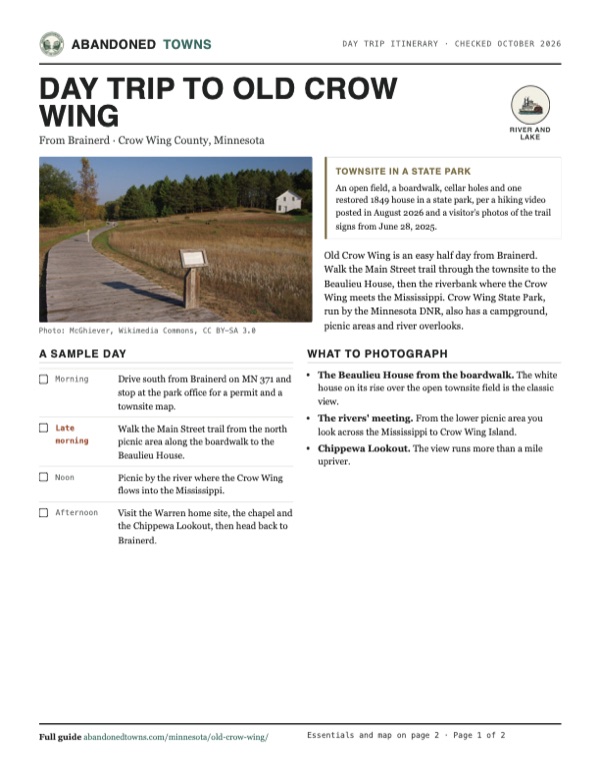
Take it with you
Day trip itinerary
The essentials, the sample day with boxes to tick, what to photograph and the coordinates, on two printable pages. Handy where there's no signal.
Download the PDF (585 KB)Old Crow Wing is an easy half day from Brainerd. Walk the Main Street trail through the townsite to the Beaulieu House, then the riverbank where the Crow Wing meets the Mississippi. Crow Wing State Park, run by the Minnesota DNR, also has a campground, picnic areas and river overlooks.
A sample day
- Drive south from Brainerd on MN 371 and stop at the park office for a permit and a townsite map.
- Walk the Main Street trail from the north picnic area along the boardwalk to the Beaulieu House.
- Picnic by the river where the Crow Wing flows into the Mississippi.
- Visit the Warren home site, the chapel and the Chippewa Lookout, then head back to Brainerd.
What to photograph and film
- The Beaulieu House from the boardwalk. The white house on its rise over the open townsite field is the classic view.
- The rivers' meeting. From the lower picnic area you look across the Mississippi to Crow Wing Island.
- Chippewa Lookout. The view runs more than a mile upriver.
Map & directions
Getting there
Brainerd is the closest city. MN 371 runs south from it past the park entrance on County Road 27. From Minneapolis, I-94 and US 10 lead northwest to MN 371.


Base map: USGS The National Map (public domain). Routes: OSRM on © OpenStreetMap contributors data (ODbL), computed October 2026. Times assume dry roads.
- From downtown Brainerd, start on South 6th Street (MN 371 Business).0.2 mi
- Turn right on Laurel Street, which becomes West Laurel Street.1.1 mi
- Bear left onto Highland Scenic Drive South (CR 48) and keep on it through the roundabout.2.5 mi
- Turn left on MN 371, the C. Elmer Anderson Memorial Highway.5.9 mi
- Turn right on CR 27.1.1 mi
- Turn left on State Park Road into the park.0.4 mi
- From downtown Minneapolis, take 4th Street, 5th Avenue and 3rd Street to the ramp for I-94.2.6 mi
- Follow I-94 northwest.35.4 mi
- Take the exit and turn right on Pine Street (MN 25).1.3 mi
- Turn left on County Road 11, which becomes Park Boulevard SE and 165th Avenue SE.3.9 mi
- Turn left on US 10 and follow it northwest.54.4 mi
- Bear right onto MN 371.19.9 mi
- Turn left on 60th Avenue, which becomes CR 27.1.3 mi
- Turn left on State Park Road into the park.0.4 mi
Road and safety notes
- The routes end on State Park Road inside the park; the townsite trail starts at the north picnic area.
- Stop at the park office on the entrance road for a permit and a map of the historic townsite, as the DNR advises.
Photos
Old Crow Wing in photos
Visitor reports
Been to Old Crow Wing?
Been there lately? Tell the next visitor what you found: whether you could get in, the state of the road and what's still standing. Photos are welcome. We read every report before it appears here.
River and lake
More river and lake ghost towns
The nearest in Minnesota, then the nearest elsewhere.

 Guide
Nininger
44.77, -92.90Dakota County, Minnesota
A paper city on the Mississippi that Ignatius Donnelly sold to the world in 1856. It held nearly 1,000 people within two years, the Panic of 1857…
 Guide
Churchs Ferry
48.27, -99.19Ramsey County, North Dakota
A town of 457 people in 1910 that the rising water of Devils Lake emptied. After a federal buyout around 2000 most houses were torn down or moved…
Nearby
Other sites near Old Crow Wing
Straight-line distance from the townsite to other mapped sites in our Minnesota index.
- Manganese23.3 mi NE · Crow Wing
- Old Wadena Historic District25.5 mi NW · Wadena
- Leaf River38.4 mi NW · Wadena
- Topelius47.3 mi W · Otter Tail
- Banning71.5 mi E · Pine
- Bodum75.5 mi SE · Isanti
- Itasca81.8 mi SE · Anoka
- Dickinson84.3 mi S · Wright
Sources
Sources and credits
- Wikipedia, "Old Crow Wing, Minnesota", read October 28, 2026: McGill in 1771-72, Morrison's 1823 post, Fort Ripley in 1848, the missions of 1852 and 1856, county seat, the 600-700 peak, the 1868 removal to White Earth, the railroad at Brainerd in 1871, the county seat moving a year later, most gone by 1880, the Beaulieu House's return in 1988, the coordinates.
- Minnesota DNR, Crow Wing State Park snapshot virtual tour, read October 28, 2026: the Beaulieu House as the only building left, over 500 residents, the boardwalk, the Father Pierz chapel and the 1867 church, the Warren home site, the 1768 battle site after Warren, the picnic shelter restrooms, the park office permits and townsite maps, the National Register listing.
- Historical Marker Database, "Welcome to Main Street, Crow Wing", marker photographed June 28, 2025, page revised July 16, 2025: the one-third-mile trail from the north picnic area, the 1860s trade center, the 1959 park, the park address.
- Historical Marker Database, "The Clement Beaulieu House", marker photographed June 28, 2025: the 1849 Greek Revival house, Beaulieu's 1856 plat, the move to White Earth in 1873, Elizabeth Ayer's 1875 description.
- Historical Marker Database, "Warehouse", photographed June 28, 2025: the warehouse sign by the boardwalk and the nearby commercial district and town well signs.
- Happy Trail Backpacking, "Day hike - Crow Wing State Park | Mississippi River and Old Minnesota History", YouTube, posted August 17, 2026: the video on this page; the trails, Beaulieu House, chapel and burial plot as a hiker found them.
- Minnesota DNR, "Minnesota state parks vehicle permit", read October 28, 2026: the $7 one-day and $35 year-round vehicle permits, sold online.
- Elevation: USGS 3D Elevation Program point query. Routes: OSRM on OpenStreetMap data, October 2026.
Photo and map credits
- The townsite field and the Beaulieu House, August 2007: McGhiever, Wikimedia Commons, CC BY-SA 3.0
- The Beaulieu House above the Mississippi, August 2007: McGhiever, Wikimedia Commons, CC BY-SA 3.0
- The boardwalk on old Main Street, September 2013: McGhiever, Wikimedia Commons, CC BY-SA 3.0
- A sign on the Red River oxcart trail, September 2013: McGhiever, Wikimedia Commons, CC BY-SA 3.0
- The Mississippi from Chippewa Lookout, September 2013: McGhiever, Wikimedia Commons, CC BY-SA 3.0
- The Crow Wing River (left) flowing into the Mississippi, September 2020: James Postema, Wikimedia Commons, CC BY 4.0
- The Mississippi in Crow Wing State Park, September 2016: Tony Webster from Minneapolis, Minnesota, Wikimedia Commons, CC BY-SA 2.0
- Area base map, topo and aerial imagery: USGS The National Map (public domain).
- Historic maps: USGS Historical Topographic Map Collection (public domain): Pillager 1916, 1:62,500; Baxter 1954, 1:24,000; Brainerd 1965, 1:250,000; Brainerd 1986, 1:100,000.