 Abandoned

Overview
The camp at the head of First Chance Gulch

Garnet sits at about 5,900 feet at the head of First Chance Gulch, in the Garnet Range east of Missoula. Placer miners had worked the gulches since the 1860s, but the town itself dates from 1895, when Dr. Armistead Mitchell built a stamp mill to crush the district's ore. The camp was called Mitchell until 1897, when it took the name Garnet from the garnet rock mined nearby.
The boom followed Sam Ritchey's strike in the Nancy Hanks mine, just west of town. By January 1898 nearly 1,000 people lived here, served by four stores, four hotels, thirteen saloons and a school with 41 pupils. The Wells Hotel, Kelly's Saloon, the Dahl saloon and F. A. Davey's store all date from these years. The ore ran thin within a few years, a fire in 1912 took much of the business district, and the First World War drew away most of the people who were left.
Garnet came back briefly after 1934, when a higher gold price sent miners into the empty cabins, and the post office reopened for seven years. By the 1940s most residents had left, although storekeeper F. A. Davey and a few others remained. Preservation began in the 1970s, and today the Bureau of Land Management, with the nonprofit Garnet Preservation Association, keeps more than 25 buildings in a state of arrested decay. More than 30,000 people visit each summer.
Video
Garnet in 30 seconds
An 1890s gold camp in the Garnet Range: the main street, the Wells Hotel, Kelly's Saloon, Davey's store and the storefronts the Bureau of Land Management keeps standing.
Timeline
From Mitchell's mill to the BLM

- Placer miners work the gulches of the Garnet Range. Legends of America dates the first gold in First Chance Gulch to 1865; by about 1870 the easy placer ground was played out.
- Dr. Armistead Mitchell builds a stamp mill at the head of First Chance Gulch to crush local ore. The camp that grows beside it is called Mitchell.
- Sam Ritchey strikes rich ore in his Nancy Hanks mine just west of town, and the boom is on. The post office opens the same year.
- The town is renamed Garnet, for the garnet rock found in the district.
- Nearly 1,000 people live here. The town has four stores, four hotels, thirteen saloons and a school with 41 pupils.
- The ore runs thin. Wikipedia puts the population at about 300 in 1900; the preservation association says about 150 by 1905, and Legends of America says most mines were abandoned by 1905.
- Fire destroys many of the commercial buildings. The business district is never rebuilt.
- About $950,000 has been taken from all of Garnet's mines by this year, by the preservation association's count.
- The post office closes.
- A higher federal gold price brings renewed interest in mining. Miners move back into the empty cabins, and the post office reopens in 1935.
- The post office closes for good. Wartime limits on dynamite make mining hard, and Legends of America says the town was abandoned by 1940; the association says storekeeper F. A. Davey and a few others stayed on after the war.
- An auction sells off the stock of the Davey store.
- The Bureau of Land Management begins managing the site, by its own account, and preservation work starts. Legends of America dates the start to 1970.
- The Garnet Historic District, 134 acres with 82 contributing buildings, is listed on the National Register of Historic Places.
- The entrance fee rises from $3 to $10 for visitors 16 and over, the first increase since 2005.
Legend and record
The haunted saloon
Garnet turns up in books on haunted places. Legends of America says Kelly's Saloon and the Wells Hotel are the buildings most often named, with tales of unexplained music in the saloon and footsteps in the hotel.
None of this is in the historical record. We keep it here because visitors will hear the stories, and we label them as legend.
What's left
What you'll see


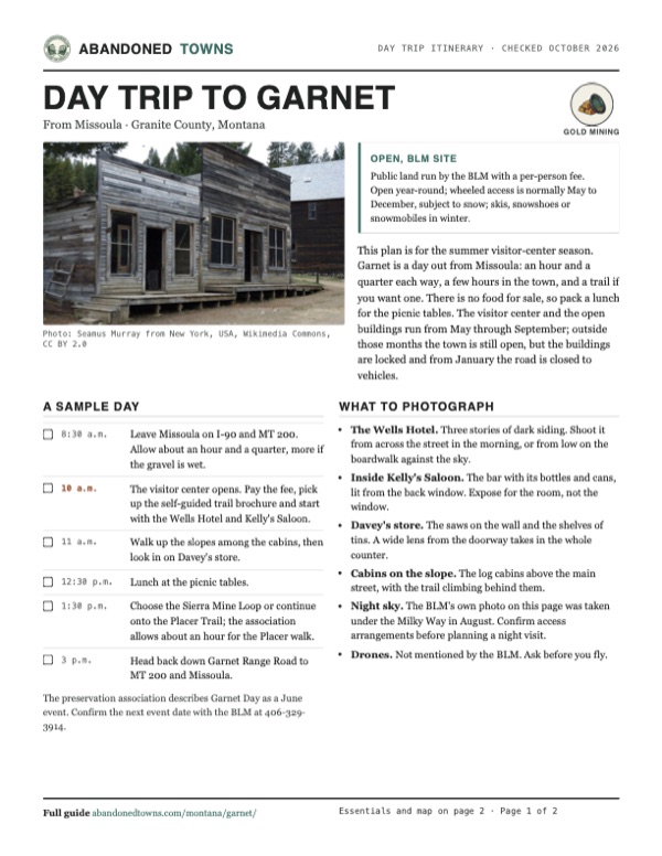
The buildings cluster at the north end of First Chance Gulch, around a short main street. The Wells Hotel, built by John and Winifred Wells, is the tallest, three stories of weathered siding with a boardwalk in front. Kelly's Saloon still has its bar, and the F. A. Davey store keeps shelves of old tins, bottles and saws. Up the slopes stand dozens of log cabins, some of them open to walk into. The BLM manages the buildings in a state of arrested decay: it stabilizes them but does not restore them. Garnet gets three to eight feet of snow a year, and when more than two feet sits on a roof the Forest Service smokejumpers from Missoula are called in to shovel it off.
Three self-guided trails leave the parking lot. The Placer Trail takes about an hour and ends at the visitor center; the Sierra Mine Loop passes claims dating to 1872 and 1884; and the Warren Park Trail is a two- to three-hour round trip past a cabin ruin.
The historic maps below show the district filling in and emptying out. The 1919 Drummond sheet draws Garnet's buildings at the head of the gulch, with the camp of Coloma to the northwest and Anderson Hill to the east. The 1965 sheet names the Nancy Hanks Mine on the ridge just west of town and the Mountain View Mine to the east. By 1984 Garnet is a dot, with Beartown and Cave Gulch below it and Reynolds City over the ridge.
- Wells Hotel
- Kelly's Saloon
- F. A. Davey store
- Dahl saloon and house
- Hannifen house
- Log cabins
- Visitor center (summer)
- Two winter rental cabins
- Nancy Hanks mine workings, west of town


Historic maps
Garnet on USGS maps, 1919–1984
Crops from the USGS Historical Topographic Map Collection, centered on the townsite. Each sheet shows what surveyors mapped that year; compare them with today's topo and aerial on this page.

Day trip
Plan a day trip to Garnet from Missoula
Take it with you
Day trip itinerary
The essentials, the sample day with boxes to tick, what to photograph and the coordinates, on two printable pages. Handy where there's no signal.
Download the PDF (624 KB)This plan is for the summer visitor-center season. Garnet is a day out from Missoula: an hour and a quarter each way, a few hours in the town, and a trail if you want one. There is no food for sale, so pack a lunch for the picnic tables. The visitor center and the open buildings run from May through September; outside those months the town is still open, but the buildings are locked and from January the road is closed to vehicles.
A sample day
- Leave Missoula on I-90 and MT 200. Allow about an hour and a quarter, more if the gravel is wet.
- The visitor center opens. Pay the fee, pick up the self-guided trail brochure and start with the Wells Hotel and Kelly's Saloon.
- Walk up the slopes among the cabins, then look in on Davey's store.
- Lunch at the picnic tables.
- Choose the Sierra Mine Loop or continue onto the Placer Trail; the association allows about an hour for the Placer walk.
- Head back down Garnet Range Road to MT 200 and Missoula.
The preservation association describes Garnet Day as a June event. Confirm the next event date with the BLM at 406-329-3914.
What to photograph and film
- The Wells Hotel. Three stories of dark siding. Shoot it from across the street in the morning, or from low on the boardwalk against the sky.
- Inside Kelly's Saloon. The bar with its bottles and cans, lit from the back window. Expose for the room, not the window.
- Davey's store. The saws on the wall and the shelves of tins. A wide lens from the doorway takes in the whole counter.
- Cabins on the slope. The log cabins above the main street, with the trail climbing behind them.
- Night sky. The BLM's own photo on this page was taken under the Milky Way in August. Confirm access arrangements before planning a night visit.
- Drones. Not mentioned by the BLM. Ask before you fly.
Map & directions
Getting there
From Missoula, use Montana Highway 200 and Garnet Range Road. The BLM confirmed this access in its September 11, 2026 notice about a temporary closure on the separate Cave Gulch route. Turn south between mileposts 22 and 23 at the brown Garnet Ghost Town sign. Check with the BLM for road conditions and snow before leaving the highway.

Base map: USGS The National Map (public domain). Routes: OSRM on © OpenStreetMap contributors data (ODbL), computed October 2026. Times assume dry roads.
- From downtown Missoula, take East Broadway and Van Buren Street to the roundabout and join I-90 east.0.9 mi
- Follow I-90 east and take the off-ramp onto MT 200.3.9 mi
- Follow MT 200 east up the Blackfoot valley to the brown Garnet Ghost Town sign between mileposts 22 and 23.23.6 mi
- Turn right onto Garnet Range Road.5.1 mi
- Turn left where the road branches, then continue on Garnet Range Road as it climbs into the range.4.0 mi
- Follow the signs through the last turns to the Garnet parking area.0.9 mi
Road and safety notes
- The BLM's September 11, 2026 notice says Highway 200 and Garnet Range Road provide access while Cave Gulch Road is closed September 14–25. That closure period has passed; it is not a report of today's road conditions.
- The FHWA road-rehabilitation project describes paved and gravel sections and anticipates construction in summer/fall 2027. Confirm any work or snow restrictions with the BLM before driving.
- From January through April the road is closed to wheeled motor vehicles and becomes part of the Garnet National Winter Recreation Trail. The BLM's 2024 business plan says it closes January 1 and reopens May 1, and that the snow is not always gone by then.
- No camping within half a mile of the town. Dispersed camping on BLM land farther out is allowed for up to 14 days.
- Download maps before leaving the highway; current mobile coverage has not been verified.
Photos
Garnet in photos
Visitor reports
Been to Garnet?
Been there lately? Tell the next visitor what you found: whether you could get in, the state of the road and what's still standing. Photos are welcome. We read every report before it appears here.
Gold mining
More gold mining ghost towns
The nearest in Montana.

 Guide
Marysville
46.75, -112.30Lewis and Clark County, Montana
Thomas Cruse's Drumlummon mine made Marysville a gold town of thousands in the 1880s. The mine closed, most people left, and about 80 now live among…
 Guide
Bannack
45.16, -113.00Beaverhead County, Montana
The camp of Montana's first big gold strike, in 1862, and for a few months the territory's capital. Its log and brick buildings still line Main…
Nearby
Other sites near Garnet
Straight-line distance from the townsite to other mapped sites in our Montana index.
- Coloma2.3 mi NW · Missoula
- Bearmouth8.0 mi S · Granite
- Nimrod10.8 mi SW · Granite
- Gold Creek26.4 mi SE · Powell
- Pioneer27.9 mi SE · Powell
- Granite35.4 mi S · Granite
- Hell Gate35.6 mi W · Missoula
- Southern Cross42.8 mi S · Deer Lodge
Sources
Sources and credits
- BLM, Cave Gulch Road closure notice, September 11, 2026: temporary September 14–25 closure and access via Highway 200/Garnet Range Road.
- FHWA, Garnet Ghost Town Roads Rehabilitation Project, 2025–2027 project schedule: road segments and anticipated 2027 construction.
- Garnet Preservation Association FAQ, read October 2026: food, water, leashed dogs, bathroom locations and building season. Its 9:30 a.m. opening differs from the BLM visitor center opening at 10 a.m.; follow the BLM or call before visiting.
- ghosttowns.com, "Garnet": fact sheet fields (county, roads, climate, best time, remains).
- Wikipedia, "Garnet, Montana", retrieved October 2026: Mitchell and the 1897 renaming, the 1895 stamp mill, population in 1898 and 1900, the builders of the hotel, saloons and store, the 1912 fire, the 2010 National Register listing, coordinates.
- Bureau of Land Management, "Garnet Ghost Town", retrieved October 2026: fee, visitor center hours, winter closure, cabin rentals, directions and road surface, camping rule, phone.
- BLM announcement, May 10, 2024: the $10 fee from May 20, 2024, the old $3 fee, cabin rate, 30,000 summer visitors.
- BLM, "Garnet Ghost Town Recreation Fee Site Business Plan 2024–2029" (PDF): more than 25 buildings, arrested decay, snow loads and smokejumpers, toilets, water and picnic tables, road closure and reopening dates, fee season, Garnet Day.
- Garnet Preservation Association, "History", "Directions", "Things To Do" and "Cabin Rentals", retrieved October 2026: Mitchell's mill, the Nancy Hanks strike, the 1898 count, 1905 population, the 1934 revival, the 1948 auction, the Bear Gulch route and road warnings, trails, Garnet Day, the two cabins.
- Legends of America, "Garnet, Montana", updated October 2026: 1865 gold, the 1896 Nancy Hanks figure, population of 1,200 and 150, mines abandoned by 1905, abandonment by 1940, preservation from 1970, the haunted-building stories.
- Jim Forte Postal History, Granite County post offices: Garnet post office 1896–1928 and 1935–1942.
- Elevation: USGS 3D Elevation Program point query. Routes: OSRM on OpenStreetMap data, October 2026.
Photo and map credits
- Log cabins under the Milky Way, August 2015: mypubliclands, Wikimedia Commons, Public domain
- The storefront row on the main street, May 2007: Seamus Murray from New York, USA, Wikimedia Commons, CC BY 2.0
- Cabins on the slope, May 2007: Seamus Murray from New York, USA, Wikimedia Commons, CC BY 2.0
- The Wells Hotel, September 2019: John Manard, Wikimedia Commons, CC BY-SA 2.0
- Inside Kelly's Saloon, September 2019: John Manard, Wikimedia Commons, CC BY-SA 2.0
- The storefronts under a night sky, a BLM photo: Bob Wick, Bureau of Land Management, Wikimedia Commons, Public domain
- Davey's store, September 2019: John Manard, Wikimedia Commons, CC BY-SA 2.0
- A sewing machine and jacket in one of the houses, September 2019: John Manard, Wikimedia Commons, CC BY-SA 2.0
- Visitors peering into a locked building, September 2020: Bob Wick, Bureau of Land Management, Wikimedia Commons, Public domain
- Visitors in a furnished room, August 2015: Alyse Backus, Bureau of Land Management, Wikimedia Commons, Public domain
- Garnet and the Nancy Hanks Mine on the 1965 USGS Elevation Mountain sheet: U.S. Geological Survey, USGS catalog, Public domain
- Topo map, area base map and aerial imagery: USGS The National Map (public domain).
- Historic maps: USGS Historical Topographic Map Collection (public domain): Drummond 1919, 1:125,000; Butte 1947, 1:250,000; Elevation Mountain 1965, 1:24,000; Missoula East 1984, 1:100,000.