 Abandoned

Overview
A town built for a tunnel

The Chicago, Burlington and Quincy Railroad pushed a line north from Alliance to Crawford in 1888 and 1889. South of Crawford the canyons were too deep to go around, so the railroad bored a tunnel, the only railroad tunnel ever built in Nebraska. A construction camp grew beside it, known as Evergreen City. When it asked for a post office, the name was already taken elsewhere in the state, so the railroad renamed the stop Belmont after one of its officials. The post office opened in November 1889.
The tunnel was finished on August 25, 1889, eight days after the tracks reached it. The town was platted the next year, just as drought and depression hit; by 1893 only five blocks had sold. Farming recovered by the First World War, and in the late 1920s Belmont had about eighty people, two general stores, two churches, a lumberyard and a new two-story brick school.
Cars and the Depression ended that. Farmers drove to bigger towns to shop and sell, the last store burned in 1949, and the post office closed in 1956. Passenger trains stopped in 1969 and the depot closed. In 1982 the railroad laid a double track just west of the old line and the tunnel went quiet. The school taught its last classes in 2008 and is now a private home. A traveler who stopped in the summer of 2026 counted maybe four houses, a few abandoned buildings and the school.
Video
A summer walk through the tunnel
Belmont starts about six minutes in. From a bridge over the tracks the creator films the town and a BNSF freight, then shows an abandoned two-story wooden house, says there are maybe four houses, a few abandoned buildings and the old school that someone seems to live in, and walks the old grade into the graffiti-covered tunnel. He says the land is private and that a man working there gave him permission. Drone shots show the new double track beside the old line. The video goes on to Marsland. An on-screen caption gives Belmont's peak as 80 people in 1920; Wikipedia puts the peak of about eighty in the late 1920s.
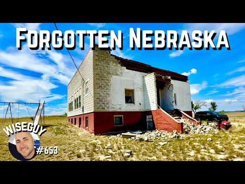 Play “Towns That Time Forgot Along Highway 2 in Northwest Nebraska” from YouTube
Timeline
Tunnel, town and bypass

- Dawes County is founded. Its southwestern townships become the Evergreen Precinct.
- Work on the tunnel starts before the Chicago, Burlington and Quincy tracks arrive. Contractor Kilpatrick Bros. & Collins digs from both ends through compacted sand and thin rock layers.
- A construction camp called Evergreen City grows beside the tunnel. The tracks reach it on August 17, and the tunnel is finished on August 25. The post office opens on November 9 under the railroad's name for the stop, Belmont.
- The townsite is surveyed and platted. Drought and hard times follow, and by 1893 only five blocks have sold.
- A freight train tears out a large part of the tunnel in November.
- The tunnel is re-bored and lined with concrete. A worker is killed when a section collapses.
- A two-story brick school replaces the old wooden one west of town.
- Belmont's peak: about eighty people, two general stores, two churches, a lumberyard and the brick school.
- The last store burns and is not rebuilt.
- The post office closes on May 11, after 67 years.
- Passenger trains end on August 24. The depot closes soon after.
- A new double-track line is built just west of the tunnel. The last train passes through it on May 3.
- The school is consolidated into Crawford's district in 2008 and sold at auction in 2010. A lightning fire strikes it in 2013 while it is being turned into a home.
- A travel video shows the school, a few houses and abandoned buildings, and the tunnel, on land the creator says is private and entered with permission.
Nebraska's only railroad tunnel
The Belmont Tunnel

The tunnel is 698 feet long by Wikipedia's count, and was dug from both ends at about three feet a day per end, sometimes six. Most of it went through compacted sand with thin beds of hard rock, so the crews needed only light blasting, and the spoil left in carts pulled by animals. Wikipedia says 1,200 men, many of them Italian, stayed on the job after learning the pay was 15 cents an hour rather than the daily wage they had been promised, and that the Nebraska National Guard stood by against vandalism.
The original timber lining did not last. In November 1917 a freight train tore out a large part of it, and in 1919 and 1920 the bore was re-dug and lined with concrete, poured in through holes that an oil derrick dug in the roof. A worker died when a section caved in. Passenger trains used the line until 1969 and freight until May 3, 1982, when trains moved to a new double track laid just west of the old one.
Wikipedia says the railroad still uses the old grade through the tunnel as a service road and that the tunnel, though marred by graffiti, is in good condition. A video posted in August 2026 shows a dirt track through a cut in pale cliffs and walls covered in spray paint.
What's left
School, houses and a cut in the hills

Belmont is a few buildings on gravel roads east of the tracks. The two-story brick school of 1927 stands on the rise; it closed in 2008, was sold in 2010 and, after a lightning fire in 2013, has been turned into a private home. Near the crossing an abandoned two-story wooden house sits among pines, and a few newer homes are lived in. Wikipedia also lists the town cemetery. In a video posted August 2026 the creator counts maybe four houses.
The tunnel is about half a mile north of the town point, at the head of a deep cut. It is reached along the old grade, on land that creator calls private property; a man working there let him in. The 1986 USGS sheet below shows Belmont on the Burlington Northern east of Highway 2/71, and the 1955 sheet shows the town by the single-track railroad among wooded ridges, with Cochran State Park to the northwest.
- Belmont school (1927), now a private home
- Abandoned two-story wooden house
- A few occupied houses
- Town cemetery (per Wikipedia)
- Belmont Tunnel (1889, relined 1919–1920, bypassed 1982), on private land per an August 2026 video


Historic maps
Belmont on USGS maps, 1955–1986
Crops from the USGS Historical Topographic Map Collection, centered on the townsite. Each sheet shows what surveyors mapped that year; compare them with today's topo and aerial on this page.

Map & directions
Getting there
Crawford is the nearest town with services, about 12 miles north. Take Highway 2/71 south and turn east on North Belmont Road. From Rapid City the drive runs south on SD 79 and US 385 into Nebraska, then west on US 20 to Highway 2/71.


Base map: USGS The National Map (public domain). Routes: OSRM on © OpenStreetMap contributors data (ODbL), computed October 2026. Times assume dry roads.
- From downtown Crawford, turn right on 2nd Street.0.5 mi
- At the end of the road, turn left on McPherson Street (US 20).0.5 mi
- Turn right on Highway 2/71 and follow it south.8.2 mi
- Turn left on North Belmont Road.1.2 mi
- Turn right on Breakneck Road.0.8 mi
- Turn left on East Belmont Road into Belmont.0.3 mi
- From downtown Rapid City, take Saint Joseph Street (I-90 Business), then Cambell Street south.4.4 mi
- Continue south on SD 79.47.5 mi
- Continue on US 18 / US 385, Ash Street and US 385 south into Nebraska.46.7 mi
- Take the ramp and turn right on US 20 west.21.1 mi
- Continue straight onto Highway 2/71 south.8.2 mi
- Turn left on North Belmont Road.1.2 mi
- Turn right on Breakneck Road.0.8 mi
- Turn left on East Belmont Road into Belmont.0.3 mi
Road and safety notes
- Highway 2/71 is the state highway between Crawford and Alliance. The last two miles are county roads; Wikipedia describes Belmont as a cluster of buildings on a gravel road, and a video posted August 2026 shows gravel roads by the tracks.
- The railroad uses the old grade to the tunnel as a service road (Wikipedia), and the creator of a video posted August 2026 calls it private property. Ask before driving or walking it, and expect work trucks.
- Freight trains run on the double-track main line through Belmont. Cross only at the road crossing.
Photos
Belmont in photos
Visitor reports
Been to Belmont?
Been there lately? Tell the next visitor what you found: whether you could get in, the state of the road and what's still standing. Photos are welcome. We read every report before it appears here.
Railroad and road
More railroad, road and fort ghost towns
The nearest in Nebraska.

 Guide
Fort Robinson
42.67, -103.47Dawes County, Nebraska
The Army post where Crazy Horse was killed in 1877 and the Northern Cheyenne broke out in 1879, later a cavalry remount depot and a prisoner-of-war…
 Guide
Monowi
42.83, -98.33Boyd County, Nebraska
A railroad village platted in 1902 that counted 123 people in 1930 and one in 2010. Elsie Eiler, its only resident, runs the tavern and the library…
Nearby
Other sites near Belmont
Straight-line distance from the townsite to other mapped sites in our Nebraska index.
Sources
Sources and credits
- Wikipedia, "Belmont, Nebraska", retrieved October 2026: Evergreen City and the renaming, the post office dates (November 9, 1889, to May 11, 1956), the 1890 plat and the five blocks sold by 1893, the peak of about eighty in the late 1920s, the stores, churches, lumberyard and school, the 1949 store fire, the end of passenger service in 1969, the gravel road, the cemetery, the school's 1927 building, 2008 consolidation, 2010 auction and 2013 lightning fire, the coordinates.
- Wikipedia, "Belmont Tunnel (Nebraska)", retrieved October 2026: the 698-foot length, the 1888–1889 construction, the contractor, the workforce and wages, the National Guard, the August 17 and 25, 1889, dates, the 1917 damage and 1919–1920 relining, the 1969 and May 3, 1982, dates, the service road, the graffiti and the tunnel's condition.
- ghosttowns.com, Belmont: fact sheet (2WD road, spring to fall, climate, remains of the school, a couple of buildings and the tunnel).
- Travel with a Wiseguy, "Towns That Time Forgot Along Highway 2 in Northwest Nebraska", YouTube, posted August 23, 2026: the video on this page; the houses, abandoned buildings and occupied school, the private land and permission at the tunnel, work trucks, the BNSF train.
- Elevation: USGS 3D Elevation Program point query. Routes: OSRM on OpenStreetMap data, October 2026.
Photo and map credits
- Belmont from the overpass: the double track, the crossing and an abandoned house, September 2012: Andrew Filer from Seattle (ex-Minneapolis), Wikimedia Commons, CC BY-SA 2.0
- The 1927 Belmont school, September 2012: Andrew Filer from Seattle (ex-Minneapolis), Wikimedia Commons, CC BY-SA 2.0
- Belmont across the tracks, with a freight train passing, September 2012: Andrew Filer from Seattle (ex-Minneapolis), Wikimedia Commons, CC BY-SA 2.0
- A visitor at the north portal of the tunnel, September 2020: Kenneth Waggener, Wikimedia Commons, CC BY-SA 4.0
- The south portal of the Belmont Tunnel, April 2012: Chevsapher, Wikimedia Commons, CC0
- The north portal and the old grade, April 2012: Chevsapher, Wikimedia Commons, CC0
- Inside the tunnel, April 2012: Chevsapher, Wikimedia Commons, CC0
- Topo map, area base map and aerial imagery: USGS The National Map (public domain).
- Historic maps: USGS Historical Topographic Map Collection (public domain): Alliance 1955, 1:250,000; Crawford 1986, 1:100,000.