 Abandoned

Overview
Seventy-three years of soldiers

Fort Robinson began in 1874 as a camp at the Red Cloud Agency, the government agency for Red Cloud’s Oglala Lakota on the White River in Nebraska's Pine Ridge country. It was named for Lt. Levi H. Robinson, killed near Fort Laramie that February, and moved a mile and a half west to its present site that May. Two events made the fort known. Crazy Horse surrendered in May 1877 and was bayoneted on September 5 while resisting imprisonment; he died near midnight in the adjutant's office. In January 1879 Northern Cheyenne held in the barracks broke out, and soldiers hunted down and killed many of them.
The fort outlived the wars. Buffalo Soldiers of the 9th Cavalry were stationed here in 1885. From 1919 it was an Army remount depot breeding horses and mules, which Wikipedia calls the world's largest, and in World War II it trained war dogs for the K-9 Corps and held German prisoners from 1943 to 1946. The Army left in 1947, and the Department of Agriculture ran a beef cattle research station here until 1971.
The state turned the fort into a park, and Game and Parks says many original buildings survive and are still used, while others have been rebuilt. Soldiers' and officers' quarters are rented as cabins, the 1905 post headquarters holds History Nebraska's Fort Robinson History Center, and the old Army theater houses the University of Nebraska State Museum's Trailside Museum of Natural History. The park covers about 22,000 acres of buttes and pine ridges, with bison and longhorn herds. In June 2026 the South Fork Fire burned over most of the park; Game and Parks reported the historic buildings unscathed.
Timeline
From Red Cloud Agency to state park

- The Red Cloud Agency, the government post for Red Cloud's Oglala Lakota, moves from the North Platte to the White River near present-day Crawford.
- The Army authorizes a camp at the agency and names it Camp Robinson, for Lt. Levi H. Robinson, killed near Fort Laramie that February.
- The camp moves about 1.5 miles west to its present site.
- Crazy Horse surrenders here with about 1,100 followers.
- Crazy Horse is bayoneted while resisting imprisonment and dies near midnight in the adjutant's office.
- Camp Robinson becomes Fort Robinson.
- Northern Cheyenne held in the barracks under Dull Knife (Morning Star) break out. Soldiers pursue and kill many of them.
- Buffalo Soldiers of the 9th Cavalry are stationed here. Lt. Charles Young serves at the fort in 1889–90.
- The fort becomes a quartermaster remount depot, which Wikipedia calls the world's largest, breeding and training Army horses and mules.
- World War II: a K-9 Corps training center, and a camp for German prisoners of war.
- The Army leaves. The U.S. Department of Agriculture takes over for a beef cattle research station.
- Fort Robinson State Park is established. Wikipedia says 1956, the year the State Historical Society opened its museum; Game and Parks says 1962.
- Designated a National Historic Landmark.
- The USDA closes its station and hands the land to Nebraska. The James Arthur Ranch is bought in 1972, bringing the park to about 22,000 acres.
- The South Fork Fire closes the park. Lodging, the restaurant, historical tours and both museums reopen on June 16; trails and rangelands reopen on July 1.
What's left
Quarters, stables and a parade ground


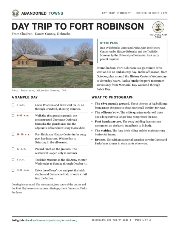
The fort spreads along the north side of US 20. On the 1874 parade ground stand reconstructed log buildings: the Cheyenne Outbreak barracks, the adjutant's office where Crazy Horse died and the guardhouse. A photographer's notes on Wikimedia Commons date the guardhouse to 1967 and the adjutant's office to 1969. Along the officers' row are white frame quarters from 1874 to 1909, now rental cabins, and Comanche Hall, built in 1909 as bachelor officers' quarters. History Nebraska lists the 1904 blacksmith shop, the 1908 veterinary hospital, the 1887 adobe officers' quarters, the 1875 guardhouse and adjutant's office, the old post cemetery and the prisoner-of-war camp site among the places to see.
The History Center, in the 1905 post headquarters, traces the fort from the Red Cloud Agency to the German prisoners. It holds the only known kennel from the World War II K-9 Corps, Buffalo Soldier Caleb Benson's marksmanship medals and Lakota objects from the agency. The Trailside Museum of Natural History is in the former Army theater. The 1955 USGS sheet in the historic maps below labels Fort Robinson just west of Crawford, with the Fort Robinson Beef and Cattle Research Station marked to the east, on the White River and the railroad.
- Officers' quarters, 1874–1909 (cabins)
- 1905 post headquarters (History Center)
- Comanche Hall (1909)
- Veterinary hospital
- Blacksmith shop (1904)
- Brick stables
- Reconstructed log barracks, guardhouse and adjutant's office
- Army theater (Trailside Museum)
- Post cemetery
- Prisoner-of-war camp site


Historic maps
Fort Robinson on USGS maps, 1955
Crops from the USGS Historical Topographic Map Collection, centered on the townsite. Each sheet shows what surveyors mapped that year; compare them with today's topo and aerial on this page.

Day trip
Plan a day trip to Fort Robinson from Chadron
Take it with you
Day trip itinerary
The essentials, the sample day with boxes to tick, what to photograph and the coordinates, on two printable pages. Handy where there's no signal.
Download the PDF (583 KB)From Chadron, Fort Robinson is a 35-minute drive west on US 20 and an easy day. In the off-season, from October, plan around the History Center's Wednesday-to-Saturday hours. Pack a lunch: the park restaurant serves only from Memorial Day weekend through Labor Day.
A sample day
- Leave Chadron and drive west on US 20 through Crawford, about 35 minutes.
- Walk the 1874 parade ground: the reconstructed Cheyenne Outbreak barracks, the guardhouse and the adjutant's office where Crazy Horse died.
- Fort Robinson History Center in the 1905 post headquarters, Wednesday to Saturday in the off-season.
- Packed lunch on the grounds. The restaurant is open only in summer.
- Trailside Museum in the old Army theater, Wednesday to Sunday through October 31.
- Drive the officers' row and past the brick stables and Comanche Hall, or walk a trail into the buttes.
Coming in summer? The restaurant, jeep tours of the buttes and the Post Playhouse are summer offerings; check Game and Parks for dates.
What to photograph and film
- The 1874 parade ground. Shoot the row of log buildings from across the grass to show how small the first fort was.
- The officers' row. The white quarters under old trees line a long curve; a longer lens compresses the row.
- Post headquarters. The 1905 building faces a stone monument on the lawn; stand back to fit both.
- The stables. The long brick riding stables make a strong horizontal frame.
- Drones. Not without a special occasion permit: Game and Parks bans drones in state parks otherwise.
Map & directions
Getting there
Chadron is the nearest city, about 35 minutes east on US 20, and the drive passes through Crawford, the closest town, which Wikipedia puts 2 miles east of the fort and the Trailside Museum 3 miles. From Rapid City, South Dakota, the drive runs south on SD 79 and US 385 to US 20. Both routes end at the fort entrance off US 20.


Base map: USGS The National Map (public domain). Routes: OSRM on © OpenStreetMap contributors data (ODbL), computed October 2026. Times assume dry roads.
- From downtown Chadron, follow West 3rd Street, which becomes Highway 20 (US 20), west out of town.3.1 mi
- Bear left to stay on US 20 (with US 385) southwest.21.0 mi
- Take the ramp into Crawford and continue west on US 20 (McPherson Street) past the town.3.5 mi
- Turn right into the fort.0.2 mi
- From downtown Rapid City, take Saint Joseph Street and Cambell Street south.4.4 mi
- Continue south on SD 79.47.5 mi
- Continue on US Highway 385 (with US 18 at first and SD 79 for a stretch) south into Nebraska.46.7 mi
- Take the ramp and turn right onto US 20 west.21.0 mi
- Take the ramp into Crawford and continue west on US 20 (McPherson Street) past the town.3.5 mi
- Turn right into the fort.0.2 mi
Road and safety notes
- The routes are computed from OpenStreetMap and haven't been driven by us. We have no dated source on road surfaces.
- A Nebraska park entry permit is required to enter the park. Buy one at the park, at Game and Parks offices and permit vendors, or online before you arrive.
- After the June 2026 South Fork Fire, Game and Parks asks hikers and riders to stay on established trails and service roads and to keep away from burned, weakened trees.
- Game and Parks warns that ongoing drought can bring local fire bans. Check its closures and safety advisories page.
- Fort Robinson keeps Mountain Time, an hour behind eastern Nebraska.
Photos
Fort Robinson in photos
Visitor reports
Been to Fort Robinson?
Been there lately? Tell the next visitor what you found: whether you could get in, the state of the road and what's still standing. Photos are welcome. We read every report before it appears here.
Railroad and road
More railroad, road and fort ghost towns
The nearest in Nebraska.

 Guide
Belmont
42.55, -103.36Dawes County, Nebraska
A tunnel camp on the Burlington line south of Crawford that became a small farm town. It peaked at about eighty people in the late 1920s and lost its…
 Guide
Monowi
42.83, -98.33Boyd County, Nebraska
A railroad village platted in 1902 that counted 123 people in 1930 and one in 2010. Elsie Eiler, its only resident, runs the tavern and the library…
Nearby
Other sites near Fort Robinson
Straight-line distance from the townsite to other mapped sites in our Nebraska index.
Sources
Sources and credits
- ghosttowns.com, "Fort Robinson": fact sheet fields (county, climate, best time).
- Wikipedia, "Fort Robinson", retrieved October 2026: the Red Cloud Agency, the naming, the 1874 move, Crazy Horse, the Cheyenne Outbreak, the 9th Cavalry and Charles Young, the remount depot, the K-9 Corps and prisoner camp, the Army's departure and the USDA, the state park and museum in 1956, the 1960 landmark designation, the 1971 transfer and 1972 ranch purchase, acreage, coordinates and elevation.
- Nebraska Game and Parks, "Fort Robinson", read in the browser October 20, 2026: the lodge construction and drought notices, surviving and reconstructed buildings, the 1962 park date, lodging and its season, the restaurant season, jeep tours, trails, the address and the permit rule.
- Nebraska Game and Parks, "Fort Robinson partially reopens after wildfire", June 16, 2026, and "Fort Robinson's expanses reopen to public", July 1, 2026: the South Fork Fire closures and reopenings, the unscathed buildings, and the trail cautions.
- Nebraska Game and Parks, "Park pricing", read October 20, 2026: park entry permit prices. Closures and safety advisories, read October 20, 2026: no Fort Robinson closure listed. Special occasion permits, read October 20, 2026: no drones in state parks without an approved special occasion permit; recreational photography needs no permit.
- History Nebraska, "Fort Robinson History Center", read October 20, 2026: off-season hours, admission, address, exhibits and the list of historic structures.
- University of Nebraska State Museum, Trailside Museum "Visit", read October 20, 2026: hours, end of season, admission, restrooms.
- Photos: Wikimedia Commons, credited below each one; the reconstruction dates come from the photographer's descriptions on the file pages. Elevation: USGS 3D Elevation Program point query. Routes: OSRM on OpenStreetMap data, October 2026. Not field-checked.
Photo and map credits
- Reconstructed buildings on the 1874 parade ground, April 2011: Ammodramus, Wikimedia Commons, CC0
- The 1905 post headquarters, now the History Center, April 2011: Ammodramus, Wikimedia Commons, CC0
- The adjutant's office, a reconstruction, April 2011: Ammodramus, Wikimedia Commons, CC0
- The guardhouse, a reconstruction, April 2011: Ammodramus, Wikimedia Commons, CC0
- Officers' quarters of 1874–75, April 2011: Ammodramus, Wikimedia Commons, CC0
- The row of officers' quarters, April 2011: Ammodramus, Wikimedia Commons, CC0
- Comanche Hall, built in 1909 as bachelor officers' quarters, April 2011: Ammodramus, Wikimedia Commons, CC0
- The veterinary hospital, April 2011: Ammodramus, Wikimedia Commons, CC0
- The Trailside Museum in the former Army theater, November 2011: Ammodramus, Wikimedia Commons, CC0
- The brick riding stables, April 2011: Ammodramus, Wikimedia Commons, CC0
- Non-commissioned officers of the 9th Cavalry, 1889: United States Army, Wikimedia Commons, Public domain
- Area base map, topo and aerial imagery: USGS The National Map (public domain).
- Historic maps: USGS Historical Topographic Map Collection (public domain): Alliance 1955, 1:250,000.