 Abandoned

Overview
Where Oklahoma got its name
Boggy Depot sits near Clear Boggy Creek west of Atoka, in what was the Choctaw Nation. Choctaw and Chickasaw people founded it in 1837, and it served as a depot for Chickasaw and Choctaw people arriving in Indian Territory on removal. Cyrus Kingsbury, the missionary, started a church in 1840, and in 1859 it served as the temporary Choctaw capitol.
The town stood on the Texas Road, the main route through Indian Territory, and in 1858 it became a stop on the Butterfield Overland Mail. In the Civil War it was the Confederates' main supply depot in the territory. Choctaw Chief Allen Wright lived here, and in 1866 he coined the word "Oklahoma" for Indian Territory.
After the war many settlers left, and a new town grew two miles south. In 1872 the Katy railroad ran about 12 miles east, and Atoka took the trade. The post office closed in 1934. Little is left but a few stone foundations and the cemetery, where Wright and Kingsbury are buried. The site became Boggy Depot State Park. In August 2011, as the state closed parks to save money, the Chickasaw Nation agreed to take over running it, and it is now a Chickasaw Nation park.
Timeline
Removal, the stage road and the railroad

- Choctaw and Chickasaw people found the town by Clear Boggy Creek. The site serves as a depot for Chickasaw and Choctaw people arriving in Indian Territory on removal.
- Rev. Cyrus Kingsbury starts a church.
- A post office opens. Sources give 1848 or November 5, 1849.
- The town becomes a stop on the Butterfield Overland Mail. It is already a trading center on the Texas Road.
- Kingsbury's church serves as the temporary capitol of the Choctaw Nation.
- Boggy Depot is the Confederates' main supply depot in Indian Territory.
- Chief Allen Wright, who lives here, coins the word "Oklahoma."
- Oklahoma's first Masonic lodge is founded here.
- The Katy railroad passes about 12 miles east, and Atoka grows on it. The post office moves to New Boggy Depot, two miles south.
- The post office closes.
- The site is listed on the National Register of Historic Places.
- With the state closing parks to save money, the Chickasaw Nation signs an agreement to take over running Boggy Depot State Park.
What's here
A cemetery in a park
The town's buildings are gone. A few stone foundations and the old cemetery remain inside Boggy Depot Park, with the graves of Allen Wright and Cyrus Kingsbury. The park adds a fishing lake, a nature trail, a playground, picnic areas, comfort stations with showers, 35 acres of RV and tent camping, and the 18-hole Lost Loksi disc golf course.
- Boggy Depot cemetery (Allen Wright, Cyrus Kingsbury)
- A few stone foundations
- Fishing lake and nature trail
- Campground and picnic areas
- Lost Loksi disc golf course


Historic maps
Boggy Depot on USGS maps, 1899–1985
Crops from the USGS Historical Topographic Map Collection, centered on the townsite. Each sheet shows what surveyors mapped that year; compare them with today's topo and aerial on this page.
Day trip
Plan a day trip to Boggy Depot from Atoka
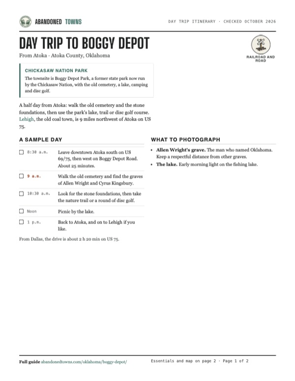
Take it with you
Day trip itinerary
The essentials, the sample day with boxes to tick, what to photograph and the coordinates, on two printable pages. Handy where there's no signal.
Download the PDF (351 KB)A half day from Atoka: walk the old cemetery and the stone foundations, then use the park's lake, trail or disc golf course. Lehigh, the old coal town, is 9 miles northwest of Atoka on US 75.
A sample day
- Leave downtown Atoka south on US 69/75, then west on Boggy Depot Road. About 25 minutes.
- Walk the old cemetery and find the graves of Allen Wright and Cyrus Kingsbury.
- Look for the stone foundations, then take the nature trail or a round of disc golf.
- Picnic by the lake.
- Back to Atoka, and on to Lehigh if you like.
From Dallas, the drive is about 2 h 20 min on US 75.
What to photograph and film
- Allen Wright's grave. The man who named Oklahoma. Keep a respectful distance from other graves.
- The lake. Early morning light on the fishing lake.
Map & directions
Getting there
Boggy Depot Park is west of Atoka, the closest town. From Dallas, take US 75 north toward Atoka and turn off on county roads.


Base map: USGS The National Map (public domain). Routes: OSRM on © OpenStreetMap contributors data (ODbL), computed October 2026. Times assume dry roads.
- From downtown Atoka, head south on South Mississippi Avenue, US 69 and US 75.5.3 mi
- Turn right onto West Boggy Depot Road.8.1 mi
- Turn right onto Park Lane into the park.1.7 mi
- From downtown Dallas, take Young Street and César Chávez Boulevard to the North Central Expressway, US 75.1.9 mi
- Follow US 75 north past Sherman and Durant.108.0 mi
- Continue onto Folsom Road.1.3 mi
- Turn right onto Buckholt Road.4.0 mi
- Turn left onto Voca Road.2.0 mi
- Turn right onto Park Lane into the park.5.7 mi
Road and safety notes
- US 69/75 is paved. We haven't confirmed the surface of the county roads to the park; an undated listing rates the drive 2WD.
- The cemetery is a burial ground with Choctaw and Chickasaw graves. Treat it with respect.
Photos
Have photos of Boggy Depot?
We haven’t added more photographs of Boggy Depot yet. If you’ve visited, share your photos and a field report below.
Visitor reports
Been to Boggy Depot?
Been there lately? Tell the next visitor what you found: whether you could get in, the state of the road and what's still standing. Photos are welcome. We read every report before it appears here.
Railroad and road
More railroad, road and fort ghost towns
The nearest in Oklahoma.

 Guide
Depew
35.80, -96.51Creek County, Oklahoma
A railroad and oil town that Route 66 passed through for less than two years. The highway moved north in 1928, and Depew's Main Street is now a row…
 Guide
Afton
36.70, -94.96Ottawa County, Oklahoma
A railroad town on Route 66 that peaked at 1,518 people in 1920 and lost its traffic to the turnpike in 1957. About 730 people still live here, among…
Nearby
Other sites near Boggy Depot
Straight-line distance from the townsite to other mapped sites in our Oklahoma index.
- Lehigh11.7 mi NE · Coal
- Bromide12.3 mi NW · Johnston
- Cobb17.1 mi S · Bryan
- Chahta Tamaha19.8 mi S · Bryan
- Mount Olive19.9 mi NE · Atoka
- Hatsboro20.2 mi SW · Bryan
- Redden29.7 mi NE · Atoka
- Zoraya31.0 mi E · Pushmataha
Sources
Sources and credits
- Wikipedia, "Boggy Depot, Oklahoma", retrieved October 2026: founding, Kingsbury, post office dates, Butterfield, Civil War, Allen Wright, Masonic lodge, railroad, New Boggy Depot, closing, remains, National Register, park history, coordinates.
- Chickasaw Country, "Boggy Depot Park", as of October 2026: management by the Chickasaw Nation, hours, address, phone, facilities, removal depot, Allen Wright's grave.
- Indianz.com, August 17, 2011, quoting the Tulsa World: the agreement for the Chickasaw Nation to run the park as the state closed parks.
- Chickasaw Nation, "Boggy Depot Park", updated January 2025: address and phone.
- ghosttowns.com, "Boggy Depot": fact-sheet fields (road, best time, 1849 post office).
- Elevation: USGS 3D Elevation Program point query. Routes: OSRM on OpenStreetMap data, October 2026. Status checked against the sources above on October 19, 2026.
Photo and map credits
- The 1899 Atoka sheet marks Old Boggy Depot by Sandy Creek and the newer Boggy Depot to the south: U.S. Geological Survey, USGS catalog, Public domain
- Area base map, topo and aerial imagery: USGS The National Map (public domain).
- Historic maps: USGS Historical Topographic Map Collection (public domain): Atoka 1899, 1:125,000; Atoka 1900, 1:125,000; Ardmore 1957, 1:250,000; Boggy Depot 1969, 1:24,000; Tishomingo 1985, 1:100,000.