 Abandoned

Overview
Bypassed in 1928

Depew sits on Route 66 between Bristow and Stroud in western Creek County, in what was the Creek Nation. The railroad came through in 1898 and a settlement called Hall grew beside it. In 1901 Walter F. Malley founded a town on the spot and named it for Chauncey M. Depew, a U.S. senator from New York. It was a farm town until oil was found nearby in 1911. By the mid-1920s, Legends of America says, it had two banks, four hotels, two theaters and three filling stations.
The town paved its business district in 1925, and when US 66 was numbered in 1926 the highway looped through it: in on Flynn Avenue, along Main Street and out on Ladd Avenue. The loop didn't last. By the fall of 1928 the highway had been moved to a straighter road just north of town. Route 66 News, citing a state highway historian, calls it probably the first time in Oklahoma that Route 66 bypassed a whole town. A town clerk told a researcher the bypass "about killed the town."
The census counted 1,126 people in 1930, the peak. The Depression and the end of the oil boom followed, and the town shrank to 411 by 2020. Depew isn't empty. It still has its schools, and most working residents commute to Bristow or Sapulpa. But its Main Street, still on the old concrete, is lined with closed brick storefronts, and that is why Route 66 travelers stop.
Video
A summer drive down Main Street
A three-minute dashcam drive, filmed on July 31, 2024 by the creator's description, with no narration. The car comes in westbound on the old road, crosses the railroad, winds through the residential blocks and turns onto Main Street, where pickups are parked in front of the brick storefronts and flags hang from the awnings. It closes with still shots of a "Memories On The Mother Road" sign marking the 1926 alignment on Main Street, a Route 66 mural, and the old filling station with its canopy. Filmed in July 2024; shops and parking may look different now.
 Play “Oklahoma Route 66 - Dashcam - Depew” from YouTube
Timeline
Railroad, oil and a short-lived highway
- The St. Louis and Oklahoma City Railroad builds through the Creek Nation, and a settlement called Hall grows by the tracks.
- Walter F. Malley founds the town and names it for Senator Chauncey M. Depew of New York. The Encyclopedia of Oklahoma History gives April 12 for the post office; Legends of America gives May 17.
- The Depew Investment Company plats the town and sells lots.
- About 150 people, a bank, a newspaper, a cotton gin and three general stores. A school is built.
- Oil is found nearby. By 1915 a railroad runs from Depew to the oil town of Shamrock.
- The town paves its business district.
- US 66 is routed through downtown in a U-shaped loop: south on Flynn Avenue, west on Main Street and back north on Ladd Avenue.
- The highway is moved north of town. Route 66 News and an Oklahoma transportation historian call it probably the first time Route 66 bypassed a whole town in Oklahoma.
- Peak census count: 1,126 people.
- The Depression and the fading oil boom take their toll. The population falls to 876 in 1940 and 686 in 1960.
- Spangler's Grocery closes.
- The Coppedge Drug Store building on Main Street is torn down.
- The census counts 411 people.
What's here
Three blocks of Main Street


Main Street runs three blocks between Flynn and Ladd avenues, lined with red brick commercial buildings. Most stood empty in 2017 photos, their windows dark behind iron-posted awnings. Legends of America says the street still carries its original 1920s Route 66 concrete. A commenter on Route 66 News added that the loop was paved between 1925 and 1927, so the pavement may predate the highway.
At Malley and Main is the town's oldest filling station, a stucco building with a gabled canopy on four tapered columns and "Drive In" over a service-bay door. Its pumps are gone. TheRoute-66.com found it missing from the 1915 fire insurance map and dates it to about 1920; a 2002 state survey calls it Hick's Service Station and Garage and says it predates Route 66. Other sources call it the Gimmel station. The 1920 Coppedge Drug Store, once the street's best-known building, is gone: TheRoute-66.com found it standing in 2013 and razed by 2019. The old bank building on the facing corner is used by the town as its police station, by the same account.
East of town, the concrete abutments of the first Little Deep Fork Creek bridge, used only from 1926 to 1928, stand beside the creek. West of town, stretches of the 1926–1984 roadbed run beside today's OK 66, and a half-mile section east of Milfay Road was added to the National Register in 2014.
- Brick storefronts on Main Street
- 1920s filling station at Malley and Main
- Former bank building
- 1920s Route 66 pavement on the downtown loop
- 1926–1928 bridge abutments on Little Deep Fork Creek
The historic maps below follow the highway. On the 1931 sheet, Route 66 already runs northwest of the town grid, on the 1928 bypass. The 1954 and 1963 sheets add the Turner Turnpike to the north, and the 1990 sheet shows Depew's grid just south of the highway and the turnpike.


Historic maps
Depew on USGS maps, 1931–1990
Crops from the USGS Historical Topographic Map Collection, centered on the townsite. Each sheet shows what surveyors mapped that year; compare them with today's topo and aerial on this page.

Day trip
Plan a day trip to Depew from Bristow
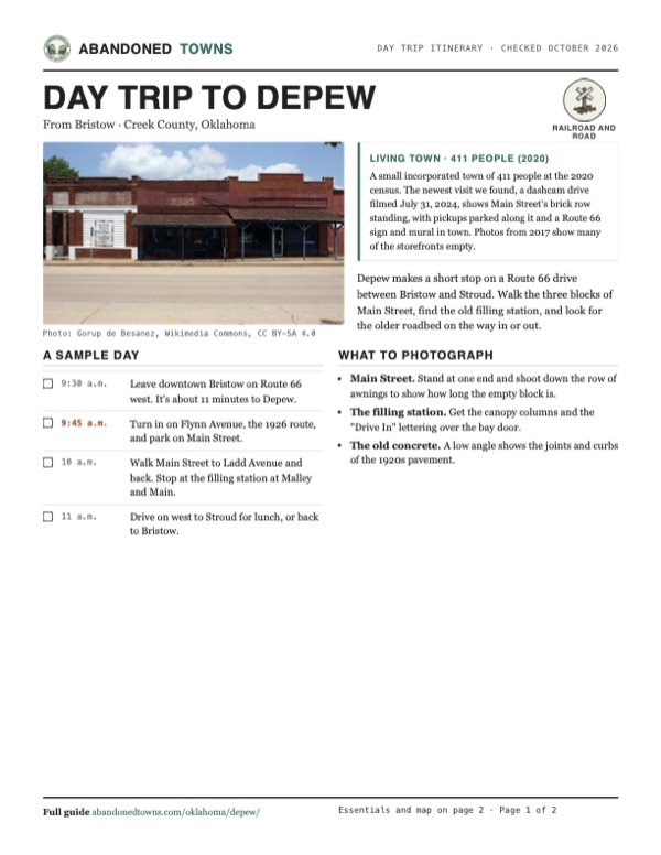
Take it with you
Day trip itinerary
The essentials, the sample day with boxes to tick, what to photograph and the coordinates, on two printable pages. Handy where there's no signal.
Download the PDF (438 KB)Depew makes a short stop on a Route 66 drive between Bristow and Stroud. Walk the three blocks of Main Street, find the old filling station, and look for the older roadbed on the way in or out.
A sample day
- Leave downtown Bristow on Route 66 west. It's about 11 minutes to Depew.
- Turn in on Flynn Avenue, the 1926 route, and park on Main Street.
- Walk Main Street to Ladd Avenue and back. Stop at the filling station at Malley and Main.
- Drive on west to Stroud for lunch, or back to Bristow.
What to photograph and film
- Main Street. Stand at one end and shoot down the row of awnings to show how long the empty block is.
- The filling station. Get the canopy columns and the "Drive In" lettering over the bay door.
- The old concrete. A low angle shows the joints and curbs of the 1920s pavement.
Map & directions
Getting there
Depew is on Route 66 (OK 66), about 11 minutes west of Bristow. From Tulsa it's about 50 minutes by the Turner Turnpike, then the old highway. Both routes leave Route 66 at Flynn Avenue and end on Main Street.

Base map: USGS The National Map (public domain). Routes: OSRM on © OpenStreetMap contributors data (ODbL), computed October 2026. Times assume dry roads.
- From downtown Bristow, turn left onto West 4th Avenue, Route 66.0.5 mi
- Continue west on Route 66 (OK 66), which becomes South Roland Street.5.7 mi
- Continue west on Route 66.0.8 mi
- Turn left onto Flynn Avenue.0.2 mi
- Turn right onto Main Street.0.2 mi
- From downtown Tulsa, take Boulder Avenue, 3rd, 6th and 7th streets to I-244.1.2 mi
- Follow I-244 west.4.9 mi
- Merge onto I-44 and OK 66, the Skelly Bypass.0.7 mi
- Continue on the Turner Turnpike, I-44.25.1 mi
- Take exit 196.0.6 mi
- Turn left onto Route 66, then right on West 12th Avenue, left on North Elm Street and right on West 4th Avenue in Bristow.1.6 mi
- Continue west on Route 66 (OK 66), which becomes South Roland Street.5.7 mi
- Continue west on Route 66.0.8 mi
- Turn left onto Flynn Avenue, then right onto Main Street.0.4 mi
Road and safety notes
- Both routes follow Route 66, signed as state highway OK 66 here, and Main Street keeps its 1920s concrete, per Legends of America.
- People live in Depew. Look at the empty buildings from the street and sidewalk, and don't go inside.
Photos
Depew in photos
Visitor reports
Been to Depew?
Been there lately? Tell the next visitor what you found: whether you could get in, the state of the road and what's still standing. Photos are welcome. We read every report before it appears here.
Railroad and road
More railroad, road and fort ghost towns
The nearest in Oklahoma.

 Guide
Boggy Depot
34.32, -96.31Atoka County, Oklahoma
A Choctaw and Chickasaw town on the Texas Road, a Butterfield stage stop and a Confederate supply depot. The railroad missed it in 1872. Its…
 Guide
Afton
36.70, -94.96Ottawa County, Oklahoma
A railroad town on Route 66 that peaked at 1,518 people in 1920 and lost its traffic to the turnpike in 1957. About 730 people still live here, among…
Nearby
Other sites near Depew
Straight-line distance from the townsite to other mapped sites in our Oklahoma index.
Sources
Sources and credits
- Linda D. Wilson, "Depew," Encyclopedia of Oklahoma History and Culture (updated March 1, 2024): Hall, the 1898 railroad, the founding and post office date, the 1905 plat, 1909 businesses, oil in 1911, the Shamrock line, populations 1930–2020, commuting.
- Wikipedia, "Depew, Oklahoma", retrieved October 2026: Hall, the name, the 2020 census, coordinates (GNIS).
- Kathy Alexander, "Depew, Oklahoma – Boom to Bust Town," Legends of America (updated April 2026): the May 17, 1901 post office date, the mid-1920s businesses, the 1920s Route 66 concrete, the decline, Spangler's Grocery closing the year after a 2011 visit.
- TheRoute-66.com, "Depew" (read October 2026): the 1925 paving and the Flynn–Main–Ladd loop, the 1928 move, the Little Deep Fork Creek bridge abutments, the filling station's date and the 2002 state survey, the Coppedge Drug Store's demolition, the bank building, the service station at the west entrance.
- Ron Warnick, "Was Depew the first Route 66 town to be bypassed?", Route 66 News, July 1, 2012: the downtown loop, the bypass finished by September or October 1928, the state historian's view, the town clerk's quote, the grocery closing; a reader comment on the 1925–1927 paving.
- Route 66 News, "Half-mile section of original Route 66 added to National Register", September 21, 2014: the section east of Milfay Road, used as Route 66 from 1926 to 1984.
- ghosttowns.com, "Depew": fact-sheet cross-check (climate, best time, remains).
- Historic 66 Dashcam, "Oklahoma Route 66 - Dashcam - Depew", YouTube, posted January 25, 2025, filmed July 31, 2024 per its description: the drive through town, Main Street's buildings and parked cars, the 1926 alignment sign, the mural and the filling station (the video on this page).
- Commons file pages for each photo: dates and places taken. Elevation: USGS 3D Elevation Program point query. Routes: OSRM on OpenStreetMap data, October 2026.
Photo and map credits
- Brick storefronts on Main Street, 2017: Gorup de Besanez, Wikimedia Commons, CC BY-SA 4.0
- The corner of the storefront row, 2017: Gorup de Besanez, Wikimedia Commons, CC BY-SA 4.0
- The Route 66 sign and the shaded sidewalk, 2017: Gorup de Besanez, Wikimedia Commons, CC BY-SA 4.0
- Benches and empty windows under an awning, 2017: Gorup de Besanez, Wikimedia Commons, CC BY-SA 4.0
- The painted Route 66 shield and town name, 2017: Gorup de Besanez, Wikimedia Commons, CC BY-SA 4.0
- Area base map, topo and aerial imagery: USGS The National Map (public domain).
- Historic maps: USGS Historical Topographic Map Collection (public domain): Drumright 1931, 1:62,500; Oklahoma City 1954, 1:250,000; Oklahoma City 1963, 1:250,000; Bristow 1990, 1:100,000.