 Abandoned

Overview
Twenty thousand people in a year, and 237 five years later

Pithole stood on a bluff above Pithole Creek, about eight miles from Titusville. Its boom came six years after Edwin Drake drilled the Drake Well there. The Frazier Well struck on January 7, 1865. By May two speculators had bought the Holmden farm and laid out 500 lots on the cleared hilltop, and by September the muddy streets held something like 15,000 people, 54 hotels, three churches, a daily newspaper, a 1,100-seat theater and a post office that, by Wikipedia's account, was the third busiest in Pennsylvania.
Pithole's lasting mark on the oil business was made by the men who hated its teamsters. Samuel Van Syckel laid a two-inch iron pipe 5.5 miles to the railroad in October 1865 (the museum history instead says fall 1866), the first successful long-distance oil pipeline in the region, and the railroad tank car was worked out here too. The town itself didn't last. Culver's banks failed in March 1866, fires took blocks of Holmden Street and 27 wells that year, and new strikes elsewhere in the county drew the crowd away. Buildings were hauled off whole to Pleasantville. The 1870 census found 237 people, and in 1879 the county took the site back for $4.37.
James B. Stevenson, the Titusville newspaper publisher, bought the land in 1957, cleared it and gave it to the state. Today the Pennsylvania Historical and Museum Commission runs Pithole through the Drake Well Museum. The old streets are mowed into the grass, 50 signs explain what stood where, and a visitor center with a scale model of the city opens on summer weekends.
Timeline
From the Frazier Well to $4.37

- The United States Well, better known as the Frazier Well, strikes oil on Thomas Holmden's farm on Pithole Creek. A Library of Congress caption instead dates the strike to January 8 and says it flowed 800 barrels a day.
- A. P. Duncan and George C. Prather buy the Holmden farm for $25,000 and a $75,000 bonus, clear the bluff above the wells and lay out 500 lots. Sales open May 24.
- The Pithole Daily Record starts on September 5 and the 1,100-seat Murphy's Theater opens on September 17. The population is about 15,000.
- Peak production: the ExplorePAHistory marker essay puts it at 6,000 to 8,000 barrels a day. Samuel Van Syckel's two-inch pipeline, an early successful oil-transport line, opens on October 9 and carries oil 5.5 miles to the Oil Creek Railroad. The Drake Well Museum dates the pipeline to fall 1866.
- Pithole is incorporated as a borough. Wikipedia puts the population at about 20,000 by Christmas; the state markers say 15,000.
- The Oil City and Pithole Branch Railroad opens.
- Charles Vernon Culver's chain of banks collapses, setting off a financial panic across the oil region.
- Fires on February 24 and August 2 burn much of Holmden Street and 27 wells. By December fewer than 2,000 people are left.
- Oil strikes elsewhere in Venango County pull people away. Houses and businesses are carted off; the Chase House and Murphy's Theater go to Pleasantville, and the newspaper moves to Petroleum Center in July 1868.
- The census counts 237 people. The Drake Well Museum says 43 households and one hotel remained that fall.
- The borough charter is annulled. Wikipedia says August; the Drake Well Museum says February.
- What's left of the city is sold back to Venango County for $4.37.
- The Catholic church is taken apart and moved to Tionesta in 1886. The Methodist church is kept up by donations until it comes down in the 1930s.
- The Methodist Episcopal Church consecrates a stone altar on the church site, on the centennial of the Drake Well strike.
- James B. Stevenson, publisher of the Titusville Herald, buys the site in 1957, clears the brush and gives it to the state. Wikipedia dates the gift to 1961 and gives 84.3 acres; the museum says 1963 and 90 acres.
- A visitor center goes up (1972 per Wikipedia, opened 1975 per the museum). The site joins the National Register of Historic Places on March 20, 1973.
- Friends of Drake Well replace the outdoor signage with 50 new interpretive signs, finished in spring 2026.
What's left
Streets in the grass


Nothing of the boomtown stands. The streets survive as mowed lanes through the grass, with foundations here and there, and a carriage stone that the Commons file page calls the only original structure remaining. On the Methodist church site is the stone altar of 1959. The visitor center on the hilltop holds a diorama of the city at its height, with more than 200 miniature buildings and about 500 figures, a 15-minute film and an oil wagon stuck in mud. Outside, 50 new interpretive signs, finished in spring 2026, can be read any day for free.
The old USGS sheets track the change. The 1927 and 1933 maps show only a Pithole School, a pipeline and a scatter of buildings on Pithole Creek. The 1967 map marks Pithole City with a dashed grid of the old streets and a roadside park, and the 1983 sheet labels the Pithole City Historical Site.
- Mowed street grid
- Foundations
- Carriage stone
- Stone altar (1959)
- Visitor center and diorama
- 50 interpretive signs


Historic maps
Pithole on USGS maps, 1927–1983
Crops from the USGS Historical Topographic Map Collection, centered on the townsite. Each sheet shows what surveyors mapped that year; compare them with today's topo and aerial on this page.

Day trip
Plan a day trip to Pithole from Titusville
Take it with you
Day trip itinerary
The essentials, the sample day with boxes to tick, what to photograph and the coordinates, on two printable pages. Handy where there's no signal.
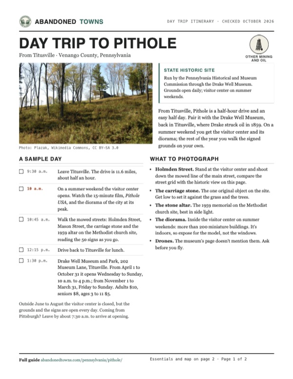
Download the PDF (681 KB)From Titusville, Pithole is a half-hour drive and an easy half day. Pair it with the Drake Well Museum, back in Titusville, where Drake struck oil in 1859. On a summer weekend you get the visitor center and its diorama; the rest of the year you walk the signed grounds on your own.
A sample day
- Leave Titusville. The drive is 11.6 miles, about half an hour.
- On a summer weekend the visitor center opens. Watch the 15-minute film, Pithole USA, and the diorama of the city at its peak.
- Walk the mowed streets: Holmden Street, Mason Street, the carriage stone and the 1959 altar on the Methodist church site, reading the 50 signs as you go.
- Drive back to Titusville for lunch.
- Drake Well Museum and Park, 202 Museum Lane, Titusville. From April 1 to October 31 it opens Wednesday to Sunday, 10 a.m. to 4 p.m.; from November 1 to March 31, Friday to Sunday. Adults $10, seniors $8, ages 3 to 11 $5.
Outside June to August the visitor center is closed, but the grounds and the signs are open every day. Coming from Pittsburgh? Leave by about 7:30 a.m. to arrive at opening.
What to photograph and film
- Holmden Street. Stand at the visitor center and shoot down the mowed line of the main street, compare the street grid with the historic view on this page.
- The carriage stone. The one original object on the site. Get low to set it against the grass and the trees.
- The stone altar. The 1959 memorial on the Methodist church site, best in side light.
- The diorama. Inside the visitor center on summer weekends: more than 200 miniature buildings. It's indoors, so expose for the model, not the windows.
- Drones. The museum's page doesn't mention them. Ask before you fly.
Map & directions
Getting there
The mapped town point is at the visitor center; the operator also gives 41.520662, -79.586201, a different point on the approach. Use the official address and signs. Titusville is the closest city, about half an hour away. From Pittsburgh the drive runs up I-79 and PA 8 through Franklin and Oil City, then out PA 227. The museum's own directions bring you in on Pithole Road just off PA 227, which is the way the Pittsburgh route arrives; the routed Titusville approach cuts across on township roads.


Base map: USGS The National Map (public domain). Routes: OSRM on © OpenStreetMap contributors data (ODbL), computed October 2026. Times assume dry roads.
- From West Central Avenue, use South Washington Street and West Spring Street, then follow Diamond Street and East Central Avenue (PA 27) east out of town.2.5 mi
- Continue on Titusville Road (PA 27), then turn right on Jerusalem Corners Road, which becomes Rouseville Road (PA 227).6.6 mi
- Bear left onto T599, then turn left on the unnamed road beyond it.0.8 mi
- Turn right on Plank Road, then bear left onto Pithole Road to the site.1.7 mi
- From Bigelow Square, take Bigelow Boulevard and the ramp to I-579 over the Veterans Bridge, then I-279, the Parkway North.13.2 mi
- Merge onto I-79 north.44.5 mi
- Exit onto I-80 east (Z. H. Confair Memorial Highway), then exit onto PA 8 north, Pittsburgh Road.11.2 mi
- Follow PA 8 north through Franklin: Richard Frame Memorial Highway, Pittsburgh Road and 15th Street, then Eagle, Elm, 11th and Liberty streets to Allegheny Boulevard (US 62 / PA 8).15.7 mi
- Stay on PA 8 through Oil City: Allegheny Boulevard, Main Street, William Flinn Highway and Seneca Street.10.9 mi
- Turn right on Cherry Run Road, which becomes Rouseville Road (PA 227).5.5 mi
- Turn right on Pithole Road to the site.2.2 mi
Road and safety notes
- The routes are computed from OpenStreetMap and haven't been driven by us. We have no dated source on road surfaces.
- The Drake Well Museum's directions use Pithole Road off PA 227, and say the site can also be reached from PA 36 north of Tionesta. The routed Titusville approach uses T599, an unnamed road and Plank Road instead, which we haven't checked.
- The grounds are not easily accessible for wheelchairs because of the terrain. A six-person golf cart is available for outside tours when the visitor center is open.
- The visitor center is closed from September to May. The grounds and the outdoor signs stay open dawn to dusk.
Photos
Pithole in photos
Visitor reports
Been to Pithole?
Been there lately? Tell the next visitor what you found: whether you could get in, the state of the road and what's still standing. Photos are welcome. We read every report before it appears here.
Other mining and oil
More lead, iron, mercury and oil ghost towns
The nearest in Pennsylvania, then the nearest elsewhere.

 Guide
Scotia
40.80, -77.95Centre County, Pennsylvania
Andrew Carnegie built this iron-ore town in the pine barrens in 1880 and sold it in 1899. The mines closed in 1911. The remains lie on public game…
 Guide
Long Pond Ironworks
41.14, -74.31Passaic County, New Jersey
Iron from this furnace went to the Continental Army, the War of 1812 and the Union. The works shut in 1882 and the village of Hewitt faded after it.…
Nearby
Other sites near Pithole
Straight-line distance from the townsite to other mapped sites in our Pennsylvania index.
Sources
Sources and credits
- Pennsylvania Heritage, interview with James B. Stevenson (1984): earlier well-to-tank pipelines existed; Van Syckel developed the successful longer transport line to the railway.
- Wikipedia, "Pithole, Pennsylvania", retrieved October 2026: coordinates and GNIS elevation, the Frazier Well, the Holmden farm sale and 500 lots, population figures, hotels, churches, post office, newspaper, theater, the pipeline and tank car, the Culver panic, the 1866 fires, the 1870 census, the charter, the $4.37 sale, the churches' fates, Stevenson, 84.3 acres, 1961, 1972, 1973, climate.
- Drake Well Museum and Park, "Historic Pithole City", read October 20, 2026: season, days and hours, admission, address, phone, GPS, directions, accessibility, the film and diorama, 90 acres given in 1963, the 1975 opening, its history summary (15,000 people, 17 fires, 43 households in 1870, charter revoked February 1877) and events.
- Drake Well Museum and Park, "Hours and Prices", read October 20, 2026: Pithole and Drake Well Museum hours, museum admission and address.
- exploreClarion, June 4, 2026, submitted by Friends of Drake Well: the 2026 dates (June 6 to August 30), admission, the 50 signs and their 2023 and 2026 installation.
- ExplorePAHistory, "Pithole Historical Marker" (dedicated December 1973) and "Pithole City Historical Marker" (dedicated July 26, 1986): marker texts, the 15,000 figure, peak production of 6,000 to 8,000 barrels, weekly fires, the February 1867 fire, the newspaper's end in July 1868.
- Wikimedia Commons, the carriage stone file page: "the only original structure remaining in Pithole." The United States Well file page: the Library of Congress caption of 800 barrels a day.
- Elevation: USGS 3D Elevation Program point query. Routes: OSRM on OpenStreetMap data, October 2026. Not field-checked.
Photo and map credits
- The weedy hillside below the visitor center, October 2009: Plazak, Wikimedia Commons, CC BY-SA 3.0
- Stereograph of the United States Well: tanks, derricks and wagons: Frank Robbins, Wikimedia Commons, Public domain
- Derricks and sheds in the fall of 1865, from a 1902 book: McLaurin, John J. (John James), b. 1841, Wikimedia Commons, Public domain
- The visitor center, July 2013: Niagara, Wikimedia Commons, CC BY-SA 3.0
- Mason Street, a mowed lane down to the trees, July 2013: Niagara, Wikimedia Commons, CC BY-SA 3.0
- The two-step carriage stone in the grass, July 2013: Niagara, Wikimedia Commons, CC BY-SA 3.0
- The Methodist church site, with the 1959 stone altar at right, 2009: David Jones, Wikimedia Commons, CC BY 2.0
- The Presbyterian church site and its marker post, 2009: David Jones, Wikimedia Commons, CC BY 2.0
- Area base map, topo and aerial imagery: USGS The National Map (public domain).
- Historic maps: USGS Historical Topographic Map Collection (public domain): Titusville 1927, 1:62,500; Titusville 1933, 1:62,500; Warren 1957, 1:250,000; Pleasantville 1967, 1:24,000; Warren 1983, 1:100,000.