 Abandoned

Overview
The ghost town a dance hall kept alive

Gruene sits on the Guadalupe River about three miles north of the old center of New Braunfels, and inside the city limits since 1979. Ernst Gruene came to New Braunfels with the German immigrants of 1845 or 1846 and found little land to be had in town. His son Henry D. Gruene built a cotton town on the family's land north of the river for the families who sharecropped it: a store in 1878, a dance hall and saloon the same year, a river-powered gin and, in 1904, a brick mercantile. He gave land for a school. Two railroads ran depots, and by 1900 the town was the banking, ginning and shipping center for the area's cotton.
Henry died in 1920. The original gin burned in 1922, the boll weevil took the cotton in the 1920s, and the store and depots closed in the Depression. The population was down to 75 by 1930. Postwar highways bypassed the place, and by 1950, in the Handbook of Texas's words, it was a ghost town. Gruene Hall never quite closed: by 1975, Texas Monthly reported, it was boarded up and dusty, but a couple still leased it and a few locals drank beer around the bar and a potbellied stove.
In 1974 Chip Kaufman, an architecture student and kayaker, glimpsed the old water tower from the river and went to look. He bought the gin ruins, got the town onto the National Register in 1975, then ran out of money. Pat Molak, a former stockbroker from San Antonio, bought the dance hall that year and, with his partner Mary Jane Nalley, restored one building after another. Today the district covers 15 acres by its own count (Texas Monthly said about 20 in 1996; Wikipedia gives 25), and its old buildings hold shops, restaurants, inns and the hall, which bills itself as Texas's oldest continually operating dance hall.
Then and now
Gruene from the air, 1983 and 2022
On February 28, 1983, the federal National High Altitude Photography program photographed Gruene on color infrared film, which shows plants in red. Pat Molak had bought Gruene Hall in 1975, and Gruene had been inside the New Braunfels city limits since 1979, but open fields still reached the old town on the east, and streets of houses stood to the north. The second photograph comes from the federal farm survey of June 8, 2022.
The river, Hunter Road and Old FM 306 are where they were. Houses, apartments and larger buildings cover much of the farmland east of town, and the old buildings by the river hold the historic district's shops, restaurants and dance hall.


1983: U.S. Geological Survey NHAP, via the Texas Geographic Information Office, source, Public domain. 2022: U.S. Department of Agriculture NAIP, via USGS The National Map, source, Public domain. Both photographs cover the same 1.6 by 1.2 km and were lined up on 24 ground features that survive, mostly in and around the old town, to within about 2 m, and checked by eye on the river and roads. Labels: the river, Hunter Road, Old FM 306 and Gruene from today's USGS topo (the guide's 1992 USGS sheet shows the same road as FM 306), the 1975 listing from this guide's sources, the fields and houses from what the photographs show.
Timeline
Cotton, weevils and a kayaker

- Ernst Gruene and his family reach New Braunfels with other German immigrants. Wikipedia and the district's history give 1845, Texas Monthly 1846. Land in town is scarce, so the family looks to the farmland along the Guadalupe. The Handbook of Texas says German farmers settled the area, then called the Goodwin community, in the 1850s.
- Henry D. Gruene, Ernst's son, is born in New Braunfels.
- The Gruene family buys 6,000 acres north of the Guadalupe, per the Handbook of Texas. Henry builds his Victorian house, now the Gruene Mansion Inn, "in what was then the town of Goodwin," as its state marker puts it. The district's slogan dates itself to this year.
- Henry opens a mercantile store for the several dozen families sharecropping cotton on his land. The store sits on the stage route between Austin and San Antonio. Gruene Hall, the dance hall and saloon, opens the same year, and a cotton gin powered by the river follows. Texas Monthly's 1996 account instead puts a gin, a sawmill and a gristmill before the 1878 hall.
- The International-Great Northern Railroad crosses Comal County in the 1880s. By the 1910s the community has two freight rail stations; the Handbook names passenger and freight depots on both the International-Great Northern and the Missouri, Kansas and Texas. By 1900 Gruene is the banking, ginning and shipping center for the area's cotton growers.
- The town takes the name Gruene in 1903, by the state marker. A new brick mercantile goes up in 1904 and stays the community's business and social center until 1938. Its marker says Henry's 1878 business stood on the same site; the district's history says the 1878 store is the building now called the Gruene General Store, across Hunter Road.
- By a family account quoted in Texas Monthly, a crowd gathers for the town's first sight of an airplane. The day ends with a Bowie-knife fight that Henry breaks up with a warning shot.
- Henry D. Gruene dies. The district's history calls his death the start of the town's downfall.
- The original cotton gin burns. An electric gin replaces it down the road; Texas Monthly dates that building to 1923.
- The boll weevil wipes out the cotton; the 1988 state marker dates the infestation to 1925. The store and the rail depots close in the Depression. By 1930 the population is down to 75.
- Postwar highways bypass the town. By 1950 its people have scattered, "leaving the once thriving community a ghost town," in the Handbook's words.
- Chip Kaufman, a University of Texas architecture student and kayaker, glimpses the old water tower from the Guadalupe and starts the work that puts much of the town on the National Register of Historic Places on April 21, 1975. Pat Molak buys Gruene Hall in 1975 and, with Mary Jane Nalley, restores other buildings.
- The Gristmill restaurant opens in the brick ruins of the old cotton gin.
- New Braunfels annexes Gruene.
- The first Gruene Music & Wine Fest raises $450 for the United Way of Comal County.
- KSAT reports in January that Molak Corporation, owner of Gruene Hall and the Gristmill, is building a lot of about 10 acres with more than 800 spaces. The district's site now reports it open.
What's here
The old buildings and what they hold now


The cotton town's buildings are nearly all in use. Gruene Hall, built in 1878, is a one-story wooden hall with a false front on Gruene Road. Just behind it, the Gristmill restaurant has occupied the brick ruins of the old cotton gin since 1977. The 1878 store is the Gruene General Store on Hunter Road, and the red-brick mercantile of 1904, which Texas Monthly says once housed a saddletree factory, is the H.D. Gruene Mercantile. Henry's 1872 home is the Gruene Mansion Inn. A Victorian cottage he built is now a shop called The Pomegranate, the frame house he built for his farm foreman is the Gruene Haus, and the electric gin that replaced the burned one is now Adobe Verde. The water tower that caught Kaufman's eye still stands over the hall.
The 1925 USGS sheet in the historic maps below shows how the town worked: Gruene on the river, Gruene Station on the San Antonio branch of the Missouri, Kansas and Texas just north of it, Thornhill School beside the station, and Goodwin to the east on the International and Great Northern. The 1992 sheet marks the water tank by the town and shows New Braunfels spread north, with Loop 337 between the city and the town.
- Gruene Hall (1878)
- Gruene General Store (1878)
- H.D. Gruene Mercantile (1904)
- Gruene family home (1872), now the Gruene Mansion Inn
- Cotton gin ruins, now the Gristmill
- Electric gin, now Adobe Verde
- Water tower
- Foreman's house, now the Gruene Haus
- Victorian cottage, now The Pomegranate


Story and record
What the family says, and what the records say
Some of Gruene's color comes from the family and from Pat Molak, as told to Texas Monthly in 1996. The 1911 airplane day, the Bowie-knife fight and Henry's warning shot are a descendant's story, not a record. The same article says the town's last official "is said to have hanged himself from the water tower in the twenties." We haven't found any record of that, so treat it as lore.
The record is clear on the big things: a National Register listing in 1975, annexation in 1979, and a Handbook of Texas entry that calls the place a ghost town by 1950.
Sources differ on smaller ones. Wikipedia says Gruene never had its own post office; the Handbook says it was served by the Goodwin post office, and the state marker on the 1904 mercantile says the post office name changed from Goodwin to Gruene the year before the building went up. Wikipedia's infobox credits a Christian Herry with building the district in 1850, and a Library of Congress caption says Herry built Gruene Hall in 1878, but neither source says who he was.
Historic maps
Gruene on USGS maps, 1925–1992
Crops from the USGS Historical Topographic Map Collection, centered on the townsite. Each sheet shows what surveyors mapped that year; compare them with today's topo and aerial on this page.

Day trip
Plan a day trip to Gruene from New Braunfels
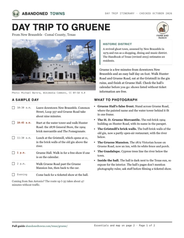
Take it with you
Day trip itinerary
The essentials, the sample day with boxes to tick, what to photograph and the coordinates, on two printable pages. Handy where there's no signal.
Download the PDF (483 KB)Gruene is a few minutes from downtown New Braunfels and an easy half day on foot. Walk Hunter Road and Gruene Road, eat at the Gristmill in the gin ruins, and finish at Gruene Hall. Check the hall's calendar before you go: shows listed without ticket information are free.
A sample day
- Leave downtown New Braunfels. Common Street, Loop 337 and Gruene Road take about nine minutes.
- Start at the water tower and walk Hunter Road: the 1878 General Store, the 1904 brick mercantile and The Pomegranate.
- Lunch at the Gristmill, which opens at 11, in the brick walls of the old gin above the river.
- Gruene Hall. Walk in for a free show if one is on the calendar.
- Walk Gruene Road past the Gruene Mansion Inn, then back to the car.
- Come back for a ticketed show at the hall.
Coming from San Antonio? The route up I-35 takes about 47 minutes without traffic.
What to photograph and film
- Gruene Hall's false front. Stand across Gruene Road, where the painted name and the water tower behind it fit in one frame.
- The H. D. Gruene Mercantile. The red-brick 1904 building on Hunter Road, with its name in the parapet.
- The Gristmill's brick walls. The buff-brick walls of the old gin, now a partly open-air restaurant, with the river below.
- The Gruene Mansion. The 1872 Victorian house on Gruene Road, now an inn, with its white fence and porch.
- The Guadalupe. Cypress trees line the river below the town.
- Inside the hall. The hall is dark next to the Texas sun, so expose for the interior. The hall's pages don't mention photography rules; ask staff before filming a ticketed show.
Map & directions
Getting there
Gruene is inside New Braunfels, about nine minutes from downtown. From San Antonio the route runs up I-35, then Loop 337. Both routes end on Gruene Road, which crosses the Guadalupe into the district.


Base map: USGS The National Map (public domain). Routes: OSRM on © OpenStreetMap contributors data (ODbL), computed October 2026. Times assume dry roads.
- From South Seguin Avenue at the Main Plaza, go around the plaza onto East San Antonio Street, then left on South Union Avenue.0.7 mi
- Turn right on Common Street.1.2 mi
- Turn left on Loop 337 (TX 46), then right on Rivercrest Drive.0.4 mi
- Turn left on Gruene Road, which crosses the Guadalupe into the district.1.0 mi
- From Dolorosa Street, take Market Street and Commerce Street to I-37/US 281 north.1.9 mi
- Merge onto I-35 north and follow it to New Braunfels.30.5 mi
- Take the exit, follow the I-35 frontage road, then turn left on State Highway 46 South, which becomes Loop 337.2.6 mi
- Turn right on Rivercrest Drive, then left on Gruene Road into the district.1.2 mi
Road and safety notes
- Gruene is a neighborhood of New Braunfels, reached on city streets. The district's site reports its new parking lot open, and a complimentary shuttle runs on select days from the lot across from Rockin' R River Rides, 1404 Gruene Road, to near the Gristmill entrance.
- Gruene Hall's FAQ says its parking is free and across the street from the hall.
- Weekends, Market Days and festivals bring crowds. A November 2021 photo in the gallery shows an officer directing traffic at the main intersection.
- The routes are computed from OpenStreetMap; drive times assume no traffic.
Photos
Gruene in photos
Visitor reports
Been to Gruene?
Been there lately? Tell the next visitor what you found: whether you could get in, the state of the road and what's still standing. Photos are welcome. We read every report before it appears here.
Farm and ranch
More farm and ranch ghost towns
The nearest in Texas.

 Guide
Albert
30.19, -98.60Gillespie County, Texas
A stage stop renamed for the storekeeper who moved here from Luckenbach. The town was put up for sale on eBay in 2007, and its icehouse and dance…
 Guide
Luckenbach
30.18, -98.76Gillespie County, Texas
A German farm hamlet of 492 people in 1904 that had nearly emptied by the 1960s. Hondo Crouch bought it in 1971, and a hit song made it famous.…
Nearby
Other sites near Gruene
Straight-line distance from the townsite to other mapped sites in our Texas index.
- Zorn9.4 mi E · Guadalupe
- Canyon City10.6 mi NW · Comal
- Zuehl17.3 mi S · Guadalupe
- Fratt23.3 mi SW · Bexar
- Honey Creek24.3 mi W · Comal
- Coker26.4 mi SW · Bexar
- Goforth27.0 mi NE · Hays
- Polonia27.1 mi NE · Caldwell
Sources
Sources and credits
- ghosttowns.com, "Gruene": fact sheet fields (county, road, climate, best time, remains).
- Wikipedia, "Gruene, New Braunfels, Texas", retrieved October 2026: the 1845 arrival, the 1872 home, the 1878 store and hall, the railroad and rail stations, no post office of its own, the 1922 gin fire, 75 people by 1930, a ghost town by 1950, Kaufman and Molak, the National Register listing of April 21, 1975, annexation in 1979, 25 acres, Christian Herry, coordinates (GNIS).
- Daniel P. Greene, "Gruene, TX," Handbook of Texas Online, Texas State Historical Association, revised November 26, 2015: the Goodwin community, the 1872 purchase of 6,000 acres, the stage route, the Goodwin post office, the depots on two railroads, the boll weevil, the dispersal by 1950, the revival and the estimated 20 residents.
- Jan Reid, "Gruene Peace," Texas Monthly, November 1996 (archived copy of April 26, 2025; the live page blocks our fetcher): the 1846 arrival, the 1911 story, Henry's death in 1920, the water-tower tale, the hall in 1975, Kaufman's gristmill purchase and money trouble, Molak and Nalley, the 1923 electric gin, the saddletree factory, about twenty acres.
- Gruene Historic District, the district's official site: its "History", "Map", "Parking" and "Annual Events" pages, read October 20, 2026: the 1845 arrival, the 1878 store, the 1904 mercantile, Henry's death in 1920, the 1922 gin fire and Adobe Verde, the current uses of the buildings, Kaufman's 1974 discovery from the river, Molak and Nalley, the 1987 festival, 15 walkable acres, free music daily, addresses, the parking lot and shuttle, and the October 2026 Market Days and Clay Festival dates.
- Gruene Hall and its FAQ, read October 20, 2026: built in 1878, "Texas' oldest continually operating" dance hall, shows listed through November 21, 2026, free shows, all ages, free parking, pets, the ticket phone.
- Gristmill River Restaurant & Bar, read October 20, 2026: hours, address, phone, "Since 1977" and the 1878 gin ruins.
- KSAT, "New facility to bring 800 parking spaces to Gruene," January 29, 2025: the lot of about 10 acres, more than 800 spaces, Molak Corporation and an opening later in 2025.
- Texas Historical Commission, marker 2293, "Gruene" (1988), marker 2314, "H. D. Gruene Mercantile" (1987) and marker 2295, "Gruene Mansion" (1984), Texas Historic Sites Atlas, read October 20, 2026: the Goodwin name, the school land, the 1903 renaming, the 1925 boll weevil, Henry Gruene's dates (1850–1920), the 1872 house, the 1904 building and its use until 1938.
- Photos: Wikimedia Commons, credited below each one; the Library of Congress caption of the 2014 Gruene Hall photo names Christian Herry. Elevation: USGS 3D Elevation Program point query. Routes: OSRM on OpenStreetMap data, October 2026. Status checked against the sources above on October 20, 2026.
- Aerial photographs: USGS National High Altitude Photography color-infrared photograph of February 28, 1983, via the Texas Geographic Information Office's NHAP image service; USDA NAIP imagery of June 8, 2022, via USGS The National Map.
Photo and map credits
- Gruene Hall, built in 1878, April 2014: Carol M. Highsmith, Wikimedia Commons, Public domain
- The Gruene water tower, January 2006: Larry D. Moore, Wikimedia Commons, CC BY 4.0
- Gruene Hall and the water tower, July 2017: Michael Barera, Wikimedia Commons, CC BY-SA 4.0
- The Gruene General Store, the 1878 store, July 2017: Michael Barera, Wikimedia Commons, CC BY-SA 4.0
- The H. D. Gruene Mercantile of 1904, July 2017: Michael Barera, Wikimedia Commons, CC BY-SA 4.0
- Gruene Hall from Gruene Road, January 2006: Larry D. Moore, Wikimedia Commons, CC BY 4.0
- The bar room inside Gruene Hall, October 2013: Van.ike, Wikimedia Commons, CC0
- The 1872 Gruene family home, now the Gruene Mansion Inn, April 2014: Carol M. Highsmith, Wikimedia Commons, Public domain
- The Gruene Haus, built for the farm foreman, with the water tower behind, July 2017: Michael Barera, Wikimedia Commons, CC BY-SA 4.0
- The Guadalupe River at Gruene, July 2012: Nicolas Henderson from Coppell, Texas, Wikimedia Commons, CC BY 2.0
- The path to the Gristmill, in the old cotton gin, July 2012: Nicolas Henderson from Coppell, Texas, Wikimedia Commons, CC BY 2.0
- An officer directing traffic outside Gruene Hall on a busy weekend, November 2021: Larry D. Moore, Wikimedia Commons, CC BY 4.0
- 1983 aerial photograph: U.S. Geological Survey NHAP, via the Texas Geographic Information Office, source, Public domain
- 2022 aerial photograph: U.S. Department of Agriculture NAIP, via USGS The National Map, source, Public domain
- Area base map, topo and aerial imagery: USGS The National Map (public domain).
- Historic maps: USGS Historical Topographic Map Collection (public domain): New Braunfels No 1 1925, 1:48,000; New Braunfels 1927, 1:62,500; New Braunfels 1992, 1:100,000.