 Abandoned

Overview
Where Texas became Texas

Washington grew up at the La Bahía Road crossing of the Brazos, where Andrew Robinson ran a ferry by 1822. John W. Hall laid out the town in December 1833. In March 1836 its businessmen offered a hall to the delegates of the Convention of 1836, who met there from March 1 to 17. They signed the Texas Declaration of Independence, wrote the Republic's constitution and then fled with the townspeople ahead of Santa Anna's army.
The town came back. It was the capital of Texas from 1842 to 1845 and reached about 750 people in 1856. Then it made a bad bet. In 1858 Washington refused to pay the Houston and Texas Central an $11,000 bonus to bring its line through. The railroad went to Hempstead and Navasota, steamboats stopped running on the Brazos, and in the 1860s most people moved away. By 1889 the townsite was mostly cultivated fields, and in 1912 the last old buildings burned.
In 1915 the legislature paid for a park on part of the townsite. Today it is Washington-on-the-Brazos State Historic Site, with a replica of Independence Hall, the Star of the Republic Museum and the Barrington Living History Farm. In November 2025 the Texas Historical Commission opened a $57 million rebuild, with reconstructed townsite buildings and a renovated museum and visitor center. The farming community around it had 265 people in 2000.
Timeline
Ferry, convention, capital, cotton field

- Andrew Robinson runs a ferry where the La Bahía Road crosses the Brazos.
- John W. Hall lays out the town. Asa Hoxey names it for Washington, Georgia.
- The Convention of 1836 meets in a hall offered free by local businessmen. Delegates sign the Texas Declaration of Independence and write the Republic's constitution.
- Government and residents flee Santa Anna's army.
- The Texas Congress incorporates the town.
- Mount Vernon takes the county seat after the 1839 depression hits trade.
- Washington is the capital of the Republic. Anson Jones is inaugurated here, and the session that approves annexation meets here in 1845.
- Peak population of about 750.
- The town refuses to pay the Houston and Texas Central an $11,000 bonus. The railroad goes to Navasota and Hempstead instead.
- Steamboats stop and most people leave for Brenham or Navasota.
- Most of the townsite is farm fields.
- The last historic buildings, including a Masonic hall, burn.
- The legislature funds a park on part of the old townsite.
- The Star of the Republic Museum opens.
- 265 people live in the community.
- The Texas Historical Commission opens a $57 million rebuild: reconstructed townsite buildings and a renovated museum and visitor center.
What's here
A rebuilt hall on an empty townsite


None of the old town stands. The Presbyterian church was the last building from the busy years in 1891, and the remaining historic buildings, a Masonic hall among them, burned in 1912. Brenham schoolchildren put up a monument on the site of Independence Hall in 1899. Archaeologists from the Texas Archeological Research Laboratory dug the townsite from 1964 to 1969.
The historic site has a replica of Independence Hall, the star-shaped Star of the Republic Museum, built in 1970 and renovated in 2025, and the Barrington Living History Farm, built around the last home of Anson Jones, the Republic's last president.
Since November 2025 a reconstructed streetscape has stood on part of the townsite, on and near Ferry Street: Rucker's Drug Store, which holds an archaeology exhibit, Hatfield's Exchange, Heath's Carpenter Shop, a log cabin standing for Sam Houston's presidential office, and a blacksmith shop. These are new buildings, not survivors. Tickets are sold at the visitor center.
- Replica of Independence Hall
- Reconstructed townsite buildings (2025)
- Star of the Republic Museum
- Barrington Living History Farm and Anson Jones home
- 1899 monument on the Independence Hall site
- Visitor center
- Brazos River bank


Historic maps
Washington-on-the-Brazos on USGS maps, 1914–1993
Crops from the USGS Historical Topographic Map Collection, centered on the townsite. Each sheet shows what surveyors mapped that year; compare them with today's topo and aerial on this page.

Day trip
Plan a day trip to Washington-on-the-Brazos from Navasota
Take it with you
Day trip itinerary
The essentials, the sample day with boxes to tick, what to photograph and the coordinates, on two printable pages. Handy where there's no signal.
Download the PDF (535 KB)Plan a full day, Wednesday to Sunday. Start at the visitor center for tickets, walk the reconstructed townsite to Independence Hall, see the Star of the Republic Museum, and spend the afternoon at the Barrington Living History Farm. Independence, the old Baylor town, is a short drive west on the way to Brenham.
A sample day
- Leave downtown Navasota west on TX 105. It's about 10 minutes to the site.
- Buy tickets at the visitor center and walk the reconstructed townsite to the replica of Independence Hall.
- The Star of the Republic Museum.
- Picnic at the free tables, or snacks from the Washington Mercantile.
- The Barrington Living History Farm, Anson Jones's last home.
- The townsite and farm close; the museum stays open until 5. Walk down to the Brazos before you leave.
From Houston, the drive is about 1 h 35 min on TX 249, part of it toll road.
What to photograph and film
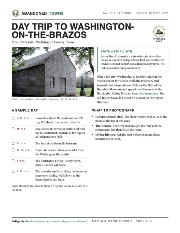
- Independence Hall. The plain wooden replica, as in the photo at the top of this page.
- The Brazos. The river that brought the ferry and the steamboats, and then failed the town.
- Living history. Ask the staff before photographing interpreters at work.
Map & directions
Getting there
Washington-on-the-Brazos is about 70 miles northwest of Houston, off TX 105 between Navasota and Brenham. Navasota is the closest town with services, 8 miles east.


Base map: USGS The National Map (public domain). Routes: OSRM on © OpenStreetMap contributors data (ODbL), computed October 2026. Times assume dry roads.
- From downtown Navasota, head west on East Washington Avenue, TX 105.1.9 mi
- Continue west on TX 105.4.2 mi
- Turn left onto FM 1155 to the historic site.1.4 mi
- From downtown Houston, take I-45 north and leave at exit 57B.10.2 mi
- Turn left onto West Mount Houston Road, TX 249. Follow TX 249 northwest as Tomball Parkway, the Tomball Tollway and the Aggie Expressway (toll sections).50.8 mi
- Merge onto TX 105 and follow it and Spur 515 into Navasota, then turn right on South La Salle Street.7.6 mi
- Turn left onto East Washington Avenue, TX 105, and follow it west.6.1 mi
- Turn left onto FM 1155 to the historic site.1.4 mi
Road and safety notes
- Paved all the way. Parts of TX 249 north of Houston are toll roads.
- From Wednesday to Sunday every visitor needs a ticket, even for the picnic area. Buy it at the visitor center.
Photos
Washington-on-the-Brazos in photos
Visitor reports
Been to Washington-on-the-Brazos?
Been there lately? Tell the next visitor what you found: whether you could get in, the state of the road and what's still standing. Photos are welcome. We read every report before it appears here.
River and lake
More river and lake ghost towns
The nearest in Texas.

 Guide
Port Sullivan
30.87, -96.70Milam County, Texas
A river port with a college and over 1,400 people in 1870. The railroads went to Hearne and Calvert instead, and twenty years later the town had…
 Guide
Indianola
28.51, -96.49Calhoun County, Texas
Texas's second port, where German immigrants and the Army's camels came ashore. Two hurricanes destroyed it, and most of the townsite now lies under…
Nearby
Other sites near Washington-on-the-Brazos
Straight-line distance from the townsite to other mapped sites in our Texas index.
- Dinkins6.8 mi N · Brazos
- Dallam7.5 mi NW · Brazos
- Rock Island10.0 mi S · Washington
- Coles Settlement11.3 mi W · Washington
- Enright15.0 mi NW · Brazos
- Wicker17.4 mi NW · Brazos
- Gay Hill20.5 mi W · Washington
- Magnolia25.5 mi E · Montgomery
Sources
Sources and credits
- Handbook of Texas Online, "Washington-on-the-Brazos, TX": ferry, founding, naming, convention, capital years, population figures, railroad bonus, decline, fires, park, museum, archaeology.
- Wikipedia, "Washington-on-the-Brazos, Texas": coordinates (GNIS).
- Texas Historical Commission, Washington-on-the-Brazos Complex, state historic site page and "Plan Your Visit", as of October 2026: hours, ticket prices, address and phone, food, restrooms, trails, pets, photography, suggested visit lengths, events.
- THC, "Rebirth on the Brazos" (January 23, 2026): the November 2025 rebuild, the reconstructed buildings, and a population of 1,700 in the 1840s.
- KBTX, July 2, 2026: the visitor center as the starting point and ticket desk.
- Elevation: USGS 3D Elevation Program point query. Routes: OSRM on OpenStreetMap data, October 2026. Status checked against the sources above on October 19, 2026.
Photo and map credits
- The replica of Independence Hall, 2008: Noconatom, Wikimedia Commons, CC BY-SA 4.0
- The George C. Childress statue: Larry D. Moore, Wikimedia Commons, CC BY 4.0
- The Brazos River at the site: Larry D. Moore, Wikimedia Commons, CC BY 4.0
- The visitor center, 2016: Reading Associate 17, Wikimedia Commons, CC BY-SA 4.0
- Inside the replica hall, 2016: Reading Associate 17, Wikimedia Commons, CC BY-SA 4.0
- Area base map, topo and aerial imagery: USGS The National Map (public domain).
- Historic maps: USGS Historical Topographic Map Collection (public domain): Navasota 1914, 1:62,500; Washington 1958, 1:24,000; Brenham 1993, 1:100,000.