 Abandoned

Overview
Wire gold on Williams Creek

Prospectors found gold dust on Swauk Creek in 1867. About six years later Benton Goodwin came back and picked up a $2 nugget, and the Swauk Creek Mining District was born. The camp grew where Williams Creek joins the Swauk. In 1892 it took the name Liberty and got a post office.
In 1895 Thomas Meaghers' settlement up Williams Creek began pulling people away, and the first camp became Old Liberty. Mining companies bought up small claims in the late 1890s, then the Klondike drew the miners north. A dredge tried Swauk Creek in 1926 and failed the same year. The last building at Old Liberty burned in 1962.
The town on Williams Creek never quite emptied, and it became a National Register historic district in 1974. Wes Engstrom, who arrived in 1971 looking for gold, has seen it through fights with mining companies and the federal government, which said residents were squatting on federal land. He counted about a dozen residents in 2023. The Swauk district is known for crystalline wire gold.
Timeline
From Swauk Creek to Williams Creek

- Four prospectors, Benton Goodwin among them, find gold dust on Swauk Creek.
- Goodwin comes back with another party and finds a $2 nugget. The Swauk Creek Mining District is organized, and a camp grows where Williams Creek meets Swauk Creek.
- The camp takes the name Liberty, builds a 30-by-60-foot public hall, and gets a post office with Gus Nelson as postmaster.
- Outside money starts buying up claims. A butcher shop built that year is one of the buildings in today's historic district.
- Thomas Meaghers' settlement, Meaghersville, grows up Williams Creek. It draws people from the first site, which becomes Old Liberty.
- The Swauk Creek Mining Co. and Cascade Mining Co. buy many small claims.
- The population falls as the Klondike rush pulls miners away.
- The post office moves from Old Liberty to the Williams Creek town.
- A dredge starts work on Swauk Creek in February. It proves too big for the creek and the company folds.
- The last building at Old Liberty burns.
- The Liberty Historic District is listed on the National Register of Historic Places. Resident Wes Engstrom finishes his replica arrastra the same year.
What's left
What you'll see


The main road through town runs about a third of a mile, and its buildings look like they came out of the 1890s, with log walls, wooden windows and fences. The historic district counts a hotel and boarding house, a grocery store, the 1894 butcher shop and a log house among its buildings. Engstrom's arrastra, a replica ore-grinding mill he finished in 1974, is the town's working piece of mining history. Hikers in 2024 and 2026 also reported an old power shovel, interpretive signs and displays on gold mining.
The 1897 Mount Stuart sheet below shows both settlements: Liberty where Williams Creek meets Swauk Creek, and Meaghersville, today's Liberty, as a row of buildings up Williams Creek. Later sheets show US 97 along Swauk Creek to the west, and the 2003 Liberty sheet marks mine shafts, strip mines and adits around the town.
- 1890s log and frame buildings
- 1894 butcher shop
- Replica arrastra (1974)
- Old power shovel and mining displays
- Town sign and historic plaque


Historic maps
Liberty on USGS maps, 1897–2003
Crops from the USGS Historical Topographic Map Collection, centered on the townsite. Each sheet shows what surveyors mapped that year; compare them with today's topo and aerial on this page.

Day trip
Plan a day trip to Liberty from Cle Elum
Take it with you
Day trip itinerary
The essentials, the sample day with boxes to tick, what to photograph and the coordinates, on two printable pages. Handy where there's no signal.
Download the PDF (591 KB)Liberty is 25 minutes from Cle Elum. The street is only about a third of a mile long, so the town makes a short stop; pair it with a picnic or a night at the BLM's Liberty Recreation Site a mile up the road.
A sample day
- Drive from Cle Elum on SR 970 and US 97 to Liberty Road.
- Walk the street: the cabins, the storefronts, the arrastra, the old power shovel and the mining displays.
- Picnic at the BLM recreation site on Williams Creek.
- Back to Cle Elum, or north over Blewett Pass toward Leavenworth.
What to photograph and film
- The street. Shoot down the road to line up the false fronts and cabins.
- The arrastra. The round grinding mill under its log-roofed shelter.
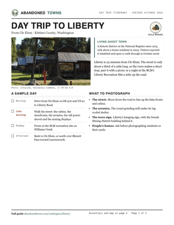
- The town sign. Liberty's hanging sign, with the Swauk Mining District building behind it.
- People's homes. Ask before photographing residents or their yards.
Map & directions
Getting there
Liberty is just off US 97 on the south side of Blewett Pass. From Cle Elum or Seattle, take I-90 to exit 85, then SR 970 and US 97 to Liberty Road.


Base map: USGS The National Map (public domain). Routes: OSRM on © OpenStreetMap contributors data (ODbL), computed October 2026. Times assume dry roads.
- From downtown Cle Elum, take North Oakes Avenue to I-90 east.2.0 mi
- Take exit 85 and follow SR 970 (Sunset Highway) east.10.3 mi
- Continue straight onto US 97 north.3.0 mi
- Turn right on Liberty Road and follow it into town.1.7 mi
- From downtown Seattle, take I-5 south to I-90.2.3 mi
- Follow I-90 east over Snoqualmie Pass to exit 85.82.4 mi
- Follow SR 970 east, then continue on US 97 north.13.3 mi
- Turn right on Liberty Road and follow it into town.1.7 mi
Road and safety notes
- Snow closes the gravel roads to the BLM's Liberty Recreation Site, a mile up Liberty Road and Pine Gulch Road, in winter.
- Cell reception is limited around Liberty.
Photos
Liberty in photos
Visitor reports
Been to Liberty?
Been there lately? Tell the next visitor what you found: whether you could get in, the state of the road and what's still standing. Photos are welcome. We read every report before it appears here.
Gold mining
More gold mining ghost towns
The nearest in Washington, then the nearest elsewhere.

 Guide
Monte Cristo
47.99, -121.39Snohomish County, Washington
A gold and silver camp of the 1890s that ran on Rockefeller money and its own railroad. Floods and poor ore finished it. Today it is a four-mile walk…
 Guide
Granite
44.81, -118.42Grant County, Oregon
Gold found on the Fourth of July in 1862 gave this camp an early name, Independence. Eighty years of mining ended in 1942, and 32 people lived among…
Nearby
Other sites near Liberty
Straight-line distance from the townsite to other mapped sites in our Washington index.
Sources
Sources and credits
- Wikipedia, "Liberty, Washington", retrieved October 2026: discovery dates, naming, hall, post office, Meaghersville, claim sales, Klondike, dredge, Old Liberty fire, National Register listing, 1894 butcher shop.
- KUOW / Northwest News Network, "Washington's only living ghost town" (2023): location off Blewett Pass on US 97, the third-of-a-mile street, the buildings, residents, Wes Engstrom, the arrastra, the land dispute, wire gold.
- Bureau of Land Management, "Liberty Recreation Site", checked October 2026: campsites, toilets, fees, stay limit, snow closure of the gravel roads, cell coverage, directions.
- Washington Trails Association, "Liberty Ghost Town", checked October 2026: parking and private property; hikers' trip reports of October 19, 2024, May 19, 2025 and October 8, 2026: residents, interpretive signs, mining displays, the power shovel and the arrastra.
- Elevation: USGS 3D Elevation Program point query. Routes: OSRM on OpenStreetMap data, October 2026.
Photo and map credits
- The town sign and the Swauk Mining District building, 2019: Schazjmd, Wikimedia Commons, CC BY-SA 4.0
- The arrastra, 2019: Schazjmd, Wikimedia Commons, CC BY-SA 4.0
- A false-front storefront with an ore cart, 2017: Washington Our Home, Wikimedia Commons, CC BY-SA 4.0
- Cabins along the street, 2017: Washington Our Home, Wikimedia Commons, CC BY-SA 4.0
- Liberty from the air, March 1981 (HABS): Michael Hoffman, Wikimedia Commons, Public domain
- Thomas Meagher's homestead among aspens, September 2018: Washington Our Home, Wikimedia Commons, CC BY-SA 4.0
- A board-and-batten house with a front porch, 2014: Washington Our Home, Wikimedia Commons, CC BY-SA 4.0
- Mamie's homestead, a long log-and-plank house, 2017: Washington Our Home, Wikimedia Commons, CC BY-SA 4.0
- Topo map, area base map and aerial imagery: USGS The National Map (public domain).
- Historic maps: USGS Historical Topographic Map Collection (public domain): Mount Stuart 1897, 1:125,000; Liberty 1961, 1:62,500; Wenatchee 1975, 1:100,000; Liberty 2003, 1:24,000.