 Abandoned

Overview
Rockefeller's camp in the Cascades

Joseph Pearsall found glittering ore at the head of the South Fork Sauk River in the summer of 1889. Within two years a syndicate tied to John D. Rockefeller had bought the main mines, paying the Wilmans brothers $470,000. A 42-mile railroad, the Everett and Monte Cristo, was built from Hartford over Barlow Pass, and a five-level concentrator went up at the townsite in 1894.
The camp peaked in 1894 with well over 1,000 people. Aerial trams brought down up to 230 tons of ore a day. In 1895 the mines paid 125 men about $10,500 a month, and by 1896 employment reached 200. Then the river turned on the railroad. Floods in November 1896 and again in 1897 tore out tunnels and track. The ore was also harder to smelt than hoped, and below about 500 feet it rarely paid. Most miners left for the Klondike, and mining stopped in 1907.
Monte Cristo lived on as a tourist spot until a 1980 flood cut the county road. The lodge burned in 1983. After a cleanup of arsenic and other mine waste, the townsite reopened to visitors in 2016. You reach it on foot or by bike from Barlow Pass.
Video
Monte Cristo in 30 seconds
A gold and silver camp that ran on Rockefeller money: the town in 1895, the concentrator in 1894, Asahel Curtis's view of about 1906 and the South Fork Sauk at the townsite.
Timeline
Eighteen years of mining

- Elisha Hubbard improves the trail up the North Fork Skykomish to Galena, and a boom follows at Mineral City.
- Joseph Pearsall spots glittering ore deposits. Claims are staked and the Monte Cristo mining district begins.
- A Rockefeller syndicate (Colby and Hoyt) takes over the main mines, including the Pride and the Mystery, paying the Wilmans brothers $470,000. The Wilmans wagon road from Sauk City is finished that fall.
- Work starts on the Everett and Monte Cristo Railroad, a 42-mile line from Hartford to Monte Cristo.
- The district counts 211 mining claims.
- A five-level concentrator is finished at the townsite and aerial trams bring down up to 230 tons of ore a day. The population is well over 1,000.
- Floods wreck railroad tunnels and track. Another flood in autumn 1897 does the same, and repairs eat into profits.
- Most miners have left for the Klondike.
- Mining stops, probably tied to the Panic of 1907.
- A flood washes out the county road to the townsite.
- The last business, a lodge, burns. The Monte Cristo Preservation Association forms to look after the site.
- Cleanup of arsenic and other mine waste starts in September 2012. The townsite reopens on June 3, 2016.
What's left
What you'll see

Very few original buildings are left. Hikers in 2025 and 2026 describe a mix of preserved and badly rotted buildings, signs marking where others stood, rusted mining equipment, Dumas Street and the foundations of the concentrator, with historical signs put up by the Monte Cristo Preservation Association. Posted signs ask visitors not to take or disturb artifacts and warn that the ground still isn't completely free of hazardous materials. Stay out of the rotting buildings.
Wikipedia lists the Boston American, Justice, Mystery and New Discovery tunnels among the mines that have not caved in. Stay out of them. The Forest Service runs a six-site campground at the townsite with a toilet, and trails lead on to Glacier Basin and Silver Lake.
The 1902 USGS sheet below shows the railroad (marked N.P.R.R.) running up the South Fork Sauk to the town, with Mineral City over the ridge to the south. The 1965 Monte Cristo sheet still shows a cluster of buildings where Glacier Creek meets the river.
- Preserved and decaying buildings
- Concentrator foundations
- Rusted mining equipment
- Historical signs
- Mine tunnels (stay out)
- Forest Service campground


Historic maps
Monte Cristo on USGS maps, 1902–1975
Crops from the USGS Historical Topographic Map Collection, centered on the townsite. Each sheet shows what surveyors mapped that year; compare them with today's topo and aerial on this page.

Day trip
Plan a day trip to Monte Cristo from Granite Falls
Take it with you
Day trip itinerary
The essentials, the sample day with boxes to tick, what to photograph and the coordinates, on two printable pages. Handy where there's no signal.
Download the PDF (639 KB)Monte Cristo makes a full day from Granite Falls: about an hour's drive to Barlow Pass, then eight miles out and back on an old road. Plan on a bike or a long walk, a river crossing, and carrying every drop of water.
A sample day
- Drive from Granite Falls up the Mountain Loop Highway to Barlow Pass and display your pass.
- Walk or ride the gated road, cross the South Fork Sauk, and pass the Weden House site.
- Lunch at the campground, then explore the townsite, Dumas Street and the concentrator foundations. Stay out of the mine tunnels.
- Back the same way to Barlow Pass and down the valley to Granite Falls.
What to photograph and film
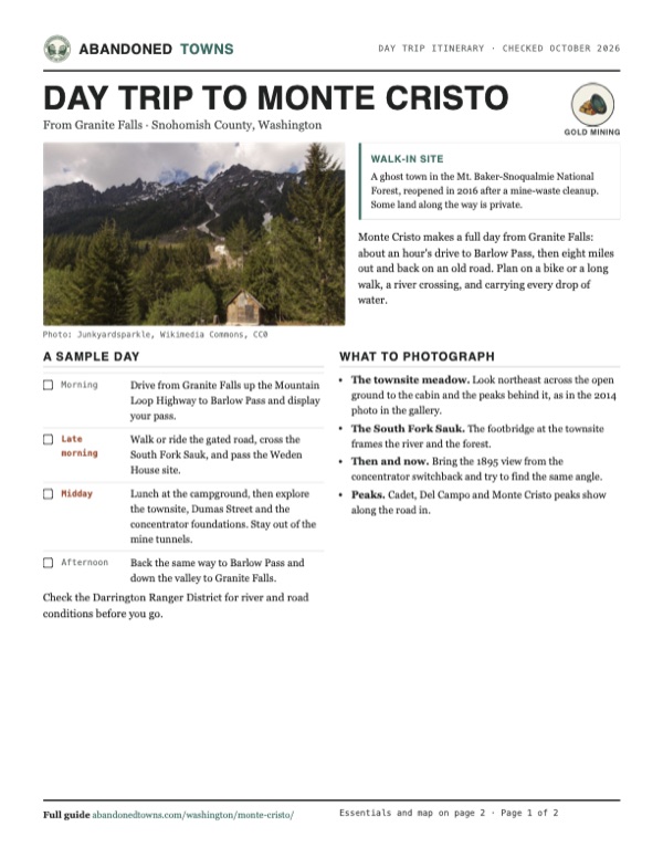
- The townsite meadow. Look northeast across the open ground to the cabin and the peaks behind it, as in the 2014 photo in the gallery.
- The South Fork Sauk. The footbridge at the townsite frames the river and the forest.
- Then and now. Bring the 1895 view from the concentrator switchback and try to find the same angle.
- Peaks. Cadet, Del Campo and Monte Cristo peaks show along the road in.
Map & directions
Getting there
Both routes end at Barlow Pass on the Mountain Loop Highway, where the gated Monte Cristo Road starts. From there it is about four miles on foot or by bike. Granite Falls is the last town with services.


Base map: USGS The National Map (public domain). Routes: OSRM on © OpenStreetMap contributors data (ODbL), computed October 2026. Times assume dry roads.
- From downtown Granite Falls, take North Granite Avenue and East Alpine Street.0.5 mi
- Turn left on the Mountain Loop Highway and follow it east past Verlot to Barlow Pass, where the route ends.30.2 mi
- Walk or bike the gated Monte Cristo Road to the townsite.≈4 mi
- From Hewitt Avenue, take US 2 east across the Snohomish River and continue on SR 204.5.4 mi
- Take SR 9 north, then SR 92 east through Lake Stevens to Granite Falls.10.8 mi
- Turn left on the Mountain Loop Highway and follow it to Barlow Pass.29.8 mi
- Walk or bike the gated Monte Cristo Road to the townsite.≈4 mi
Road and safety notes
- The route printout ends at Barlow Pass. The last four miles on Monte Cristo Road are closed to cars and open to foot and other non-motorized travel.
- About a mile past the gate there is no bridge over the South Fork Sauk River, and the Forest Service says many people turn around there. Hikers ford it or cross on logs, depending on the water.
- Some land between Barlow Pass and the townsite is private, with patented mining claims and summer cabins.
- Each winter the Mountain Loop Highway closes between the Deer Creek and Bedal gates, which cuts off Barlow Pass. Snohomish County reopened Deer Creek to Barlow Pass on April 19, 2024, about a month earlier than usual, and WTA expected a mid-May reopening in 2026. The unpaved stretch from Barlow Pass to Bedal opens only when the Forest Service finds it safe.
- Surface water around the townsite carries arsenic and heavy metals. Filtering or boiling doesn't remove them, so carry all the water you need.
Photos
Monte Cristo in photos
Visitor reports
Been to Monte Cristo?
Been there lately? Tell the next visitor what you found: whether you could get in, the state of the road and what's still standing. Photos are welcome. We read every report before it appears here.
Gold mining
More gold mining ghost towns
The nearest in Washington, then the nearest elsewhere.

 Guide
Liberty
47.25, -120.67Kittitas County, Washington
A gold camp from the 1890s where log cabins still line a single short street. About a dozen people live there, which is why locals call it a living…
 Guide
Granite
44.81, -118.42Grant County, Oregon
Gold found on the Fourth of July in 1862 gave this camp an early name, Independence. Eighty years of mining ended in 1942, and 32 people lived among…
Nearby
Other sites near Monte Cristo
Straight-line distance from the townsite to other mapped sites in our Washington index.
- Mineral City3.1 mi SW · Snohomish
- Galena6.8 mi S · Snohomish
- Wellington20.7 mi SE · King
- Sultan20.9 mi SW · Snohomish
- Sauk City35.5 mi N · Skagit
- Moore39.8 mi NE · Chelan
- Rockdale41.1 mi S · King
- Monohon42.3 mi SW · King
Sources
Sources and credits
- USDA Forest Service, "Old Monte Cristo Townsite Trail", checked October 2026: Barlow Pass parking and Recreation Pass, the gated road, 4-mile distance, no bridge at the river, Weden House site, private land, arsenic warning, campground and toilet.
- Wikipedia, "Monte Cristo, Washington", retrieved October 2026: discovery, Rockefeller syndicate, railroad, claims, concentrator, population, payroll, floods, 1907 closure, 1980 flood, 1983 lodge fire, cleanup and 2016 reopening, surviving tunnels, elevation.
- Washington Trails Association, Hiker Headlines, December 4, 2025: winter closure of the Mountain Loop Highway between the Deer Creek and Bedal gates, cutting off Barlow Pass, and the expected mid-May 2026 reopening.
- Snohomish County, April 19, 2024: Deer Creek to Barlow Pass reopened a month early; the unpaved Barlow Pass to Bedal section stays closed until the Forest Service finds it safe.
- WTA, "Monte Cristo Ghost Town" trip reports of August 21, 2025 and September 6, 12 and 18 and October 4, 2026: river crossing, buildings, concentrator, historical and warning signs, trailhead toilet.
- Routes: OSRM on OpenStreetMap data, October 2026.
Photo and map credits
- A cabin on the townsite, looking northeast, 2014: Junkyardsparkle, Wikimedia Commons, CC0
- The South Fork Sauk from the footbridge, 2014: Junkyardsparkle, Wikimedia Commons, CC0
- Monte Cristo by Asahel Curtis, about 1906: Asahel Curtis, Wikimedia Commons, Public domain
- Monte Cristo from the concentrator switchback, 1895: Unknown author, Wikimedia Commons, Public domain
- The ore concentrator, about 1893: Unknown author, Wikimedia Commons, Public domain
- The backs of buildings on Dumas Street, about 1895: Unknown author, Wikimedia Commons, Public domain
- The United Concentration Company's plant above the railroad, with the Cliff House Hotel at right, 1894: Kirk, Wikimedia Commons, Public domain
- Inside the Monte Cristo Mercantile Co. store, 1902: Unknown author, Wikimedia Commons, Public domain
- Topo map, area base map and aerial imagery: USGS The National Map (public domain).
- Historic maps: USGS Historical Topographic Map Collection (public domain): Skykomish 1902, 1:125,000; Monte Cristo 1965, 1:24,000; Skykomish River 1975, 1:100,000.