 Abandoned

Overview
The coal camp on the first federal lease
In June 1906 Sam Gebo and a group of investors filed coal claims north of Thermopolis, and the prospect of the mines brought the Burlington railroad south to Kirby that year. Gebo formed the Owl Creek Coal Company, and in 1907 its first coal went out by rail. The camp that grew beside the mine took his name, and Crosby grew up next to it.
Gebo's claims covered thousands of acres more than the law allowed. After years of appeals, Congress let the government lease the land instead: on August 29, 1912, Owl Creek Coal signed the first lease of federal coal in the nation, paying a royalty on every ton. Production peaked at about 500,000 tons in 1920. At its height Gebo had more than 2,000 people of as many as 16 nationalities, more than Thermopolis, with a hospital, a K-12 school, a company store and paved streets. It was never incorporated, so there is no census count.
Mining ended in 1938 and families moved away. The empty buildings were bulldozed in 1971, and the last resident left in the 1980s. Today the BLM manages the site as the Gebo-Crosby Historic Mining District.
Video
A winter morning in the stone houses
A van traveler camps below the townsite on a 15-degree night and drives up on a clear winter morning, on his second route of the day. He looks over the row of small stone houses, some with full basements and one with a timber floor over a crawl space, the scattered foundations and a timber-framed shed built against a sandstone ledge, and reads the interpretive sign. He says mud kept him from camping here on a spring visit years earlier, and he skips the tunnels. He did not find the cemetery. The creator guesses the town emptied in the 1940s or 1950s, then corrects himself from the BLM sign, which gives 1938 for the end of mining. He flew a drone briefly; we found no BLM drone rule for the site.
 Play “It Took 2 Tries to Reach Gebo Ghost Town; Winter Van Camping in Wyoming” from YouTube
Timeline
Claims, lease, closing, bulldozers
- Sam Gebo and his partners file coal claims north of Thermopolis on June 22, and the prospect of the mines brings the Burlington railroad south to Kirby.
- Sam Gebo's Owl Creek Coal Company ships its first coal, and the camp named for him grows beside the mine. Crosby rises next door.
- After a fight over oversized claims, the government leases 2,480 acres to Owl Creek Coal, the first lease of federal coal in the nation.
- Gebo's heyday. More than 2,000 people of as many as 16 nationalities live in the camp, the largest settlement in Hot Springs County though never incorporated. It has a hospital, a K-12 school, a company store, boarding houses and paved streets.
- Owl Creek production peaks at about 500,000 tons a year.
- The Crosby mine closes after a fire.
- Mining at Gebo ends. Families move to nearby towns.
- The remaining buildings are bulldozed; Cowboy State Daily credits the BLM.
- The last resident leaves.
- The BLM schedules a volunteer cleanup of the site's parking area for August 26.
- Cowboy State Daily reports that E Clampus Vitus will dedicate a marker at the cemetery, where many of the graves are children's.
What's left
What you'll see
The BLM describes the town and cemetery as the first stop, with the main mine workings and their many tunnels a few miles on. WyoHistory lists the fan from Owl Creek Mine No. 1, several building foundations, the walls of several rock houses, stone dugouts and BLM interpretive signs. Visitor notes describe stone houses that keep most of their walls, simple dugouts faced with stacked rock, and a cemetery where most of the graves are of babies and children. In July 2024 Cowboy State Daily reported that E Clampus Vitus would dedicate a marker there.
A BLM sign at the site, filmed in December 2024, dates the district's first commercial mine, the Jones mine (later Gebo No. 1), to 1889, says the BLM and Wyoming's abandoned mine lands division have worked to reduce hazards, and asks visitors to use caution off the roads and to respect the adjacent private property. One visitor note reports that the site also serves as an informal shooting area.
Stay out of the tunnels: the BLM says they are old and unstable, could cave in, and are closed to entry. The 1945 Kirby sheet below shows Gebo as a grid of buildings with a cemetery west of town and the abandoned Crosby mine to the southeast; by 1985 the sheet shows only a few symbols, the old railroad grade and the cemetery.
- Stone walls of the rock houses
- Stone dugouts
- Building foundations
- Fan of Owl Creek Mine No. 1
- Gebo cemetery
- BLM interpretive signs
- Mine tunnels (closed to entry)


Historic maps
Gebo on USGS maps, 1945–1985
Crops from the USGS Historical Topographic Map Collection, centered on the townsite. Each sheet shows what surveyors mapped that year; compare them with today's topo and aerial on this page.

Day trip
Plan a day trip to Gebo from Thermopolis
Take it with you
Day trip itinerary
The essentials, the sample day with boxes to tick, what to photograph and the coordinates, on two printable pages. Handy where there's no signal.
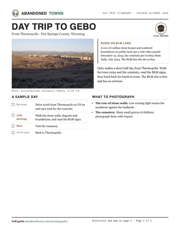
Download the PDF (457 KB)Gebo makes a short half day from Thermopolis. Walk the town ruins and the cemetery, read the BLM signs, then head back for lunch in town. The BLM site is free and has no services.
A sample day
- Drive north from Thermopolis on US 20 and turn west for the townsite.
- Walk the stone walls, dugouts and foundations, and read the BLM signs.
- Visit the cemetery.
- Back to Thermopolis.
What to photograph and film
- The row of stone walls. Low evening light warms the sandstone against the badlands.
- The cemetery. Many small graves of children; photograph them with respect.
Map & directions
Getting there
Thermopolis is the closest town. US 20 runs north from it toward Worland; the turnoff west to Gebo is about 12 miles out. From Casper, US 20/26 crosses the state to Shoshoni and US 20 goes north through the Wind River Canyon.


Base map: USGS The National Map (public domain). Routes: OSRM on © OpenStreetMap contributors data (ODbL), computed October 2026. Times assume dry roads.
- From downtown Thermopolis, take South 6th Street (US 20/WY 789).0.3 mi
- Continue north on Park Street, which is US 20/WY 789.10.0 mi
- Turn left on Gebo Oil Field Road.0.8 mi
- Turn right on the unnamed road to the townsite.2.0 mi
- From downtown Casper, take West 1st Street, which becomes West Yellowstone Highway (US 20/26 Business).10.5 mi
- Continue west on US 20/26.87.5 mi
- Turn right on Idaho Street (US 20/WY 789) in Shoshoni and follow it north through the Wind River Canyon to Thermopolis.31.9 mi
- Turn left on South 6th Street.0.8 mi
- Continue north on Park Street (US 20/WY 789).10.0 mi
- Turn left on Gebo Oil Field Road.0.8 mi
- Turn right on the unnamed road to the townsite.2.0 mi
Road and safety notes
- The BLM's directions differ from the routed ones: 12 miles north of Thermopolis on US 20, left on Sand Draw Road for 1.4 miles, then Gebo Road for almost a mile to the town site.
- The off-highway roads are dirt, rated 4WD. A visitor reached the ruins in a high-top camper van in December 2024 but called the roads rough and too sketchy to drive after dark, and took a second route in; mud stopped him on a spring visit years before.
- Entering the mine tunnels is not allowed, per the BLM.
Photos
Gebo in photos
Visitor reports
Been to Gebo?
Been there lately? Tell the next visitor what you found: whether you could get in, the state of the road and what's still standing. Photos are welcome. We read every report before it appears here.
Coal mining
More coal mining ghost towns
The nearest in Wyoming, then the nearest elsewhere.

 Guide
Carbon
41.85, -106.38Carbon County, Wyoming
The coal town that fueled the first Union Pacific trains across Wyoming. A fire in 1890 and a new main line through Hanna in 1899 finished it, and…
 Guide
Sego
39.03, -109.70Grand County, Utah
A coal camp in the Book Cliffs became Ballard, Neslen and finally Sego. Its store walls and railroad remains survive in the canyon.
Nearby
Other sites near Gebo
Straight-line distance from the townsite to other mapped sites in our Wyoming index.
- Hoshoni38.5 mi S · Fremont
- Kirwin53.5 mi W · Park
- Cody64.0 mi NW · Park
- Hiland64.3 mi SE · Natrona
- Heart Mountain70.4 mi NW · Park
- Kane72.8 mi N · Big Horn
- Hamilton89.8 mi S · Fremont
- Jeffrey City92.1 mi S · Fremont
Sources
Sources and credits
- Wikipedia, "Gebo, Wyoming", read October 28, 2026: the 1907 founding, Sam Gebo, more than 2,000 people, mining until 1938, bulldozing in 1971, the coordinates.
- ghosttowns.com, Gebo, read October 28, 2026: the 4WD road, spring as the best time, the climate, the stone houses, dugouts, blower and graves of children, and a visitor note that the site doubles as a local rifle range (undated).
- Lea Cavalli Schoenewald, "Sam Gebo and the Leasing of Federal Coal," WyoHistory.org, July 1, 2024: the 1906 railroad and claims, the oversized claims, the August 29, 1912 lease as the first of federal coal, the 1920 peak, 2,000 people of 16 nationalities, the K-12 school, the remains and BLM signs.
- Wyoming Tales and Trails, "Coal Camps: Gebo": first coal shipped 1907, larger than Thermopolis, mining ended 1938, bulldozed 1971, the Crosby mine fire about 1933.
- BLM, Gebo-Crosby Historic Mining District, read October 28, 2026: the town and cemetery, the tunnels and the ban on entering them, free, the 14-day limit, directions, the Worland Field Office phone, the coordinates.
- BLM press release, August 10, 2023: the cleanup of the parking area planned for August 26, 2023, the directions.
- Jackie Dorothy, Cowboy State Daily, July 29, 2024: the hospital, school, store and paved streets, the BLM bulldozing in the 1970s, the last resident in the 1980s, the foundations, relics and cemetery, the planned E Clampus Vitus marker.
- Robert Witham, "It Took 2 Tries to Reach Gebo Ghost Town; Winter Van Camping in Wyoming", YouTube, posted December 19, 2024: the video on this page; the stone houses and foundations as he found them, the BLM sign text (the 1889 Jones mine, hazard work, private land nearby), the rough roads and the muddy spring visit.
- Bigbore's Outdoors JW, "Gebo Wyoming. A ghost town.", YouTube, posted March 3, 2024: foundations, trash and target-shooting debris on the BLM land.
- Elevation: USGS 3D Elevation Program point query. Routes: OSRM on OpenStreetMap data, October 2026.
Photo and map credits
- The row of stone houses in evening light. The camera dates it February 8, 2018, but the green grass suggests late spring or summer; it was uploaded in August 2018.: Swissarmysalad, Wikimedia Commons, CC BY 4.0
- Area base map, topo and aerial imagery: USGS The National Map (public domain).
- Historic maps: USGS Historical Topographic Map Collection (public domain): Kirby 1945, 1:62,500; Thermopolis 1955, 1:250,000; Kirby 1985, 1:24,000.