 Abandoned

Overview
The fort at Apache Spring

Apache Pass crosses the low gap between the Dos Cabezas and Chiricahua Mountains, and in it is Apache Spring, a dependable source of water in dry country. In 1858 the Butterfield Overland Mail built a stone stage station near it, and the spring is the main reason the Army built a fort here.
Two fights in the pass came first. In February 1861 Lt. George Bascom tried to hold Cochise hostage over a raid Cochise denied, and the Bascom Affair ended with hostages killed on both sides. In July 1862 Cochise and Mangas Coloradas fought a California Volunteer column for the spring, and lost. Within two weeks soldiers of the 5th California Volunteer Infantry were building a post, which they named for their colonel, George Washington Bowie. A bigger second fort followed in 1868.
For more than 20 years Fort Bowie was the Army's base in its campaigns against the Chiricahuas. Those ended in September 1886, when Geronimo and Naiche surrendered and the Chiricahuas were exiled to Florida. The Army closed the post on October 17, 1894, leaving more than 50 adobe and stone buildings. The land was sold in 1911 and many buildings came down. Most of the adobe has since melted away, but walls and foundations remain. The site was authorized as a national historic site in 1964 and is run by the National Park Service.
Timeline
Thirty-two years at Apache Pass


- The Butterfield Overland Mail builds a stone stage station in Apache Pass, near Apache Spring.
- The Bascom Affair. Lt. George Bascom tries to hold the Chokonen leader Cochise over a raid he denies. Cochise cuts his way out of the tent, both sides take and kill hostages, and the Army hangs six Apache men as it leaves.
- The Battle of Apache Pass. Cochise and Mangas Coloradas, with about 150 warriors, fight a California Volunteer column over two days. The soldiers take the spring and the high ground.
- Soldiers of the 5th California Volunteer Infantry start building a post and name it for their commander, Col. George Washington Bowie.
- Stone and adobe huts replace the first camp of 13 tents behind stone breastworks.
- A larger second fort goes up on a plateau a few hundred yards east.
- The census counts 400 people at Apache Pass.
- Cochise makes peace with Gen. O. O. Howard and his people get a reservation of about 3,000 square miles.
- Cochise dies in 1874. The government abolishes the Chiricahua reservation in 1876, and some bands, Geronimo's among them, flee to Mexico.
- Geronimo leads 134 Chiricahuas off the reservation into Mexico for the last time. A year of pursuit follows.
- Geronimo and Naiche surrender to Gen. Nelson Miles on September 4 at Skeleton Canyon. The Chiricahuas are sent into exile in Florida.
- The Army closes Fort Bowie. It leaves more than 50 adobe and stone buildings.
- The land is sold, and many of the buildings are torn down.
- Fort Bowie and Apache Pass become a National Historic Landmark.
- Fort Bowie National Historic Site is authorized.
- The site records 8,739 visitors.
Legend and record
Where Geronimo surrendered, and other loose ends


The surrender. The National Park Service's own summary page says Geronimo surrendered at Fort Bowie. The surrender itself took place at Skeleton Canyon on September 4, 1886, when Geronimo and Naiche gave up to Gen. Nelson Miles. Fort Bowie's part came next. The prisoners were brought to the post and left from there for exile, a departure C. S. Fly photographed.
Photo dates. Old pictures of the fort carry dates that don't fit. The Commons copy of Fly's departure photo is titled 1895, a year after the fort closed. The National Archives dates a well-known picture of Apache prisoners at the post to 1884. We give the dates as the archives give them and note the problem.
The record is solid on the Bascom Affair, because the Park Service has pieced it together day by day, from the raid on January 27, 1861, to the hangings on February 19.
The two forts. Sources differ on how far apart they were. The Park Service puts the second fort about 300 yards from the first camp; Wikipedia says about 500 yards east. Both ruins are on the trail, so you can pace it out yourself.
The founder. The Park Service says soldiers named the post for their commander, Col. George Washington Bowie. Some popular histories say Bowie founded it himself. The name is certain; accounts of his part in founding it differ.
What's left
A walk through the ruins


The 1.5-mile trail from Apache Pass Road is the way in. Most people find it moderate, with just under 200 feet of climbing over uneven ground. Along the way you pass the ruins of the Butterfield stage station, the post cemetery, a replica Chiricahua Apache camp, signs at the site of the 1862 battle, the first fort's ruins and Apache Spring, which still runs. The trail ends at the second fort, where adobe walls stand on stone foundations around the old parade ground. The visitor center there has artifacts from the fort and a park store. The NPS describes the full walk as a 3-mile loop, and the Overlook Ridge Trail makes the return.
Among the graves in the post cemetery is that of Orizoba Spence, a Medal of Honor recipient. Of the second fort's more than 50 buildings, the stone parts have lasted best, such as corral walls and foundations. Most adobe has melted back into the ground.
The historic maps below show the change. The 1917 San Simon and 1926 Cochise Head sheets print OLD FORT BOWIE across the pass, with Apache Pass, Siphon Canyon, Bear Spring and Helens Dome around it, and the 1926 sheet adds the Knap Ranch at Bear Spring. The 1979 Bowie Mountain North sheet marks Fort Bowie Ruins as a cluster of building squares, with Apache Spring, Overlook Ridge, the cemetery and the historic site boundary.
- Second fort adobe walls (1868 on)
- Stone foundations and corral walls
- First fort ruins (1862)
- Butterfield stage station ruins (1858)
- Post cemetery
- Apache Spring
- Replica Apache camp
- Visitor center and museum


Historic maps
Fort Bowie on USGS maps, 1917–1996
Crops from the USGS Historical Topographic Map Collection, centered on the townsite. Each sheet shows what surveyors mapped that year; compare them with today's topo and aerial on this page.

Day trip
Plan a day trip to Fort Bowie from Willcox
Take it with you
Day trip itinerary
The essentials, the sample day with boxes to tick, what to photograph and the coordinates, on two printable pages. Handy where there's no signal.
Download the PDF (486 KB)From Willcox, Fort Bowie fills a morning, and with a stop or two it makes an easy day. The fort is a 1.5-mile walk from the trailhead, and the Park Service suggests allowing at least two hours. The only food for sale is snacks at the park store, so pack lunch and water. Dos Cabezas is right on the way out on AZ 186.
A sample day
- Leave Willcox east on Maley Street, which is AZ 186.
- Dos Cabezas. Pull well off the highway to look at the adobe ruins. They're private, so stay by the road.
- Reach the Fort Bowie Trailhead after the unpaved climb over Apache Pass, about 45 minutes on from Dos Cabezas.
- Walk in past the Butterfield stage station ruins, the post cemetery, the replica Apache camp, the 1862 battle site, the first fort and Apache Spring.
- Reach the second fort's ruins and the visitor center. Refill your water at the fountain outside.
- Return on the Overlook Ridge Trail, which looks down on the fort, to make the 3-mile loop.
- Eat your packed lunch at the trailhead picnic shelter, then drive back to Willcox, about an hour.
- The Rex Allen Museum on Railroad Avenue is open Thursday to Saturday, 11 a.m. to 3 p.m., and on Monday mornings. Admission is $5; veterans and children under 10 get in free.
- The City of Willcox's dining list includes Big Tex BBQ on Maley Street, the road you drove out on.
Coming from Tucson? The Park Service's route by I-10 and Bowie takes about 2 h 25 min to the trailhead and skips Dos Cabezas. Leave by 6:30 a.m. to walk before the heat of the day.
What to photograph and film
- The second fort from Overlook Ridge. The return trail climbs above the parade ground. From up there the adobe walls, the visitor center and Apache Pass fit in one frame.
- Adobe on stone. The guardhouse and corral walls show adobe sitting on stone foundations. Low morning or evening light brings out the texture.
- The post cemetery. White headboards against dry grass. Shoot from outside the fence line and leave the graves undisturbed.
- Apache Spring. The spring the Army came to guard still runs. Frame it with the pass behind it to show why it mattered.
- The replica wickiup. The Apache camp beside the trail makes a good detail shot, especially with the hills behind.
- Walk-in video. The 1.5-mile trail makes a natural sequence, from the stage station and the cemetery to the spring and the first view of the fort.
- Drones. Prohibited at Fort Bowie without the superintendent's written approval.
Map & directions
Getting there
Both routes end at the Fort Bowie Trailhead on Apache Pass Road, where the 1.5-mile walk to the fort begins. From I-10, the Park Service sends you through the village of Bowie and 13 miles south on Apache Pass Road, paved except for the last mile; that's the Tucson route below. The routed approach from Willcox is shorter but uses 8 miles of unpaved road from AZ 186. Visitors who can't make the walk can drive Old Fort Bowie Road to an accessible lot near the visitor center.


Base map: USGS The National Map (public domain). Routes: OSRM on © OpenStreetMap contributors data (ODbL), computed October 2026. Times assume dry roads.
- From downtown Willcox, take Maley Street, which is AZ 186, east out of town on the Willcox–Bonita Highway.5.9 mi
- Bear left to stay on AZ 186 toward the Chiricahua Mountains.16.8 mi
- Turn left onto Apache Pass Road. It's unpaved for the 8 miles over the pass to the Fort Bowie Trailhead.8.1 mi
- From downtown Tucson, take Congress Street to I-10 and follow it east past Benson and Willcox.105 mi
- Take the first Bowie exit onto Business I-10 into the village of Bowie.2.2 mi
- Turn right onto Apache Pass Road and follow the park signs south. The last mile to the Fort Bowie Trailhead is unpaved.12.9 mi
Road and safety notes
- The Park Service's route from I-10 runs through Bowie and 13 miles south on Apache Pass Road. Only the last mile is unpaved.
- The shortcut from AZ 186 has 8 miles of unpaved road over the pass. In monsoon season, June 15 to September 30, washes can flood. If water is running across the road, turn around.
- Lightning is a real hazard in summer storms. Hike in the morning and get off exposed ground when a storm builds.
- Can't make the walk? Old Fort Bowie Road dead-ends at an accessible lot with a 500-foot path that climbs about 80 feet to the visitor center. Staff can open a gate so you can drive up during visitor center hours; call 520-549-6751. No buses, RVs or trailers in that area.
- There's no entrance fee, and federal recreation passes aren't sold on site.
- The Park Service warns of rabies in the region. Don't approach, feed or touch wild animals.
Photos
Fort Bowie in photos
Visitor reports
Been to Fort Bowie?
Been there lately? Tell the next visitor what you found: whether you could get in, the state of the road and what's still standing. Photos are welcome. We read every report before it appears here.
Railroad and road
More railroad, road and fort ghost towns
The nearest in Arizona.

 Guide
Cochise
32.11, -109.92Cochise County, Arizona
A Southern Pacific coal-and-water stop that grew to about 3,000 people and shrank to a few dozen. The old railroad hotel, where Big Nose Kate once…
 Guide
Fairbank
31.72, -110.19Cochise County, Arizona
Tombstone's nearest railroad stop, on the San Pedro River. Fairbank outlasted the silver boom by decades, and the BLM now keeps its schoolhouse…
Nearby
Other sites near Fort Bowie
Straight-line distance from the townsite to other mapped sites in our Arizona index.
- Dos Cabezas10.6 mi W · Cochise
- Hilltop14.0 mi SE · Cochise
- Galleyville18.6 mi SE · Cochise
- Paradise19.4 mi SE · Cochise
- Fittsburg28.0 mi SW · Cochise
- Cochise28.5 mi W · Cochise
- Courtland34.0 mi SW · Cochise
- Bisbee34.6 mi SW · Cochise
Sources
Sources and credits
- ghosttowns.com, "Fort Bowie": fact sheet fields (road, legal description, climate, best time, remains).
- Wikipedia, "Fort Bowie", retrieved October 2026: coordinates, landmark and register dates, 1870 and 1880 census counts, the second fort's distance, the 1.5-mile trail, Orizoba Spence, 2025 visitor count.
- National Park Service, Fort Bowie National Historic Site: Operating Hours & Seasons (updated July 16, 2026), Fees (December 11, 2025), Directions (July 11, 2025), Accessibility, Alerts (January 12, 2026), FAQ and Visitor Centers: hours, fees, trail, routes, accessible access, monsoon and rabies warnings, phone, as of October 19, 2026.
- National Park Service, "Bascom Affair" and "The Battle of Apache Pass": dates and events of 1861 and 1862.
- National Park Service, "Arizona: Fort Bowie National Historic Site" (2018): the July 28, 1862 start and the name, the first camp, the 1868 fort, the reservation years, the 1885 outbreak, the October 17, 1894 closing, what survives, the address.
- National Park Service, Fort Bowie: Basic Information (updated August 3, 2026), Plan Your Visit, Apache Pass Trailhead, Safety and park store, as of October 2026: time to allow, shade, picnic sites, trailhead toilet, drinking water, snacks and no cash, leashed pets, cell coverage, holiday closures.
- Chiricahua National Monument and Fort Bowie National Historic Site, Superintendent's Compendium (effective January 9, 2026): drones prohibited without written approval, no pets on the ruins.
- Rex Allen Museum, official site: days, hours and admission, as of October 2026. City of Willcox, "Dining": Big Tex BBQ on Maley Street, as of October 2026.
- Legends of America, "Fort Bowie": the 1858 stage station, the 1911 land sale, the 1964 authorization.
- Wikipedia, "Geronimo": the surrender to Gen. Nelson Miles at Skeleton Canyon on September 4, 1886.
- USGS Historical Topographic Map Collection: San Simon 1917, Cochise Head 1926 and 1950, Bowie Mountain North 1979 and 1996 sheets. Trailhead and Bowie positions, and trail features (first fort ruins, battle site signs, Overlook Ridge return trail): OpenStreetMap. Elevation: USGS 3D Elevation Program. Routes: OSRM on OpenStreetMap data, October 2026.
Photo and map credits
- The fort site at Apache Pass, 2009: Wilson44691, Wikimedia Commons, Public domain
- The second fort from the Overlook Ridge Trail: Ian Poellet, Wikimedia Commons, CC BY-SA 4.0
- The parade ground, visitor center and ruins from above: NPS Photo, Wikimedia Commons, Public domain
- Guardhouse wall: adobe laid on a stone foundation: NPS Photo, Wikimedia Commons, Public domain
- Stone corral walls, which have outlasted the adobe: NPS Photo, Wikimedia Commons, Public domain
- The post cemetery: John Fowler from Placitas, NM, USA, Wikimedia Commons, CC BY 2.0
- A replica Apache wickiup beside the trail: NPS staff, Wikimedia Commons, Public domain
- The blue dot marks where Bascom met Cochise in 1861: Wilson44691, Wikimedia Commons, Public domain
- Fort Bowie in 1893, a year before the Army left: Unknown author, Wikimedia Commons, Public domain
- C. S. Fly's photo of Geronimo's band leaving for exile (titled 1895 on Commons): Fly, C. S. (Camillus Sidney) (1849-1901) (Photographer), Wikimedia Commons, Public domain
- Apache prisoners at Fort Bowie, dated 1884 by the National Archives: Unknown author or not provided, Wikimedia Commons, Public domain
- Chihuahua, Naiche and Geronimo talk surrender with Gen. George Crook, March 25, 1886: Unknown author, Wikimedia Commons, Public domain
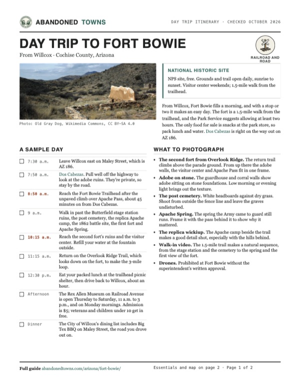
- Second-fort ruins with Apache Spring and Apache Pass beyond, 2015: Old Gray Dog, Wikimedia Commons, CC BY-SA 4.0
- Topo map, area base map and aerial imagery: USGS The National Map (public domain).
- Historic maps: USGS Historical Topographic Map Collection (public domain): San Simon 1917, 1:125,000; Cochise Head 1926, 1:62,500; Cochise Head 1950, 1:62,500; Bowie Mtn North 1979, 1:24,000; Bowie Mountain North 1996, 1:24,000.