 Abandoned

Overview
The second boom on Turkey Creek

Paradise sits on East Turkey Creek on the east side of the Chiricahua Mountains, 5.7 miles up the mountain from Portal and about a mile south of the Galeyville site. It was the valley's second mining town. Galeyville had come and gone in the early 1880s. Paradise followed after the turn of the century, when the Chiricahua Development Company took over claims in the canyons to the west. Wikipedia dates the company's strike to 1901, the year the post office opened. Carson Morrow, who knew the town as a boy, put the company's purchase in late 1902 or early 1903.
George A. Walker and George Myers laid out the townsite and sold lots. Walker opened the first grocery and Myers the first saloon, both in tents and later in buildings of lumber sawed in Barfoot Park, higher up the range. The company sank a shaft more than 400 feet deep and hauled in machinery that took more than 30 horses to pull. It was a copper bet: the shaft, about 1.5 miles northwest of town, went into chalcopyrite, a copper ore, while Walker and Myers had first shipped lead ore from the nearby Leadville mine. By 1904 the town had about 300 people.
The boom ended with the Panic of 1907, by Morrow's account, though the post office held on until September 1943. A few people never left. In 1958 Morrow counted three original houses still standing. When the Horseshoe Two Fire burned toward town in May 2011, officials listed five permanent residents and 29 structures. Today Paradise is a quiet private settlement on a Forest Service scenic loop, known to birders for the feeders at the George Walker House.
Timeline
Boom, bust and a few who stayed
- Galeyville, a mile up Turkey Creek, booms and empties. Its post office lasts from January 1881 to May 1882.
- The Chiricahua Development Company locates a vein of ore here, by Wikipedia's account.
- The Paradise post office opens.
- Prospector Cap Burns sells his claims to the Chiricahua Development Company, which starts sinking a shaft. Carson Morrow dates the town's start to early 1903.
- George A. Walker and George Myers lay out the townsite and sell lots. Walker opens the first grocery and Myers the first saloon, both in tents.
- Paradise reaches about 300 people. On July 4 it throws a celebration with a free barbecue, dancing and bronc riding.
- Portal, down the mountain, takes its name as the gateway to Paradise.
- The boom ends with the Panic of 1907, in Morrow's telling. A stone jail goes up about this time.
- The post office closes.
- Morrow counts three original houses still standing, one of them home to a resident who has lived in Paradise since the start. The stone jail has been remodeled into a house.
- The Horseshoe Two Fire forces a precautionary evacuation. Officials list five permanent residents and 29 structures. The order is lifted by June 10.
Recollections
Thirteen saloons and a log-chain jail
Most of what we know about daily life in boom-time Paradise comes from one man. Carson Morrow was in Paradise as a child during the boom years. Between 1957 and 1959 he wrote about it in the Chiricahua Bullsheet, a mimeographed newsletter printed at the Southwestern Research Station in Cave Creek Canyon. He warned readers that he was writing from memory and that his memory wasn't the best. Read what follows as recollection.
Morrow remembered the Chiricahua Development Company employing around 500 men who worked 12-hour shifts, seven days a week, and nearly all took payday off. He wrote of thirteen saloon keepers in town and a red-light district "across the creek." The first jail was a log chain stretched between two oak trees. The constable shackled rowdy miners to it overnight and walked them to the justice of the peace in the morning.
The stone jail that replaced the chain went up around the time of the 1907 bust. Morrow guessed it never held more than half a dozen prisoners. By the late 1950s it had been remodeled into a house.
What's left
A private town in the forest

Paradise is private land surrounded by the Coronado National Forest. During the 2011 fire the Forest Service noted that Forest Road 42B within Paradise is not forest land. Older buildings stand among newer homes along the creek. The cemetery lies east of town on the road to Portal, and concrete mine foundations sit in the woods nearby. The George Walker House rents rooms, and its owners say day visitors drop by to watch the birds in the yard.
The historic USGS sheets below show the town over the century. The 1917 Chiricahua sheet marks Paradise on Turkey Creek, with no Galeyville, and a road running east down Silver Creek toward the Portal ranger station. The 1958 Portal sheet adds the Galeyville site to the north and the Paradise Cemetery to the east. The 1987 sheet shows houses strung along Turkey Creek, with adits and a mine shaft on the slopes around them.
- Original buildings among newer homes
- Stone jail, remodeled as a house by 1958
- Paradise Cemetery, east of town
- Concrete mine foundations
- The George Walker House


Historic maps
Paradise on USGS maps, 1917–1998
Crops from the USGS Historical Topographic Map Collection, centered on the townsite. Each sheet shows what surveyors mapped that year; compare them with today's topo and aerial on this page.

Day trip
Plan a day trip to Paradise from Willcox
Take it with you
Day trip itinerary
The essentials, the sample day with boxes to tick, what to photograph and the coordinates, on two printable pages. Handy where there's no signal.
Download the PDF (687 KB)Paradise is about an hour and a half from Willcox, much of it on dirt, so give it a full day. Add the Forest Service's Cave Creek loop and lunch in Portal, which has the only café and store nearby. There's no gas in Portal or Paradise, so fill up before you leave I-10.
A sample day
- Leave Willcox east on I-10.
- Leave the interstate at San Simon and head south on Noland Road. The pavement ends after about 6.5 miles.
- South Turkey Creek Road passes the Galeyville site about a mile before Paradise. It's private land with nothing confirmed standing, so keep driving.
- Arrive in Paradise. Drive slowly past the old buildings along the creek, then stop at the cemetery on the road east toward Portal.
- Follow FR 42B east down to Portal, about 15 minutes, and turn up FR 42 into Cave Creek Canyon to the visitor information center.
- Lunch at the Portal Cafe. Pick up drinks for the drive home.
- Head back to Willcox, about 1 h 45 min.
From Tucson the drive is about 3 hours each way. If that's too long for one day, the George Walker House in Paradise and the lodge in Portal both rent rooms.
What to photograph and film
- The cemetery gate. An iron arch over the gate frames the oaks and the mountains behind. The fenced graves inside reward a quiet look.
- Mine foundations. Concrete footings from the mining years stand in the woods near town. Shoot from the ground, not from on top of the walls.
- Old trucks and houses. Rusting vehicles under the oaks and the older houses make good subjects from the road. Keep homes and yards out of close-ups.
- Birds. The George Walker House yard is an eBird hotspot. Bring a long lens, and ask before you walk in.
- The loop. The Forest Service's 17-mile loop around Silver Peak runs through Paradise and Cave Creek Canyon. Pull fully off the road before you film.
Map & directions
Getting there
There are two ways in. The routes below come from Willcox and Tucson by way of I-10 and San Simon, then run south on Noland Road and South Turkey Creek Road, past the Galeyville site. They were computed from OpenStreetMap and haven't been driven by us. The Forest Service's suggested approach is from Portal: follow FR 42 into Cave Creek Canyon to the Paradise turnoff, take FR 42B 3 miles to Paradise, and return on FR 42B to Portal. It also gives directions to Portal from Tucson on I-10 east into New Mexico and US 80 south.


Base map: USGS The National Map (public domain). Routes: OSRM on © OpenStreetMap contributors data (ODbL), computed October 2026. Times assume dry roads.
- From downtown Willcox, head north on North Haskell Avenue (Business I-10) and take the ramp onto I-10.5.3 mi
- Follow I-10 east.36.8 mi
- Take the exit for Business I-10 and San Simon, turn left, and continue straight to Noland Road.1.2 mi
- Turn right on Noland Road and follow it south. The pavement ends after about 6.5 miles; the rest is unpaved.17.5 mi
- Continue straight onto South Turkey Creek Road, unpaved, past the Galeyville site to Paradise. The route ends at George Walker Lane.5.4 mi
- From downtown Tucson, take West Congress Street to the ramp and merge onto I-10 east.2.3 mi
- Follow I-10 east past Benson and Willcox.122.4 mi
- Take the exit for Business I-10 and San Simon, turn left, and continue straight to Noland Road.1.2 mi
- Turn right on Noland Road, then continue straight onto South Turkey Creek Road to Paradise. Most of this is unpaved.22.9 mi
Road and safety notes
- On the routed approach, OpenStreetMap shows Noland Road paved for its first 6.5 miles south of I-10 and unpaved after that, and South Turkey Creek Road unpaved.
- From Portal, the road to Paradise is paved at first and then dirt for the rest of its roughly 5 miles, and somewhat rocky, according to a 2024 birding guide.
- The Forest Service closes FR 42 and FR 42B for snow, floods or fire danger. Call the Douglas Ranger Station at 520-364-3468 for conditions.
- There's no gas in Portal or Paradise. The Forest Service lists the nearest stations in San Simon, Road Forks and Lordsburg.
- Paradise is private land. Stay on the road unless you're a guest, and ask before walking into anyone's yard.
Photos
Paradise in photos
Visitor reports
Been to Paradise?
Been there lately? Tell the next visitor what you found: whether you could get in, the state of the road and what's still standing. Photos are welcome. We read every report before it appears here.
Copper mining
More copper mining ghost towns
The nearest in Arizona.

 Guide
Courtland
31.77, -109.81Cochise County, Arizona
A copper boomtown that grew to about 2,000 people in a few years and was largely empty by 1921. A concrete jail, foundations and mine workings remain.
 Guide
Gleeson
31.73, -109.83Cochise County, Arizona
A copper town built on an old turquoise camp, burned in 1912 and emptied in the 1930s. Its concrete jail has been restored, and a few people still…
Nearby
Other sites near Paradise
Straight-line distance from the townsite to other mapped sites in our Arizona index.
- Galleyville1.1 mi N · Cochise
- Hilltop5.4 mi NW · Cochise
- Fort Bowie19.4 mi NW · Cochise
- Dos Cabezas28.5 mi NW · Cochise
- Fittsburg35.3 mi W · Cochise
- Courtland36.4 mi W · Cochise
- Gleeson38.4 mi W · Cochise
- Bisbee40.8 mi W · Cochise
Sources
Sources and credits
- USGS Mineral Resource Data System, "Chiricahua Mine", read October 2026: copper, lead and silver, about 1.5 miles northwest of Paradise, worked by the Chiricahua Development Co.; the 400-foot shaft bottomed in chalcopyrite.
- ghosttowns.com, "Paradise": fact sheet fields (roads, legal description, climate, best time, post office dates).
- Wikipedia, "Paradise, Arizona", retrieved October 2026: the 1901 strike, post office dates, 2011 residents and structures, distance from Portal, temperature records, coordinates (GNIS).
- "Paradise Remembered," portalrodeo.com: excerpts from Carson Morrow's Chiricahua Bullsheet (1957–1959), transcribed by Dick Zweifel. Townsite founders, the mining company, saloons, both jails, the 1907 bust, Portal's name, what stood in 1958.
- William Ascarza, "Mining in Chiricahua Mountains had varied success," Arizona Daily Star (undated online): the California mining district, Paradise's population of 300 by 1904, Portal as gateway.
- Arizona Emergency Information Network, Horseshoe Two Fire updates of May 21, 2011 and June 10, 2011 (Internet Archive): evacuation, residents and structures, FR 42B in Paradise not forest land.
- Coronado National Forest, "Cave Creek Road #42/42B Scenic Drive" (updated April 13, 2026) and the Cave Creek Canyon recreation guide: the loop through Paradise, directions, closures, fuel.
- The George Walker House, checked October 2026: lodging and the birding yard; Paradise described by its owners as a small settlement.
- The George Walker House, directions and need-to-know pages, as of October 2026: road surface and vehicle advice, day visitors at the bird yard, phone.
- Coronado National Forest, Cave Creek Visitor Information Center (updated April 13, 2026), Sunny Flat Campground (updated April 16, 2026) and the Cave Creek Canyon recreation guide (December 2022), as of October 2026: hours, toilets, no water at the center, day-use fee, year-round water at Sunny Flat, the 17-mile loop.
- Portal Cafe Country Store & Lodge, official site: daily hours, café, store and rooms, as of October 2026.
- Bird and Hike, "Paradise" (updated June 2024): the road from Portal, the cemetery on the way in.
- Road surfaces: OpenStreetMap tags for Noland Road and South Turkey Creek Road, October 2026. Elevation: USGS 3D Elevation Program point query. Routes: OSRM on OpenStreetMap data, October 2026. Status checked against the sources above on October 19, 2026.
Photo and map credits
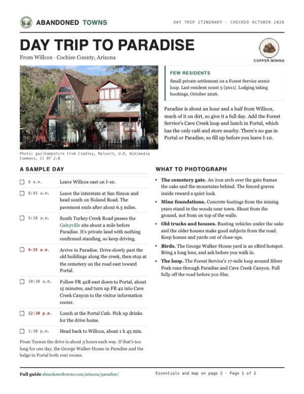
- A house in Paradise, 2013: gailhampshire from Cradley, Malvern, U.K, Wikimedia Commons, CC BY 2.0
- The cemetery gate, 2012: dedhed1950, Wikimedia Commons, CC BY-SA 2.0
- Fenced graves in the Paradise Cemetery, 2012: dedhed1950, Wikimedia Commons, CC BY-SA 2.0
- Concrete mine foundations near town, 2012: dedhed1950, Wikimedia Commons, CC BY-SA 2.0
- An old truck under the oaks, 2013: gailhampshire from Cradley, Malvern, U.K, Wikimedia Commons, CC BY 2.0
- Topo map, area base map and aerial imagery: USGS The National Map (public domain).
- Historic maps: USGS Historical Topographic Map Collection (public domain): Chiricahua 1917, 1:125,000; Rodeo 1926, 1:62,500; Portal 1958, 1:62,500; Portal 1987, 1:24,000; Portal 1998, 1:24,000.