 Abandoned

Overview
Iron, glass, then a millionaire's farm

Batsto sits below the dam of Batsto Lake on CR 542, about 9 miles east of Hammonton. Charles Read built an iron works here in 1766, smelting bog ore dug from the Pine Barrens streams. During the Revolution the furnace supplied the Continental Army with iron goods, including cannon and cannonballs.
William Richards took control of the works in 1784, and his family built most of the village over the next nine decades. When demand for iron fell in the mid-1800s, Batsto switched to glass, making window panes and glass for street lamps. That didn't last either, and by 1867 the village's industry had ended.
In 1876 the Philadelphia industrialist Joseph Wharton bought it. He farmed the land, ran a sawmill and used the mansion as a family retreat. The state bought his 96,000 acres in 1954 and 1955, and that land is now the core of Wharton State Forest. The village was restored and dedicated in 1961. The last house was vacated in 1989.
Timeline
A century of iron and glass

- The name comes from the Swedish bastu, a bathing place, by Wikipedia's account; the first bathers were probably the Lenape.
- Charles Read builds the Batsto Iron Works on the Batsto River, using bog ore from the Pine Barrens.
- Batsto's furnace supplies General Washington's Continental Army with iron goods, including cannon and cannonballs.
- William Richards buys a controlling interest. His son Jesse and grandson Thomas run the works after him, and the family builds most of the village over the next 91 years.
- Demand for iron falls, and Batsto turns to glass, making window panes and glass for street lamps.
- Jesse Richards opens the post office. It closes and reopens several times; the Batsto Citizens Committee reopened it in 1966.
- Iron and glass making end; the Pinelands Alliance dates the industrial era to 1766–1867. Wikipedia says Batsto went bankrupt.
- Philadelphia industrialist Joseph Wharton buys Batsto. He turns it into a farm and milling village and a family estate, and in time owns 96,000 acres of South Jersey.
- Wharton's water-powered sawmill is built. It still runs.
- Wharton dies. The Girard Trust Company manages his Pine Barrens lands.
- The State of New Jersey buys the 96,000-acre Wharton estate, now the core of Wharton State Forest. (Wikipedia gives 1958.)
- The restored village is dedicated on May 27, and work on the visitor center begins.
- Batsto Village is listed on the National Register of Historic Places.
- The last house in the village is vacated.
What's left
What you'll see


NJ State Parks counts more than thirty 19th-century buildings. The highlights it names are the furnished 36-room mansion, the 1882 water-powered sawmill, which still works, and the 1852 post office, which still hand-cancels mail. Wikipedia adds a gristmill, general store, blacksmith and wheelwright shop, carriage house and stable, ice and milk houses, a charcoal kiln, workers' houses and a 19th-century ore boat. The 1808 Batsto-Pleasant Mills church nearby still holds services.
The visitor center has a museum on the Pine Barrens and the village. On the lake shore, the Annie M. Carter Nature Center opens seasonally. The 1890 USGS sheet below shows Batsto at the south end of its millpond, where several roads meet, with Pleasant Mills just across the river. The 1942 sheet adds the Batsto Lookout Tower on the rise to the northeast.
- Batsto Mansion (36 rooms)
- Sawmill (1882)
- Gristmill
- Post office (1852)
- General store
- Blacksmith and wheelwright shop
- Carriage house and stable
- Workers' houses
- Charcoal kiln
- Visitor center museum


Historic maps
Batsto Village on USGS maps, 1890–1953
Crops from the USGS Historical Topographic Map Collection, centered on the townsite. Each sheet shows what surveyors mapped that year; compare them with today's topo and aerial on this page.

Day trip
Plan a day trip to Batsto Village from Hammonton
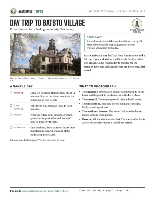
Take it with you
Day trip itinerary
The essentials, the sample day with boxes to tick, what to photograph and the coordinates, on two printable pages. Handy where there's no signal.
Download the PDF (541 KB)Batsto makes an easy half day from Hammonton and a full one if you add Atsion, the Richards family's other iron village. Come Wednesday to Sunday for the mansion tour, and call ahead: tours are first come, first served.
A sample day
- Drive CR 542 from Hammonton, about 15 minutes. Start at the visitor center for the museum and tour tickets.
- Take the 11 a.m. mansion tour, 45 to 55 minutes.
- Walk the village loop: sawmill, gristmill, general store, post office and workers' houses. Picnic by the lake.
- On a weekend, drive to Atsion for its 1826 mansion and lake. Or walk one of the trails along Batsto Lake.
Coming from Philadelphia? The drive is about an hour.
What to photograph and film
- The mansion tower. Step back across the lawn to fit the tower and the porch in one frame, as in the hero photo.
- The sawmill. The water-powered 1882 mill still works.
- The post office. Mail sent here is still hand-cancelled. Mail yourself a postcard.
- The workers' houses. The row of dark wooden houses makes a strong receding line.
- Drones. Ask the visitor center first. The state's rules for its Atsion historic site require a special use permit.
Map & directions
Getting there
Hammonton is the closest town, about 15 minutes away on CR 542. From Philadelphia, the fastest route runs down the Atlantic City Expressway to the Hammonton exit, which the Batsto Citizens Committee gives as exit 28, and joins the Hammonton route.


Base map: USGS The National Map (public domain). Routes: OSRM on © OpenStreetMap contributors data (ODbL), computed October 2026. Times assume dry roads.
- From downtown Hammonton, follow Central Avenue (CR 542).1.7 mi
- Turn right on the White Horse Pike (US 30), then left on Pleasant Mills Road, still CR 542.2.4 mi
- Continue on CR 542 (Nesco Road, then Pleasant Mills Road) to Batsto.4.8 mi
- From City Hall, take Broad Street and Race Street to the bridge, then I-676 and I-76 into New Jersey.10.1 mi
- Follow NJ 42 onto the Atlantic City Expressway.22.2 mi
- Take exit 28 and follow NJ 54 north into Hammonton.2.5 mi
- Follow the Hammonton route: Central Avenue, US 30, then CR 542 to Batsto.8.9 mi
Road and safety notes
- CR 542 runs past the village; the visitor center is at 31 Batsto Road.
- Sand roads lead off into Wharton State Forest. Drive only roads on the state's Visiting Vehicle Use Map, at up to 20 mph.
- There are no trash cans in the forest. Carry out what you bring.
- The state advises repellent and tick checks after a visit.
Photos
Batsto Village in photos
Visitor reports
Been to Batsto Village?
Been there lately? Tell the next visitor what you found: whether you could get in, the state of the road and what's still standing. Photos are welcome. We read every report before it appears here.
Other mining and oil
More lead, iron, mercury and oil ghost towns
The nearest in New Jersey.

 Guide
Atsion
39.74, -74.73Burlington County, New Jersey
An ironworks village in the Pine Barrens that failed, revived under the Richards family, and emptied again. Its 1826 mansion stands beside Atsion…
 Guide
Allaire Village
40.16, -74.13Monmouth County, New Jersey
James P. Allaire's Howell Works smelted bog iron here for his New York steam engine shops, then went cold in the 1840s. Thirteen of its buildings…
Nearby
Other sites near Batsto Village
Straight-line distance from the townsite to other mapped sites in our New Jersey index.
- Pleasant Mills0.7 mi W · Atlantic
- Washington4.8 mi NE · Burlington
- Harrisville6.8 mi E · Burlington
- Martha7.8 mi E · Burlington
- Atsion8.1 mi NW · Burlington
- High Crossing8.8 mi N · Burlington
- Hampton Furnace9.0 mi N · Burlington
- Eagle9.7 mi NE · Burlington
Sources
Sources and credits
- ghosttowns.com, "Batsto Village": fact sheet fields (county, roads, best time).
- Wikipedia, "Batsto Village, New Jersey", retrieved October 2026: the name, bog ore, early owners and the Richards family's 91 years, bankruptcy, Girard Trust, the 1958 purchase date it gives, 1961 dedication, 1971 National Register listing, 1989 last house vacated, building list, church.
- NJ State Parks, "Wharton State Forest" (updated May 28, 2026; read from the Internet Archive copy of June 18, 2026, because the live site blocks automated readers): Revolutionary iron goods, glass production, Wharton's 1876 purchase, more than thirty surviving buildings, the 36-room mansion, 1852 post office and 1882 sawmill, grounds open daily dawn to dusk, tours through the year, office hours, summer entrance fees, museum, nature center, accessibility, vehicle rules, trash, permits. The state's own Batsto Village page could not be opened for this review.
- NJ State Parks, "Atsion Mansion Historic Site" (Internet Archive copy of July 27, 2026): the 96,000-acre Wharton estate bought in 1954 and 1955; drone rule at the state's historic sites.
- Batsto Citizens Committee, the nonprofit that assists the state at Batsto: "Tours" (mansion tour days, times, group size, prices and length; village walking tours), "Post Office" (openings and closings since 1852), "Location & Directions" (exit 28 from the Atlantic City Expressway) and "Wharton Monthly: August 2026" (entrance fees at Batsto on summer weekends and holidays), read October 2026.
- New York-New Jersey Trail Conference, "Wharton State Forest": trails along Batsto Lake.
- Pinelands Alliance, "Pine Barrens Ghost Towns": the village as a bog iron and glass center, 1766 to 1867, and its workers' homes.
- Elevation: USGS 3D Elevation Program point query. Routes: OSRM on OpenStreetMap data, October 2026.
Photo and map credits
- Batsto Mansion, 2024: Travellers & Tinkers, Wikimedia Commons, CC BY-SA 4.0
- The post office, 2010: Frederikto, Wikimedia Commons, CC BY-SA 3.0
- The water mill, 2010: Frederikto, Wikimedia Commons, CC BY-SA 3.0
- A row of village houses, 2010: Frederikto, Wikimedia Commons, CC BY-SA 3.0
- The mansion and its tower in winter, 2012: en:User:JackTheVicar, Wikimedia Commons, CC BY-SA 3.0
- Batsto on the 1890 USGS sheet: U.S. Geological Survey, USGS catalog, Public domain
- Area base map, topo and aerial imagery: USGS The National Map (public domain).
- Historic maps: USGS Historical Topographic Map Collection (public domain): Mullica 1890, 1:62,500; Mullica 1919, 1:62,500; Egg Harbor 1942, 1:62,500; Atsion 1953, 1:24,000.