 Abandoned

Overview
Bog iron for New York steam engines

Allaire Village stands on the north bank of the Manasquan River in Allaire State Park, off CR 524 near Farmingdale. A sawmill worked here by 1750, and an iron works known as Williamsburg Forge, then Monmouth Furnace, followed. It smelted bog iron, an ore that hardens in marshes and swamps.
James P. Allaire, who built steam engines in New York, bought the works in 1822 and ran it as the Howell Works. Its pig iron went to his New York foundry for steamship engines and boilers, and the furnace also cast pots, kettles, stoves, pipes and sash weights. The operator calls it a self-sustained community and puts its peak at 400 people; Wikipedia says about 500.
The depression that began in 1837 started the decline. The local ore had been over-mined, and the furnace went cold in 1846 by Wikipedia's date, 1848 by the operator's. The village emptied. Arthur Brisbane bought the land in 1901, and his widow gave it to the state in 1941. Today Allaire Village, Inc., a nonprofit, opens 13 surviving buildings to visitors under a state license.
Video
Rolling through the village in early spring
A wheelchair user tours the village on an early spring afternoon, the trees still bare. The camera follows the paved and gravel lanes past the millpond, the blacksmith shop, the bakery, the carpentry shop, a large white house he calls the owner's "big house," the foreman's cottage and the chapel, then rolls the length of the brick row houses to the parking area. He points out a ramp with a lip he couldn't climb and says he couldn't get into the blacksmith shop or bakery without help. The narration is the creator's own. Its figure of about 400 people is the operator's; Wikipedia gives about 500. The village history on this page follows the operator and Wikipedia.
 Play “Alaire State Park Village Accessible Early American Industrial Town” from YouTube
Timeline
From sawmill to state park

- The ground beside the Manasquan River is a Native American ceremonial site, by Wikipedia's account.
- Isaac Palmer has a sawmill here. The village's operator dates the first industry to the early 1750s.
- A bog iron works grows up on the site, known as Williamsburg Forge and later Monmouth Furnace. Wikipedia says Benjamin B. Howell renamed it the Howell Works.
- James P. Allaire, a New York steam engine builder, buys the property. The operator says he named it the Howell Works and shipped its pig iron to his New York foundry for steamship engines and boilers.
- The village is a self-contained company town. The operator puts its peak at 400 people; Wikipedia says about 500.
- An economic depression begins, and with it, in the operator's account, the village's decline. Wikipedia adds that the bog ore beds had been over-mined and ore had to be bought from Staten Island.
- The furnace goes cold. Wikipedia says the business collapsed in 1846; the operator says the fires were put out in 1848.
- Newspaper editor Arthur Brisbane buys the property. A New York Times headline of October 19, 1901, cited by Wikipedia, reads "Hal Allaire, Village Owner, Is Dead."
- Allaire State Park is created (1940, per Wikipedia's park article). In 1941 Phoebe Brisbane deeds the land to the state in memory of her husband.
- The village is dedicated as part of the state park in June 1957 and reopened by Governor Robert B. Meyner on May 24, 1958.
- The Pine Creek Railroad, run by the New Jersey Museum of Transportation, moves to the park.
- Allaire Village is listed on the National Register of Historic Places on January 11.
- Thirteen original buildings stand. The nonprofit Allaire Village, Inc. runs the village under a license from the State of New Jersey.
What's left
What you'll see


The operator counts 13 original buildings. It names a carpentry and pattern shop, blacksmith shop, bakery, boarding house, blast furnace, mills, school, church, general store with post office, and workers' homes. Wikipedia's park article adds the manager's and foreman's houses, and says one workers' row house was rebuilt to hold the visitor center and museum. Costumed volunteers demonstrate the trades in the shops.
The 1888 USGS sheet below shows Allaire as a cluster where roads meet north of the Manasquan River, with the Freehold and Jamesburg railroad passing to the northeast, Squankum to the west and Allenwood to the southeast. By 1954 the sheet prints ALLAIRE STATE PARK across the river marshes, and CR 524 runs along the park's northern edge.
- Blast furnace stack
- General store
- Bakery
- Chapel
- Workers' row houses
- Manager's house
- Foreman's cottage
- Blacksmith and carpentry shops
- Wheelwright shop
- Visitor center museum


Historic maps
Allaire Village on USGS maps, 1888–1954
Crops from the USGS Historical Topographic Map Collection, centered on the townsite. Each sheet shows what surveyors mapped that year; compare them with today's topo and aerial on this page.

Day trip
Plan a day trip to Allaire Village from Freehold
Take it with you
Day trip itinerary
The essentials, the sample day with boxes to tick, what to photograph and the coordinates, on two printable pages. Handy where there's no signal.
Download the PDF (611 KB)Allaire makes an easy half day from Freehold. Come on a weekend from April, when the shops and homes are open, or Friday to Sunday for the bakery and general store. Check the village's events calendar first: special events replace general admission.
A sample day
- Drive from Freehold, about 25 minutes. Start at the visitor center museum in the rebuilt row house.
- Walk the village: blast furnace, general store, bakery, chapel, row houses and the working shops.
- Lunch from the bakery or a picnic in the park.
- Ride the Pine Creek Railroad, or walk a trail along the Manasquan River.
What to photograph and film
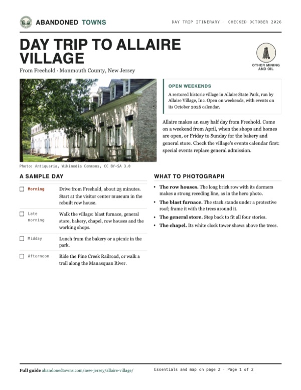
- The row houses. The long brick row with its dormers makes a strong receding line, as in the hero photo.
- The blast furnace. The stack stands under a protective roof; frame it with the trees around it.
- The general store. Step back to fit all four stories.
- The chapel. Its white clock tower shows above the trees.
Map & directions
Getting there
Freehold is the closest town, about 25 minutes away by NJ 33 Business and CR 524. From New York City the route runs through the Holland Tunnel, down the New Jersey Turnpike and the Garden State Parkway, about an hour and a half.


Base map: USGS The National Map (public domain). Routes: OSRM on © OpenStreetMap contributors data (ODbL), computed October 2026. Times assume dry roads.
- From downtown Freehold, take South Street (NJ 79).0.7 mi
- Turn left on Park Avenue and follow NJ 33 Business east.6.0 mi
- Turn right on Colts Neck Road, which becomes North Main Street (CR 35).1.8 mi
- Bear left on Main Street (CR 524), which becomes Lakewood Farmingdale Road.2.4 mi
- Turn left on Allaire Road, which becomes Atlantic Avenue (CR 524).1.3 mi
- Turn right into the park and the village.0.5 mi
- From Park Row, follow Church and Hudson Streets to the Holland Tunnel approach.1.2 mi
- Take the Holland Tunnel (I-78) and 14th Street in Jersey City.2.2 mi
- Follow NJ 139 over the Pulaski Skyway.4.7 mi
- Continue on US 1/9 and the ramps to the Newark Bay Extension.4.2 mi
- Take the New Jersey Turnpike (I-95) south.11.9 mi
- Leave at exit 11 for the Garden State Parkway southbound.2.1 mi
- Follow the Garden State Parkway south.30.3 mi
- Leave at exit 98 and follow the ramps to NJ 34.2.0 mi
- At the roundabout take Allaire Road, turn left on Allenwood Road, then right on Atlantic Avenue (CR 524).2.3 mi
- Turn left into the park and the village.0.5 mi
Road and safety notes
- The village is at 4263 Atlantic Avenue (CR 524), inside Allaire State Park.
- Allaire State Park charges no entrance fee, and its office is open 9 a.m. to 4:30 p.m. daily, 732-938-2371 (state park page, archived August 29, 2026).
- The park has no trash cans: carry out what you bring. Fishing in the Manasquan River follows New Jersey fish and wildlife law.
Photos
Allaire Village in photos
Visitor reports
Been to Allaire Village?
Been there lately? Tell the next visitor what you found: whether you could get in, the state of the road and what's still standing. Photos are welcome. We read every report before it appears here.
Other mining and oil
More lead, iron, mercury and oil ghost towns
The nearest in New Jersey.

 Guide
Atsion
39.74, -74.73Burlington County, New Jersey
An ironworks village in the Pine Barrens that failed, revived under the Richards family, and emptied again. Its 1826 mansion stands beside Atsion…
 Guide
Batsto Village
39.64, -74.65Burlington County, New Jersey
An iron town that cast cannonballs for Washington's army, then made glass, then became Joseph Wharton's country estate. The state keeps it as it…
Nearby
Other sites near Allaire Village
Straight-line distance from the townsite to other mapped sites in our New Jersey index.
- Asbury Park7.7 mi NE · Monmouth
- Crossley16.7 mi SW · Ocean
- Double Trouble State Park18.7 mi S · Ocean
- Island Beach21.9 mi S · Ocean
- Aserdaten23.6 mi SW · Ocean
- Whitesbog24.4 mi SW · Burlington
- Raritan Landing29.8 mi NW · Middlesex
- Ong's Hat31.2 mi SW · Burlington
Sources
Sources and credits
- ghosttowns.com, "Allaire Village": fact sheet fields (county, road, remains, best time, climate) and the 500 residents.
- Wikipedia, "Allaire Village", retrieved October 2026: ceremonial ground, Palmer's sawmill, Williamsburg Forge and Monmouth Furnace, Howell's naming, the 1822 purchase, about 500 people, over-mined ore, the 1846 collapse, Brisbane's 1901 purchase and the 1941 deed, the 1957 dedication and 1958 reopening, the January 11, 1974 National Register listing, and the cited New York Times headline "Hal Allaire, Village Owner, Is Dead" (October 19, 1901).
- Wikipedia, "Allaire State Park", retrieved October 2026: park created 1940, the Howell Works name, building list and the visitor center in a rebuilt row house, the Pine Creek Railroad (1962, half-mile loop), trails.
- Allaire Village, Inc., "History", read October 2026: early-1750s industry, the 1822 purchase and the Howell Works name, pig iron for New York steamship engines and boilers, products, 400 people, the 1837 depression, fires out in 1848, 13 original buildings.
- Allaire Village, Inc., home page and "Village Hours & General Admission", read October 29, 2026: operator and state license, building list, address, phone, shop, bakery, store and office hours, $5 general admission; and its 2026 Calendar of Events: the October 2026 events and Friday to Sunday general admission days, Fridays free.
- New Jersey Monthly, "Allaire State Park and Historic Village" (September 13, 2010): trade demonstrations by volunteers in period dress.
- NJ State Park Service, "Allaire State Park", archived copy of August 29, 2026 (the live page is behind a bot wall): no entrance fee, park office 9 a.m. to 4:30 p.m. daily and its phone, the family campsites closed for a new bathroom and shower building (group sites open April 1 to December 15), partial accessibility, no trash cans, fishing under state fish and wildlife law, the Pine Creek Railroad and its phone.
- Wheelchair Travel & Adventure Channel, "Alaire State Park Village Accessible Early American Industrial Town," YouTube, posted February 23, 2026: the video on this page; the lanes, buildings and doorways in early spring.
- Elevation: USGS 3D Elevation Program point query. Routes: OSRM on OpenStreetMap data, October 2026.
Photo and map credits
- Engraving of the Howell Works, 1853: Unknown author, Wikimedia Commons, Public domain
- The foreman's cottage, August 2012: Antiquaria, Wikimedia Commons, CC BY-SA 3.0
- Brick buildings of the village, identified by the photographer as the bakery and manager's house, August 2012: Antiquaria, Wikimedia Commons, CC BY-SA 3.0
- Workers' row houses, with a datestone at the corner, August 2013: bobistraveling, Wikimedia Commons, CC BY 2.0
- The general store, July 1970: Jerrye & Roy Klotz, MD, Wikimedia Commons, CC BY-SA 3.0
- The blast furnace stack, August 2012: Antiquaria, Wikimedia Commons, CC BY-SA 3.0
- The chapel, August 2012: Antiquaria, Wikimedia Commons, CC BY-SA 3.0
- The wheelwright shop, September 2018: Joe Bittabip, Wikimedia Commons, CC BY-SA 4.0
- A weathered dormer window on a village building, August 2013: bobistraveling, Wikimedia Commons, CC BY 2.0
- The row houses, August 2012: Antiquaria, Wikimedia Commons, CC BY-SA 3.0
- Allaire on the 1888 USGS Asbury Park sheet: U.S. Geological Survey, USGS catalog, Public domain
- Area base map, topo and aerial imagery: USGS The National Map (public domain).
- Historic maps: USGS Historical Topographic Map Collection (public domain): Asbury Park 1888, 1:62,500; Farmingdale 1942, 1:24,000; Farmingdale 1954, 1:24,000.