 Abandoned
Overview
Hay, zinc and the highway

Quapaw is the first town on Route 66 in Oklahoma, a few miles south of the Kansas line and 9 miles northeast of Miami. It takes its name from the Quapaw people, who were moved here from Arkansas in the 1830s, and it is the capital of the Quapaw Nation today. A Kansas farmer, Isaac "Red Ike" Bingham, settled in 1891, and a railroad stop in 1896 made the place a shipping point for hay, corn and flax. It was known as "the Hay Capital."
Lead and zinc changed it. As the Tri-State mining district opened up, the new townsite east of the old one incorporated in 1917, and the 1920 census counted 1,394 people. Bingham built the Palace Theater, a Masonic hall and the three-story Gateway Hotel, and the town had banks, drugstores, a Ford dealer, a Nehi bottler and a factory making zinc-faced washboards. US 66 came through in 1926, and in March 1933 the town hosted the celebration of its paving across Ottawa County.
The mines began to decline before World War II, and the turnpike took the highway traffic in 1957. The town fell to 850 people by 1960 and was left ringed by mine waste, the gray chat piles of the Tri-State field. A tornado in 2014 took more of the old downtown. Quapaw is a living town of about 800 people, with a school, churches and a 1969 restaurant on Main Street. It is on ghost-town lists for what mining and the bypass took away: thinned-out brick blocks, empty storefronts and vanished highway businesses.
Video
Veterans Day flags on Main Street
A Quapaw native drives in from the countryside and down Main Street the day before Veterans Day, past the brick and metal storefronts. American flags line the street, and banners with local veterans' photos and names hang on the power poles. He stops by the Dallas' Dairyette sign to zoom in on the banners.
 Play “I am proud of how my hometown honors veterans. #Quapaw OK #veterans” from YouTube
Timeline
From hay stop to mining town
- The Quapaw, pushed out of Arkansas, are assigned land in the northeast corner of Indian Territory.
- Kansas farmer Isaac "Red Ike" Bingham settles here and brings in relatives to open businesses.
- St. Mary's of the Quapaws, a school, opens on land given by Chief John Quapaw.
- The Kansas City, Fort Scott and Memphis Railroad puts a stop here. Hay, corn and flax ship east by the carload, and a post office opens in a grocery store on June 9, 1897.
- "New Town Quapaw," platted east of the old town on land bought from Harry Whitebird, incorporates as the lead and zinc boom brings miners to the region.
- The first census counts 1,394 people.
- US 66 is routed through town.
- Quapaw celebrates the paving of US 66 across Ottawa County. Chief Victor Griffin lays a zinc tablet in the middle of Main Street before a crowd of more than 5,000, Cyrus Avery among them.
- Mining declines; 1,054 people.
- The new turnpikes, now I-44, link Oklahoma City and Joplin and bypass this stretch of Route 66.
- The census low: 850 people.
- Dallas Wall opens Dallas' Dairyette on Main Street.
- On April 27 a tornado with no warning goes through the center of town, killing one person and destroying the fire station.
- Hemi's Cafe, opened as the 69A Cafe in 1997, closes for good.
- The census counts 811 people (808 per the state encyclopedia).
- Dallas Wall dies on October 13. The Dairyette closes for a few days and reopens.
What's here
Main Street, Route 66


Route 66 runs straight through town as Main Street. TheRoute-66.com says the red-brick downtown was badly hit by the 2014 tornado, that the town has lost many buildings, and that most of its old highway sights are gone. Legends of America points out the murals on downtown buildings. Photos from 2008 show low brick storefronts, some with painted-over walls, and the town hall at 410 Main in a brick storefront with a shingled porch roof.
The landmark still open is Dallas' Dairyette at 103 North Main Street, which Dallas Wall opened in 1969 and ran for more than 50 years. Wall, who also served four years as mayor and more than 45 years on the town council, died on October 13, 2026, and the restaurant reopened after a few days, Route 66 News reported. Across the road, Hemi's Cafe closed in 2018. The Casa Loma Court, a U-shaped motel at 513 Main, has been replaced by one-story apartments. Near the south end of town a "Where East Meets West" sign stands where the 1926 road kept straight south and the 1930s alignment curves west.
Northeast of town, toward Kansas, the highway passes a granite "Entering Indian Territory" marker just south of the state line and the site of the 1950s Indian Village Trading Post, where only foundations and a ring of trees are left, TheRoute-66.com says. A quarter mile past the marker, South 630 Road forks off. It is the original unpaved 1926 route into Quapaw, and TheRoute-66.com (2025) describes it as dirt.
Two more things draw visitors. The Quapaw Nation's powwow, which the state encyclopedia calls one of the oldest in Oklahoma, is held each July at the Quapaw Powwow Grounds at Beaver Springs Park, 5681 South 630 Road; the 154th ran July 2 to 5, 2026, and the encyclopedia says it is free to the public. East of town is the Devil's Promenade, a bluff on Spring River. Legend says the "Spook Light" seen near there is the ghosts of two young lovers. Legends of America says it can only be seen east of town and is often named for Joplin or Hornet, in Missouri.
Most of Quapaw is homes and private property. The old storefronts and the chat piles around the Tri-State field are not for climbing into or onto: Wikipedia notes the region was left with widespread mine waste and serious environmental hazards.
- Brick storefronts and murals on Main Street
- Dallas' Dairyette (open, October 2026)
- Town hall, 410 Main
- Casa Loma Motel site, now apartments
- "Where East Meets West" sign
- "Entering Indian Territory" marker near the state line
- 1926 Route 66 roadbed, South 630 Road (dirt)
- Chat piles and tailings to the north
The historic maps below show the town before and after the mines. On the 1907 sheet Quapaw is a few blocks beside the railroad, with Lincolnville and two river ferries to the southeast, years before the highway. The 1954 sheet shows US 66 curving through Quapaw on its way from Kansas to Commerce and Miami, with mine symbols scattered around Picher and Cardin to the west. The 1961 sheet shows the full grid, with US 66 down Main Street, a water tower at the south end and tailings to the northeast. The 1986 sheet shows the road marked 66 and 69 and the tailings around Picher, Cardin and Douthat.


Historic maps
Quapaw on USGS maps, 1907–1986
Crops from the USGS Historical Topographic Map Collection, centered on the townsite. Each sheet shows what surveyors mapped that year; compare them with today's topo and aerial on this page.

Day trip
Plan a day trip to Quapaw from Miami
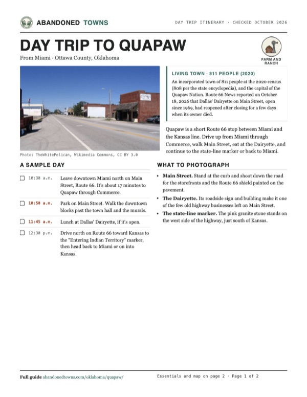
Take it with you
Day trip itinerary
The essentials, the sample day with boxes to tick, what to photograph and the coordinates, on two printable pages. Handy where there's no signal.
Download the PDF (465 KB)Quapaw is a short Route 66 stop between Miami and the Kansas line. Drive up from Miami through Commerce, walk Main Street, eat at the Dairyette, and continue to the state-line marker or back to Miami.
A sample day
- Leave downtown Miami north on Main Street, Route 66. It's about 17 minutes to Quapaw through Commerce.
- Park on Main Street. Walk the downtown blocks past the town hall and the murals.
- Lunch at Dallas' Dairyette, if it's open.
- Drive north on Route 66 toward Kansas to the "Entering Indian Territory" marker, then head back to Miami or on into Kansas.
What to photograph and film
- Main Street. Stand at the curb and shoot down the road for the storefronts and the Route 66 shield painted on the pavement.
- The Dairyette. Its roadside sign and building make it one of the few old highway businesses left on Main Street.
- The state-line marker. The pink granite stone stands on the west side of the highway, just south of Kansas.
Map & directions
Getting there
Quapaw is on Route 66, signed as US 69A, between Commerce and the Kansas line. From Miami it's about 17 minutes north through Commerce. From Joplin, Missouri, it's about 34 minutes west on Route 66 through the corner of Kansas.

Base map: USGS The National Map (public domain). Routes: OSRM on © OpenStreetMap contributors data (ODbL), computed October 2026. Times assume dry roads.
- From downtown Miami, head north on Main Street.3.1 mi
- Continue north on US 69, Route 66, through Commerce.3.8 mi
- Continue northeast on OK 66 and US 69A.2.0 mi
- Turn left on South 600 Road, which becomes South Maple Street, then right on West 3rd Street.1.0 mi
- From downtown Joplin, head west on 7th Street, Route 66.6.0 mi
- Continue on KS 66 in Kansas.5.5 mi
- Go straight through the roundabout on Route 66.1.8 mi
- Continue on US 69 Alternate into Oklahoma and Quapaw.8.1 mi
- Turn right on County Road E40, then left on North Elm Street to West 3rd Street.0.4 mi
Road and safety notes
- Both routes are U.S. and state highways to the edge of town, then town streets. Route 66 here is signed as US 69A, OK 66 and US 69.
- The 1926 roadbed into town from the northeast, South 630 Road, is dirt, TheRoute-66.com said in 2025.
- People live in Quapaw, and the old buildings are private. Stay off the chat piles and mine tailings around the Tri-State field.
Photos
Quapaw in photos
Visitor reports
Been to Quapaw?
Been there lately? Tell the next visitor what you found: whether you could get in, the state of the road and what's still standing. Photos are welcome. We read every report before it appears here.
Farm and ranch
More farm and ranch ghost towns
The nearest in Oklahoma.

 Guide
Ingalls
36.10, -96.88Payne County, Oklahoma
A land-run farm town that sheltered the Doolin-Dalton gang. On September 1, 1893, a posse of deputy marshals rode in, and three of them died. The…
 Guide
Bridgeport
35.55, -98.38Caddo County, Oklahoma
A cotton town on the Canadian River that boomed in 1901 and carried Route 66 across a toll bridge until 1934. The new highway went half a mile south…
Nearby
Other sites near Quapaw
Straight-line distance from the townsite to other mapped sites in our Oklahoma index.
Sources
Sources and credits
- Mickey Johnson, "Quapaw," Encyclopedia of Oklahoma History and Culture (last updated March 25, 2024): location on US 69A, Bingham, Chief John Quapaw and the school land, the 1896 railroad stop and "Hay Capital," the 1897 post office, New Town Quapaw and the 1917 incorporation, the mining-era businesses, the March 1933 paving celebration, populations 1920 to 2020 (808 in 2020), the powwow.
- Wikipedia, "Quapaw, Oklahoma", retrieved October 2026: capital of the Quapaw Nation, 9 miles from Miami, the 2020 census (811), chat and environmental hazards, coordinates (GNIS).
- Austin Whittall, "Quapaw," TheRoute-66.com (updated July 13, 2025): the Quapaw removal, the school land in 1894, the 1926 and 1930s alignments, the 1933 paving, the 1957 turnpikes, the tornado's toll on downtown, Dallas' Dairyette, Hemi's Cafe, the Casa Loma site, the "Where East Meets West" sign, the state-line marker and trading post site, South 630 Road.
- Kathy Alexander, "Quapaw & Commerce – Entering Indian Territory on Route 66," Legends of America (updated November 2025): the hay and mining eras, the murals, the Spook Light legend.
- Route 66 News, "Longtime owner and operator of Dallas’ Dairyette restaurant in Quapaw dies", October 18, 2026: Dallas Wall's death on October 13, the 1969 opening, the address, the reopening, his years as mayor and on the council.
- Route 66 News, "Tornado kills at least one in Quapaw, Baxter Springs", April 27, 2014 (updated April 28): one death, the fire station destroyed, the police station damaged, the tornado through the center of town without warning.
- Quapaw Nation, "154th Quapaw Nation Powwow" (read October 2026): the July 2 to 5, 2026 dates and the Beaver Springs Park address.
- Paul Case Farms, "I am proud of how my hometown honors veterans. #Quapaw OK #veterans", YouTube, posted November 10, 2025: the video on this page; a drive down Main Street with the Veterans Day flags and veterans' banners.
- ghosttowns.com, "Quapaw" (undated): fact sheet (county, 2WD road, climate, best time, remains) and history (farming and mining, the June 9, 1897 post office).
- Commons file pages for each photo: dates and places taken. USGS historical topographic maps (Wyandotte 1907, Tulsa 1954, Picher 1961, Neosho 1986). Elevation: USGS 3D Elevation Program point query. Routes: OSRM on OpenStreetMap data, October 2026.
Photo and map credits
- Main Street, Route 66, September 2008: TheWhitePelican, Wikimedia Commons, CC BY 3.0
- The town hall at 410 Main, September 2008: TheWhitePelican, Wikimedia Commons, CC BY 3.0
- Tornado damage in Quapaw, May 2014: National Weather Service in Tulsa, Oklahoma, Wikimedia Commons, Public domain
- Area base map, topo and aerial imagery: USGS The National Map (public domain).
- Historic maps: USGS Historical Topographic Map Collection (public domain): Wyandotte 1907, 1:125,000; Tulsa 1954, 1:250,000; Picher 1961, 1:24,000; Neosho 1986, 1:100,000.