 Abandoned

Overview
The miners left; the cottages almost went with them

Mineral Point grew on a hill of shallow lead ore between two branches of the Pecatonica River. Settlers arrived in 1827, ore was found the next year, and by the 1830s Cornish tin miners were building limestone cottages in the hollow under the hill. The street became Shake Rag. On the hill across the street miners sank shallow pits, and the Society's trail guide counts more than 100 filled shafts and badger holes on that one slope.
The lead boom lasted from 1827 to 1849, when many of the miners left for the California gold fields; Wikipedia puts the loss at 700 people. Zinc kept the mines going for decades more, and the census count was highest in 1870. The last mine in Mineral Point closed in 1928, and by then the Cornish quarter was being pulled down. Robert Neal came home from London to find many of the stone cottages gone. With Edgar Hellum he bought the first one in 1935 for $10, restored it with help from an old Cornish-trained mason, and paid for more by serving Cornish food in it for 35 years. Their cottages became Pendarvis, which the Wisconsin Historical Society has run since 1971.
The ghost-town part of this story is a neighborhood and a hillside. The miners' quarter emptied and its diggings were abandoned, but Mineral Point carried on and counted 2,581 people in 2020. Pendarvis keeps the cottages on Shake Rag Street as a museum, and across the street the Merry Christmas Mine Hill trails lead past the old badger holes, a mine shaft and a mill foundation through a restored prairie.
Timeline
Lead, zinc and a $10 cottage

- Settlers reach the hill that gives Mineral Point its name, and lead ore is found the next year. The miners are squatters on Ho-Chunk land not yet open to settlement.
- Cornish tin miners arrive, the 1970 National Register nomination says from 1830. They build small limestone cottages under the hill along what becomes Shake Rag Street. Treaties cede the land south of the Wisconsin River by the early 1830s.
- Pendarvis House is built: about 1835 by the nomination, 1845 by the Wisconsin Historical Society's site. The Society dates the Martin cabin to 1841 and calls it the oldest building on the site, Polperro to 1842 and Trelawny to late 1842 or early 1843.
- The lead boom that began in 1827 ends, in the Society's words, when many miners leave to dig gold in California. Wikipedia says the town lost 700 people to the gold rush.
- The census counts 3,275 people, the highest count in Wikipedia's census table, which starts in 1860; its Pendarvis article says the town passed 4,000 at the height of mining. Zinc has revived the mines; the Mineral Point Zinc Company is founded in 1882.
- The Merry Christmas Mine, on the hill across Shake Rag Street, resumes work on its zinc, as the Mineral Point Tribune reports on October 3.
- The last mine in Mineral Point closes.
- Robert Neal, home from London, finds many of the Cornish cottages gone. He and Edgar Hellum meet in 1934, buy Pendarvis House for $10 and open the Pendarvis House restaurant in 1935, serving pasties, saffron cake and tea.
- They buy Polperro in 1937 and restore Trelawny, their home for 37 years, in the late 1930s. A Cornish-trained mason in his eighties, Charles Curtis, supervises the rebuilding of Polperro's chimney.
- Neal and Hellum close the restaurant after 35 years.
- The Wisconsin Historical Society takes over the property and opens it as a historic site. It joins the National Register on January 25.
- The Society and the Wisconsin Conservation Corps start restoring a 43-acre prairie on Merry Christmas Mine Hill. The state finishes cleaning up the zinc works' tailings in 1993.
- The site's season runs May 28 to October 11. It plans to reopen in May 2027.
What's here
Cottages on Shake Rag, diggings on the hill


The Pendarvis buildings sit on a 4.5-acre hillside on Shake Rag Street, with the hill they were quarried from behind them. Pendarvis House is a one-storey limestone cottage whose walls are 18 to 20 inches thick; the 1970 nomination says the front stones fit so tightly that a knife blade won't pass between some of them. Trelawny next door is two storeys of the same stone. Polperro has a stone ground floor under two and a half storeys of logs, which had been hidden under clapboards until Neal and Hellum stripped them off. Up the hill is Tamblyn's Row, which takes in the Martin cabin of 1841 and, in its basement, the Kiddleywink, a Cornish-style pub Hellum created in the 1960s.
The abandoned mining ground is across the street. On Merry Christmas Mine Hill two half-mile loops, each about 30 minutes, pass badger holes, Mine Shaft No. 1 of the Merry Christmas Mine (the other shafts were filled when it closed), a 550-foot adit dug in the early 1900s, a tailings pile, a 1905 air compressor, the concrete piers of the ore mill and a stone mine building the Society dates to between the 1840s and 1900. The prairie around them covers 43 acres.
The 1952 Mineral Point sheet in the historic maps below shows the setting: the road along Brewery Creek through Shake Rag, a quarry and Soldiers Memorial Park just north, and the open hill to the east. Today's map names Shakerag Street, Spruce Street and Merry Christmas Lane.
- Pendarvis House (c. 1835 or 1845)
- Trelawny (1842–43)
- Polperro (1842)
- Martin cabin (1841)
- Tamblyn's Row and the Kiddleywink pub
- Badger holes and Mine Shaft No. 1
- Adit, 550 ft
- Ore mill foundation
- Stone mine building
- 43-acre restored prairie


Story and record
Shake Rag and the badgers
Two of Mineral Point's best-known stories come down as tradition. The 1970 National Register nomination tells the first: the men working the ridge with their windlasses could look down at mealtime and see their wives shaking rags to call them home, so the street became Shake Rag. No record shows it happening; it is the town's explanation of the name.
The second is the state's nickname. The Society's trail guide says the early miners roofed their shallow pits with logs, brush or sod and lived in them, and that the Badger State takes its name from those miners. Treat it as the usual story rather than settled fact.
The record is firmer on the cottages: Neal found many gone, while the 1970 nomination says a substantial number still stood intact a century after they were built. Both can be true, and the street today is the result.
Historic maps
Pendarvis on USGS maps, 1902–1984
Crops from the USGS Historical Topographic Map Collection, centered on the townsite. Each sheet shows what surveyors mapped that year; compare them with today's topo and aerial on this page.

Day trip
Plan a day trip to Pendarvis from Dodgeville
Take it with you
Day trip itinerary
The essentials, the sample day with boxes to tick, what to photograph and the coordinates, on two printable pages. Handy where there's no signal.
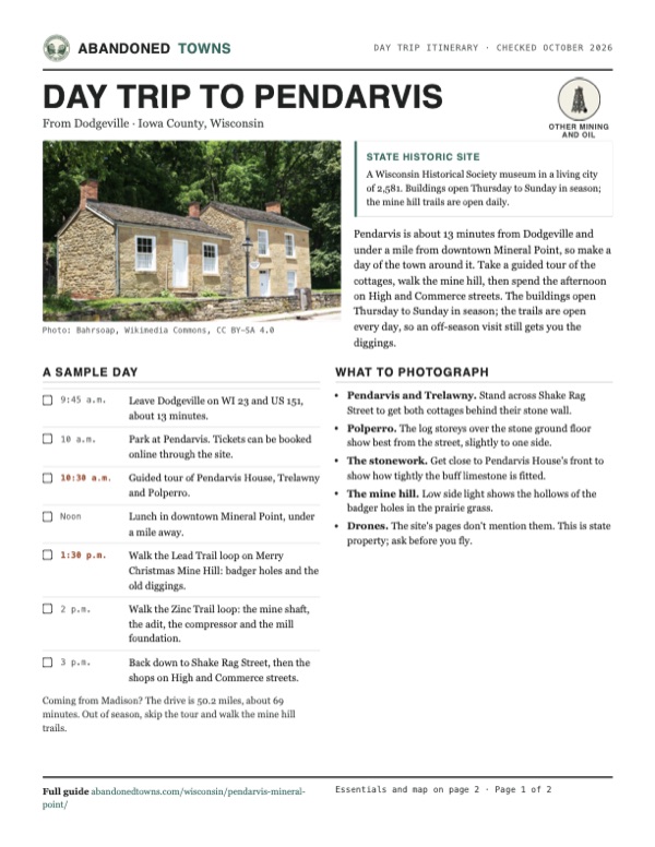
Download the PDF (704 KB)Pendarvis is about 13 minutes from Dodgeville and under a mile from downtown Mineral Point, so make a day of the town around it. Take a guided tour of the cottages, walk the mine hill, then spend the afternoon on High and Commerce streets. The buildings open Thursday to Sunday in season; the trails are open every day, so an off-season visit still gets you the diggings.
A sample day
- Leave Dodgeville on WI 23 and US 151, about 13 minutes.
- Park at Pendarvis. Tickets can be booked online through the site.
- Guided tour of Pendarvis House, Trelawny and Polperro.
- Lunch in downtown Mineral Point, under a mile away.
- Walk the Lead Trail loop on Merry Christmas Mine Hill: badger holes and the old diggings.
- Walk the Zinc Trail loop: the mine shaft, the adit, the compressor and the mill foundation.
- Back down to Shake Rag Street, then the shops on High and Commerce streets.
Coming from Madison? The drive is 50.2 miles, about 69 minutes. Out of season, skip the tour and walk the mine hill trails.
What to photograph and film
- Pendarvis and Trelawny. Stand across Shake Rag Street to get both cottages behind their stone wall.
- Polperro. The log storeys over the stone ground floor show best from the street, slightly to one side.
- The stonework. Get close to Pendarvis House's front to show how tightly the buff limestone is fitted.
- The mine hill. Low side light shows the hollows of the badger holes in the prairie grass.
- Drones. The site's pages don't mention them. This is state property; ask before you fly.
Map & directions
Getting there
Pendarvis is on Shake Rag Street, under a mile from downtown Mineral Point. Dodgeville, the county seat, is about 13 minutes north by US 151. From Madison the route runs out Verona Road and US 18/151, then into Mineral Point on WI 23. Parking at Pendarvis is free, with more on the street and in a lot by the Merry Christmas Mine Hill trails.


Base map: USGS The National Map (public domain). Routes: OSRM on © OpenStreetMap contributors data (ODbL), computed October 2026. Times assume dry roads.
- From Diagonal Street, turn right on WI 23 and follow it south through Dodgeville as North and South Iowa Street.1.8 mi
- Keep right on WI 23 and merge onto US 151.3.8 mi
- Take the exit for WI 23 and Business US 151, turn left on WI 23, which becomes Dodge Street.1.2 mi
- Turn left on Shake Rag Street to Pendarvis.1.0 mi
- From University Avenue, take North Randall Avenue and Monroe Street.2.5 mi
- Turn left on Nakoma Road, then left on South Midvale Boulevard, which becomes Verona Road.21.4 mi
- Continue on US 18/US 151, then US 151.24.1 mi
- Take the exit for WI 23 and Business US 151, turn left on WI 23, which becomes Dodge Street.1.2 mi
- Turn left on Shake Rag Street to Pendarvis.1.0 mi
Road and safety notes
- The routes are computed from OpenStreetMap and haven't been driven by us. Both stay on paved highways and city streets on the map; we have no dated source on their condition.
- Parking at Pendarvis is free, per the site, with street parking and a lot in the Merry Christmas Mine Hill area.
- The site sits on a 4.5-acre hillside. Paths are partly level but rugged, with uneven ground and steps. The visitor center and store are wheelchair accessible; access to the other buildings is limited, and the site asks visitors who need help to call 608-987-2122 ahead.
Photos
Pendarvis in photos
Visitor reports
Been to Pendarvis?
Been there lately? Tell the next visitor what you found: whether you could get in, the state of the road and what's still standing. Photos are welcome. We read every report before it appears here.
Other mining and oil
More lead, iron, mercury and oil ghost towns
The nearest in Wisconsin, then the nearest elsewhere.

 Guide
Stonehaven
43.49, -87.80Ozaukee County, Wisconsin
From 1901 to 1925 a stone company quarried dolomite here and housed its immigrant workers in a company town. The pit is now a 26-acre lake in a state…
 Guide
Fayette
45.72, -86.67Delta County, Michigan
An iron company town of about 500 people that made charcoal pig iron for 24 years. Its furnace complex, hotel and houses stand on Snail Shell Harbor…
Nearby
Other sites near Pendarvis
Straight-line distance from the townsite to other mapped sites in our Wisconsin index.
- Belmont11.7 mi SW · Lafayette
- Adamsville13.5 mi E · Iowa
- Farmers Grove23.4 mi E · Green
- Potosi29.9 mi SW · Grant
- Sinnipee31.7 mi SW · Grant
- Pleasant Ridge32.5 mi W · Grant
- Corwin44.5 mi N · Richland
- Cooksville47.2 mi E · Rock
Sources
Sources and credits
- Wisconsin Historical Society, "Plan Your Visit," Pendarvis, read October 20, 2026: the 2026 season, days, hours and tour times, the July 4 closure, admission, the grounds pass, parking, the 4.5-acre hillside and accessibility, the phone, and the mine hill trails open sunrise to sunset.
- Pendarvis home page, read October 20, 2026: closed for the season, reopening for general admission in May 2027.
- "History of Pendarvis" and "Explore", Wisconsin Historical Society, read October 20, 2026: the squatters on Ho-Chunk land, the Cornish arrivals, Neal's return from London, the $10 cottage, 1935, the restaurant to 1970, the 1971 acquisition, the 1988 prairie and 1993 cleanup, the dates of Pendarvis House (1845), Polperro (1842, bought 1937), Trelawny and the Martin cabin (1841), the Kiddleywink, more than 100 badger holes and shafts.
- "Merry Christmas Mine Hill Trails & Prairie Visitor's Guide", Wisconsin Historical Society (2019 map, linked from the plan page in October 2026): the lead boom of 1827 to 1849, the badger holes and the Badger State, the last mine closing in 1928, the 1993 cleanup, the two half-mile loops, Mine Shaft No. 1, the adit, compressor, mill foundation and mine building, the 1912 Tribune item, 43 acres, 114 Shake Rag Street.
- National Register nomination, "Pendarvis", Donald N. Anderson, State Historical Society of Wisconsin, 1970, listed January 25, 1971: 114 Shake Rag Street, the three houses and their dates of about 1835, the walls and stonework, Charles Curtis, the Shake Rag story, the cottages still standing in 1935, 4.6 acres, coordinates.
- Wikipedia, "Pendarvis (Mineral Point, Wisconsin)", retrieved October 2026: the miners leaving for California, the 1970 transfer and 1971 opening, the Rowhouse, the demolition of many cottages in the 1920s and 1930s, the article's place in Wikipedia's ghost towns of Wisconsin category.
- Wikipedia, "Mineral Point, Wisconsin", retrieved October 2026: settlement in 1827 and ore in 1828, 700 people lost to the gold rush, 3,275 people in 1870, the Mineral Point Zinc Company of 1882, zinc into the 1920s, 2,581 people in 2020.
- Historic American Buildings Survey, "Cornish Miner's House No. 1, 114 Shakerag Alley", via Wikimedia Commons: the measured drawing.
- Photos: Wikimedia Commons, credited below each one. Elevation: USGS 3D Elevation Program point query. Historic maps: USGS. Routes: OSRM on OpenStreetMap data, October 2026. Not field-checked.
Photo and map credits
- Pendarvis House (left) and Trelawny on Shake Rag Street, June 2025: Bahrsoap, Wikimedia Commons, CC BY-SA 4.0
- Polperro, August 2010: JeremyA, Wikimedia Commons, CC BY-SA 3.0
- Shake Rag Street in autumn, with Polperro at left, September 2012: QuartierLatin1968, Wikimedia Commons, CC BY-SA 3.0
- Pendarvis House and Trelawny under fall color, September 2012: QuartierLatin1968, Wikimedia Commons, CC BY-SA 3.0
- Pendarvis House and Trelawny from the street, by Carol M. Highsmith: Carol M. Highsmith, Library of Congress (highsm.40350), Wikimedia Commons, Public domain
- A log house at Pendarvis, 1975: The old perfesser, Wikimedia Commons, CC BY-SA 3.0
- The long stone row of cabins, June 2006: James Steakley, Wikimedia Commons, CC BY-SA 3.0
- HABS drawing of a Cornish miner's house at 114 Shake Rag, April 1934: Historic American Buildings Survey (sheet signed by delineator Phillips), Wikimedia Commons, Public domain
- Area base map, topo and aerial imagery: USGS The National Map (public domain).
- Historic maps: USGS Historical Topographic Map Collection (public domain): Mineral Point 1902, 1:125,000; Mineral Point 1952, 1:24,000; Dubuque North 1984, 1:100,000.