 Abandoned

Overview
A village traded for a reservoir

Delta grew up in the 1800s on the Mohawk River in the town of Western, north of Rome. Israel Stark laid it out, a grist mill and a sawmill gave it work, and by 1858 Gillette's county map showed a main street with a grist mill, a woolen factory, a foundry and a tannery. Wikipedia places it on the west bank of the river. The State Archives counts about 150 homes, and Hamilton College's account gives 300 people when the end came.
The end was the Barge Canal. In 1903 New York agreed to enlarge the Erie Canal, and the bigger canal needed water in dry summers. In 1908 the state told Delta's 300 residents to leave and began the dam. A contract for $995,347, reported in the Barge Canal Bulletin of October 1909, covered removing 295 buildings, 70 of them houses, and digging up two cemeteries. That count of houses doesn't match the State Archives' figure of about 150 homes, and we can't say which is right. Buildings that could be moved were moved. The rest came down. The Barge Canal Commission bought the land but, by Jessie Clough's research at Hamilton, did not help resettle the people.
The Barge Canal was finished in 1915 and the reservoir filled on May 18, 1916. The foundations are still down there. Wikipedia gives the lake 2,377 acres (the State Archives says about 4½ square miles); it averages 22 feet deep and reaches 60 at its deepest. Delta Lake State Park was created on the southeast shore in 1962, on a peninsula leased from the Canal Corporation, and today it is the easiest place to stand and look out over the water that covers the village.
Timeline
From Stark's mill village to the lake

- Israel Stark plans and develops the village. Prosper E. Rudd, from Connecticut, puts in an early grist mill, and David Smith Sr. builds the first sawmill, which cuts lumber for homes and stores.
- New villages form around Delta and draw some of its people away, by Wikipedia's account.
- Gillette's map of Oneida County shows Delta's main street on the west side of the Mohawk, with a grist mill, a woolen factory, a foundry, a tannery, a post office and a numbered business directory.
- New York agrees to enlarge the Erie Canal. The bigger Barge Canal needs more water, and new reservoirs.
- The State Assembly begins discussing a reservoir to supply the Barge Canal, by Hamilton College's account.
- Delta's 300 occupants are required to leave and construction of the dam begins.
- The Barge Canal Bulletin of October 1909 reports the reservoir contract: $995,347, covering the removal of 295 buildings, 70 of them dwellings, and the exhuming of two cemeteries and private burial plots.
- The Barge Canal is complete. In the words of the New York State Archives, "the village of Delta was washed away."
- The reservoir is filled. Hamilton College's account says everything but the foundations had been moved; Wikipedia says most structures were torn down or moved.
- The Canal Corporation leases about 350 acres on the southeast shore to the state parks office, and Delta Lake State Park is created.
- The park grows by 370 acres to 720 after a 2005 announcement, and counts 309,577 visitors in 2022.
What's left
Foundations under the lake

Nothing of Delta stands above water. Hamilton College's 2006 account says everything but the foundations was moved, and the foundations remain under the lake. One listing reports that some remains can be seen when the water is at its lowest point, but gives no date or detail, and we haven't found a dated report of what shows. The dam, begun in 1908, stands on the south side of the reservoir, southwest of the park.
Our map point is the one Wikipedia gives, which is also its point for the reservoir as a whole, so it marks open water rather than the old main street. The 1904 USGS sheet in the historic maps below shows the village itself, roughly 0.9 mile west of that point: Delta on the west bank of the Mohawk, with Potash Creek beside it, the canal feeder running east and the Black River Canal beyond. The 1947 sheet shows the reservoir in its place, with a Delta Cemetery on the northwest shore and Elmer Hill on the southwest shore, and the 1955 sheet labels Delta Lake State Park on the peninsula.
- Foundations under the reservoir
- Delta Dam (begun 1908)
- Delta Lake State Park (1962)


The park
Delta Lake State Park

The park's own page, read on October 20, 2026, gives the facts. It is open year-round from dawn to dusk. Cars pay $7 and buses $35 from May 24 to September 7, and the fee covers the beach, swimming and the boat launch. The 2026 camping season runs May 16 to September 12, with 101 campsites at $27 to $39 a night plus $5 for out-of-state visitors, a two-night minimum and a limit of six people a site; the page notes limitations are in place. Swimming runs the same dates, daily from 11 a.m. to 7 p.m. The boat launch opens from the end of April to the end of October, weather and lake levels permitting, and there are no boat rentals.
The park lists a swimming beach, pavilions and shelters (rented from mid-May to Columbus Day), hiking trails, biking, fishing, a playground, showers and camping, and in winter snowmobile trails, snowshoeing, cross-country skiing and ice fishing. An all-terrain beach wheelchair is available. Hunting is not allowed. The park office is open 8 a.m. to 8 p.m. in camping season; off-season hours vary, so call (315) 337-4670.
Historic maps
Delta on USGS maps, 1904–1985
Crops from the USGS Historical Topographic Map Collection, centered on the townsite. Each sheet shows what surveyors mapped that year; compare them with today's topo and aerial on this page.

Day trip
Plan a day trip to Delta from Rome
Take it with you
Day trip itinerary
The essentials, the sample day with boxes to tick, what to photograph and the coordinates, on two printable pages. Handy where there's no signal.
Download the PDF (461 KB)Delta is a short half day from Rome. Nothing of the village stands above the water, so the visit is to Delta Lake State Park on the peninsula: walk the shoreline trail and look west across the reservoir to where the mill village stood until 1908. Bring a picnic.
A sample day
- Leave Rome on NY 46 north, about 15 minutes to the park.
- Park and pick up the Yellow Trail. Follow it around the peninsula's shore.
- From the west side of the peninsula, look out across the reservoir toward the drowned village site.
- Eat a packed lunch in one of the picnic areas.
- Head back to Rome.
Coming from Syracuse? Allow about 1 hour 15 minutes each way.
What to photograph and film
- The reservoir from the Yellow Trail. The trail follows the shore of the peninsula. The village lies under the water to the west.
- Then and now. Gillette's 1858 county map, in the guide's photos, shows Delta's main street. Pair it with your own shot of the lake for a before-and-after.
- Drones. Launching, landing or flying a drone in a New York state park needs a written permit from the parks agency.
Map & directions
Getting there
Rome is the closest city, a quarter of an hour south on NY 46. From Syracuse the drive runs out the Thruway to exit 33 and along NY 365 and NY 46 through Rome. Both routes end inside Delta Lake State Park, on the peninsula; the village site is out in the water to the west.


Base map: USGS The National Map (public domain). Routes: OSRM on © OpenStreetMap contributors data (ODbL), computed October 2026. Times assume dry roads.
- From North James Street (NY 26), turn right on Stanwix Street, then left on Black River Boulevard North (NY 46).2.3 mi
- Stay on NY 46 as it becomes North James Street, Ridge Mills Road, Rome-Westernville Road and State Highway 46.4.1 mi
- Turn left into Delta Lake State Park and follow the park road to its end.0.5 mi
- From East Genesee Street, take South State Street (US 11), James Street (NY 290), Teall Avenue, Arterial Road and Court Street (NY 298) through the rotary to the Thruway.5.5 mi
- Take the New York State Thruway (I-90) east to exit 33.26.4 mi
- Follow NY 365 east, then NY 26 into Rome.10.8 mi
- Continue on NY 46: Black River Boulevard South, North James Street, Ridge Mills Road, Rome-Westernville Road and State Highway 46.6.4 mi
- Turn left into Delta Lake State Park and follow the park road to its end.0.5 mi
Road and safety notes
- The routes are computed from OpenStreetMap and haven't been driven by us. We have no dated source on road surfaces.
- The route ends inside the state park, on the peninsula. The village site is under the water to the west.
- The park charges $7 a car from May 24 to September 7.
- The boat launch runs from the end of April to the end of October, weather and lake levels permitting. Call the park before towing a boat up early or late in the season.
Photos
Delta in photos and maps
Visitor reports
Been to Delta?
Been there lately? Tell the next visitor what you found: whether you could get in, the state of the road and what's still standing. Photos are welcome. We read every report before it appears here.
Mill, lumber and company
More mill, lumber and company ghost towns
The nearest, in other states.

 Guide
Gay City State Park
41.73, -72.44Tolland County, Connecticut
A religious colony of 1796 that became a woolen-mill village called Factory Hollow, burned out twice and emptied in 1879. The state took the land in…
 Guide
Feltville
40.68, -74.39Union County, New Jersey
A stationer's model mill town of the 1840s, then a summer resort, then empty. Union County keeps it as the Deserted Village, open to walk every day…
Nearby
Other sites near Delta
Straight-line distance from the townsite to other mapped sites in our New York index.
- Waterville24.9 mi S · Oneida
- Brownville56.3 mi NW · Jefferson
- Sharon58.5 mi SE · Schoharie
- Jayville61.0 mi N · St. Lawrence
- Shavertown88.1 mi S · Delaware
- Tahawus88.3 mi NE · Essex
- Parksville104.8 mi S · Sullivan
- Trapps Mountain Hamlet124.2 mi SE · Ulster
Sources
Sources and credits
- ghosttowns.com, "Delta": fact sheet fields (roads, climate, best time, remains at low water).
- Wikipedia, "Delta, New York", retrieved October 2026: coordinates, the town of Western, Israel Stark, the mills, 1811, the 1903 canal agreement, the $995,347 contract, 295 buildings and 70 dwellings, the cemeteries (citing the Barge Canal Bulletin, October 1909).
- Wikipedia, "Delta Reservoir", retrieved October 2026: dam begun 1908 on the south side, 2,377 acres, 22 and 60 feet of depth, 548-foot surface, the village on the west bank, most structures torn down and moved.
- Wikipedia, "Delta Lake State Park", retrieved October 2026: 720 acres, the 1962 lease of about 350 acres, the 2005 expansion, 309,577 visitors in 2022, the park's coordinates.
- New York State Parks, "Delta Lake State Park", read October 20, 2026: hours, 2026 seasons, fees, campsites, amenities, beach wheelchair, hunting, office hours, address and phone. Rechecked October 21, 2026 for the day trip: off-season office hours, the boat launch, the wooded, flat terrain, picnic areas and the pet rules.
- New York State Parks, Delta Lake State Park trail map, produced July 17, 2023: the Yellow, Fox Run and Beach trails and their lengths, restrooms and the concession stand.
- New York State Parks, "Regulating Unmanned Aircraft Systems", procedure OPR-PCD-018, effective January 6, 2015: drones need a written permit.
- Hamilton College, "Jessie Clough '07 Exploring History of the Village of Delta, N.Y.", June 28, 2006: 300 occupants, the 1906 Assembly discussion, the 1908 order to leave, the May 18, 1916 filling, foundations under the lake, the Barge Canal Commission.
- New York State Archives Partnership Trust, "Delta Dam, Near Rome, 1916", read as the Internet Archive copy of April 17, 2026 (the live page refused our requests): about 150 homes, water for the dry summer months, about 4½ square miles of lake, "With the completion of the Barge Canal in 1915, the village of Delta was washed away."
- Gillette's Map of Oneida County, 1858, via Wikimedia Commons (in the photos): Delta's main street, mills and shops, and business directory.
- USGS Boonville sheet, 1904, and Westernville sheets, 1947 and 1955 (in the historic maps below): the village on the river, the reservoir, Delta Cemetery and the state park label.
- Elevation: USGS 3D Elevation Program point query. Routes: OSRM on OpenStreetMap data, October 2026. Not field-checked.
Photo and map credits
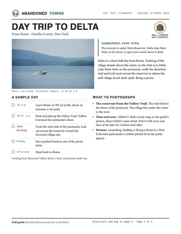
- A motorboat on Delta Lake, July 2008: Ducio1234, Wikimedia Commons, CC BY-SA 3.0
- Delta's main street and business directory on Gillette's 1858 county map: J. H. French, Wikimedia Commons, Public domain
- Delta, Stokes and Westernville on the 1858 map: J. H. French, Wikimedia Commons, Public domain
- The park beach, July 2021: Mysticrain19, Wikimedia Commons, CC0
- Delta Lake from the Yellow Trail in the state park, August 2015: Nick Hepler from Troy, New York, USA, Wikimedia Commons, CC BY 2.0
- Delta Lake through the trees on the park's south shore, looking southwest, May 2021: Mysticrain19, Wikimedia Commons, CC0
- Area base map, topo and aerial imagery: USGS The National Map (public domain).
- Historic maps: USGS Historical Topographic Map Collection (public domain): Boonville 1904, 1:62,500; Westernville 1947, 1:31,680; Westernville 1955, 1:24,000; Utica 1962, 1:250,000; Utica 1985, 1:100,000.