 Abandoned

Overview
The village abandoned twice

Adirondac stood on the upper Hudson just below Henderson Lake, in the mountains of the Town of Newcomb. In 1826 Archibald McIntyre and David Henderson found iron ore here, a bed so rich, by the OSI marker's account, that it dammed the river, and from 1827 their works dug and smelted it. The village got a bank, a boarding house for the workers and a manager's cottage. A great stone blast furnace went up by the river in the mid-1850s. Titanium in the ore made it hard to process, floods washed out the dams, the economy crashed and McIntyre died. By 1858 the village was empty.
Hunters came next. By the late 1870s every iron-era building but the MacNaughton Cottage had decayed, the OSI marker says. From 1877 the Adirondack Club, renamed the Tahawus Club in 1898, leased the deserted village and built lodges, some on the iron-era foundations. Theodore Roosevelt was staying at the MacNaughton Cottage in 1901 when word reached him about the wounded President McKinley. The OSI marker says the news was that McKinley had been shot; Wikipedia says it was that he was dying. OSI says his "midnight ride to the presidency" began there. The titanium that had ruined the ironworks brought the valley back in 1940, when National Lead reopened the mines along Sanford Lake and in 1943 built a company village called Tahawus to the south. Mine workers moved into the old club cottages too, until 1963, when the company moved everyone to Newcomb and Adirondac emptied for the second time.
Mining ended in 1989. The Open Space Institute acquired the 10,000-acre tract in 2003, passed most of it to the state and kept the 212-acre Upper Works. Today the furnace is stabilized, the MacNaughton Cottage got a new roof and porch in 2025, and nearly 20,000 people a year come through, many on their way to the trails.
Timeline
Iron, hunters, titanium, wilderness
- Archibald McIntyre and David Henderson find iron ore here. The OSI marker describes a bed of rich ore that formed a natural dam across the Hudson.
- Mining and smelting begin at the Upper Works. A village, Adirondac, grows around them, with the McIntyre Bank, which the marker calls the first chartered bank in the Adirondacks.
- The MacNaughton Cottage is built, the owners' and manager's residence. The OSI markers and OSI's 2025 announcement say 1834; Wikipedia says 1845.
- The stone blast furnace goes up by the river. Wikipedia dates it to 1854; OSI says 1856.
- The works close and the village is abandoned. Wikipedia blames titanium dioxide in the ore, a flood and a national economic crisis; the marker adds the death of Archibald McIntyre and dams washed out by floods.
- James R. Thompson forms the Preston Ponds Club in February 1876. In 1877 it is reorganized as the Adirondack Club, which leases the deserted village and builds lodges, some on iron-era foundations.
- The club renames itself the Tahawus Club.
- Vice President Theodore Roosevelt and his family are staying at the MacNaughton Cottage. The OSI marker says word came here that President McKinley had been shot. Wikipedia tells it differently: Roosevelt had already been to Buffalo after the shooting, and was hiking Mount Marcy from here when a messenger brought word that McKinley was dying. OSI says his "midnight ride to the presidency" began at the cottage.
- National Lead reopens the mines along Sanford Lake, the Lower Works, for titanium. A new company village called Tahawus is built in 1943 and has 84 buildings by 1945. The club leases end, and mine workers move into the modernized cottages at the Upper Works.
- The mining company moves the workers and their families to Newcomb, and the Upper Works village is abandoned a second time.
- Mining stops after 40 million tons of titanium. No buildings are known to remain at the 1943 village.
- The Open Space Institute acquires the 10,000-acre Tahawus tract ($8.5 million, by Wikipedia's account). Most of it goes to the state, in 2008 by OSI's account; OSI keeps 212 acres at the Upper Works.
- OSI opens two interpretive trails from the northern parking area through the old village to the blast furnace.
- Parking moves to a new 60-car lot beside the MacNaughton Cottage. Adirondack Hub says the old lot at the end of Upper Works Road is closed and unauthorized cars left there after June 18, 2021 are towed.
- OSI finishes a new roof, porch, windows, doors, siding and ramp on the MacNaughton Cottage, rebuilds the Upper Works Trail with eight new bridges, and installs new signs.
What's left
A furnace, a cottage and the club's ruins


Wikipedia counts the remains of at least 10 buildings on the village site. The OSI markers say only one is from the iron era: the MacNaughton Cottage, which OSI restored with a new roof, a rebuilt front porch, replica windows, doors and siding and a wheelchair ramp, finished in August 2025. The rest are hunting-club cottages built from the 1880s on, many of them now ruins. The markers name them one by one, among them the Coe, Terry, Jennings, Savage, Abbott/Lockwood, Debevoise, Williams and Bateson cottages and Lazy Lodge. The clubhouse, first built as a boarding house for the iron workers, was demolished in the 1960s. An undated listing warns that the buildings are not safe to enter.
Downstream, the stone blast furnace stands with its wheel pit, forebay and blowing engines, which the Historic American Engineering Record photographed in 1978 and OSI has since stabilized. On the historic maps below, the 1904 sheet marks "Tahawus Club" by the river and "Mac Intyre Ironworks" to the southwest; the 1953 sheet labels "Old MacIntyre Furnace" with the village buildings strung along the road above it; the 1979 sheet adds a cemetery west of the road; and the 1985 sheet shows the strip mine, tailings pond and landing strip of the Lower Works to the south. A wooden footbridge crosses the Hudson at the village.
- McIntyre blast furnace
- Wheel pit and blowing engines
- MacNaughton Cottage (restored 2025)
- Club-era cottages and ruins
- Cemetery
- Footbridge over the Hudson
- Interpretive signs


Names
Three places called Tahawus
The name moves around, and so do the map points. Adirondac, the Upper Works, is the iron village of 1827 and the ruins on this page. The Tahawus Club occupied it from 1877 and, by the OSI marker, still exists, now on private property at the Lower Works to the south. Tahawus is also the name of the company village National Lead built in 1943 by Sanford Lake. Wikipedia's article tells the whole story, but its coordinates lie about 2.5 miles south of the Upper Works marker by our measurement, toward that later village, and the article itself puts the Lower Works about a mile south of the original operation. No buildings are known to remain there. We've put this page's point at the Upper Works, where the OSI markers stand and visitors park.
Access
Parking, trails and winter

The Town of Newcomb's directions: from I-87 exit 29, go west on Blue Ridge Road (CR 84) 17.4 miles to Tahawus Road (CR 25), turn right and follow it 6.3 miles, then turn left at the sign for the High Peaks trails. You pass the blast furnace 2.8 miles up, and from there it is less than a mile to the parking lot, where the road dead-ends; the MacNaughton Cottage is in view of the lot. Park in the 60-car lot; Adirondack Hub says the old lot at the end of Upper Works Road is closed and that cars left there after June 18, 2021 are towed.
From the parking area OSI's interpretive trail runs through the old village to the furnace, and the one-mile Upper Works Trail follows the Hudson. OSI counts three trailheads to hiking trails, including Mount Adams. Adirondack Hub describes the Calamity Brook trail as the shortest approach to Mount Marcy from the south and the Indian Pass trail as 4.4 miles one way to Summit Rock. OSI says Henderson Lake is a popular spot for kayaks and canoes and that campers can pitch tents along the Calamity Brook Trail. In winter the High Peaks require snowshoes or skis when there are 12 or more inches of snow, and the town notes the trailhead usually has more snow than Newcomb.
Historic maps
Tahawus on USGS maps, 1904–1985
Crops from the USGS Historical Topographic Map Collection, centered on the townsite. Each sheet shows what surveyors mapped that year; compare them with today's topo and aerial on this page.

Day trip
Plan a day trip to Tahawus from Newcomb
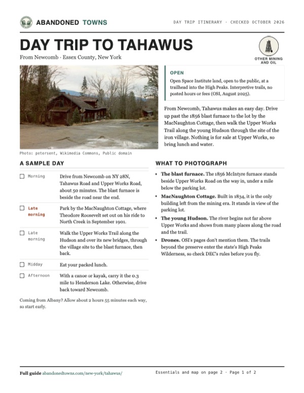
Take it with you
Day trip itinerary
The essentials, the sample day with boxes to tick, what to photograph and the coordinates, on two printable pages. Handy where there's no signal.
Download the PDF (672 KB)From Newcomb, Tahawus makes an easy day. Drive up past the 1856 blast furnace to the lot by the MacNaughton Cottage, then walk the Upper Works Trail along the young Hudson through the site of the iron village. Nothing is for sale at Upper Works, so bring lunch and water.
A sample day
- Drive from Newcomb on NY 28N, Tahawus Road and Upper Works Road, about 50 minutes. The blast furnace is beside the road near the end.
- Park by the MacNaughton Cottage, where Theodore Roosevelt set out on his ride to North Creek in September 1901.
- Walk the Upper Works Trail along the Hudson and over its new bridges, through the village site to the blast furnace, then back.
- Eat your packed lunch.
- With a canoe or kayak, carry it the 0.3 mile to Henderson Lake. Otherwise, drive back toward Newcomb.
Coming from Albany? Allow about 2 hours 55 minutes each way, so start early.
What to photograph and film
- The blast furnace. The 1856 McIntyre furnace stands beside Upper Works Road on the way in, under a mile below the parking lot.
- MacNaughton Cottage. Built in 1834, it is the only building left from the mining era. It stands in view of the parking lot.
- The young Hudson. The river begins not far above Upper Works and shows from many places along the road and the trail.
- Drones. OSI's pages don't mention them. The trails beyond the preserve enter the state's High Peaks Wilderness, so check DEC's rules before you fly.
Map & directions
Getting there
Newcomb is the nearest town, about 50 minutes away by the county roads. From Albany the drive runs up the Northway to exit 26 and across on NY 28N. Both routes end on Upper Works Road, which passes the blast furnace and dead-ends at the parking lot.


Base map: USGS The National Map (public domain). Routes: OSRM on © OpenStreetMap contributors data (ODbL), computed October 2026. Times assume dry roads.
- From Newcomb, head east on NY 28N.5.2 mi
- Turn left on Tahawus Road, which continues as Blue Ridge Road (CR 84).1.3 mi
- Turn left on Tahawus Road (CR 25).6.3 mi
- Turn left on Upper Works Road (CR 25A), past the blast furnace.3.3 mi
- Turn right into the parking area beside the MacNaughton Cottage.0.1 mi
- From Washington Avenue (NY 5), take Central Avenue, Henry Johnson Boulevard and Loudon Road (US 9) through the rotary onto Troy Schenectady Road (NY 2).7.8 mi
- Take the ramp onto the Adirondack Northway (I-87) and follow it north to exit 26.72.4 mi
- Turn left on Valley Farm Road, right on US 9, then follow Olmstedville Road (CR 19), County Highway 29, Donnelly Road and the A P Morse Highway (CR 30).10.0 mi
- Continue on NY 28N, then turn right on Blue Ridge Road (CR 84).15.0 mi
- Turn left on Tahawus Road (CR 25).6.3 mi
- Turn left on Upper Works Road (CR 25A), past the blast furnace, and right into the parking area.3.4 mi
Road and safety notes
- The routes are computed from OpenStreetMap and haven't been driven by us. An undated listing rates the road 2WD; we have no dated source on its surface.
- The road dead-ends at the parking lot beside the MacNaughton Cottage (Town of Newcomb). Adirondack Hub says the old lot beyond it is closed and cars left there after June 18, 2021 are towed.
- In winter expect more snow at the trailhead than in Newcomb. Snowshoes or skis are required in the High Peaks with 12 inches or more of snow.
- The club-era buildings are ruins. An undated listing says they are not safe to enter, and OSI's work has been on the cottage, the furnace and the trails.
Photos
Tahawus in photos
Visitor reports
Been to Tahawus?
Been there lately? Tell the next visitor what you found: whether you could get in, the state of the road and what's still standing. Photos are welcome. We read every report before it appears here.
Other mining and oil
More lead, iron, mercury and oil ghost towns
The nearest, in other states.

 Guide
Long Pond Ironworks
41.14, -74.31Passaic County, New Jersey
Iron from this furnace went to the Continental Army, the War of 1812 and the Union. The works shut in 1882 and the village of Hewitt faded after it.…
 Guide
Allaire Village
40.16, -74.13Monmouth County, New Jersey
James P. Allaire's Howell Works smelted bog iron here for his New York steam engine shops, then went cold in the 1840s. Thirteen of its buildings…
Nearby
Other sites near Tahawus
Straight-line distance from the townsite to other mapped sites in our New York index.
- Jayville56.4 mi W · St. Lawrence
- Delta88.3 mi SW · Oneida
- Sharon94.7 mi S · Schoharie
- Brownville95.9 mi W · Jefferson
- Waterville103.7 mi SW · Oneida
- Shavertown143.3 mi S · Delaware
- Parksville158.1 mi S · Sullivan
- Trapps Mountain Hamlet162.8 mi S · Ulster
Sources
Sources and credits
- ghosttowns.com, "Tahawus or Adirondak": fact sheet fields (roads, climate, best time, remains) and its note that the buildings are unsafe to enter.
- Wikipedia, "Tahawus, New York", retrieved October 2026: the 1826 find, the 1827–1857 works, the bank, the 1854 furnace and 1845 cottage dates, the causes of the closure, the Preston Ponds, Adirondack and Tahawus clubs, Roosevelt, National Lead from 1940, the 1943 village and its 84 buildings, 40 million tons, 1989, the $8.5 million 2003 purchase, at least 10 buildings, CR 25, and the coordinates we discuss above.
- Open Space Institute, MacNaughton Cottage opening, August 5, 2025: the 212 acres, the 1834 cottage and its exterior restoration with porch and ramp, Roosevelt's midnight ride, the one-mile Upper Works Trail along the Hudson and its eight bridges, signage, $2.1 million, nearly 20,000 visitors a year, the 60-car parking area, three trailheads, the 1856 furnace, the 2003 acquisition and transfer to the state.
- Open Space Institute, "Tahawus", read October 2026: the 2017 interpretive trails from the northern parking area, paddling Henderson Lake, tents on the Calamity Brook Trail, the 2008 transfer to the state, no posted hours or fees.
- Town of Newcomb, "Upper Works", read October 2026 (undated): directions from I-87 exit 29, the furnace 2.8 miles up, the dead-end lot, the cottage in view, snowshoe rule, more snow at the trailhead, the 0.3-mile carry to Henderson Lake, the Hudson visible from the road.
- Adirondack Hub, "Upper Works", read October 2026 (undated): the 60-car lot by the cottage, the old lot closed and towing after June 18, 2021, the interpretive loop to the furnace, the Calamity Brook and Indian Pass trails.
- HMdb, "Adirondac" marker (erected by OSI, photographed March 28, 2020) and "The Club Era" marker, read in a browser October 20, 2026 (marker photos dated March 28, 2020): the ore dam, 1826–1858, the causes of abandonment, the chartered bank, the cottage as the only iron-era frame building and its 1834 date, the decay of the other iron-era buildings by the late 1870s, Roosevelt's family at the cottage, the club era 1876–1947, the named cottages, the clubhouse's demolition, the move of mine workers into the cottages, the 1963 move to Newcomb, and the marker coordinates we use for the site.
- USGS Santanoni sheets, 1904 and 1953, Santanoni Peak sheet, 1979, and Tupper Lake sheet, 1985 (in the historic maps below): "Tahawus Club," "Mac Intyre Ironworks," "Old MacIntyre Furnace," the cemetery and the Lower Works mine.
- Elevation: USGS 3D Elevation Program point query. Routes: OSRM on OpenStreetMap data, October 2026. Not field-checked.
Photo and map credits
- Adirondac village, April 1994: petersent, Wikimedia Commons, Public domain
- The "new" furnace stack about 1900: Unknown photographer (print copied for HAER, 1978), Wikimedia Commons, Public domain
- The footbridge over the Hudson, July 2017: Adam Moss, Wikimedia Commons, CC BY-SA 2.0
- The furnace stack, looking southeast, June 1978: Jet Lowe, Wikimedia Commons, Public domain
- The wheel pit and crankshafts, June 1978: Jet Lowe, Wikimedia Commons, Public domain
- The wheelhouse, forebay and blowing engines, June 1978: Jet Lowe, Wikimedia Commons, Public domain
- A blowing engine from the tailrace, June 1978: Jet Lowe, Wikimedia Commons, Public domain
- Area base map, topo and aerial imagery: USGS The National Map (public domain).
- Historic maps: USGS Historical Topographic Map Collection (public domain): Santanoni 1904, 1:62,500; Santanoni 1953, 1:62,500; Santanoni Peak 1979, 1:25,000; Tupper Lake 1985, 1:100,000.